
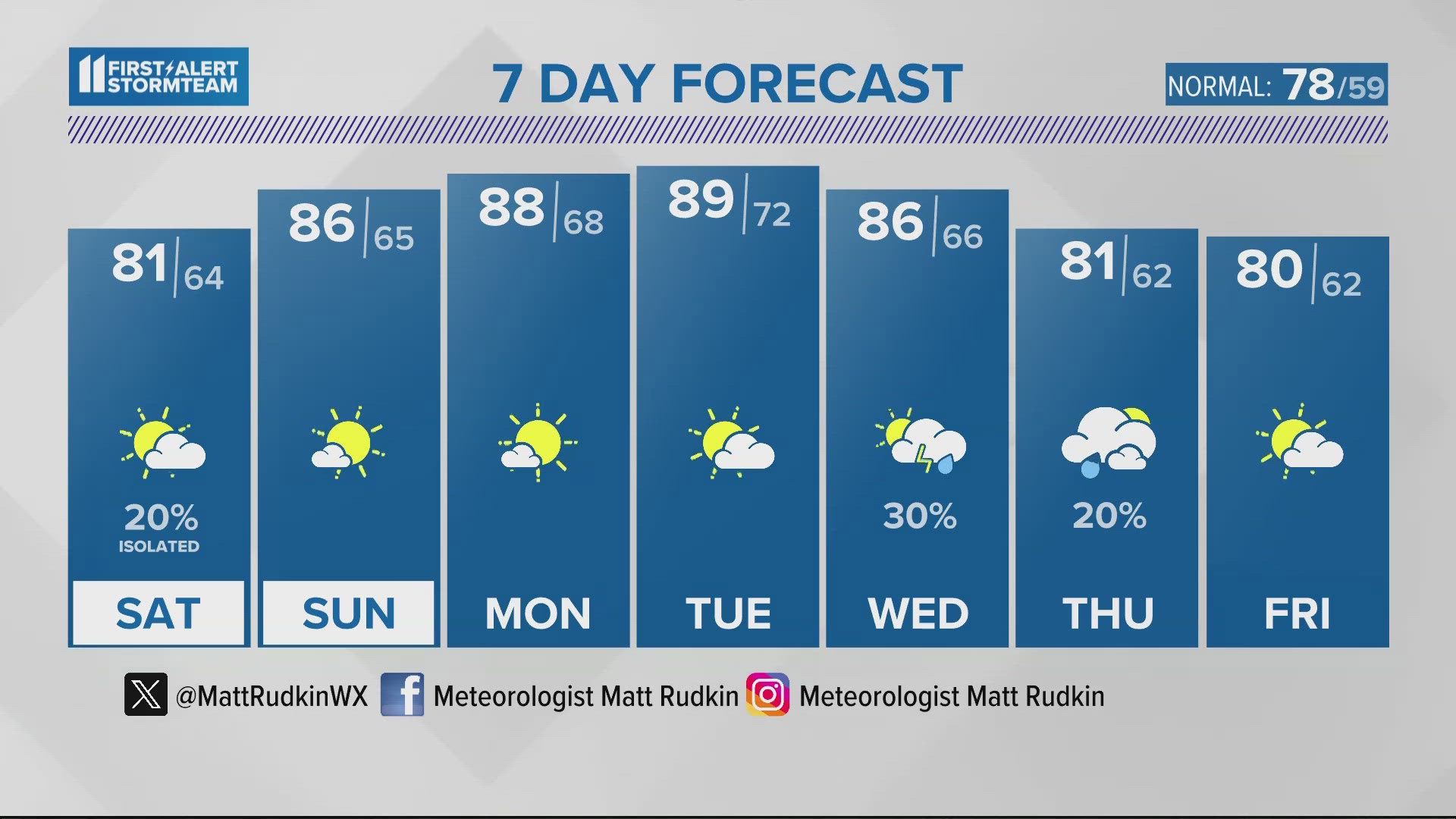
LOUISVILLE, Ky. — A dense fog advisory through 10 this morning top start the weekend. Conditions are perfect for fog with moist ground, light winds and temperatures and dew points close together. Once the fog burns off the good news is rain chances have declined. Temperatures top out in the low 80s this afternoon. There is a slight chance for an isolated shower. Tomorrow plenty of sunshine with highs in the mid 80s.
For the new week the big story will be a sample of summer as temperatures move into the upper 80s Monday and Tuesday with could see the first 90 degree reading of the season.
The next best chance for rain arrives Wednesday into Thursday morning. Highs Thursday and Friday will be in the low 80s.


Download the free WHAS11 app to watch live coverage during severe weather and get real-time weather alerts, even if your power goes out. For Apple or Android u
SATURDAY: Dense Fog Advisory through 10 AM. Becoming partly sunny and mild. High: 81°. Wind: E 5-10 mph
TONIGHT: Mainly clear, mild. Low: 62°. Wind: Calm..
SUNDAY: Mostly sunny and warm. High: 86°. Wind: NE 5 mph.
---------------
LIVE RADAR
Related video
More from the First Alert StormTeam

Follow the First Alert StormTeam on social media.
DOWNLOAD THE WHAS11 APP:
Download the free WHAS11 app for the latest weather alerts from the First Alert StormTeam. For Apple or Android users.
JOIN THE CLOUD WATCHERS FACEBOOK GROUP:
Interested in photography? Join nearly 8,000 residents from Kentucky and southern Indiana and share your weather photos. Click here to join the group!