LOUISVILLE, Ky. —
EXTREME COLD
We will continue to see frigid temperatures across Kentuckiana. Highs will only be in the teens Tuesday despite the sunshine.
Lows tonight will be in the single digits once again with wind chills between minus-4 to 4 degrees.
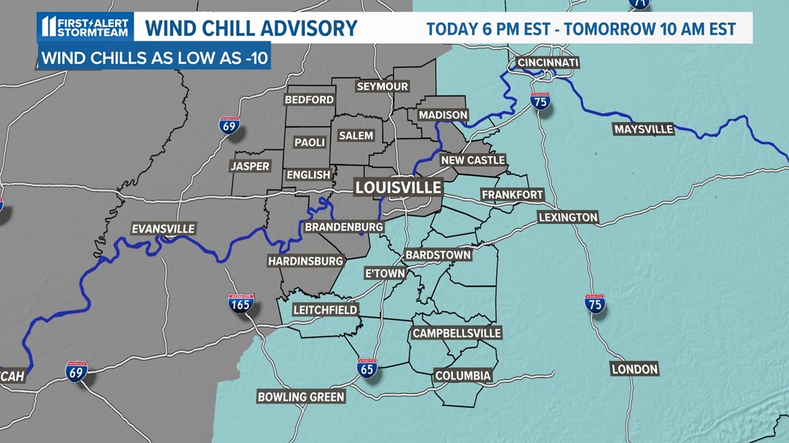
A Wind Chill Advisory is in effect for portions of Kentuckiana. In the areas highlighted in light blue, wind chills could get as low as -10 tonight through tomorrow morning. This is dangerous levels of extreme cold.

Temperatures will at least reach for the upper 20s and lower 30s on Wednesday, but it's not until Thursday afternoon where we could see temperatures get above freezing, but only for a brief period of time. Another cold blast arrives Friday into Saturday with high temperatures falling back to the lower 20s.
Lows will drop to the single digits and wind chills could get as low as -10 degrees. Please check on your elderly neighbors and do not forget about your pets.
Frostbite can occur in as little as 30 minutes in these conditions. However the end of this weather pattern is in sight. Temperatures will be on the rebound beginning Sunday, and back to the lower 40s by Monday.

SNOWFALL
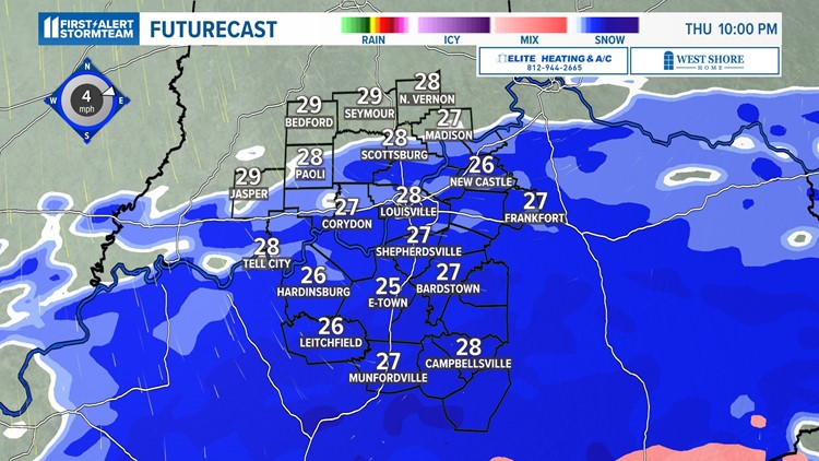
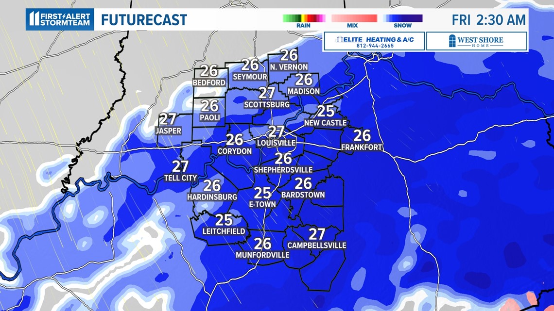
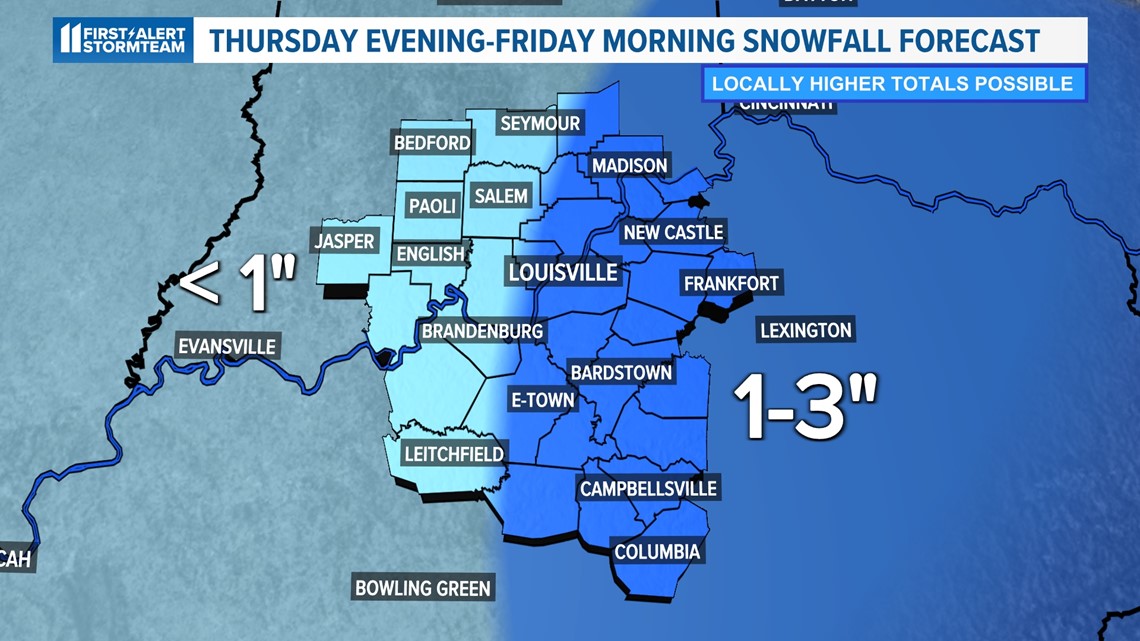
We have another shot at seeing light snow accumulations early Thursday evening into Friday morning. There is a good chance that most of the WHAS11 viewing area will be able to pick up at least 0.5-1 inch of accumulation.
At it stands now, the better snow is likely to found to the east of I-65. 1-3 inches is possible in those communities, with the chance for up to 2-4 in far southeastern Kentucky.


IMPACTS
This event will likely meet criteria for the National Weather Service to issue a winter weather advisory for the area due to the minor winter impacts expected. Slick spots will be possible, especially on bridges and overpasses.
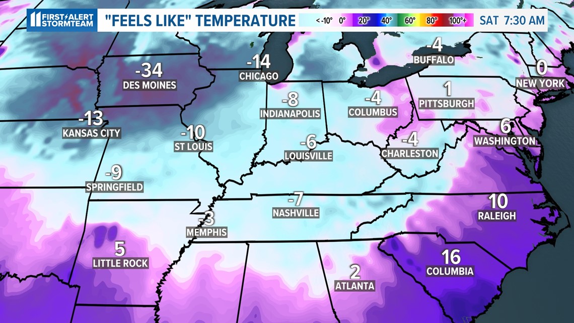
The incoming secondary push of arctic air that comes along with the system could even warrant a wind chill advisory as "feels-like" temperatures could get as low as -10 degrees Friday night into Saturday morning.