The first fall frost of 2022 may be coming soon: Here's the science behind it
We’ll look at what frost is, how it forms, and some historical records for the first frost/freeze in Louisville.
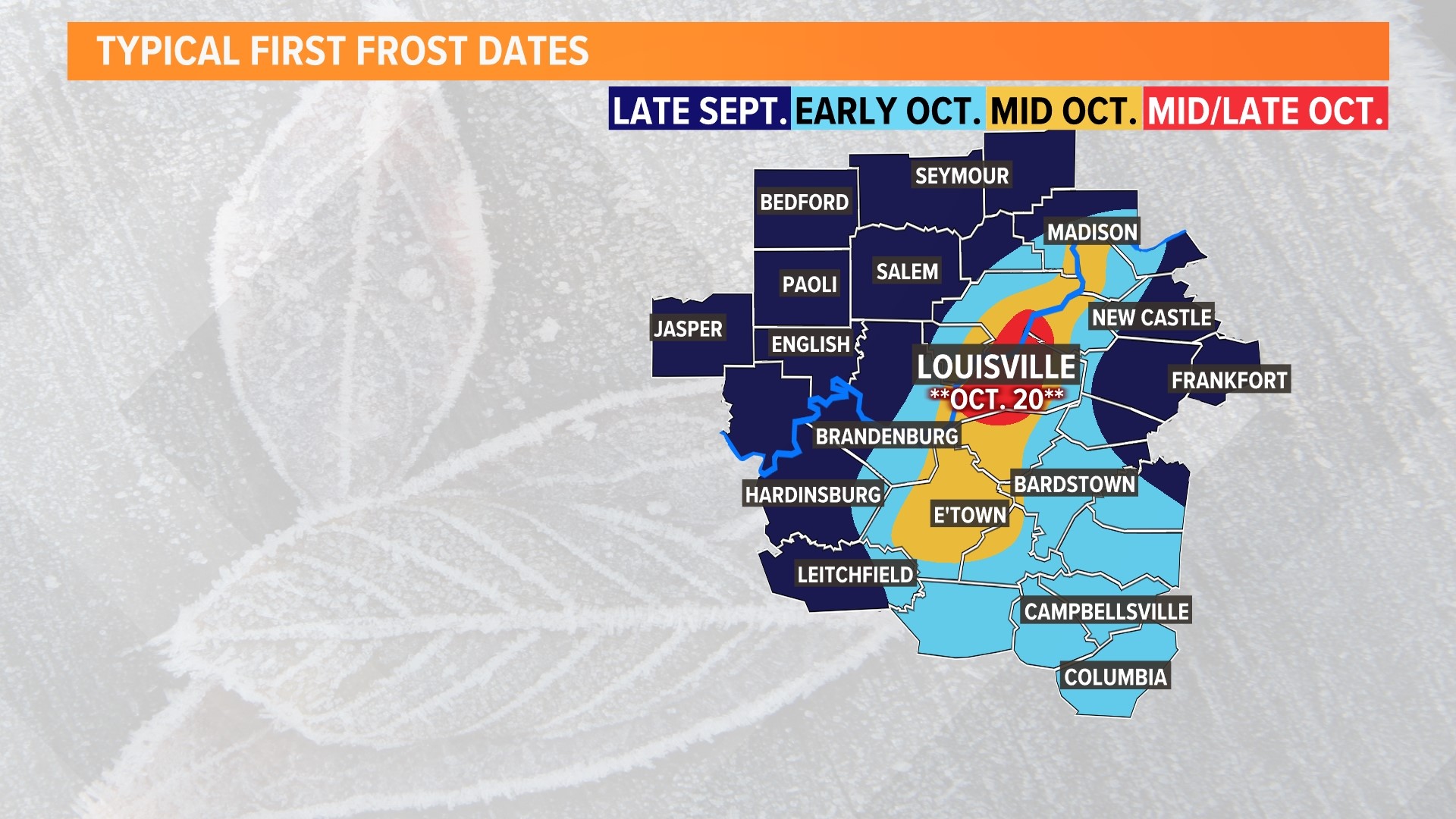
Temperatures are getting cooler as we continue through early autumn.
The first widespread fall frost of 2022 will be possible to end the first week of October. Some localized rural areas (particularly those in valleys or high hills) have already reported light frost a few weeks ago, but most of the region has stayed just warm enough overnight to avoid that.
We’ll look at what frost is, how it forms, and some historical records for the first frost/freeze in Louisville.
What is frost and how does it form?
The American Meteorological Society defines frost as “the fuzzy layer of ice crystals on a cold object, such as a window or bridge, that forms by direct deposition of water vapor to solid ice,” (deposition is a process in which a gas changes state directly to a solid).
Frost forms by usually two different methods: deposition (mentioned above) and the freezing of liquid. When the dewpoint is below freezing, water vapor will directly change into the solid state and create that little layer of ice. Frost that forms from deposition can cover plants, cars, roofs, and other objects with ice crystals.

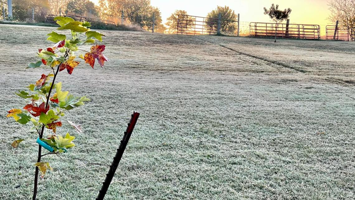
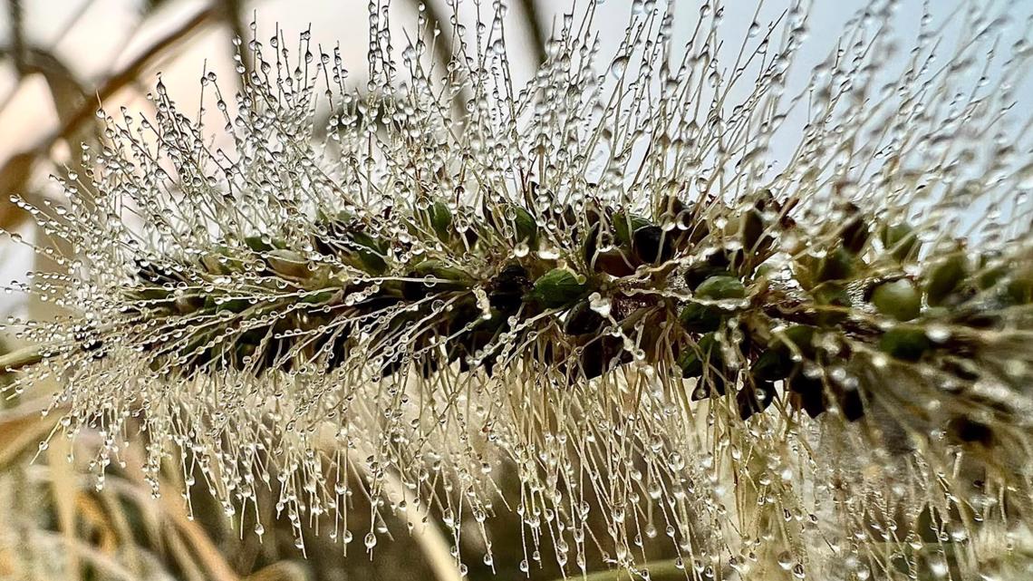
Frost that forms from the freezing of liquid is better described as frozen dew than frost. This happens when temperature and dewpoint is above freezing when dew forms. However, as the night cools and those temperatures drop below freezing, the liquid dew freezes over.

How cold does it need to be?
Since frost/frozen dew is a type of ice, the temperature needs to be 32°F or colder on the surfaces it forms on. However, there’s a catch: National Weather Service or other professional weather stations thermometers are usually placed about six feet above the ground and measure the air temperature, not the ground temperature. Due to this caveat, we might see frost outside despite the air temperature being, for example, 36°. 36° is usually a good threshold for frost formation in our region, particularly in rural areas.

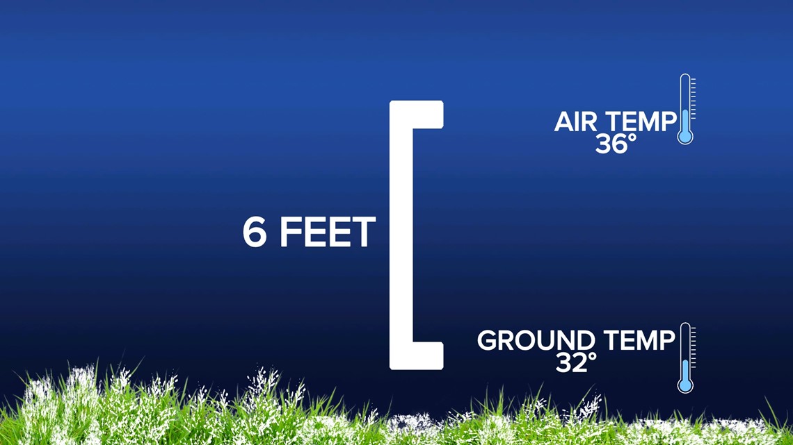
Why is this? Cold air is more dense than warm air, so it sinks. Temperatures right at round level can be a few degrees colder than the actual air temperature meaning it (and other surfaces such as your car or roof) may dip to 32° or colder and create a good environment for frost formation.
If the air temperature is 32°, then it’s a good bet frost will form if there’s enough moisture available for deposition frost or if there’s dew already in place.
Historical Information
Climatologically (30-year averages from 1991-2020) , the Louisville region experiences its first freeze between November 1 and November 10. This is consistent with data seen over the past five years. According to the Midwest Regional Climate Center, Louisville’s first freeze has occurred, on average, on October 21. This date was determined using special tools taking temperature data in Jefferson County dating back to 1950.
Here are the first 36° temperature recorded in Louisville in the fall season:


- 2017: October 28
- 2018: October 22
- 2019: November 4
- 2022: November 17
- 2021: November 14
Over the past five years, the mean first date of 36° is November 4. The 10 year mean is November 8. In the past 10 years, the earliest arrival of 36° was October 22, 2018, with the latest being December 2, 2015.
As for past first fall freezes in Louisville:

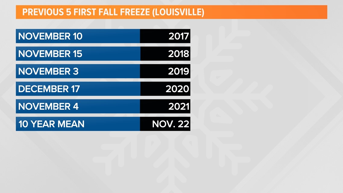
- 2017: November 10
- 2018: November 15
- 2019: November 3
- 2020: November 17
- 2021: November 4
The five-year mean for Louisville’s first freeze is November 15. The 10-year mean is November 22 with the earliest occurring November 3, 2019, and the latest occurring December 26, 2014! For some added perspective, the earliest first freeze since 2000 was October 10, 2000, with the latest being a shocking January 2, 2007!
Climate change impacts
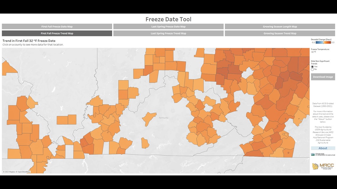
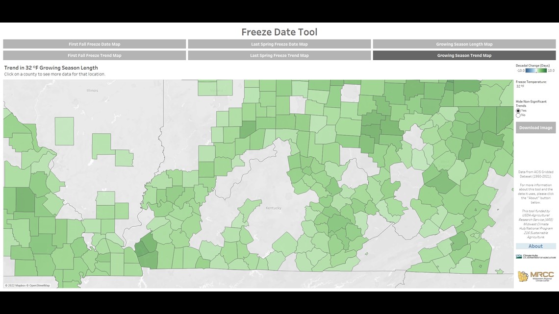
Climate change over the past century has resulted in warmer temperatures globally. This has also caused the average first freeze date to occur later in many counties across the country. In Kentuckiana, most of the area hasn’t seen a significant delay in when the first freeze occurs. Counties in southern Indiana have seen their first freeze occur up to two days later than normal over the last decade. These later freeze dates have also caused slightly longer growing seasons by around one to four days.

Once the first hard freeze occurs (28°), the growing season is officially considered over as pretty much all vegetation enters its dormant stage for the winter.

Meteorologist Alden German
Facebook: Facebook.com/AldenGermanWX | Twitter: @WXAlden
►Make it easy to keep up-to-date with more stories like this. Download the WHAS11 News app now. For Apple or Android users.
Have a news tip? Email assign@whas11.com, visit our Facebook page or Twitter feed.
RELATED VIDEO


