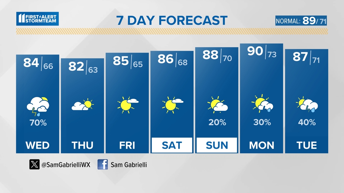
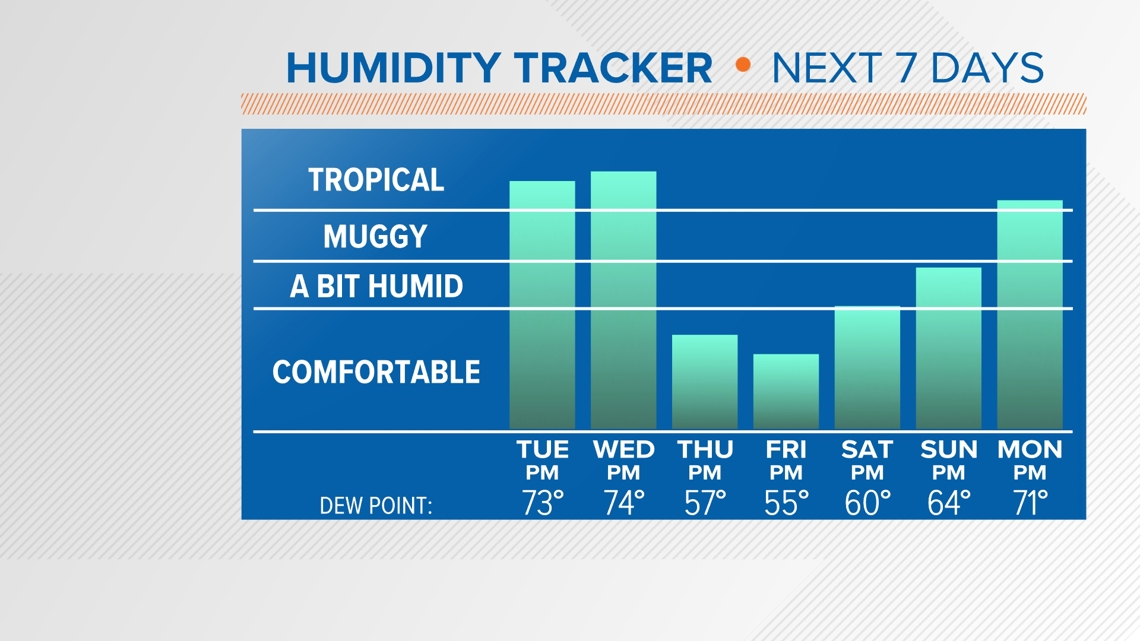
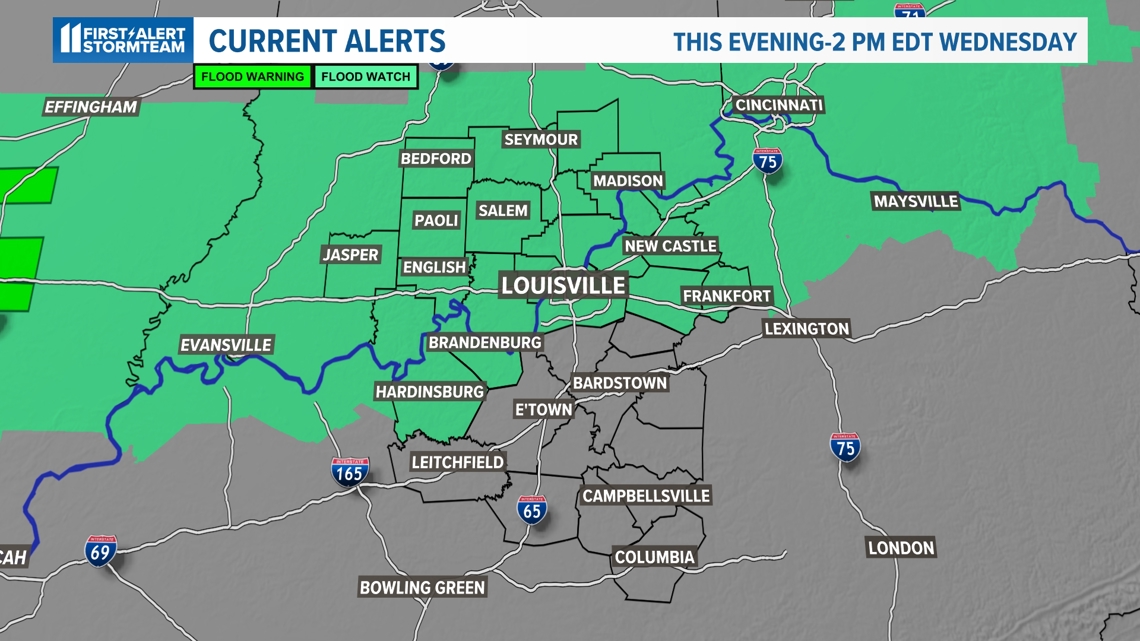
LOUISVILLE, Ky. — The concern for extreme heat is now an after thought. Now our attention shifts to a Flood Watch, which begins with storm chances late Tuesday through Wednesday afternoon. As we have seen several times this summer, in this tropical atmosphere, any storm can produce locally heavy rainfall, with localized flooding possible.

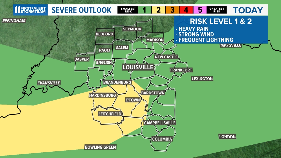
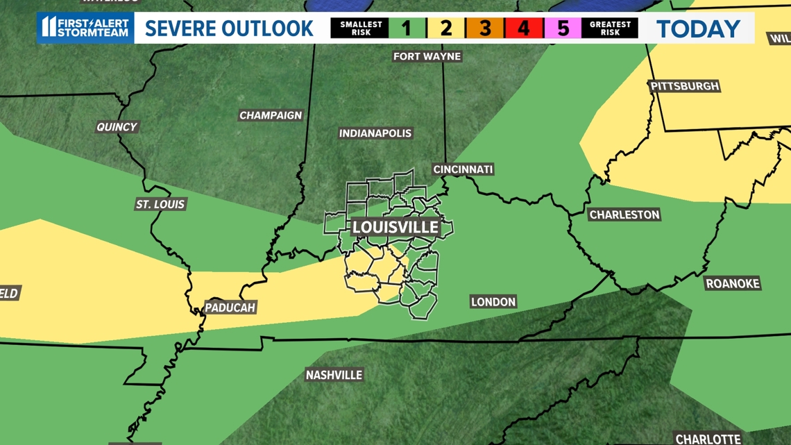
SEVERE WEATHER RISK
The severe weather threat is relatively low, but keep in mind that it is levels 1 and 2 out of a scale of 5 for a concern of wind gusts between 55-65 mph, hail up to quarter size and flash flooding potential. The atmosphere is so juiced with moisture that storms will drop very heavy rainfall (over an inch per hour) in a short amount of time.


TIMING
Storms chances will increase along the slow-moving front arriving late today through Tuesday night and will continue off and on through Wednesday afternoon.
RELIEF!
Thankfully, once the front moves south overnight Wednesday into early Thursday, our temperatures and humidity levels will be dropping. Highs will be in the lower 80s, with drier air arriving for Thursday! Quite pleasant Thursday and Friday, especially for July.