LOUISVILLE, Ky. — Summer officially starts Thursday at 4:51 p.m. and it will certainly feel like it in the Louisville area.
The WHAS11 First Alert StormTeam is forecasting a high temperature of 96 degrees in the Derby City, which is nine degrees above normal for June 20. A large portion of the country is in the middle of a heat wave bringing heat advisories and warnings across the Midwest and Northeast.
How does this compare to a normal first day of summer? Here are the high and low temperatures in Louisville for the last 10 years:
- 2023: 85/71.
- 2022: 90/62.
- 2021: 91/74.
- 2020: 92/71.
- 2019: 79/69.
- 2018: 90/76.
- 2017: 88/69.
- 2016: 89/76.
- 2015: 85/72.
- 2014: 89/74.


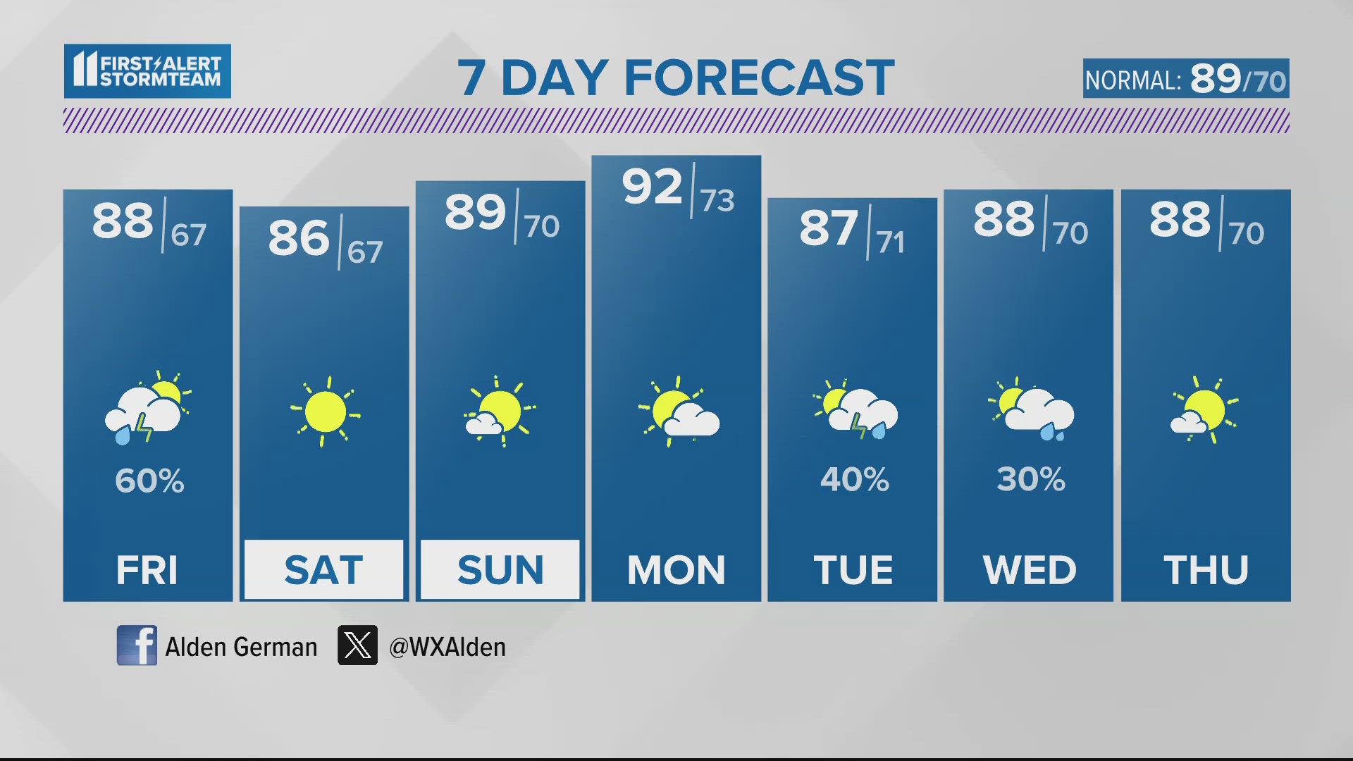
The average high temperature in Louisville for June 20 is 87. The record high is 100.
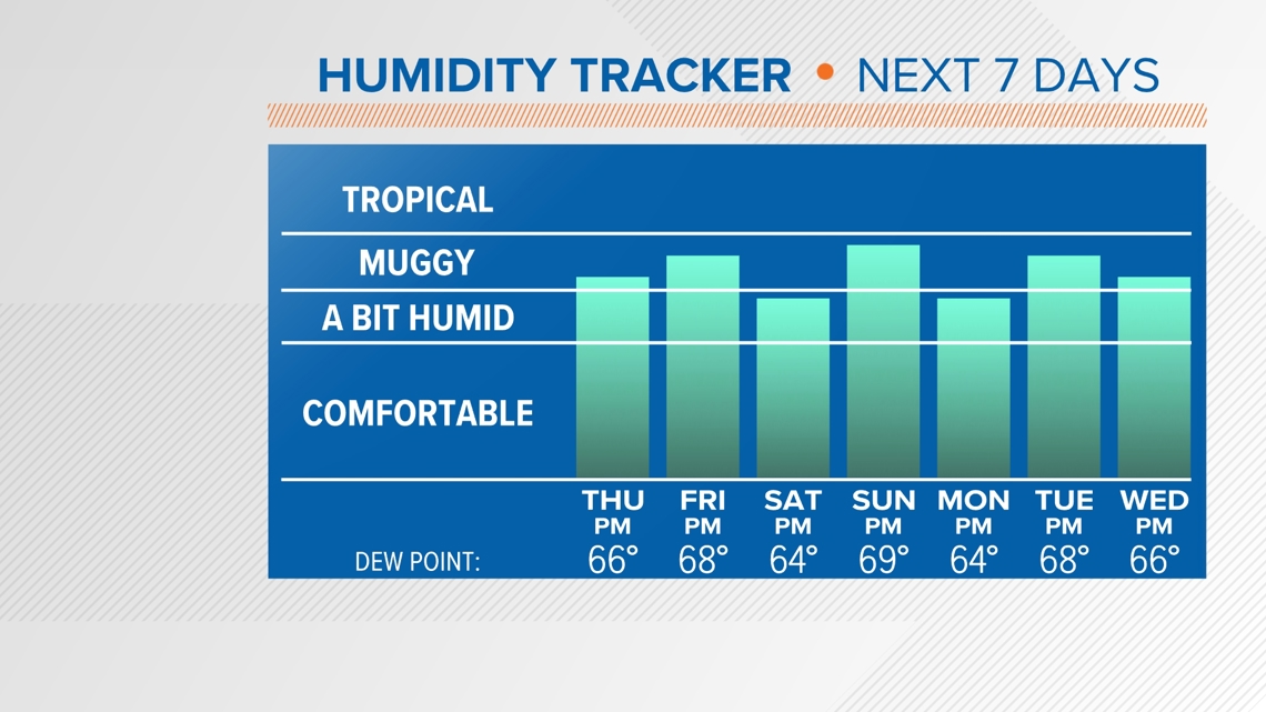
As warm as your thermometer will indicate Thursday, it will feel even hotter. Dew points will remain in the upper 60s for the next several days, and "feels like" temperatures will approach and possibly exceed 100.

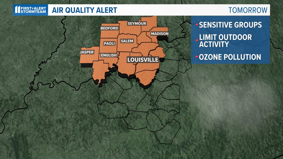
There is also an air quality alert in effect for Thursday across the Louisville and southern Indiana areas. People in sensitive groups should be cautious with their time outdoors.

Friday will be one of the hottest days of the year for the vast majority of the country, with many spots in the middle and upper 90s around the Ohio Valley. Record high temperatures are expected to be broken.
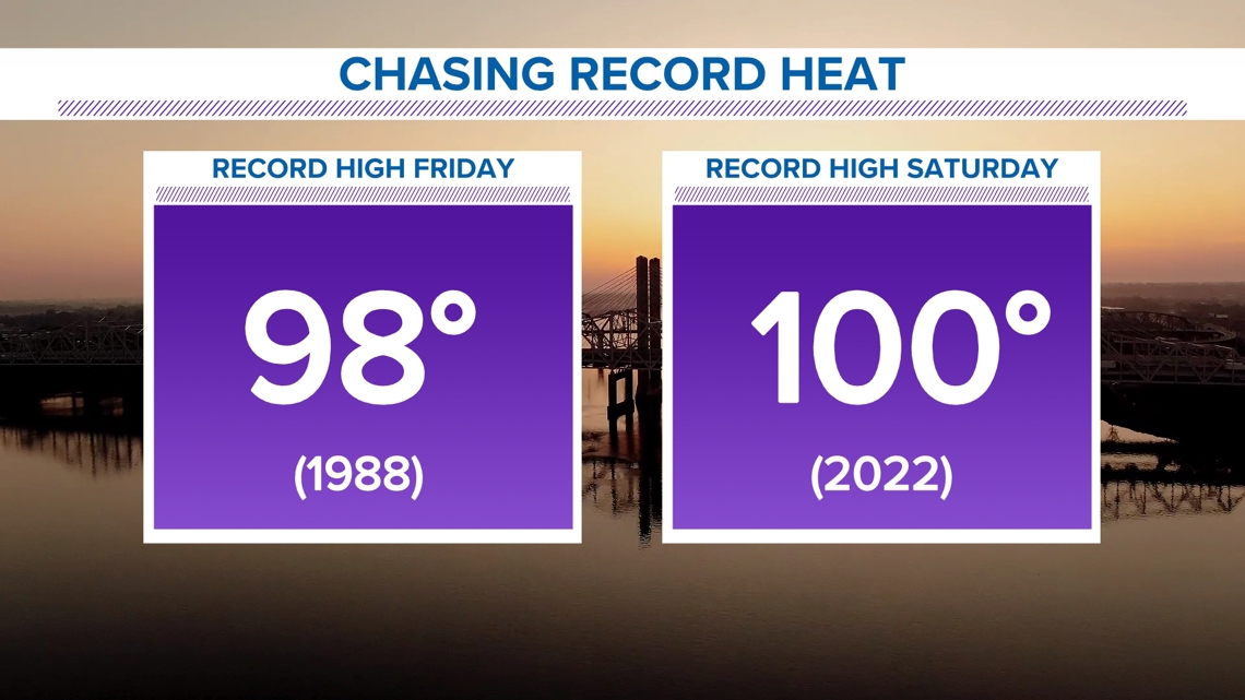
In Louisville, Friday and Saturday's record high temperatures are 98 (1988) and 100 (2022), respectively. The forecast calls for 98 on Friday and 99 on Saturday.

The high heat appears here to stay. High temperatures above 90 are expected well into next week.
RELATED VIDEO