
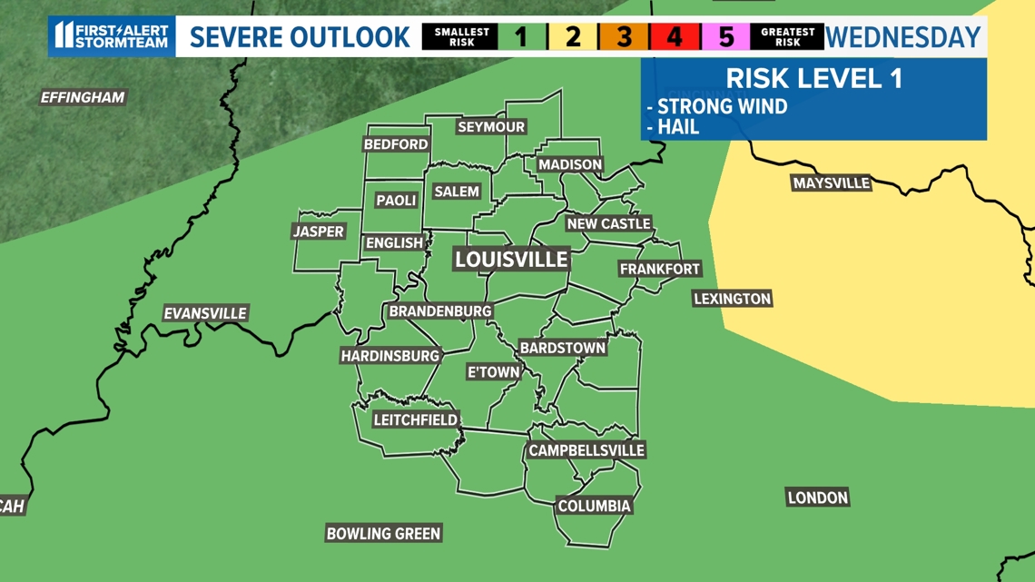
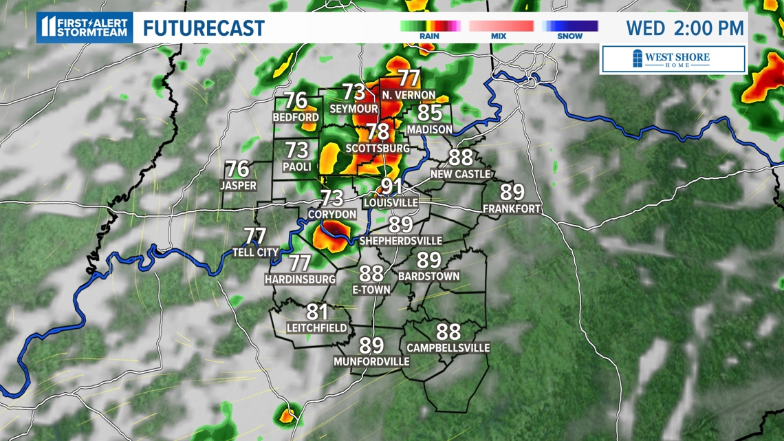
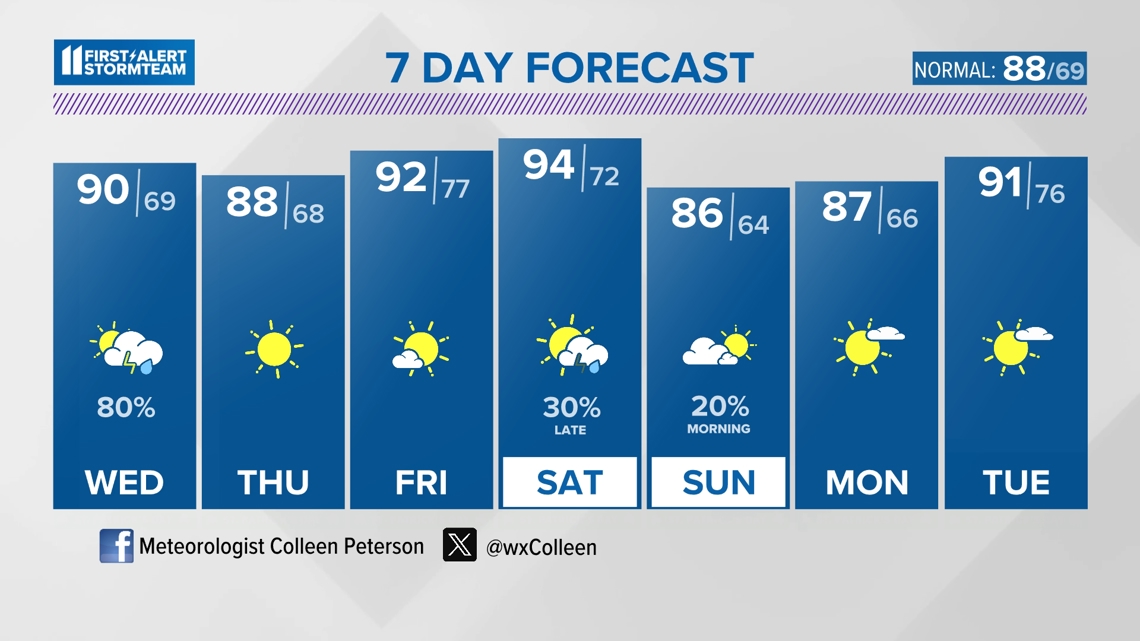
LOUISVILLE, Ky. — There is a low chance of seeing a storm produce either hail or a strong wind gust throughout Wednesday. We will start with scattered rain, then scattered storms into the afternoon. It's mainly going to be a classic summertime set-up.

Humidity levels
The muggy weather will continue tomorrow, but a front will be moving through the region Wednesday bringing more scattered showers and thunderstorms. Again, the risk of severe weather will stay low Wednesday.
Humidity levels will stay high through Wednesday, but behind the front, drier air arrives Thursday.

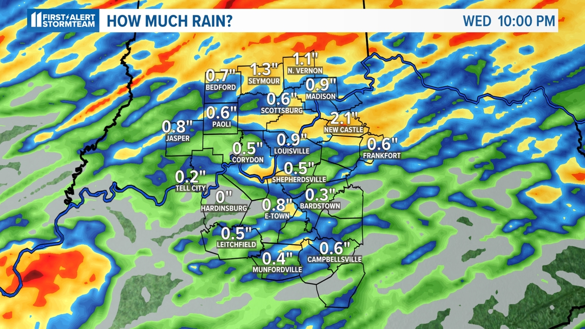
How much rain will we get?
Rainfall totals of .50 inch to 1 inch will be possible over the next couple of days. We'll take every raindrop we can get. We are heading deeper into our 2024 growing season, and farmers need this rainfall.

Mild weather ahead
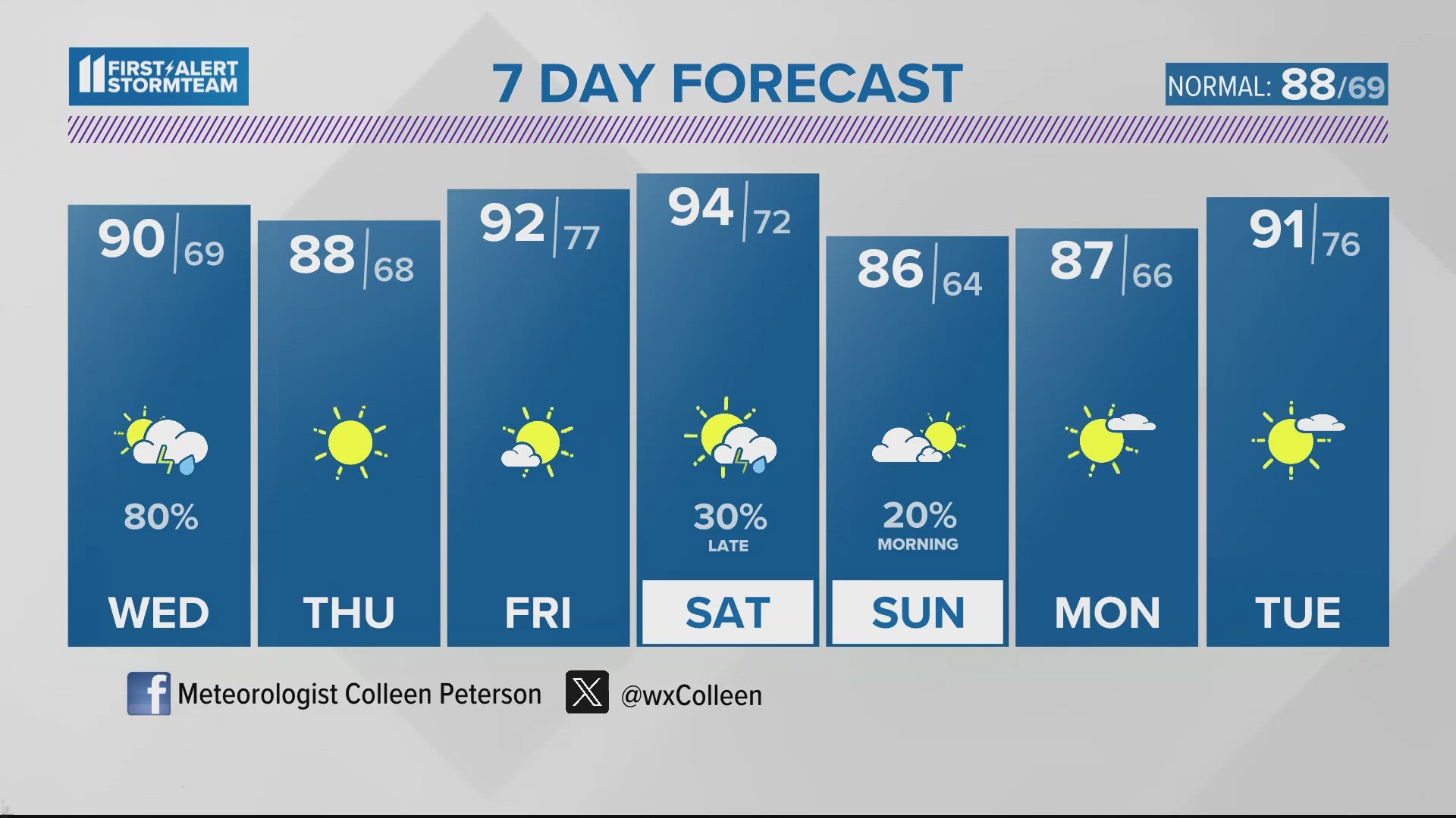
Some relief from this long-lasting heat wave arrives Thursday with lower humidity and temperatures. Temperatures climb back to the lower 90s before our next chance of showers and storms Saturday. Seasonably warm conditions round out the 7-day forecast with mid-80s and lower humidity Sunday and Monday.

Make it easy to keep up-to-date with more stories like this. Download the WHAS11 News app now. For Apple or Android users.
Have a news tip? Email assign@whas11.com, visit our Facebook page or Twitter feed.