FLORIDA, USA — Millions of people in Florida are evacuating from the major threat posed by Hurricane Milton, the second massive and dangerous storm to hit the state in as many weeks.
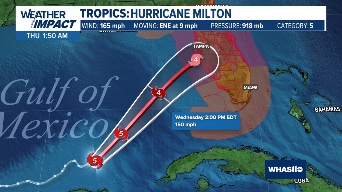
As of Tuesday afternoon, Milton was spinning in the Gulf of Mexico about 520 miles southwest of Tampa, Florida, as a strong Category 4 hurricane. Milton was carrying wind speeds of 155 mph and tracking east-northeast at 8 mph.
About 4:30 p.m., Milton became a Category 5 hurricane again with 165 mph wind speeds.
"Milton has the potential to be one of the most destructive hurricanes on record for west-central Florida," the National Hurricane Center (NHC) said during its Tuesday morning discussion.
Follow the direction of local officials and evacuate. Storm surge in certain areas of Florida, including the western Gulf Coast and Tampa Bay, could reach a catastrophic 15 feet.
According to The Weather Channel, Milton experienced an eyewall replacement cycle overnight Monday into Tuesday, which caused some weakening. However the hurricane is still a severe threat to Florida.
Live interactive radar and satellite
Forecast and projected path
Milton gained a bit of strength Tuesday afternoon. The hurricane will then gradually weaken as it nears Florida due to increasing wind shear and pockets of dry air.
Any weakening that occurs will not decrease impacts of the storm. Deadly storm surge and destructive winds will still be present in Florida, and Milton still poses grave danger to the state.
Milton is also expected to widen, meaning wind, rain and storm surge impacts will become more widespread.
The latest NHC forecast calls for storm surge between 10 and 15 feet above ground level for the west-central Gulf Coast, including Tampa Bay. Surge could reach 10 feet as far south as Fort Myers Beach and areas north of Tampa.
Surge will be highest in areas nearest and south of the eye. Storm surge will start building Wednesday and peak Wednesday night into early Thursday.
Strong winds could knock out power for days, and possibly longer. The strongest winds will begin Wednesday afternoon.

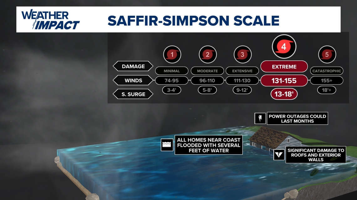
Winds in excess of 110 mph should be expected along the coast between Tampa and Naples.
Rainfall amounts between 5 and 12 inches are expected across Florida. Up to 18 inches is possible locally.