FLORIDA, USA — Millions of people have evacuated Florida from Hurricane Milton, which is set to be the second major hurricane to hit the state in as many weeks.
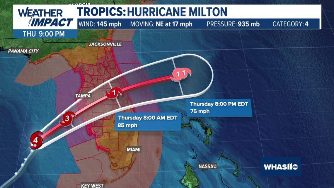
Milton made landfall Wednesday evening around 8:30 p.m. as a Category 3 storm.
A tornado watch is in effect for the southern half of the Florida peninsula until 9 p.m., including Miami, Tampa and Fort Myers.
"The track of Hurricane Milton continues to be a worst-case scenario for the Tampa Bay region southward to Charlotte," the National Weather Service in Tampa Bay said in a briefing Wednesday morning.
Milton is a life-threatening hurricane. All evacuations and storm preparedness should be done by Wednesday morning.
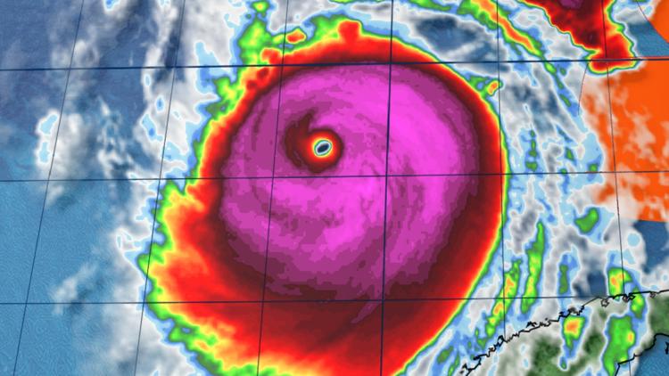
Milton grew overnight and will continue to expand as it approaches Florida. Impacts will be vast across the state.
Live interactive radar
Forecast and projected path
Hurricane warnings are in effect for many areas of Florida, including the Tampa, Fort Myers, Orlando, Cape Canaveral and Daytona Beach areas. Life-threatening storm surge is expected in these areas late Wednesday into Thursday.
Milton slowly weaken as it approached Florida due to increasing wind shear, but remained a major Category 3 when it made landfall Wednesday evening. This will not lessen the impacts of the storm, including storm surge and rainfall.

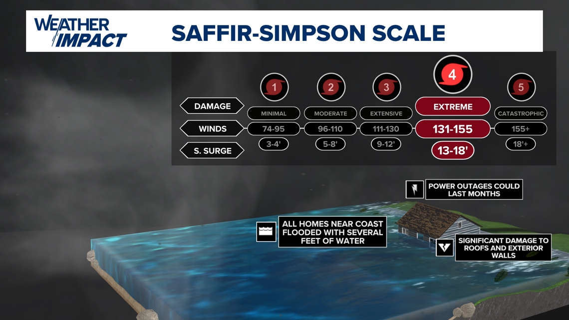
The National Hurricane Center is calling for 8-15 feet of storm surge along the west-central Gulf Coast, including Tampa Bay and Charlotte Harbor. Surge will be most dangerous near and to the south of Milton's eyewall.
If forecasts hold true, it would be the most storm surge Tampa has seen in more than 100 years.
The strongest winds, possibly well in excess of 110 mph, are expected between Tampa and Naples. Expect power to be out in those areas for days.

Rainfall amounts between 6 and 12 inches are expected in the worst areas. 18 inches of rain locally is not out of the question.
The NOAA Weather Prediction Center issued a rare "high risk" flood threat for parts of central Florida, including the Tampa and Orlando areas.