
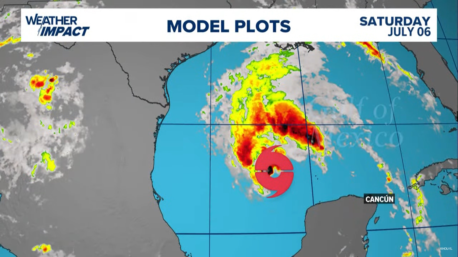
HOUSTON — As of 10 a.m. Saturday, Beryl remained a tropical storm with winds at 60 mph as it headed toward the Texas Gulf Coast, the National Hurricane Center said.
EDITOR'S NOTE: THIS STORY IS NO LONGER BEING UPDATED. CLICK HERE FOR THE MOST CURRENT INFORMATION.
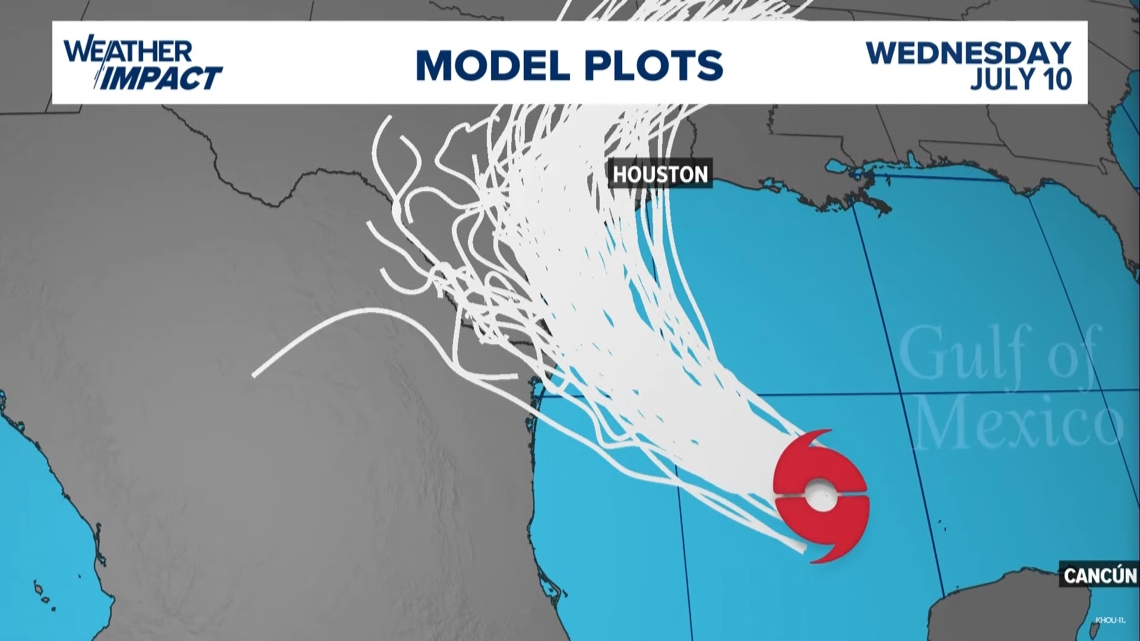
The forecast track from the National Hurricane Center brings Beryl onshore along the middle Texas coast as a Cat 1 storm early Monday morning. The cone, however, extends to include parts of Southeast Texas and Matagorda Bay. Even a glancing blow from a strong Cat. 1 hurricane will have impacts on the coast and inland, with a heavy rain threat in play for the Houston area on Monday and Tuesday. (Update in Spanish).
Heavy rain is expected to be the main threat with a band of 5" to 7" or more expected across the Southeast Texas area.
With Texas in Beryl's path, the KHOU 11 weather team is calling for Weather Impact Alert Days on Monday and Tuesday.
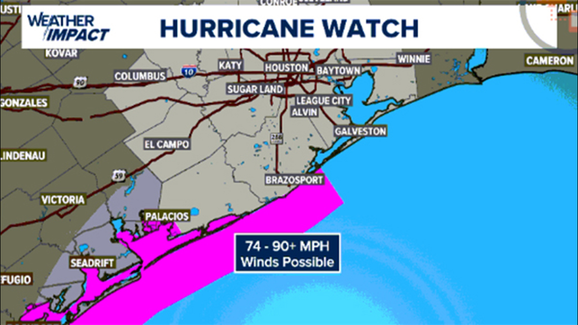
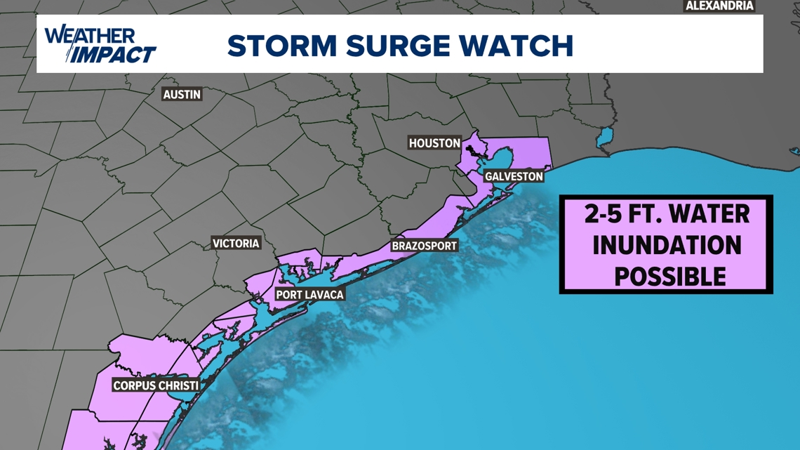
Hurricane and storm surge watches have been issued for portions of the western Gulf Coast from the Rio Grande north to High Island.
Right now, the exact landfall on the Texas Gulf Coast remains uncertain, but we will have a better understanding this weekend. It is crucial to stay on top of this forecast through the weekend.
Beryl 10 a.m. statistics
With the 10 a.m. Saturday update, Beryl was a tropical storm with maximum sustained winds of 60 mph, moving west-northwest at 12 mph.
Live tropical tracker
Beryl forecast cone
Beryl spaghetti models

Be prepared
Watches and warnings
Hurricane and storm surge watches are in effect for Brazoria, Matagorda and Jackson counties.


Disaster declaration


Lt. Gov. Dan Patrick, who is acting governor with Gov. Abbott out of the country, issued a disaster declaration for 40 counties he said were at-risk in Beryl. Those counties are: Aransas, Atascosa, Bee, Bexar, Brooks, Calhoun, Cameron, DeWitt, Dimmit, Duval, Frio, Goliad, Gonzales, Hidalgo, Jackson, Jim Hogg, Jim Wells, Karnes, Kenedy, Kinney, Kleberg, LaSalle, Lavaca, Live Oak, Matagorda, Maverick, McMullen, Medina, Nueces, Refugio, San Patricio, Starr, Uvalde, Victoria, Webb, Wharton, Willacy, Wilson, Zapata, and Zavala.
Evacuations
A voluntary evacuation was called for residents in coastal areas of Matagorda County.
Record-setting Beryl
The 2024 Atlantic Hurricane Season was promised to be an active one, with Colorado State University and NOAA predicting well above normal numbers. In fact, the NOAA forecast for the season was the most aggressive forecast ever produced. Several factors including record warm sea-surface temperatures and a transition to La Nina by late summer were the driving factors in these aggressive forecasts. However, Hurricane Beryl is already shattering records before the peak of the season arrives. Meteorologist Pat Cavlin has a list of records the storm has already broken.