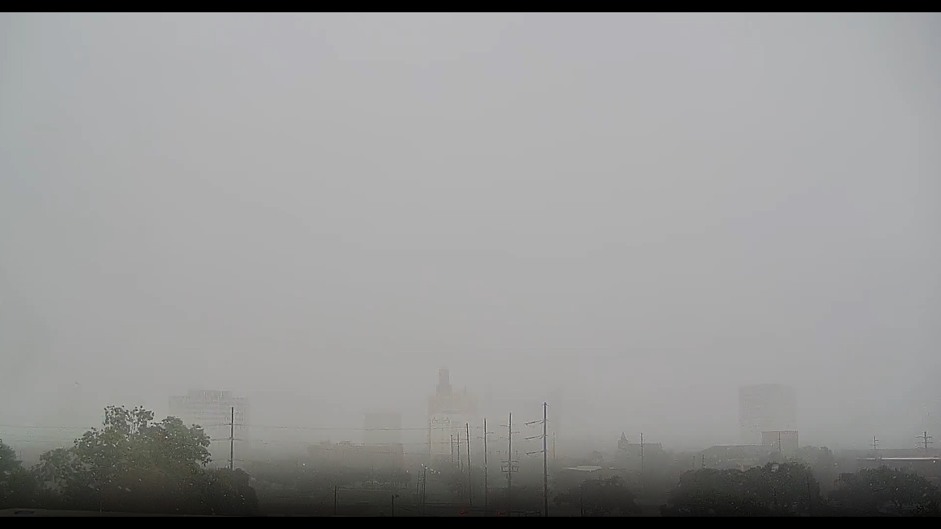
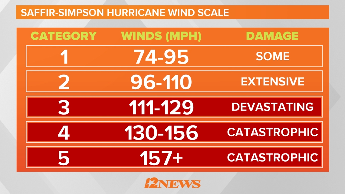
BEAUMONT, Texas — Beryl made landfall near Matagorda, Texas as a Category 1 storm with maximum sustained winds of 80 mph. The storm made landfall at 3:55 a.m., according to the National Hurricane Center.
Southeast Texas is dealing with damage and power outages left in the wake of Beryl.
Keep up to date
Tuesday
5:33 p.m. - Highway 87 in High Island has reopened on both sides, according to April Loftin the President of High Island Volunteer Fire Department.
5:30 p.m. - Blue Roof through Army Core of Engineers is giving out free blue tarps to cover roofs while waiting for them to be fixed. You can contact them at 888-766-3258.
3:20 p.m. - An EF-2 tornado touched down in Jasper Monday afternoon, according to the National Weather Service's Doug Cramer.
Monday
5: 20 p.m. - National Weather Service cancels tornado watch for Hardin, Jasper, Jefferson, Newton, Orange, and Tyler counties.
4:30 p.m. - Jefferson County Emergency Management has begun the process of reporting damages to the Individual State of Texas Assessment Tool (iStat) following the impact of Hurricane Beryl. This system will be used to document and assess the extent of the damages caused by the hurricane throughout the County. JCEM strongly encourages peopl to report their damages through the iStat system. By doing so, you will help state and county officials better understand the damages to allocate the necessary resources for recovery and assistance.
2:30 p.m. - Photos emerge from Jasper and show what meteorologist Patrick Vaughn calls "classic tornado damage".
1:50 p.m. - Jasper, Kirbyville, Buna and Sam Rayburn is under tornado warning until 5:00 p.m.
1: 45 p.m. - Beaumont has issued a tornado warning until 2 p.m.
1:45 p.m. - Red Cross is setting up shelters in Chambers County at White Park and in Jasper County. There are search and rescue operations in both counties so Red Cross was asked to set up shelter. The Red Cross said there is flooding in Chambers County and that is another reason they were told to be ready.
11:45 a.m. - According to Vidor Police Chief Rod Carroll, A portable building was blown off a business property and into the feeder road of Interstate 10. As a result the ramp was closed for cleanup. However, as crews were working to clear the building, a car wrecked on the off-ramp. No injuries were reported.


11:25 a.m. - MLK Pkwy in front of Lamar University between E Lavaca St and Rolfe Christopher Dr. is closed in both
11:15 a.m. - Our crew in Jasper is hearing tornado sirens in downtown Jasper
10:05 a.m. - The National Weather Service has issued a tornado watch for parts of Arkansas, Louisiana and Texas that includes ALL of Southeast Texas until 10 p.m.
10 a.m. - Beryl has now been downgraded to a tropical storm with winds
10 a.m. - Orange County judge John Gothia has issued a disaster declaration for Orange County that is effective immediately.
9:50 a.m. - More than 12,000 Entergy customers are now without power in Southeast Texas.
- Jefferson County: 9,146
- Orange County: 1,155
- Hardin County: 1,786
7:15 a.m. - Nearly 6,000 Entergy customers are without power in Southeast Texas.
- Jefferson County: 4,456
- Orange County: 1,205
- Hardin County: 295
4 a.m. - National Hurricane Center Hurricane Beryl Advisory 39: The center of Hurricane Beryl has made landfall near Matagorda.
3:30 a.m. - National Hurricane Center update: Beryl is nearing the middle Texas coast and is expected to make landfall within the next hour or two. Life-threatening storm surge, heavy rainfall, and strong winds are ongoing across portions of Texas.
2:05 a.m. - The eyewall of Hurricane Beryl appears to be starting to come ashore. 12News Meteorologist Jeff Gerber says it could make landfall in the next hour or so.
12:45 a.m. - National Hurricane Center Advisory 38A: Beryl Strengthening as the Center Approaches the Middle Texas Coast. Conditions Deteriorating With Dangerous Storm Surge, Flash Flooding, and Strong Winds Expected.
Live tropical loop
Live tropical tracker
Sunday
11 p.m. - Beryl has become a category 1 hurricane again as it heads toward the Texas coast.
10:45 p.m. - A tornado watch has been issued for Hardin, Jefferson, Chambers, and Liberty counties until 10 a.m. Monday morning.
7:30 p.m. - A small potential tornado was spotted in Beaumont near 11th St and North Stas well as at MLK and I-10. Our 12News Weather Impact meteorologists say small tornadoes like this are not uncommon in these outer bands of storms.
6 p.m. - Port Arthur Mayor calls for voluntary evacuation of Sabine Pass and Pleasure Island.
5:30 p.m. - Hardin County Judge Wayne McDaniel issues disaster declaration. The Hardin County Courthouse and all Offices/Departments will be open for normal business hours on Monday.
4:50 p.m. - A tropical storm warning has been issued for Chambers, Liberty, Jefferson, Hardin and Tyler Counties where we can expect winds of up to 40 mph.
4:15 p.m. - Jefferson County has joined Chambers and Liberty County in issuing a disaster declaration ahead of expected rains brought by Beryl.
4 p.m. - The City of Port Arthur will be operating with essential staff only on Monday. Services will be limited.
3 p.m. - Chambers County issues disaster declaration ahead of Beryl.
2 p.m. - Liberty County issues disaster declaration ahead of Beryl
1 p.m. - Here's a list of school district closures and delays. Check with your school's website or social media for more info and instructions.
- All Saints Episcopal School: Summer 360 camps are canceled for Monday.
- Beaumont: All BISD offices and buildings will be closed Monday and all programs are canceled.
- Bridge City ISD: Offices and campus closed on Monday.
- Bob Hope ISD: All school campus offices in Beaumont and Port Arthur will be closed Monday.
- Buna ISD: Girls summer workouts cancelled for Monday and Tuesday.
- Deweyville ISD: All buildings and operations are closed on Monday.
- East Chambers ISD: There will be no summer school or meals on Monday.
- Hamshire-Fannett ISD: All summer activities for students are closed on Monday and Tuesday.
- Hardin ISD: Facilities are closed and activities are canceled on Monday.
- Hardin-Jefferson ISD: All student activities are canceled on Monday.
- Little Cypress-Mauriceville CISD: All district facilities closed on Monday.
- Monsignor Kelly Catholic High School: All activities have been canceled on Monday.
- Nederland ISD: All student activities are canceled on Monday.
- Orangefield ISD: Offices are closed and workouts are cancelled on Monday.
- Port Neches-Groves ISD: All student activities are canceled on Monday.
- Port Arthur ISD: All student activities, athletic practices and summer recreation programs have been canceled on Monday.
- Sabine Pass ISD: All student activities and camps are postponed.
- Silsbee ISD: All out-of-town employee and student activities have been canceled on Monday
- Vidor ISD: District is closed on Monday.
- Warren ISD: Athletic facilities will be closed on Monday. Strength and conditioning and sport-specific workouts are canceled, and gyms will be closed.
- West Orange-Cove CISD: Offices and campuses will be closed on Monday
- Lamar University, Lamar Institute of Technology as well as Lamar State College in Port Arthur and Orange will be closed on Monday.
12 p.m. - Nutrition and Services for Seniors will be closed on Monday. Meals on wheels deliveries will also be canceled.
11:55 a.m. - Lamar University, Lamar Institute of Technology as well as Lamar State College in Port Arthur and Orange will be closed on Monday.
All Gulf Coast Health Center locations will be closed on Monday.
The CDL Training & Testing Center in Nederland will be closed on Monday.
Port Arthur Public Library will be closed Monday.
Art Museum of Southeast Texas closed Monday. Monday ArtVentures camp canceled.
The ferry from the Bolivar Peninsula to Galveston is planning to operate as long as it is safe to do so, but will be monitoring conditions.
11 a.m. - As we kick off our Beryl live blog here's a few items of note.
- With the 10 a.m. Sunday update from the National Weather Service a storm surge warning has been issued from High Island to Sabine Pass.
- The 12News meteorologists have declared a weather impact alert day for Monday when we expect to get some possibly heavy rain from the remnants of Beryl.
- The FEMA and State Disaster Resource Center in Jasper will be closed on Monday due to the storm. It's possible it may reopen on Tuesday.
- The Texas State Emergency Operations Center remains in "24-hour Escalated Response Ops" to support local officials as Beryl approaches.
- Police departments around Southeast Texas have been urging residents not to call 911 or police to ask about storm conditions. They ask you to turn to the media and the weather service for that information.
- Sea Rim State Park is closed through July 11 due to the storm.
- Cinemark is closed through July 8 due to the storm.
- Chambers County has established an Emergency Operations Center and is monitoring the weather closely. Residents are asked to contact the EOC with questions at 409-267-4500 and are reminded that 911 should be contacted for emergencies only.
2024 Hurricane season outlook
The 2024 Atlantic Hurricane Season is nearly here and we want to make sure you're prepared. According to Colorado State University, it's expected to be a busy season, but regardless of projections, it just takes one storm to cause mass devastation and life-changing effects. So make sure you have everything you need to keep yourself, your home and your family safe. And make sure you have the 12News app to stay updated when you're not in front of your TV or computer.
Colorado State University issues a hurricane season forecast well before June 1, and this year, they called for an active season. How active?
On average, the Atlantic sees about 14 named storms each hurricane season. Of those, seven become hurricanes with three becoming major (Cat-3 or above) storms. The CSU forecast is significantly above that normal. They believe we will see 23 named storms, 11 hurricanes with five of those becoming major hurricanes.

Be prepared if a storm comes our way
BEFORE THE STORM
- Make a home inventory
- Have a current copy of your declarations page that has your policy number and your agent's number
- Review your policy with your insurance agent to determine if you have adequate coverage
- Repair loose boards, shingles, shutters and downspouts to prevent them from becoming an issue in high winds or torrential rain
- Have an evacuation plan, and include plans for your pets
- Make sure your emergency equipment is in working order, including a battery-powered radio, flashlights and extra batteries. Also, make sure to gather all medicine, replenish your first-aid kit and stock a week's worth of non-perishable food and water
- Charge your cell phone and fill your car with gas
- Program all emergency phone numbers
DURING THE STORM
- If you are advised to evacuate, leave as soon as possible. Retain all related receipts - they may be considered in your claim. If you aren't in a recommended evacuation and you plant to stay home, stay informed by listening to weather alerts
- Keep windows and doors closed at all time, and, if possible, board them up with wooden or metal shutters
- Stay away from the windows and in the center of the room, or, stay in an interior room
- Avoid flood water, as it may be electrically charged from downed power lines
- Check on family members and friends
AFTER THE STORM
- Check to be sure your family members are safe
- If you did evacuate, wait for official notice that it is safe to re-enter your neighborhood and your house
- Document damaged property, and take photos and videos. Don't dispose of any damaged items without approval
- Keep a record of any temporary repairs or expenses to prevent further damage to your property.
GET NEWS & WEATHER ALERTS | Download the 12News App to your mobile device