CORPUS CHRISTI, Texas — The NHC continues to monitor two named storms - Helene and Isaac - and two areas of interest in the Atlantic.
The area of interest in the Central Atlantic has a 90% chance of development into the next named storm, which would be Joyce.
The second area of interest in the Western Caribbean has a 20% chance of development over the next week. We'll be watching this one closely, but for now it is not a threat.

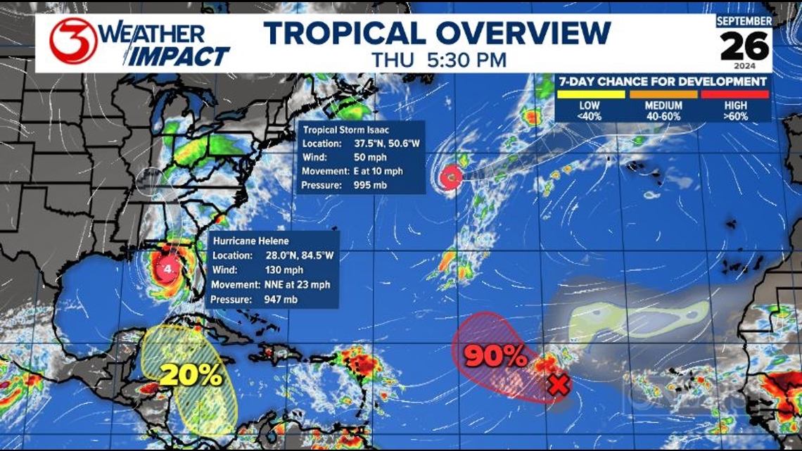
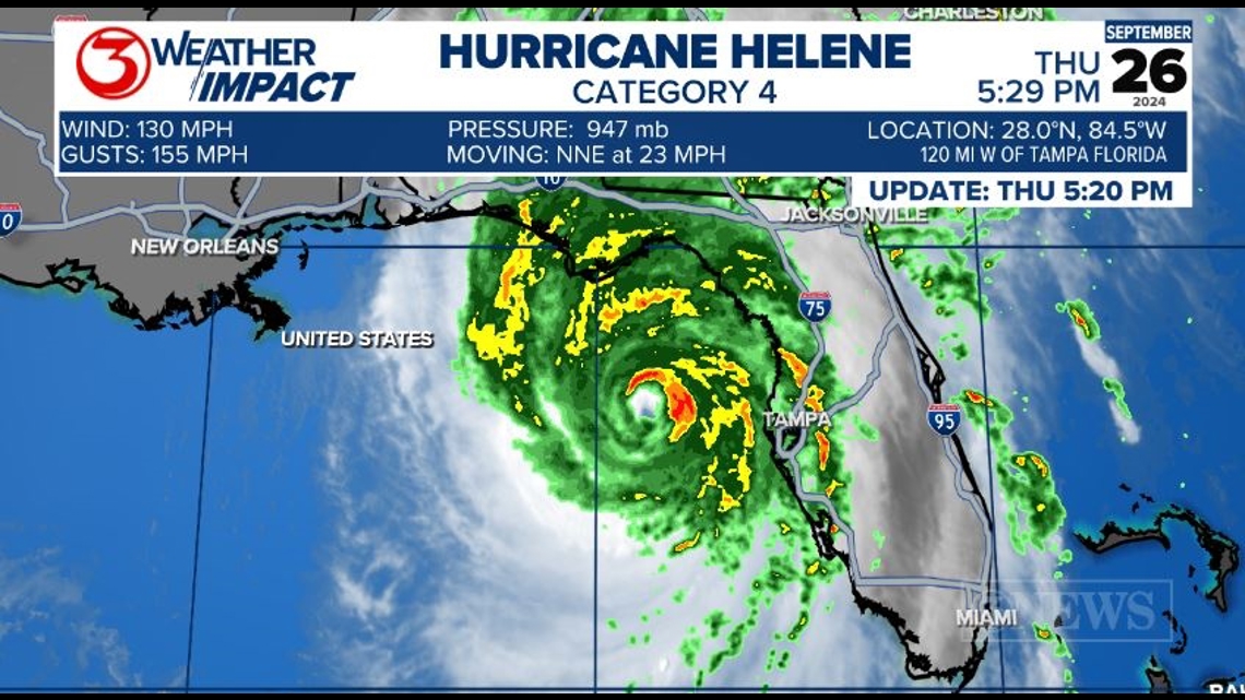
Hurricane Helene continues to gain strength as it makes its final approach into Florida tonight. Helene is currently a major Category 4 hurricane, with winds of 130 mph and gusts to 155 mph as of 5:20pm.

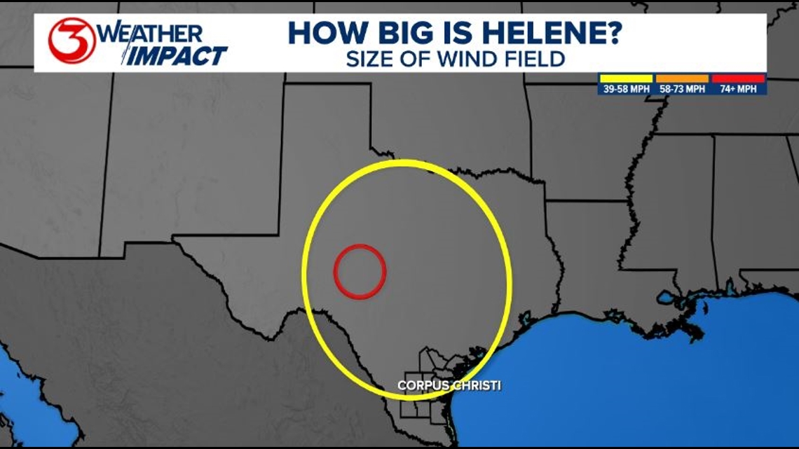
Helene is huge storm - not just its strength, but its literal size. Below is a size comparison of Helene's wind field and the state of Texas. The yellow circle encompasses tropical storm-force winds (39-73 mph) and the red circle encompasses hurricane-force winds (74+ mph).

This huge wind field will push a massive storm surge into parts of the Florida Big Bend and Panhandle. Storm surge forecasts of up to 15-20 ft are forecast in this area. This kind of storm surge is practically unsurvivable.

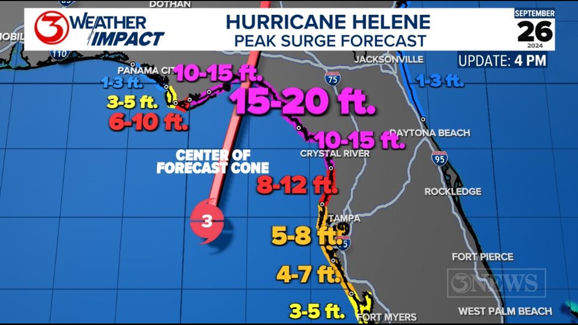
Between the strong winds, storm surge, flooding rainfall, and tropical tornadoes, Helene is expected to be a catastrophic storm for parts of the Southeast.
Landfall is expected around 10pm tonight. Helene will maintain its strength far inland, prompting hurricane warnings to be issued halfway through Georgia. Tropical storm warnings reach as far inland as North Carolina.

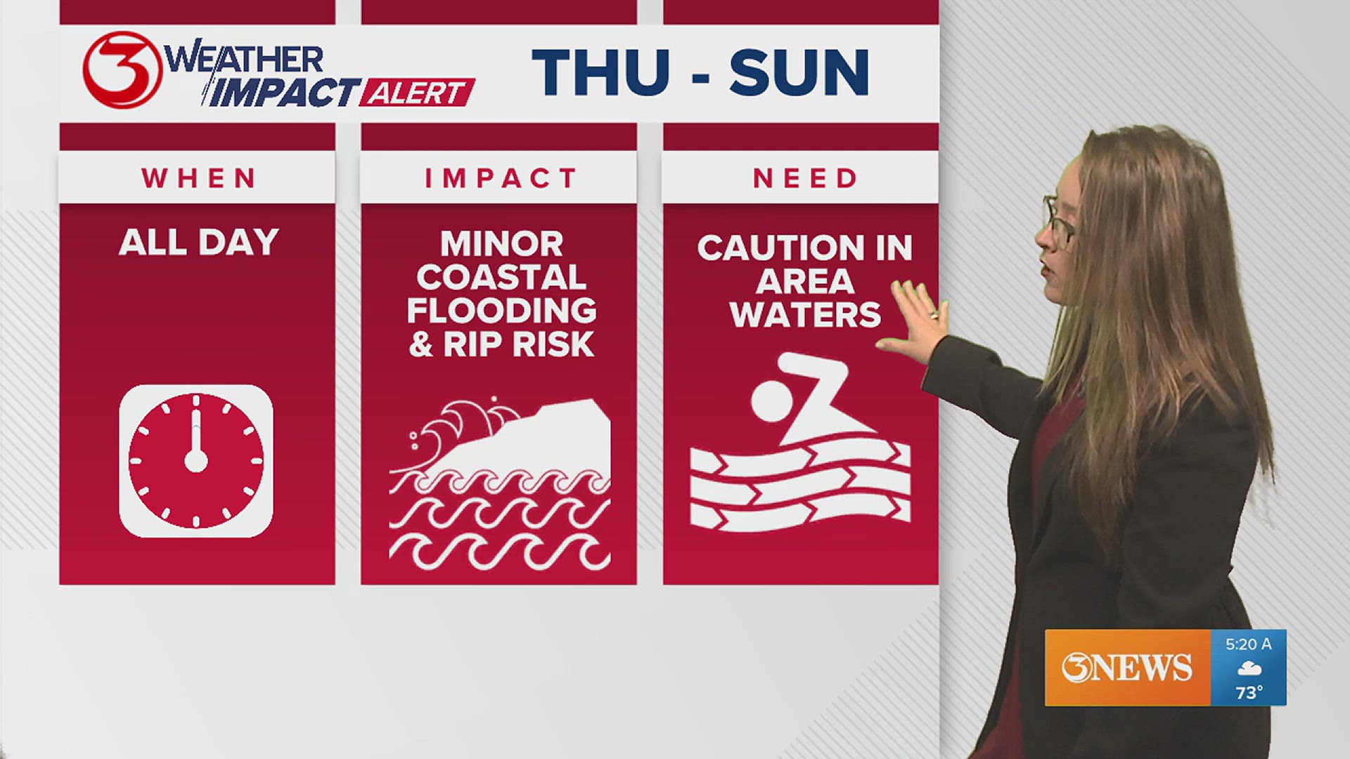
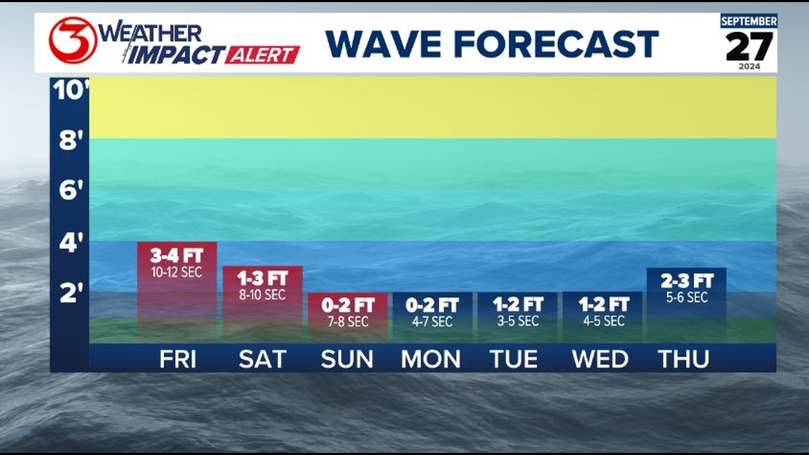
Even though our wave heights won't be that impressive, it's the longer wave period leading to our increased rip current risk. This will likely last through the weekend, so if you're looking to enjoy the nicer weather at the beach, make sure you're staying vigilant and actively looking for rip currents.
If you get pulled away from shore in a rip current, remember to stay calm and swim parallel to the shore until you aren't being pulled out any more. Swim with a buddy, if you can.

---------------------------------------------------------------
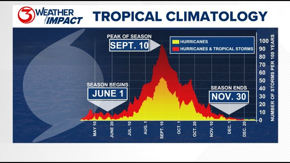
The Atlantic Hurricane Season runs from June 1 to November 30, with the peak of the climatological peak of the season happening on September 10.

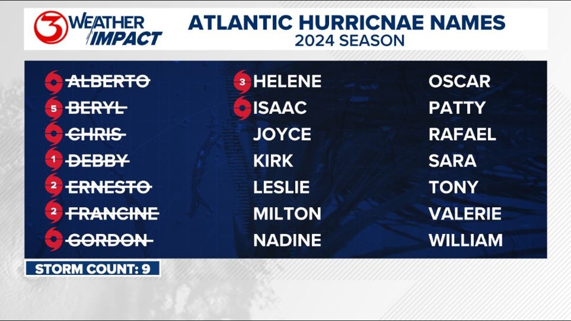
Here are the names for the 2024 Atlantic Hurricane Season. Names are given to tropical cyclones (tropical storms and hurricanes).

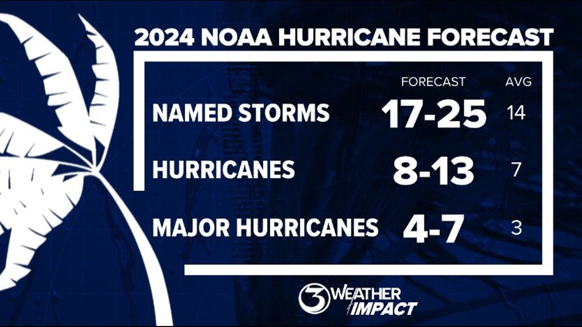
On May 23, NOAA released their forecast for the 2024 Atlantic Hurricane Season. They're predicting an above-average year, with 17-25 named storms. This is the highest pre-season forecast they've ever issued.
The high number of storms forecast is due to near-record sea surface temperatures and the return of La Nina, both of which favor tropical cyclone development. We talk more about those in our Hurricane Special, which you can watch here!

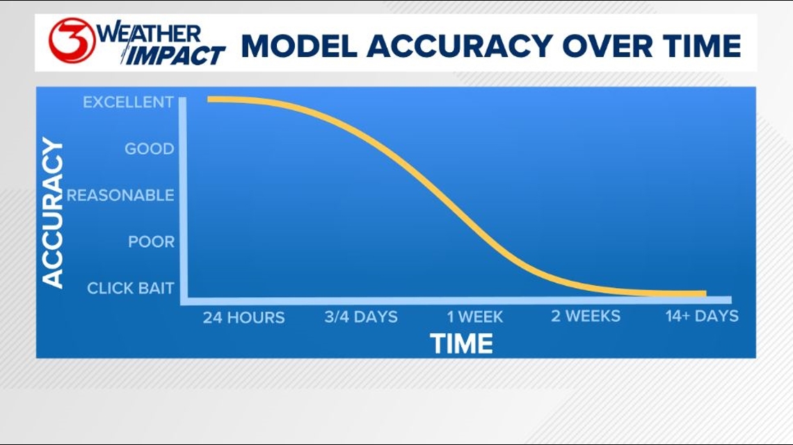
Remember to not "anchor" to the first forecast you see - forecasts change. Also, rely on a credible source for your tropical information and forecasts.