LOUISVILLE, Ky. — A Severe Thunderstorm Watch has been issued for much of Kentuckaina, including Louisville, until 10 p.m. p.m.
Be sure to download the free WHAS11 app for the latest weather alerts from the First Alert StormTeam. For Apple or Android users.
------------------------------------------
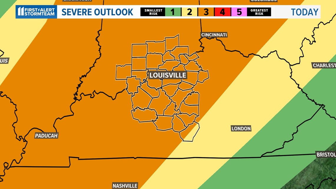
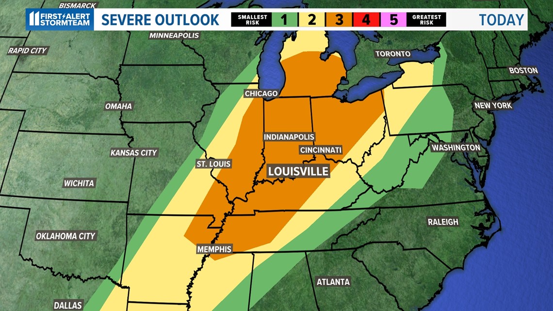
Much of the WHAS11 viewing area is also under a level 3 out of 5 risk for severe weather on Wednesday.

Timeline of severe weather
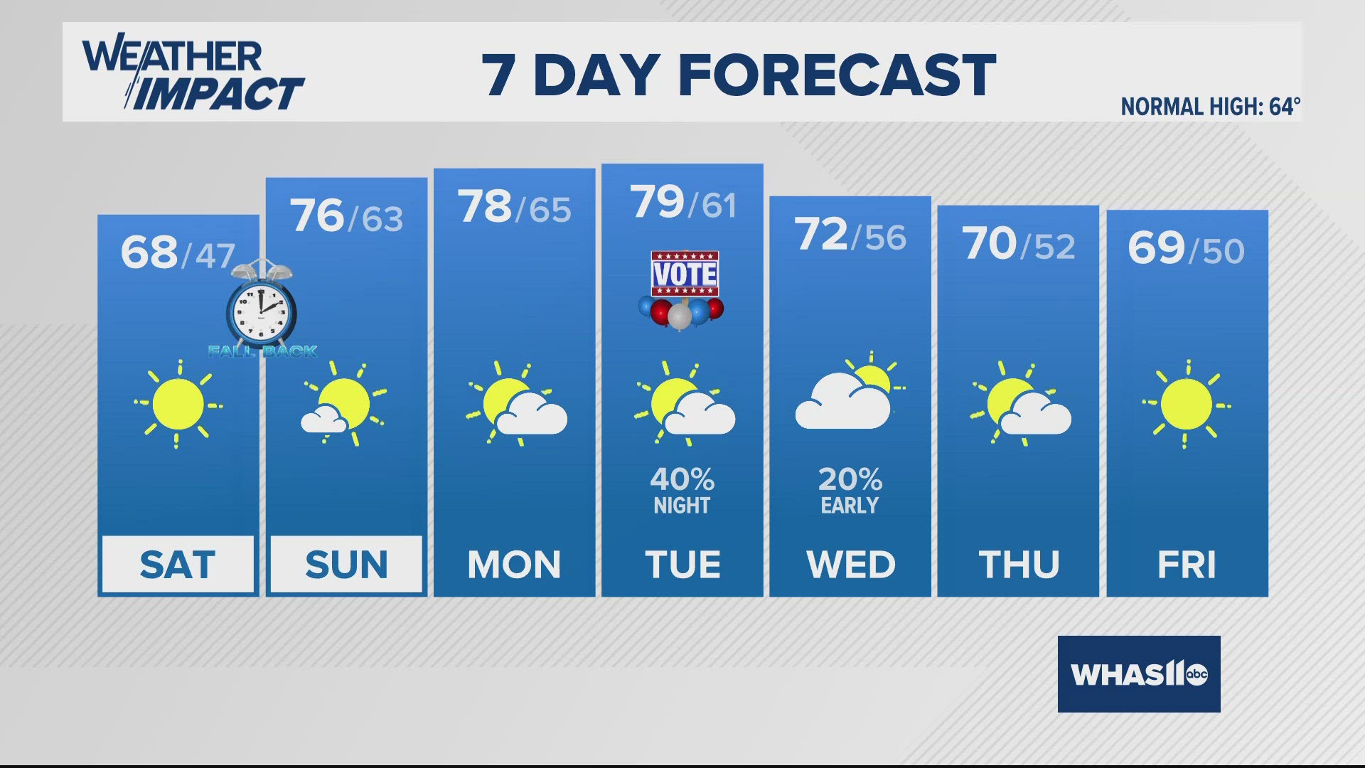
Expect temperatures today to be unseasonably warm, climbing into the middle and upper 70s and possibly the low 80s if we see more sunshine.
A few broken lines of showers and thunderstorms is in the forecast this morning. The activity will likely not be severe.
The greater severe threat will come in the later this afternoon and into the early evening/nighttime hours.

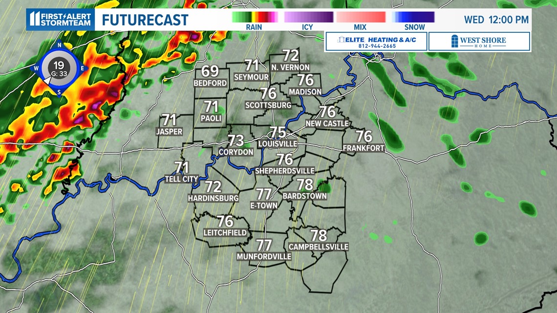
This also means a good portion of the midday hours will be dry.
If we see any sunshine temperatures may jump quickly into the lower 80s. Expect a rather humid outlook as well!
Sunshine is very important, as it could energize our atmosphere and heighten the risk for strong to severe storms late today.


Severe Weather Outlook
The current severe weather risk is level 3 of 5 for the entirety of the WHAS11 viewing area.
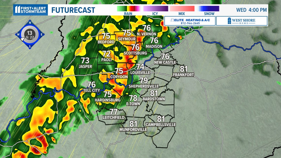
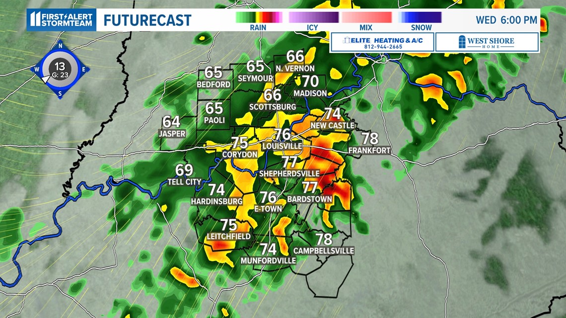
Severe weather is expected in Kentuckiana around beginning at 4 PM for our western communities and stretching into the late evening and early overnight hours.
The line of storms should again be stronger west of I-65 and weaken as it crosses the I-65 corridor.

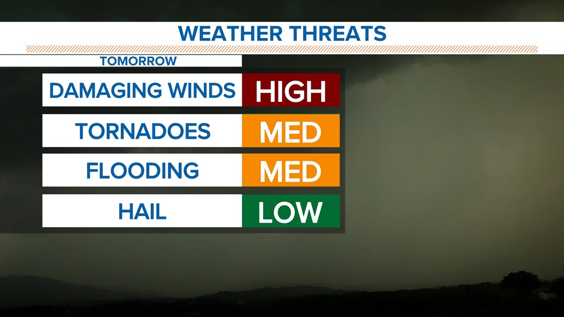
Damaging straight-line wind gusts (60-70 mph) are the biggest threat, but isolated spin-up tornadoes like last Friday night will be a possibility as well.
Hail concerns remain on the low end, but we may see some areas of flooding due to the ground still being quite saturated from last week’s heavy rain.

How much rain is coming?
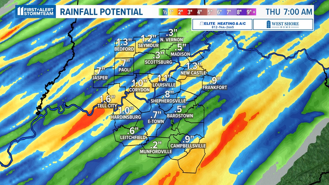
Around 1-1.5” of rain will be possible with this next round of thunderstorms.
Locally higher totals will happen in regions with particularly heavy rainfall.
As mentioned before, localized flooding will be a concern given how wet the ground still is from last week.

The next chance of rain will be Monday, but for now, severe weather seems unlikely. Get the latest seven-day forecast by clicking here.
Make it easy to keep up-to-date with more stories like this. Download the WHAS11 News app now. For Apple or Android users.
Have a news tip? Email assign@whas11.com, visit our Facebook page or Twitter feed.


