LOUISVILLE, Ky. — Heads up if you are out and about throughout the day Tuesday!
A low pressure system is organizing to the west of Kentuckiana at the moment and there remains sufficient moisture across our atmosphere.
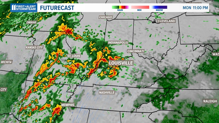
As a result, the incoming fronts and low pressure center will make for enough instability for strong (to perhaps severe) storms to form late Monday night and linger through much of the day Tuesday.
Dew point temperatures remain on the high side for early January as our sky will remain juiced for rain to be locally heavy at times with the developing storms.
Main risks for overnight severe weather
- Heavy rain (exceeding an inch per hour at times)
- Strong wind gusts (up to 60-65 mph)
- Frequent lightning
- Possibility for an isolated tornado
Get the latest weather alerts by downloading the free WHAS11 app to your smartphone. For Apple or Android users.



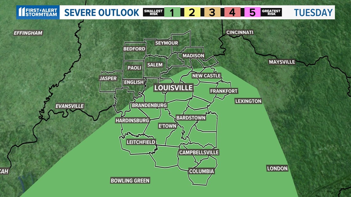
Fortunately, our sky will lack the ideal combination of ingredients for tornadoes but there will be enough wind shear (difference in wind direction with height) for a few isolated tornadoes to form.
Nonetheless, the risk for severe weather remains on the "slight" scale or 1/5 on the severity scale anywhere across our Kentuckiana communities.

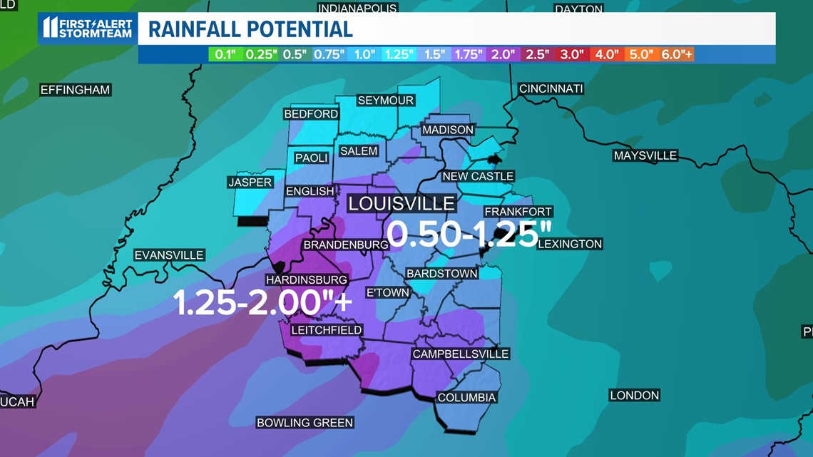
Flooding rains will be the primary risk. When it is all said and done, well over an inch of rain is in the forecast for Metro Louisville, with models displaying the likelihood of 1.50-2.00" of rain for spots along the I-64 corridor in southern Indiana as well as cities along and southwest of Louisville.
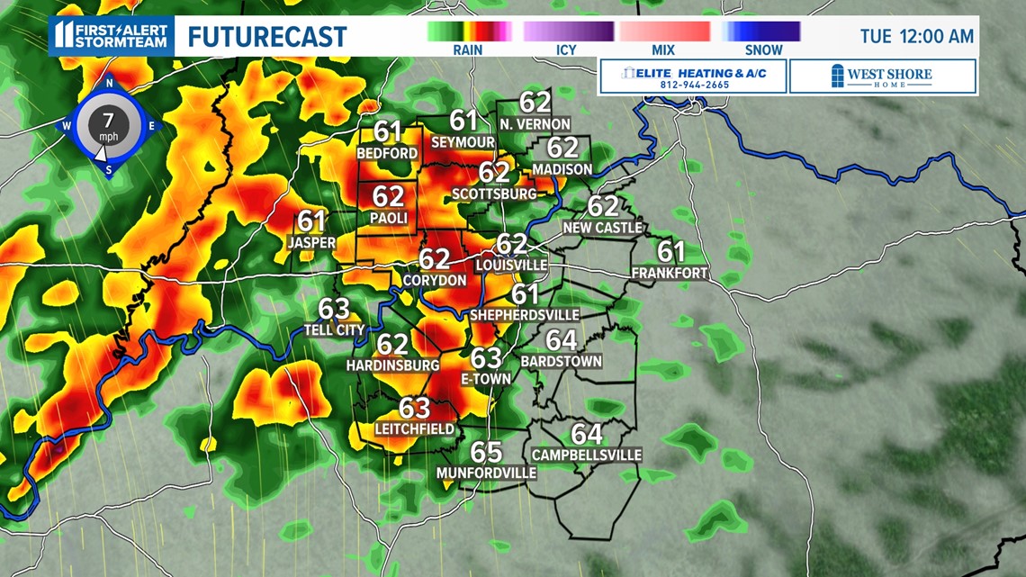
The timing of the heaviest storms will occur by midnight for our western communities, thus stretching eastward with time.
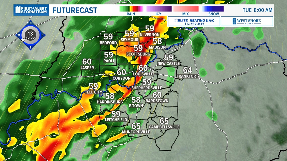
The storms will likely organize in a line along the Ohio River and much of extreme southern Indiana and will push toward Metro Louisville just in time for the morning commute. Therefore, be on alert localized flash flooding and heavy downpours that will limit visibility during the morning hours!

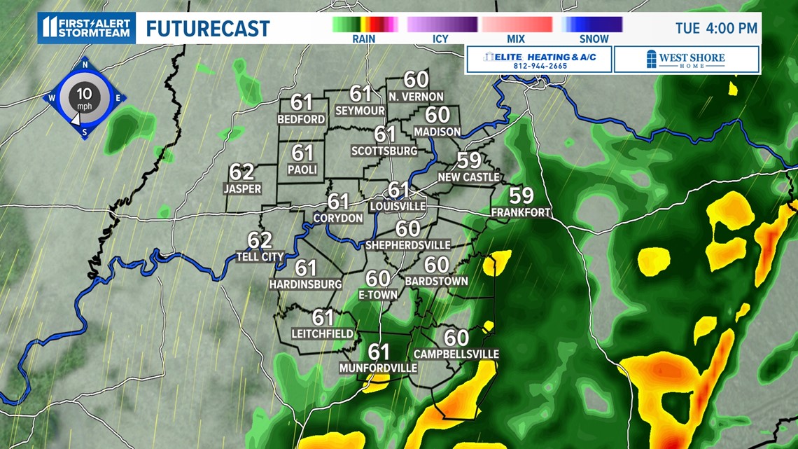
We do not expect widespread showers and storms through the course of Tuesday afternoon and evening but a few additional lines of showers and storms will organize again for the second half of the day.
Tuesday night may bring a few hit or miss rumbles of thunder, but the general consensus is for lesser chances for storms.
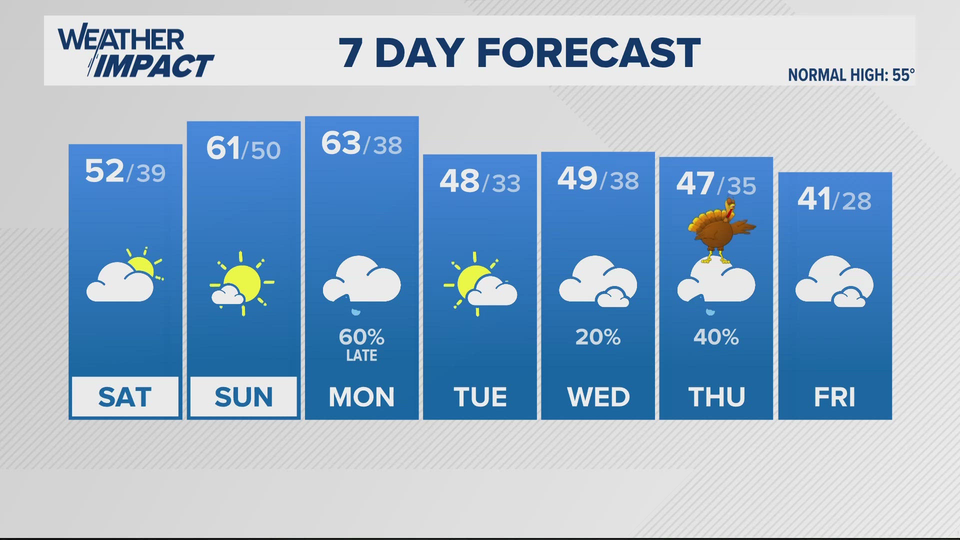
The cold front will slide through by Wednesday morning, thus a lot drier air will move in but will knock back temperatures quite a bit to for the final days of the week.
Make it easy to keep up-to-date with more stories like this. Download the WHAS11 News app now. For Apple or Android users.
Have a news tip? Email assign@whas11.com, visit our Facebook page or Twitter feed.


