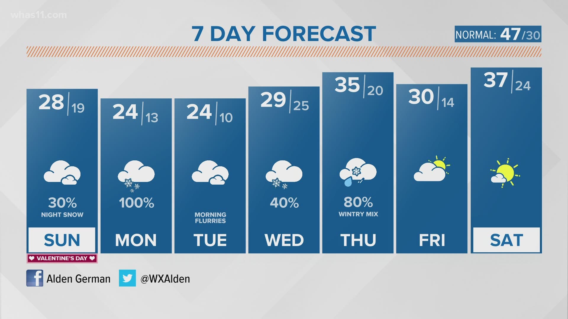
LOUISVILLE, Ky. — A major winter storm bringing several inches of snow is still in the forecast for Monday. Another winter storm late next week may bring more snow and ice.
Forecast at-a-glance:
- Sunday will largely be cloudy, cold, and dry
- Snow Monday will come in two waves, starting late Sunday evening
- Heaviest snow likely Monday afternoon
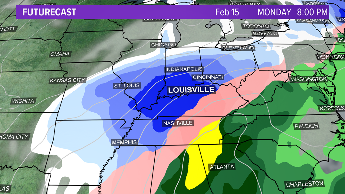
The snow is expected to begin late Sunday night with light accumulations possible through Monday morning. The area may get a little break, before the snow turns heavier late Monday afternoon through Monday night.

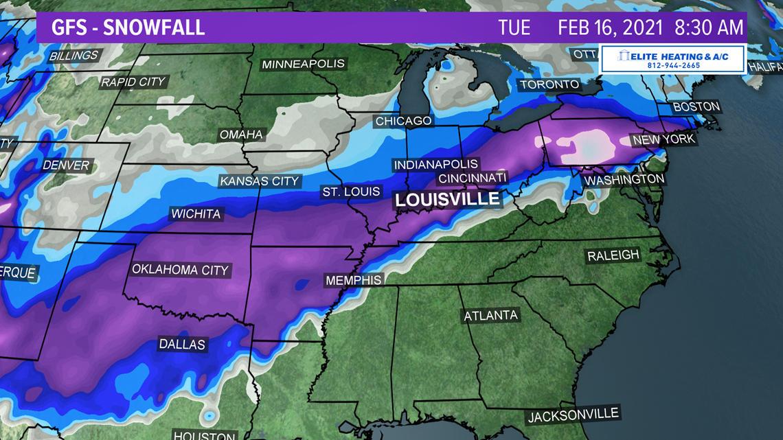

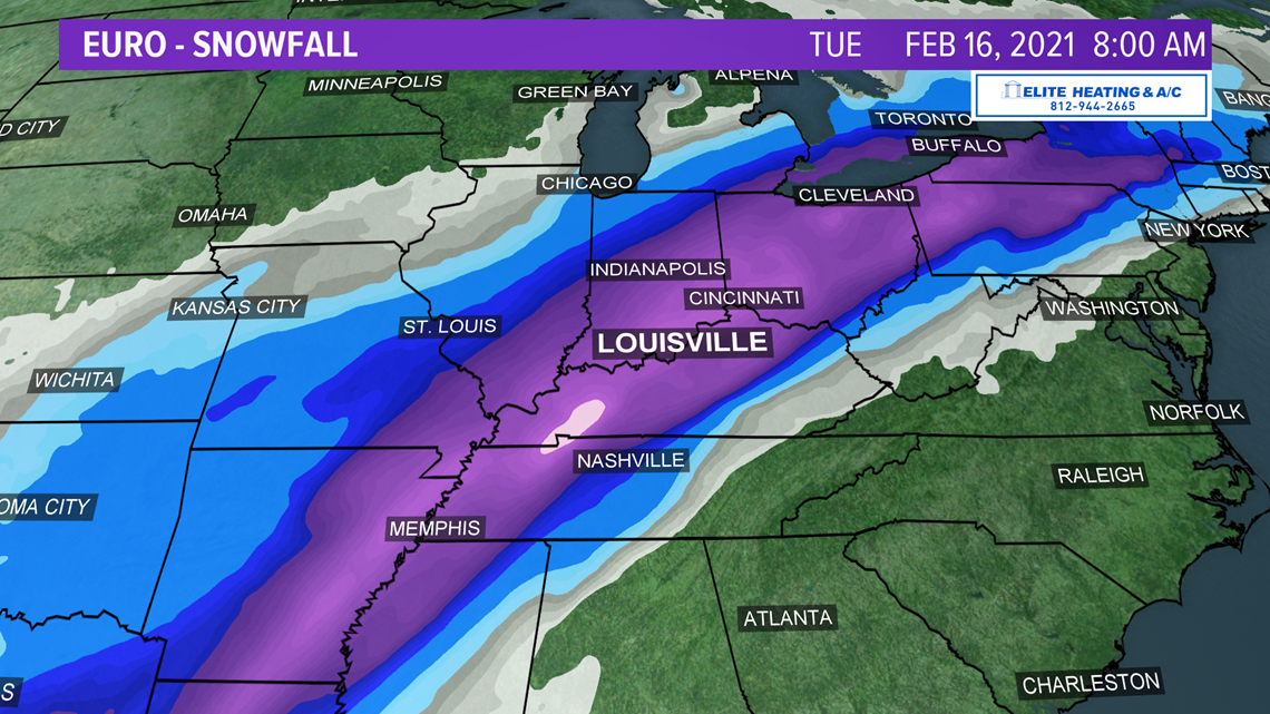

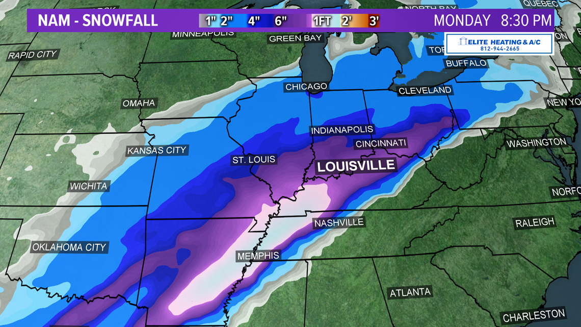
Below shows the timing of the heaviest snow late in the day Monday. Temperatures will be very cold with highs in the lower 20s, and that's something to watch. Often colder temperatures will provide higher snowfall ratios, which can bring higher snowfall totals.
Thankfully, Monday's winter storm looks like it will pack mostly snow, and not all of the other types of precipitation. So, looking snowy and not icy for most of us in Kentuckiana.

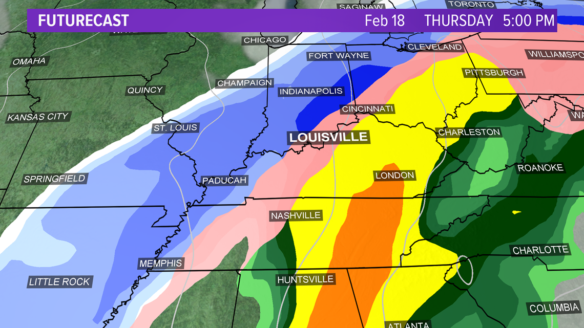
Winter storm No. 2 will be possible next Wednesday into Thursday. This one could be trickier, since it could involve another mixed bag of precipitation. If Thursday's storm tracks farther east, we would have more snow chances, a more western track will mean a chance of more rain, snow or sleet. We've got plenty of time to fine tune the details next week. Stay tuned!

Get the salt, snow blowers and shovels ready!
Follow the WHAS11 First Alert Storm Team on Social Media:
►Make it easy to keep up-to-date with more stories like this. Download the WHAS11 News app now. For Apple or Android users.
Have a news tip? Email assign@whas11.com, visit our Facebook page or Twitter feed.

