
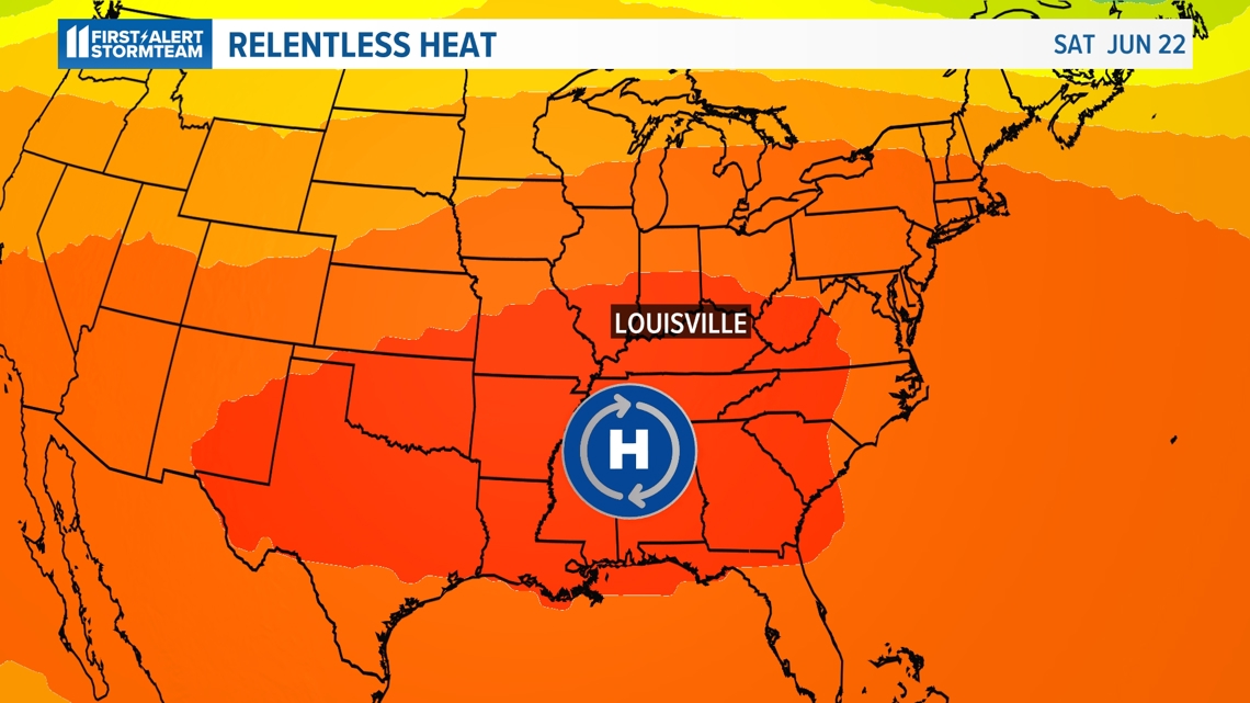
LOUISVILLE, Ky. — A prolonged heat wave has gripped the eastern half of the United States, including here in Kentucky and southern Indiana, with no signs of letting up any time soon. In fact, temperatures will test record highs for this weekend.
Rain is also a scarce possibility over the next week or more, which may result in drought conditions.
A large heat dome has been sitting over the eastern U.S. for the previous week. This has resulted in numerous cities experiencing record high temperatures or record warm low temperatures.
Although we haven’t experienced any record-breaking heat in Louisville yet, we will come close in the next few days.

Heat domes are the result of areas of high pressure settling over an area.
High pressure means air is sinking, and because sinking air compresses and warms, this results in high temperatures at the surface. Thankfully we’ve had expansive cloud cover at times, which has acted like a shield to keep temperatures from really running away.
Testing record highs
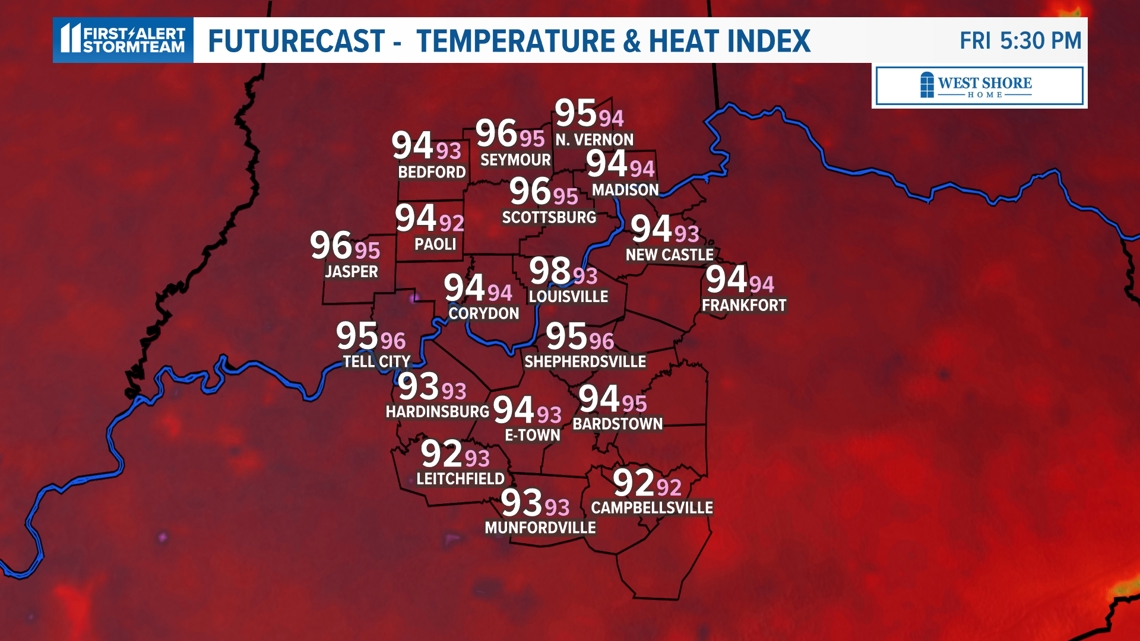
High temperatures are forecast to reach the upper 90s, near 100 degrees, in metro Louisville Friday through Sunday. This is also expected to be the peak of the heat.
A look at current record highs for the coming days:
- Thursday, June 20: 100 degrees set in 1953
- Friday, June 21: 98 degrees set in 1988
- Saturday, June 22: 100 degrees set in 2022
- Sunday, June 23: 98 degrees set in 1988

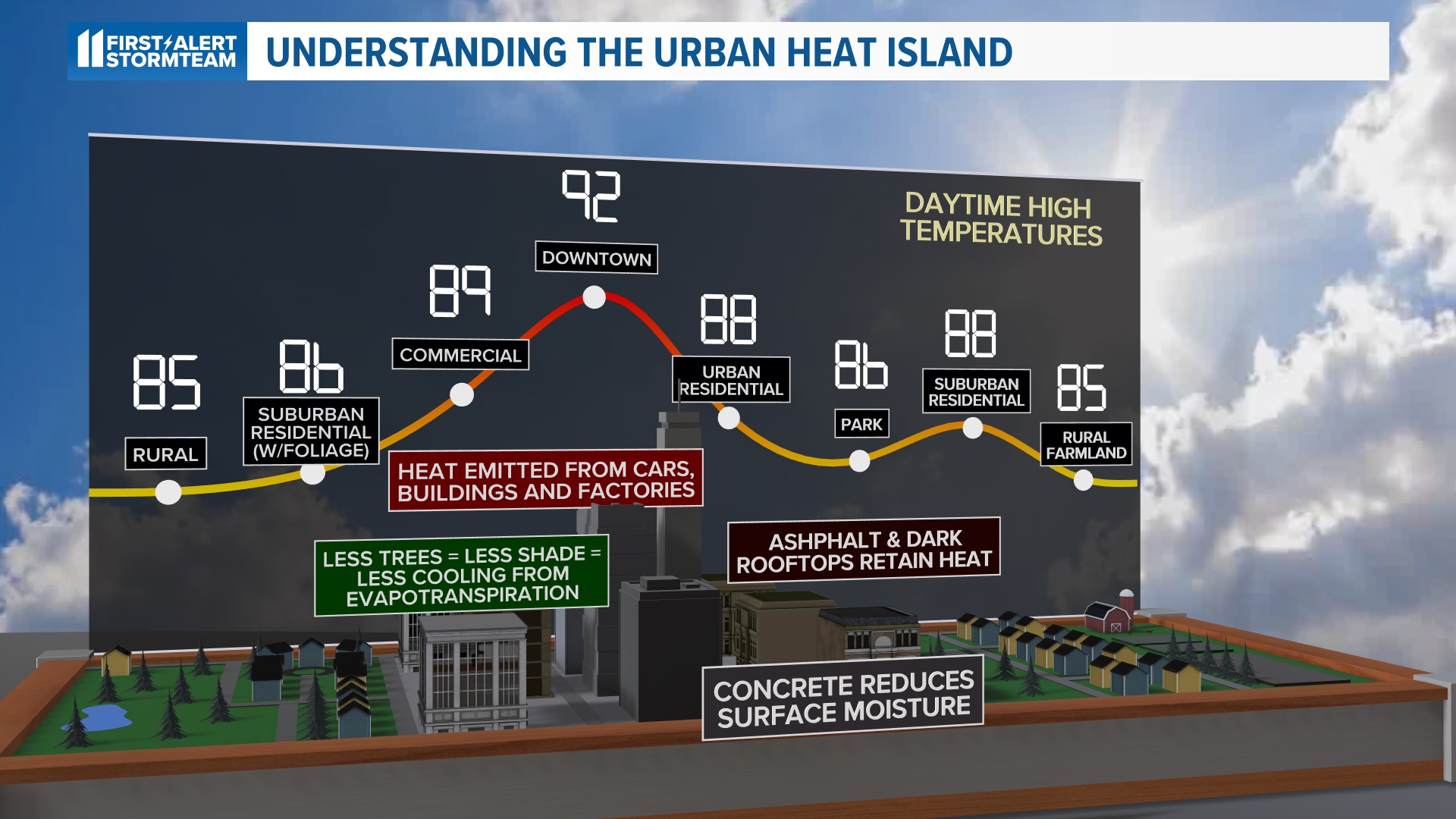
One thing that doesn’t help the heat, especially in Louisville, is the urban heat island.
The urban heat island is a phenomenon that forms as a result of a lack of greenspace or tree canopy and an excess amount of concrete and asphalt.
Concrete and asphalt absorb heat very well and release it very slowly. This results in inflated high temperatures and very warm nights. With Louisville having one of the worst heat islands in the country, specifically areas west of Interstate 65, forecast high temperatures may overachieve.


That said, we have had a good deal of cloud cover the last couple days.
If we continued to see partly-to-mostly cloudy skies, then that would help in blocking some sunlight from reaching the surface and put a lid on temperatures.
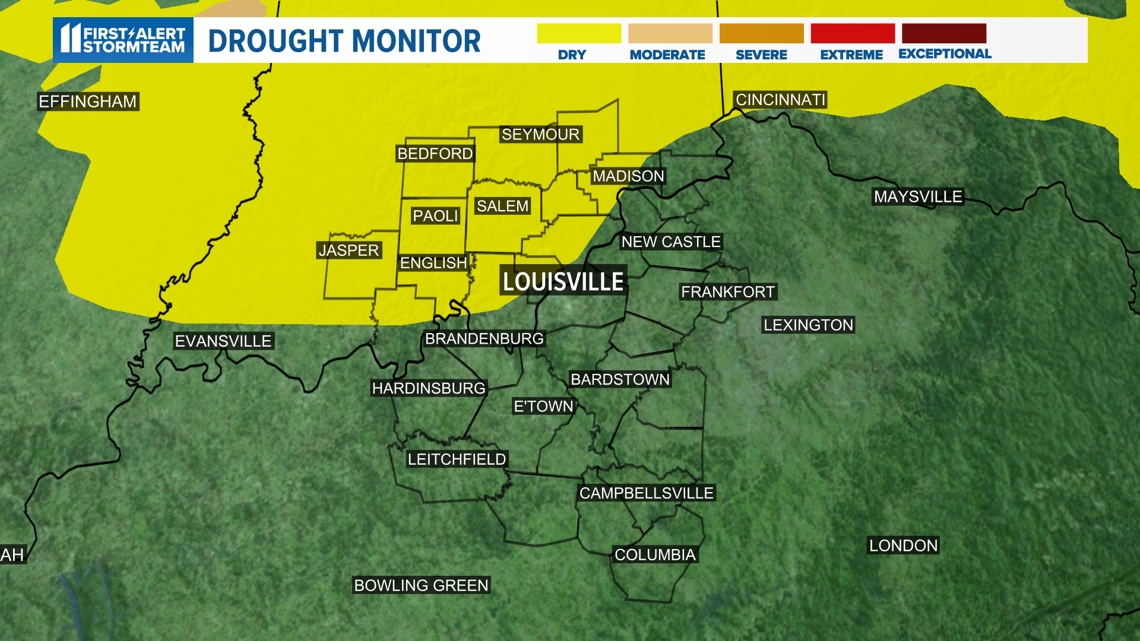
Monitoring drought concerns
This sudden and prolonged heat exposure has resulted in rapid drying across Kentucky and southern Indiana, and has brought concerns of a flash drought.

A flash drought can be thought of as the opposite of a flash flood.
According to NOAA, a flash drought is the “rapid onset or intensification of drought. It is set in motion by lower-than-normal rates of precipitation, accompanied by abnormally high temperatures, winds, and radiation.”

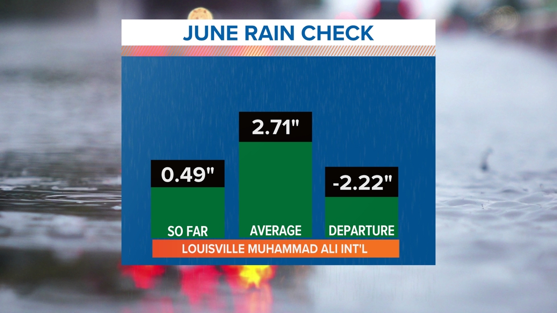
That lack of rainfall is certainly evident. Louisville’s last measurable precipitation came June 5 when a whopping 0.05 inches of rain fell at Muhammad Ali International Airport.
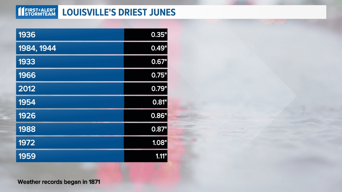
For the month to date, only 0.49 inches of rain have officially fallen. This puts us currently tied for second driest June in Louisville’s recorded weather history.

And if you're looking for any relief from this heat, you may be waiting a while longer. Thursday marks the official start of summer and highs are likely to stay in the 90s through next week.
Temperatures are also likely to stay above normal through the end of June.
Make it easy to keep up-to-date with more stories like this. Download the WHAS11 News app now. For Apple or Android users.
Have a news tip? Email assign@whas11.com, visit our Facebook page or Twitter feed.