A strong storm system will be moving through our area on Saturday bringing a guarantee of heavy rain, and a small potential of strong to severe storms.
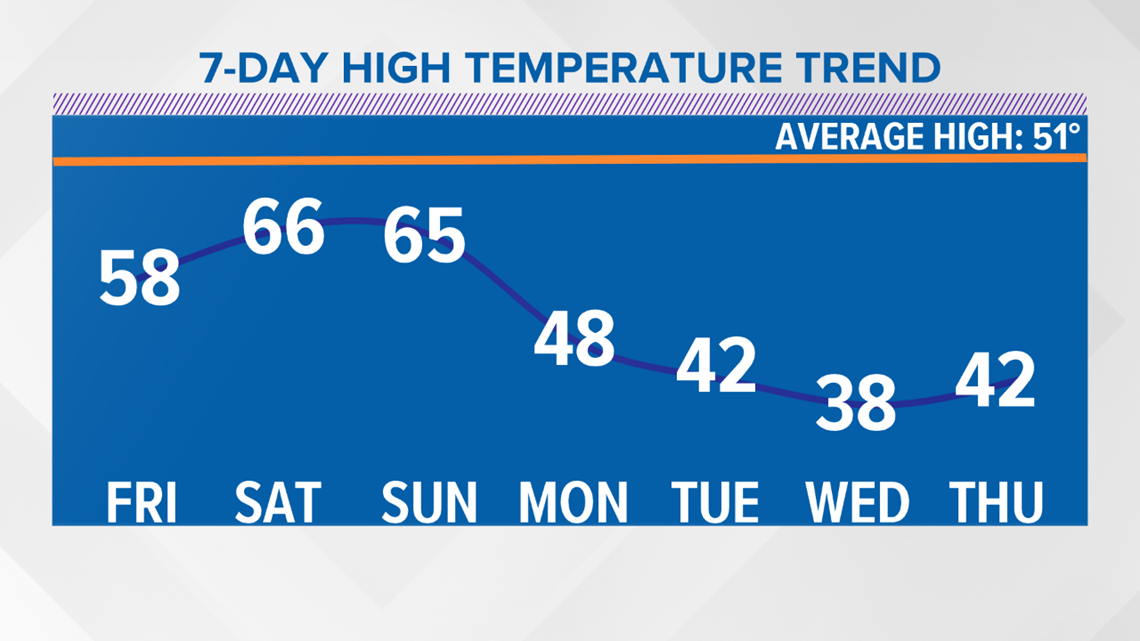
The good news, this storm is from the Pacific, so warmer temperatures are on the way as this system moves through Kentuckiana with highs in the 60s Saturday and Sunday!
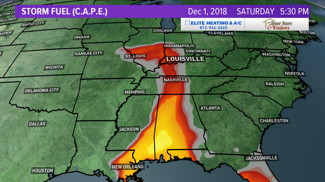
The first map below shows the Storm Prediction Center has a Slight Risk of Severe Storms over the Deep South and that is well south of our area. We are only under a Marginal Risk (level 1 of 5). The second map shows the higher energy or fuel for severe storms is south of us as well.
While the air isn't very unstable, there is a lot of wind energy, so if any storm does get going, we'll have to watch our for isolated damaging wind gusts. But, again, overall the severe weather threat is low at this point for Saturday afternoon.
STORM PREDICTION CENTER


FUTURECAST
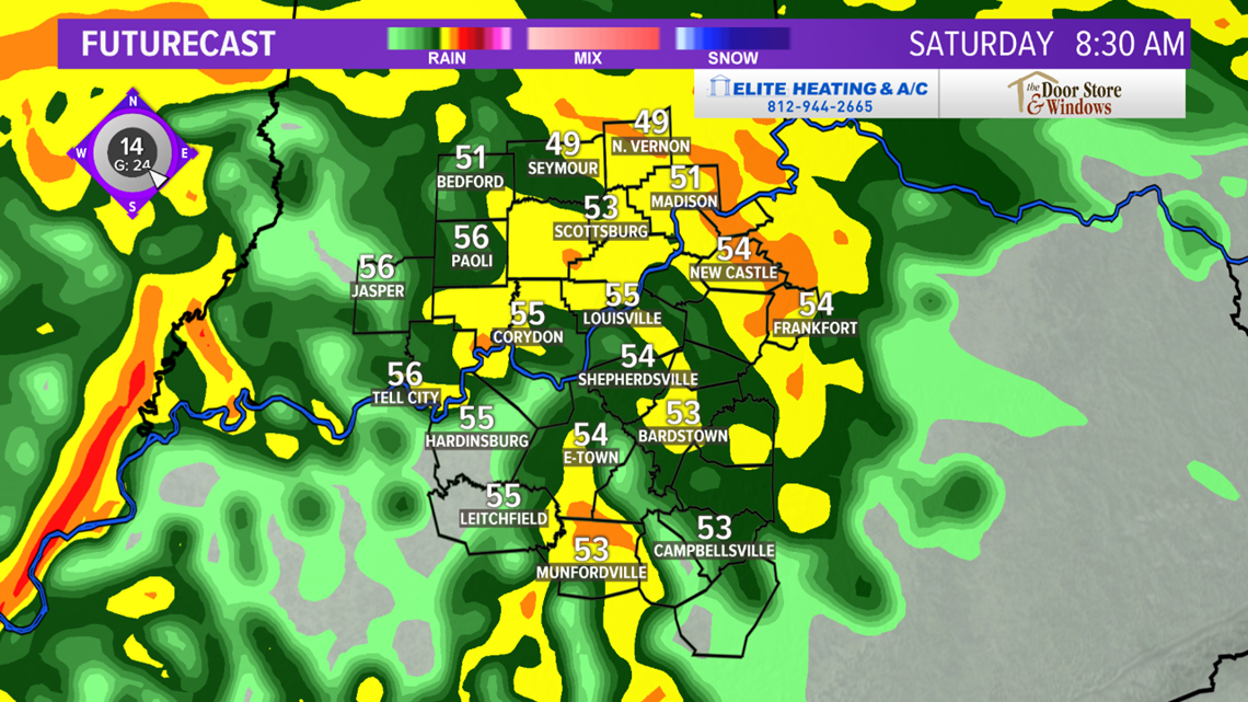
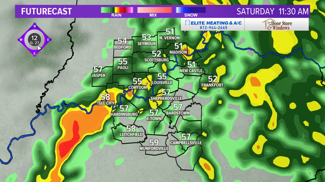
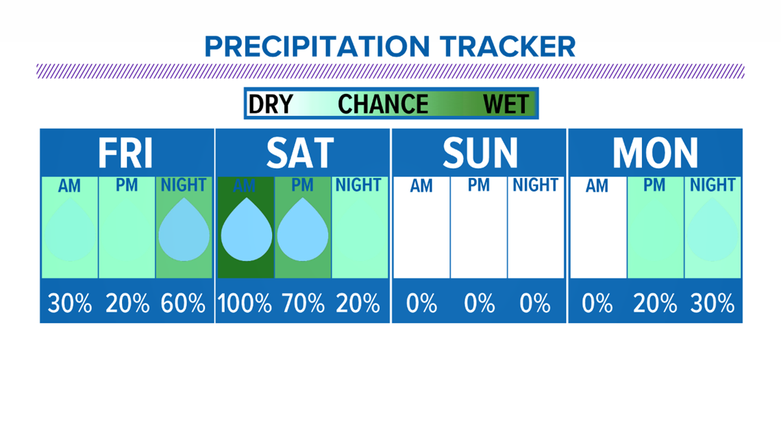
Now, here is a look at our Futurecast maps timing out the heavy rain on the way. This looks like a 100% chance of heavy downpours during the overnight and early Saturday morning. The rain is expected to taper off by late Saturday afternoon and especially by Saturday evening. This should work in our favor if you Saturday night plans, and our weather is looking very nice for Sunday!
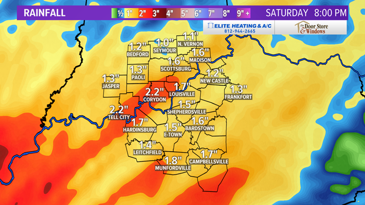
The last Futurecast map shows the rainfall totals - most around 1-2". Now, this won't cause major problems, but isolated flooding could be possible.
3:30 AM SATURDAY

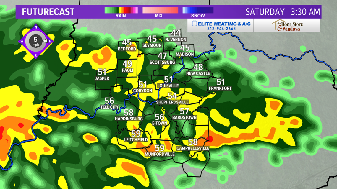
8:30 AM SATURDAY

11:30 AM SATURDAY



PRECIPITATION TRACKER

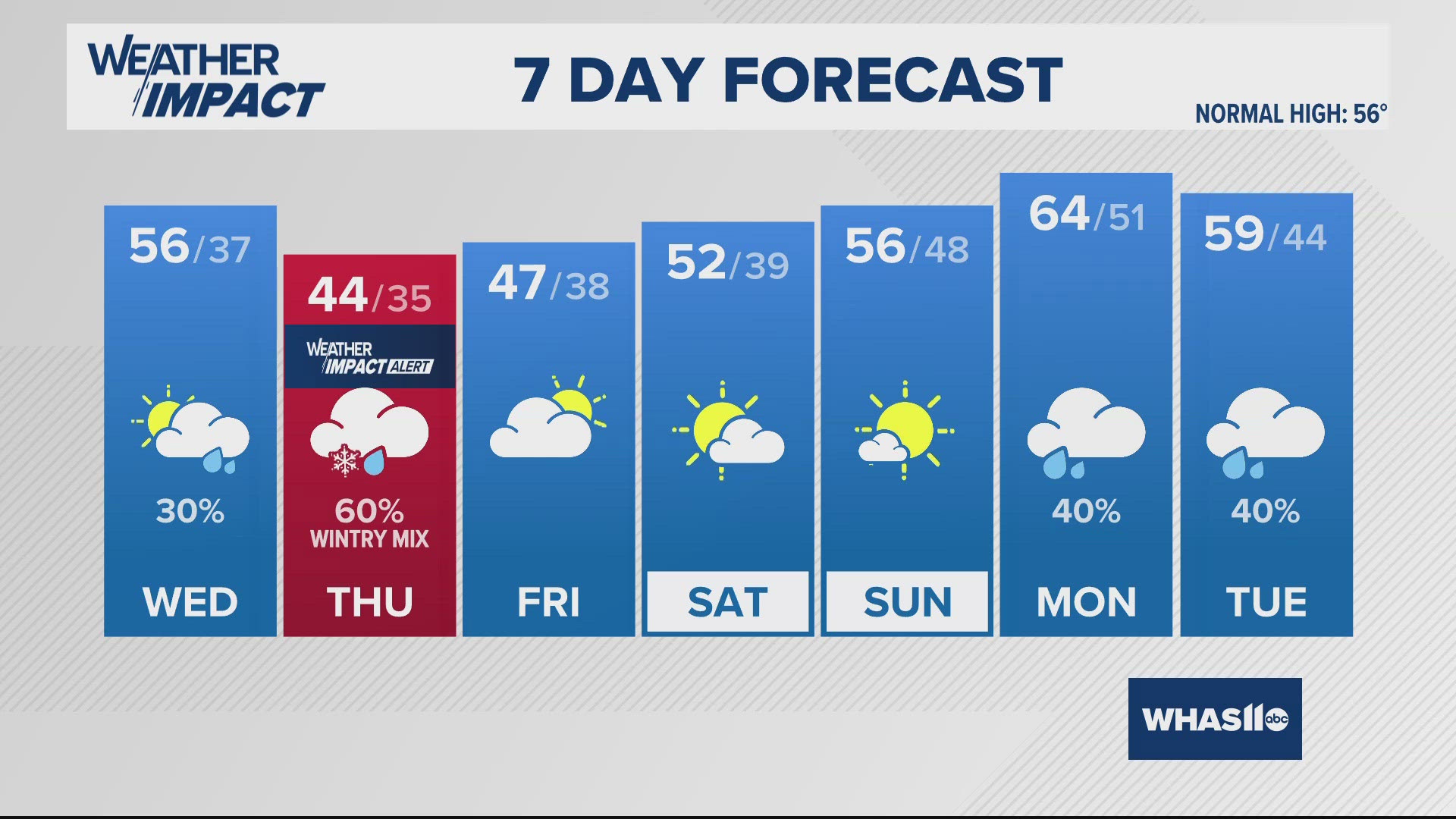
Finally, enjoy the spring-like temperatures this weekend, before another cold winter-like blast next week! Flurries and light snow showers are likely again by Tuesday!

As always, if you have any weather questions, feel free to tweet me @WHAS11Ben or message me on facebook - Chief Meteorologist Ben Pine

