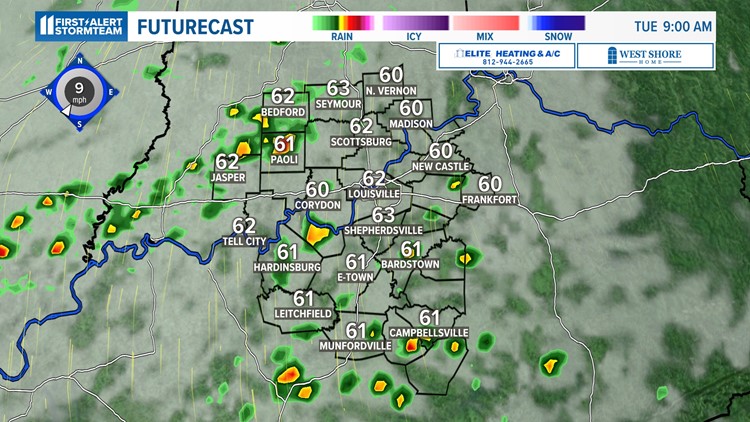
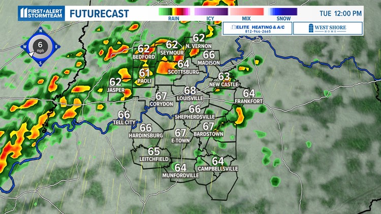
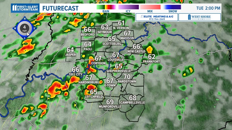
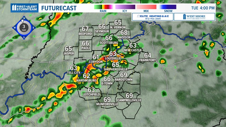
LOUISVILLE, Ky. — A wet set up through the next 5 days will bring up to 1.50-2.00 inches of rain for portions of Kentuckiana. Luckily, we are not tracking severe weather but this pattern will definitely make for the umbrella and windshield wipers to be used as we open up March.
Timeline
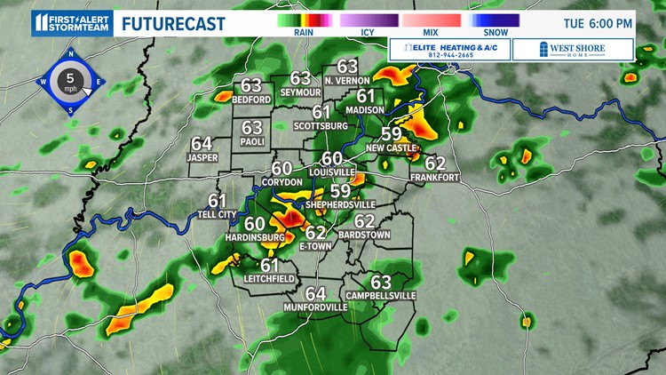
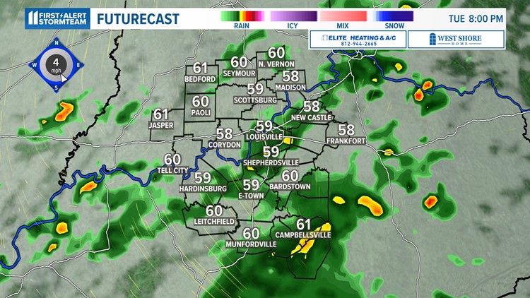
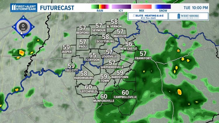
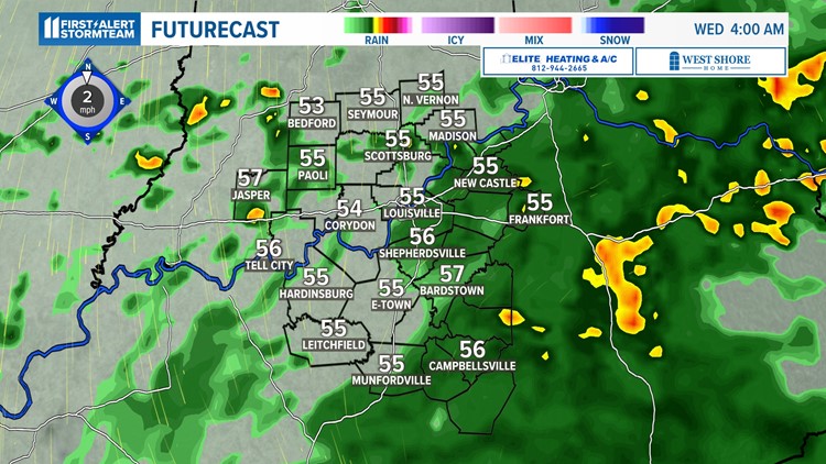
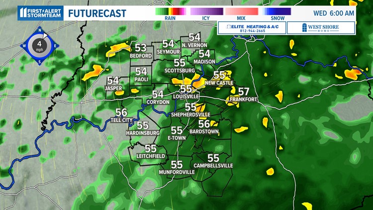
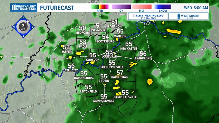
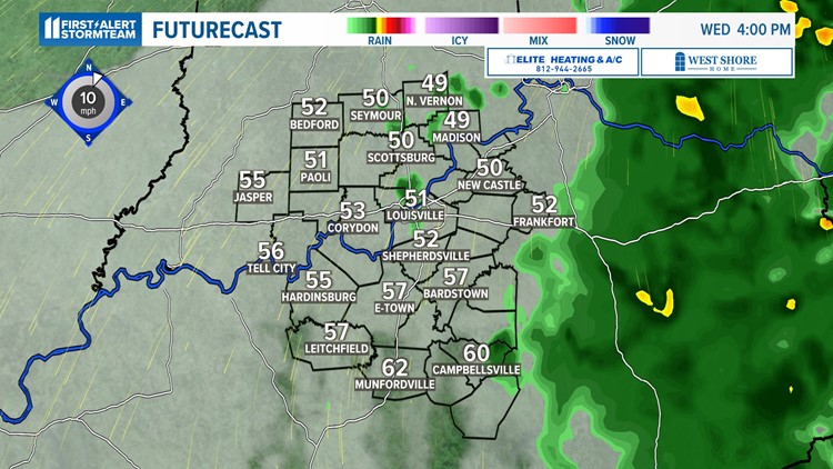
A low pressure center and cold front are drifting in from the west and will make for pop up showers and storms throughout Tuesday afternoon, some Tuesday night and again Wednesday morning. Most cities this morning will stay dry but the front will begin to inch closer to us by early Tuesday afternoon. If you plan to step out the door for lunch, it may be wise to pack the umbrella.
In the meantime, a few sporadic light showers may pop up to get Tuesday morning started. The main line of showers and storms will move from southern Indiana into the Ohio River Valley (midday), and eventually Louisville and southern Kentuckiana spots (early to mid-afternoon).
If some of these storms train over your area, do not be surprised to pick up locally heavy downpours for a brief 5-15 minute window.
Midweek storm system brings steady rainfall to Kentuckiana
As the front slides to the south and east, the showers and storms will be a lot more isolated in coverage. As a result, Tuesday night will stay mild and mostly cloudy with a few stray showers at times.
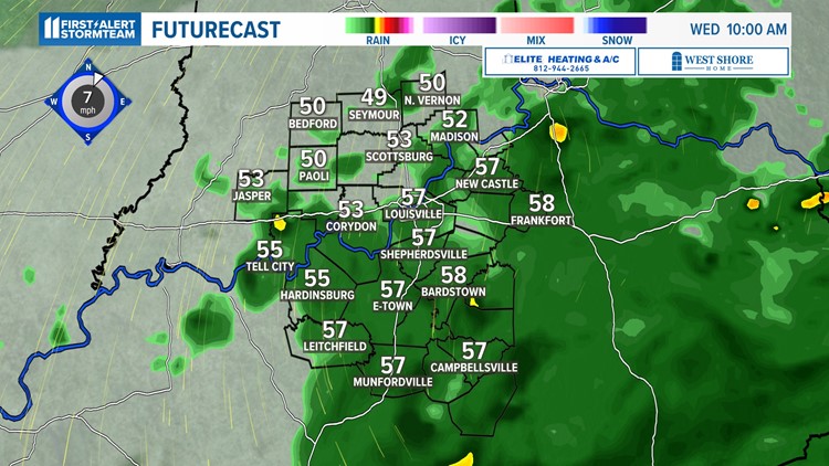
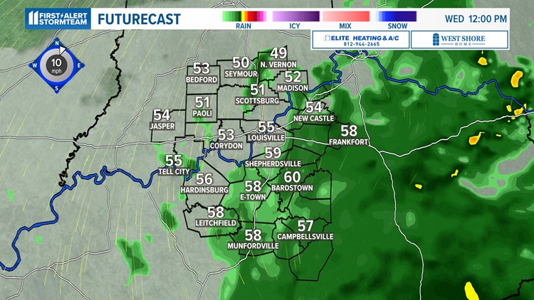
Expect a wet morning on Wednesday. Temperatures will also stay in the 50s and possibly lower 60s at best Wednesday afternoon. The storm system will be a slow-mover, finally exiting us by late in the day.

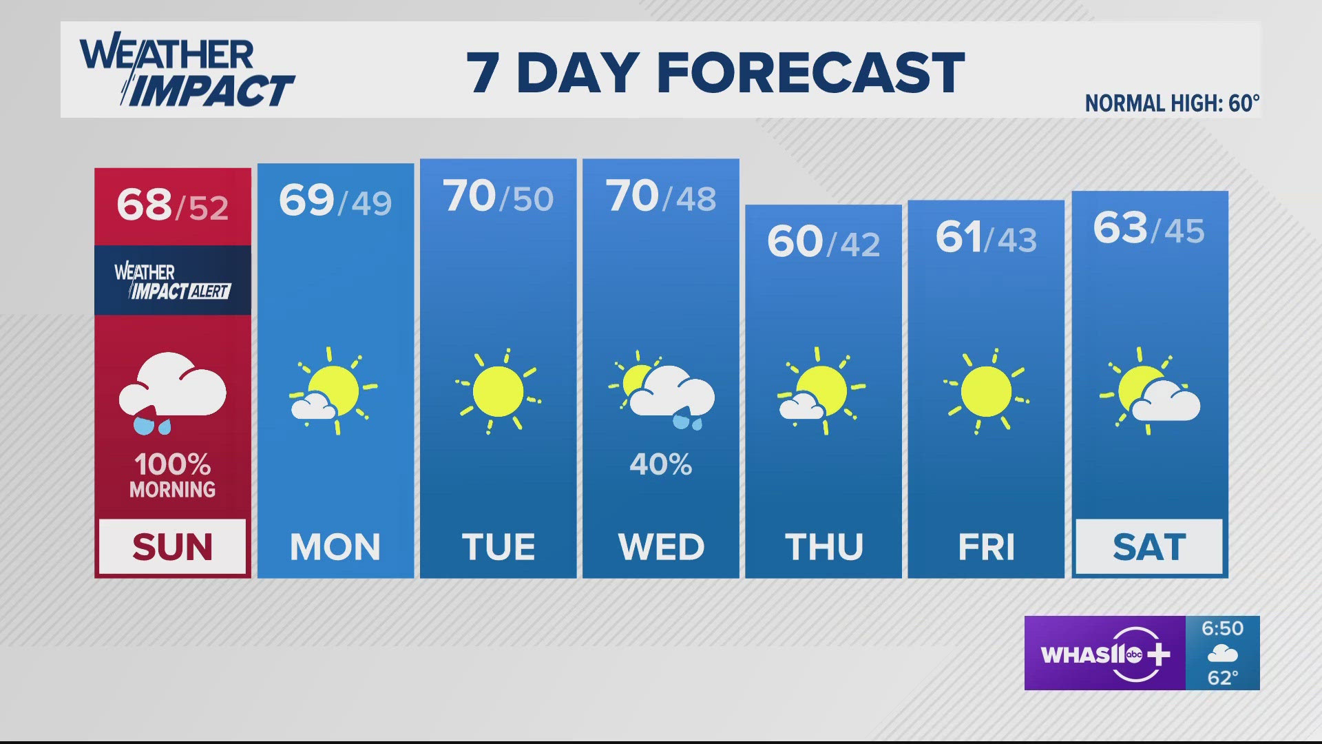
We will dry out Wednesday night and the daytime hours Thursday. Thursday is a good day to book outdoor plans before another storm system arrives to begin next weekend.
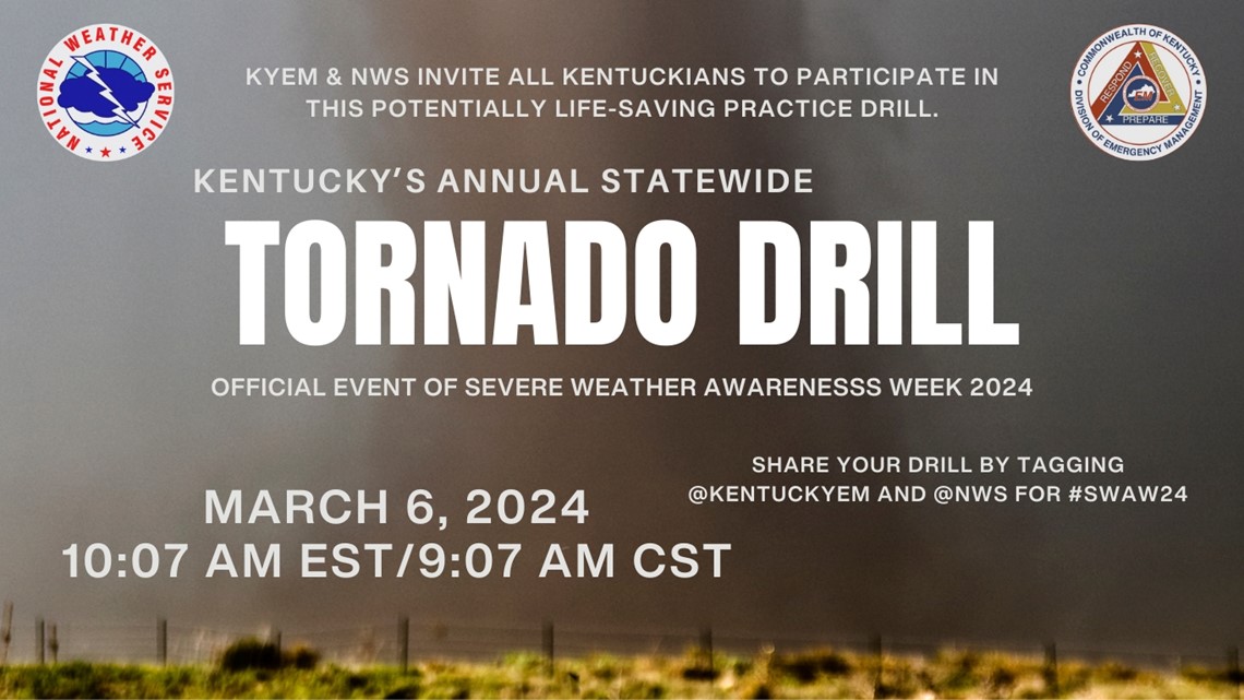
Tornado Drill Tomorrow
This week marks Severe Weather Awareness Week in Kentucky. Along with that also comes our first tornado drill of the year. The sirens will alarm at 10:07 a.m. on Wednesday. To reiterate, this is just a drill. It's a good opportunity to get to know your safe space at home or even at the workplace and to be prepared when severe weather may strike this Spring or Summer.

Friday to Saturday Storm System
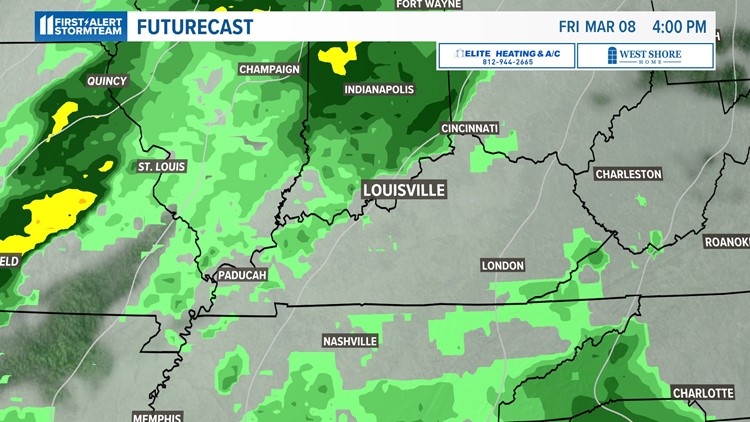
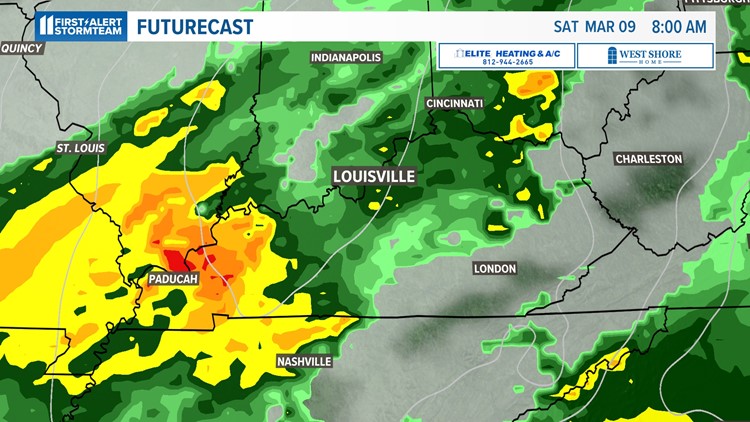
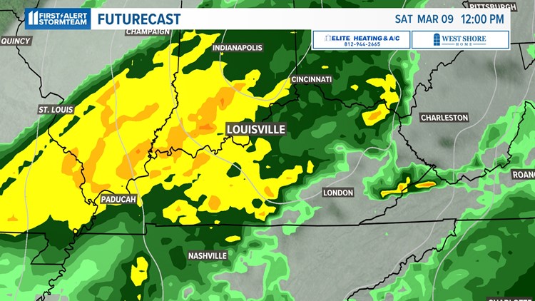
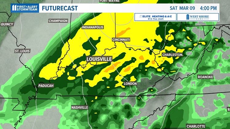
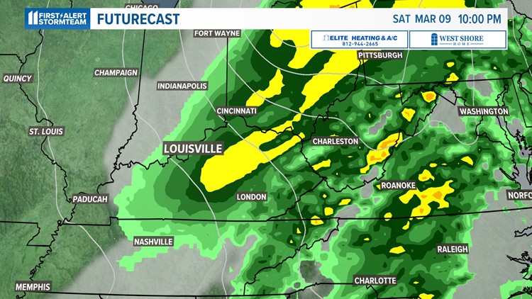
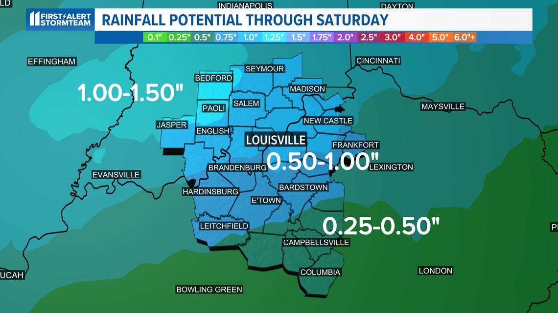
After Thursday's sunshine, attention shifts to the next storm system as we head into the holiday weekend. Right now, the severe weather risk remains very low but we will be monitoring it and keeping Kentuckianans posted. Nonetheless, plan on a wet storm system to say the least. Model forecasts are hinting at a swath of an inch or more of rain.
The main timing of this storm system appears to be from Friday afternoon through Saturday night. We are mainly focused on the cool and breezy conditions along with the rainfall when it comes to this system. No severe storms are in the forecast.
Storm system eyes Kentuckiana this weekend
Keep in mind, temperatures will also fall from the 50s to the 40s and eventually even the upper 30s as this storm system rips through to start off the weekend. Packing the rain poncho may be a good idea, especially if you plan to take part in St. Patrick's Day Parade festivities.
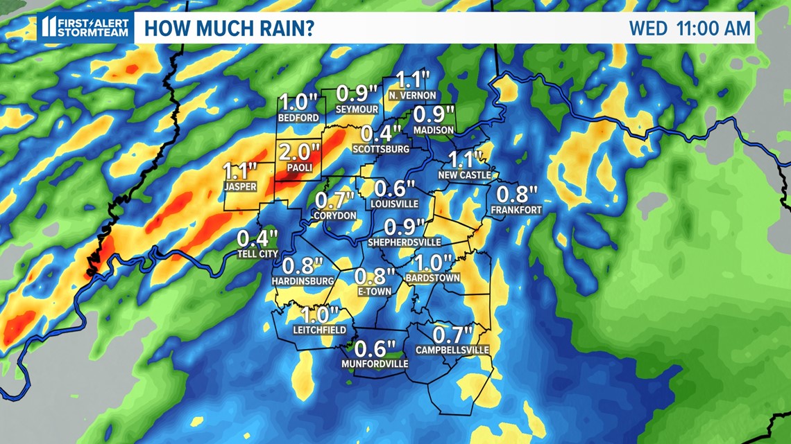
Here is a look at the rainfall forecast for our area through next weekend:

St. Patrick's Day Parade
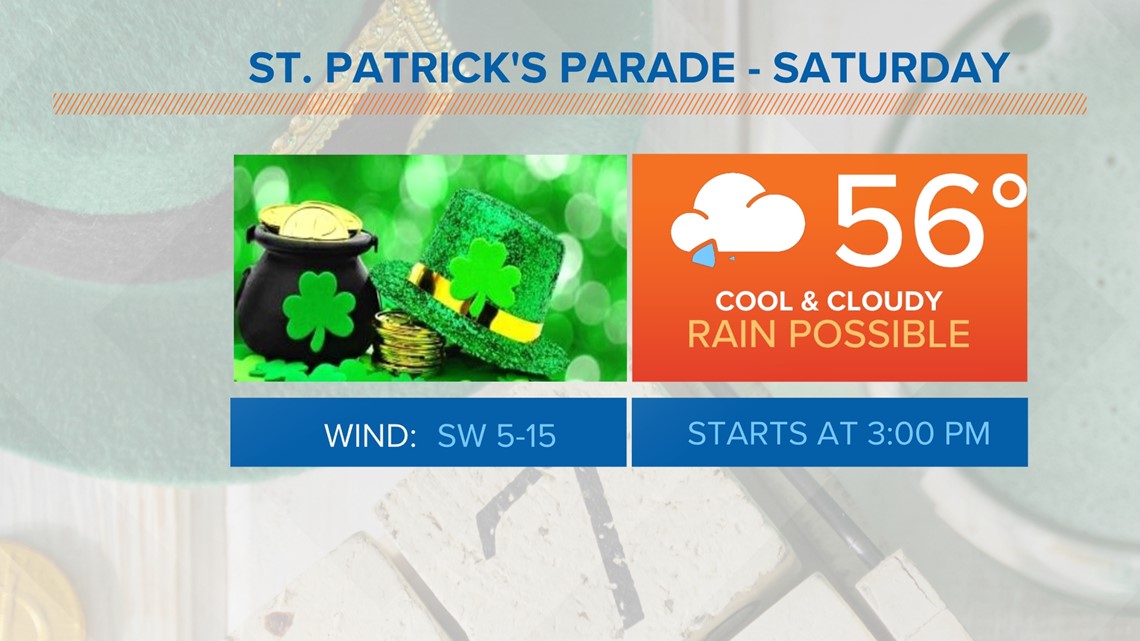
Unfortunately, the Louisville St. Patrick's Day Parade appears to be gloomy, cool and at times rainy. Rain or shine, the Parade will go on! Just make sure you dress accordingly if you will be participating or observing the Parade down Bardstown Road. The St. Patrick's Day Parade begins at 3 p.m. and we will be watching the latest forecast for you closely.

Make it easy to keep up-to-date with more stories like this. Download the WHAS11 News app now. For Apple or Android users.
Have a news tip? Email assign@whas11.com, visit our Facebook page or Twitter feed.


