
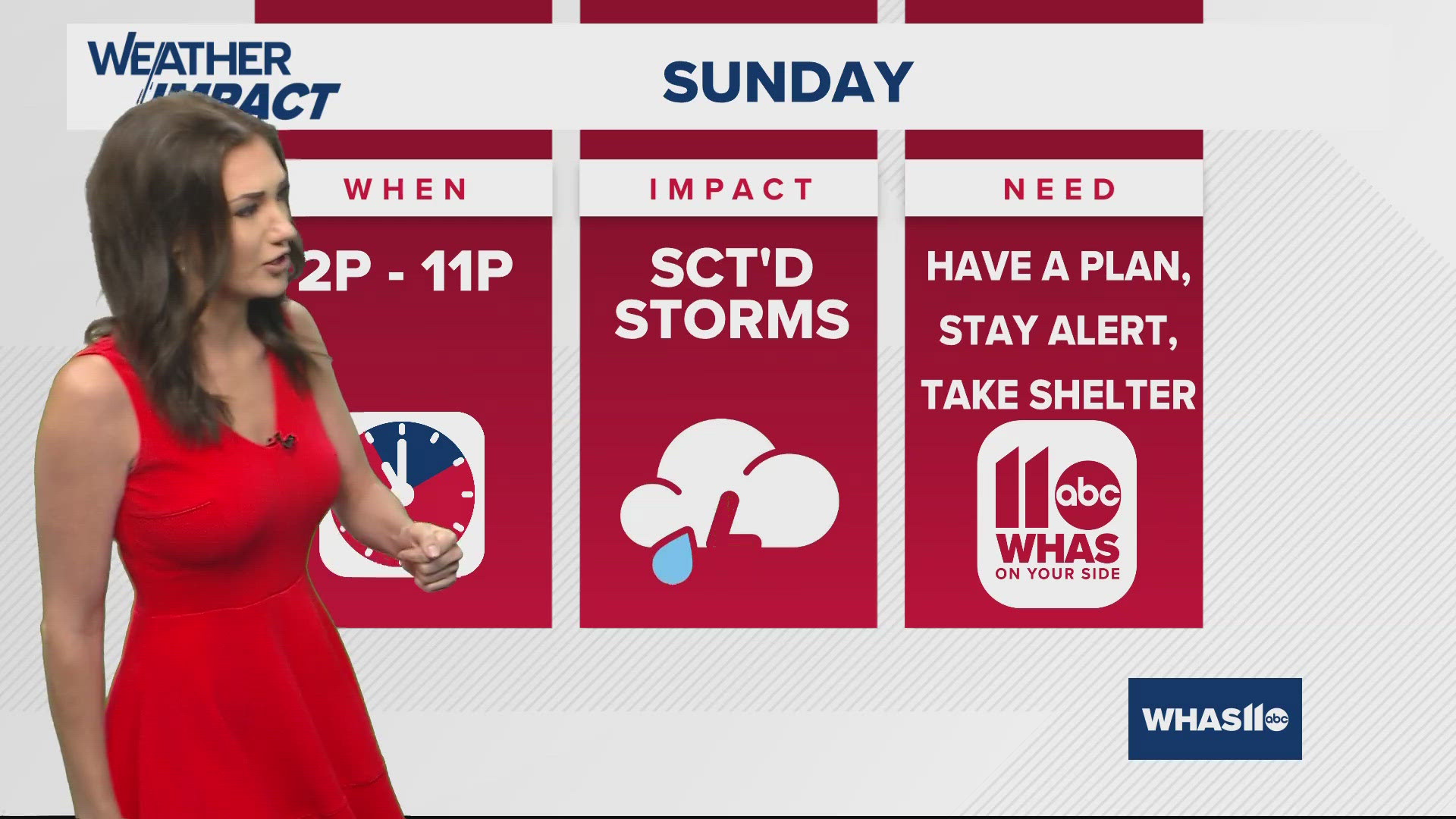
LOUISVILLE, Ky. — The WHAS11 Impact Weather Team has issued an alert day for Sunday and Monday as showers and thunderstorms are expected to impact for several spots across Kentuckiana.
There is no highlighted risk for severe weather at this time, but that forecast may change as we guide you into the next few days.
Timing
Right now, storms will ignite just to the west of Kentuckiana Sunday afternoon and they will drift eastward with time and look to affect many spots into the final hours of the weekend.
Severe weather is not in the forecast at this time, but locally heavy rainfall is likely going to bring issues to a lot of flood-prone locations. Keep in mind, well-above-normal rainfall has been recorded so far this month.
Storms approaching Louisville area

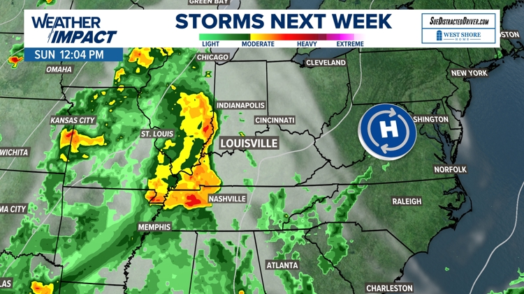

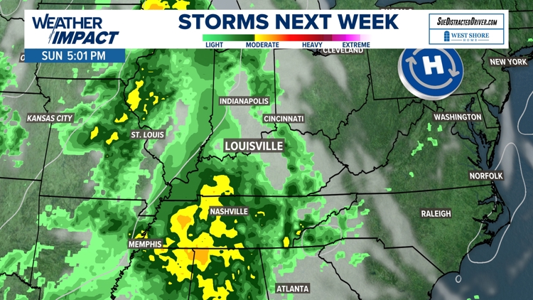

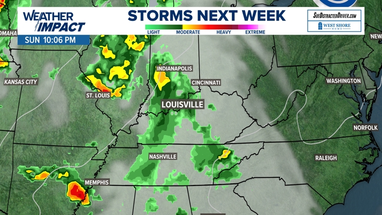

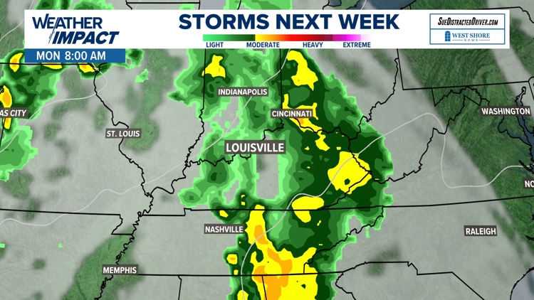

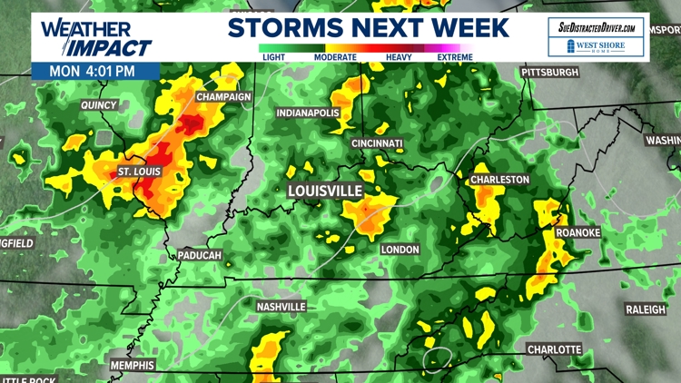
Storm chances look highest during the day Monday. We will be tracking the incoming storm system and keeping you informed and safe as we gather more information.
There are multiple weekend events going on that may be impacted by the chance of storms.

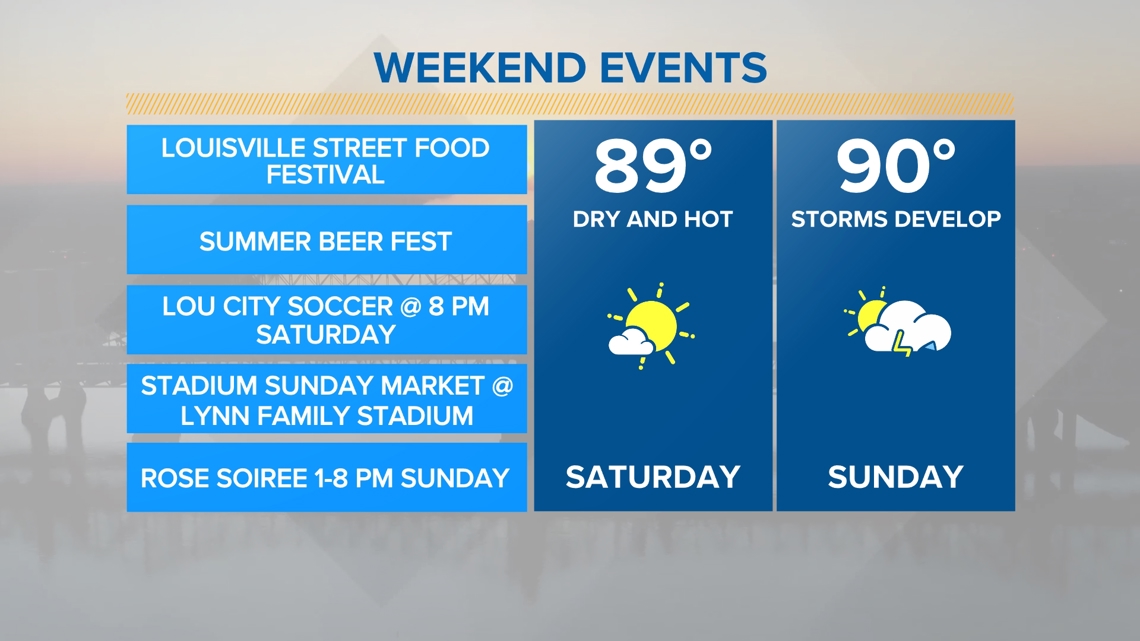
Definitely stay hydrated and pack plenty of water if you plan to be out and about this weekend and into much of next week.
Central Kentucky and southern Indiana's forecast calls for high temperatures in the 90s and a fair amount of humidity. This will bring our feels like temperatures into the mid to at times upper 90s as we get into much of next week.