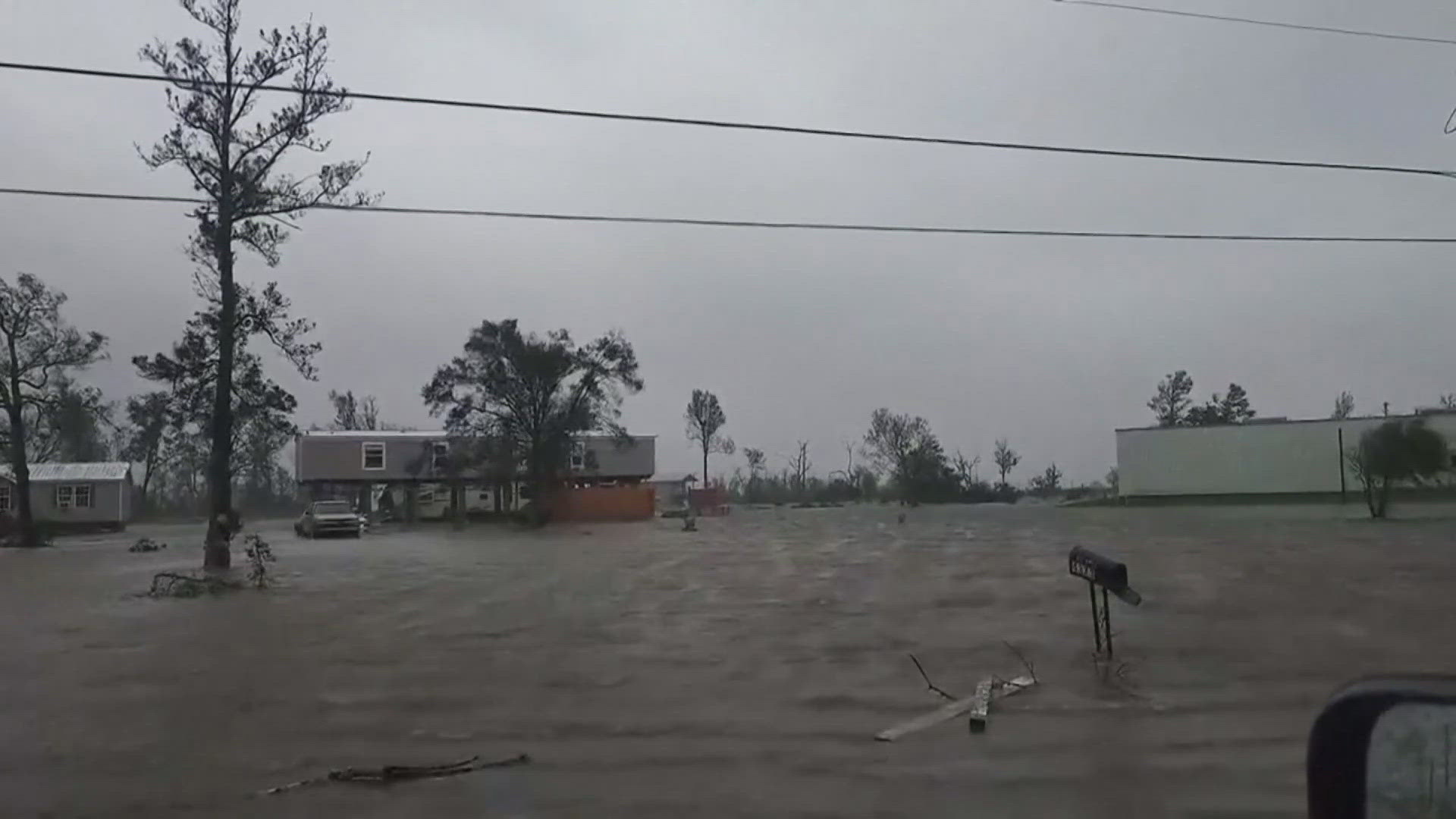
LOUISVILLE, Ky. — Hurricane Beryl finally made landfall Monday morning along the Gulf Coast of Texas on Monday as a Category 1 hurricane with wind speeds up to 80 mph and a four to eight foot storm surge, causing flooding and widespread wind damage in east Texas.
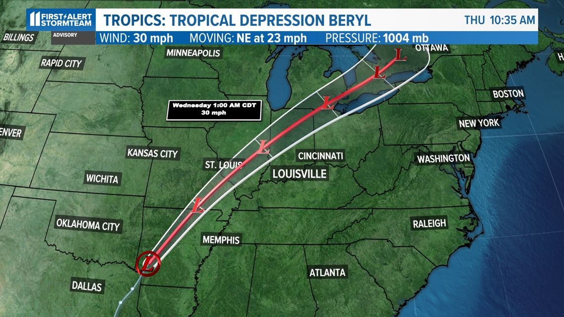
Beryl will continue to weaken as it makes its way towards Indiana and Kentucky by Tuesday.
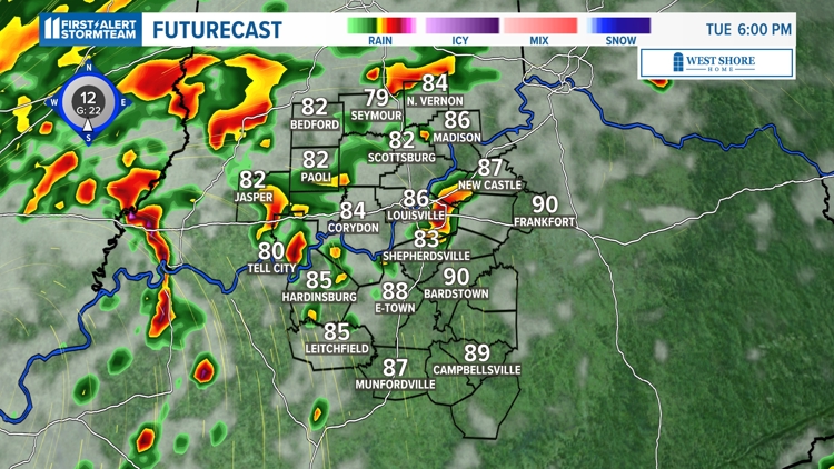
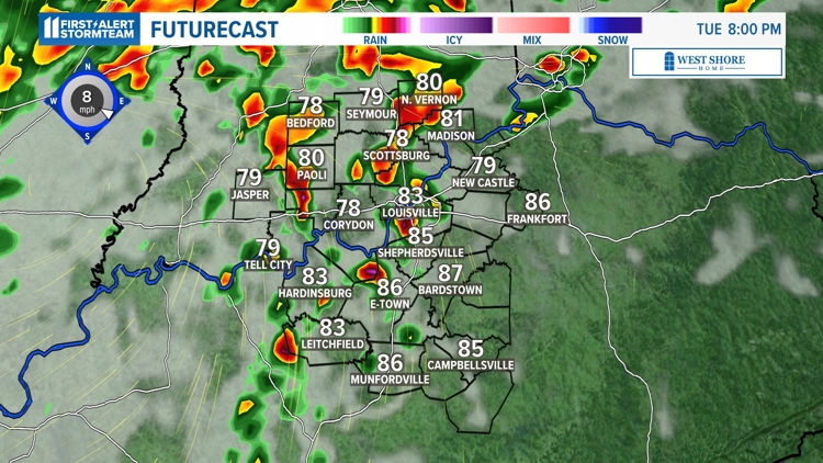
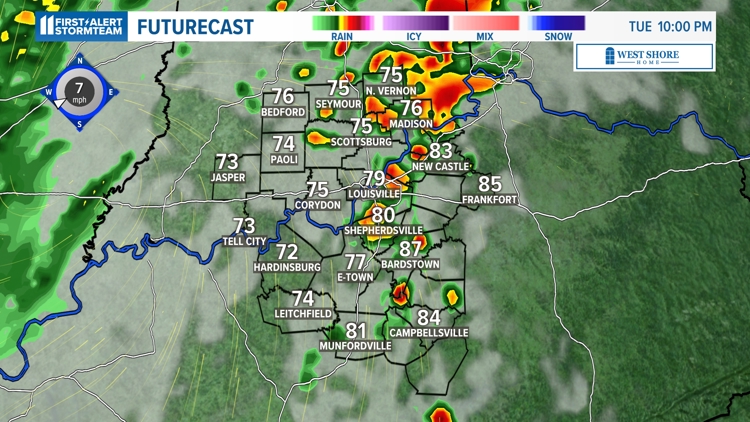
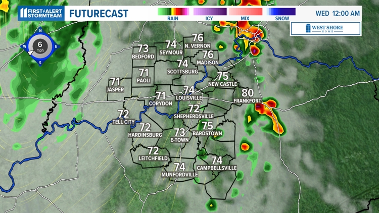
Remnants of Beryl will arrived by late Tuesday afternoon and continue through the evening hours. Much of our area will receive pockets of steady to heavy rainfall, a few reports of 50-60 mph wind gusts and a few weak tornadoes Tuesday afternoon and Tuesday evening.

How will Hurricane Beryl affect our area?
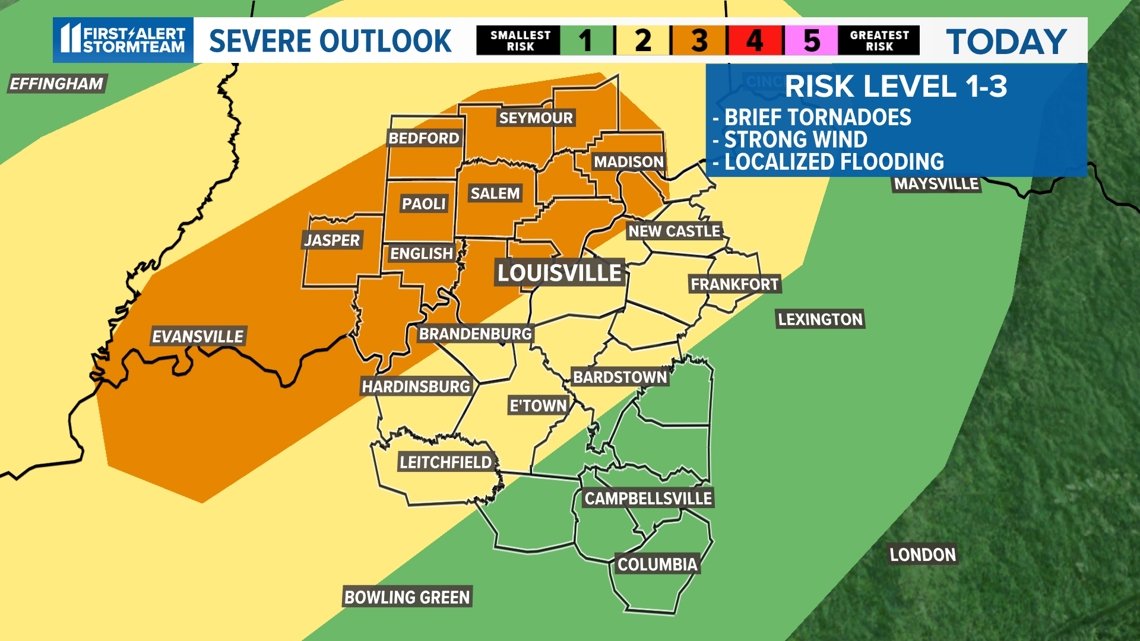
Although parts of southern Indiana and Kentucky are under an enhanced risk for severe weather, we are not forecasting an outbreak of severe weather by any means. The activity will be isolated in nature.
Tornadoes may be possible because our atmosphere will have a lot of spin in it (wind shear), making for the slightly increased chance for a tornado.

When remnants of Hurricane Beryl are expected to reach Louisville
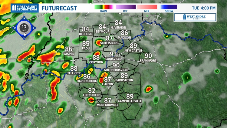
Beryl mainly appears to bring extensive clouds and some times of showers and storms as we hit the midday hours Tuesday, lingering into the afternoon and early evening hours. A few more additional showers may persist on Wednesday but the majority of the heavy showers and storms will impact us on Tuesday.
The most likely wettest time from the storm will be from 5-10 p.m. on Tuesday.
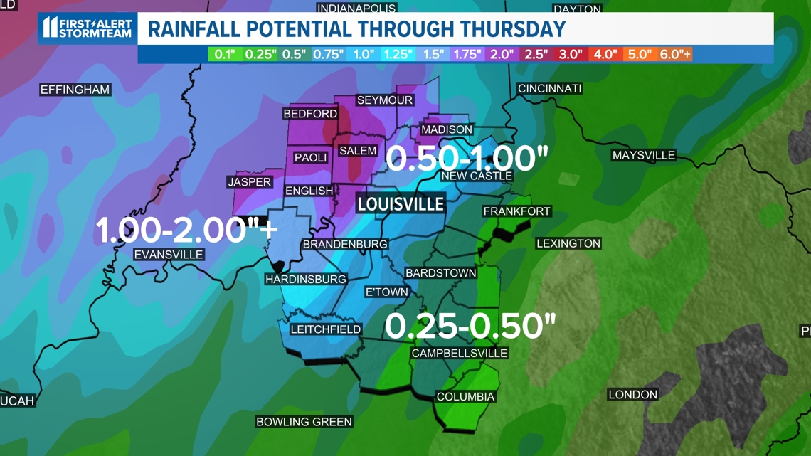
Some of the storms that trek through will produce rainfall rates one to two inches per hour. This will be enough to make for localized flooding and ponding of water on roadways.
Beryl remnants will make for strong/severe storms Tuesday afternoon and evening


Rainfall Impacts
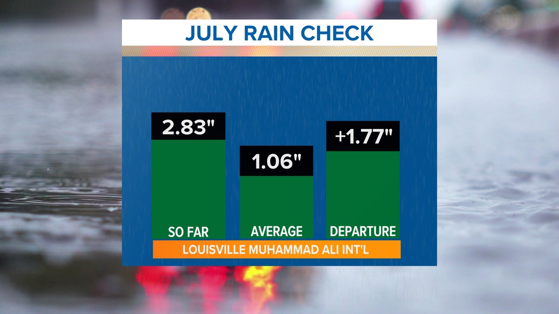
Louisville is already well above normal when it comes to July rainfall and there is more in the forecast with Beryl's remnants.

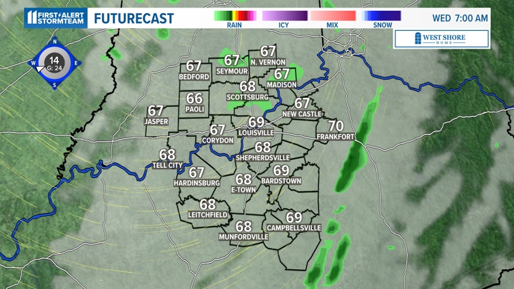
Please make sure you never drive through a flooded roadway. As of now, weather forecast models drag the rain out of our area as soon as midday Wednesday. Stay tuned for updates.

Make it easy to keep up-to-date with more stories like this. Download the WHAS11 News app now. For Apple or Android users.
Have a news tip? Email assign@whas11.com, visit our Facebook page or Twitter feed.