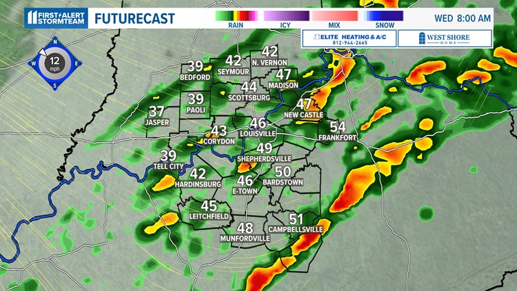
LOUISVILLE, Ky. — We are watching the radar closely overnight as a line of strong to severe storms is expected to develop. All modes of severe weather are possible.
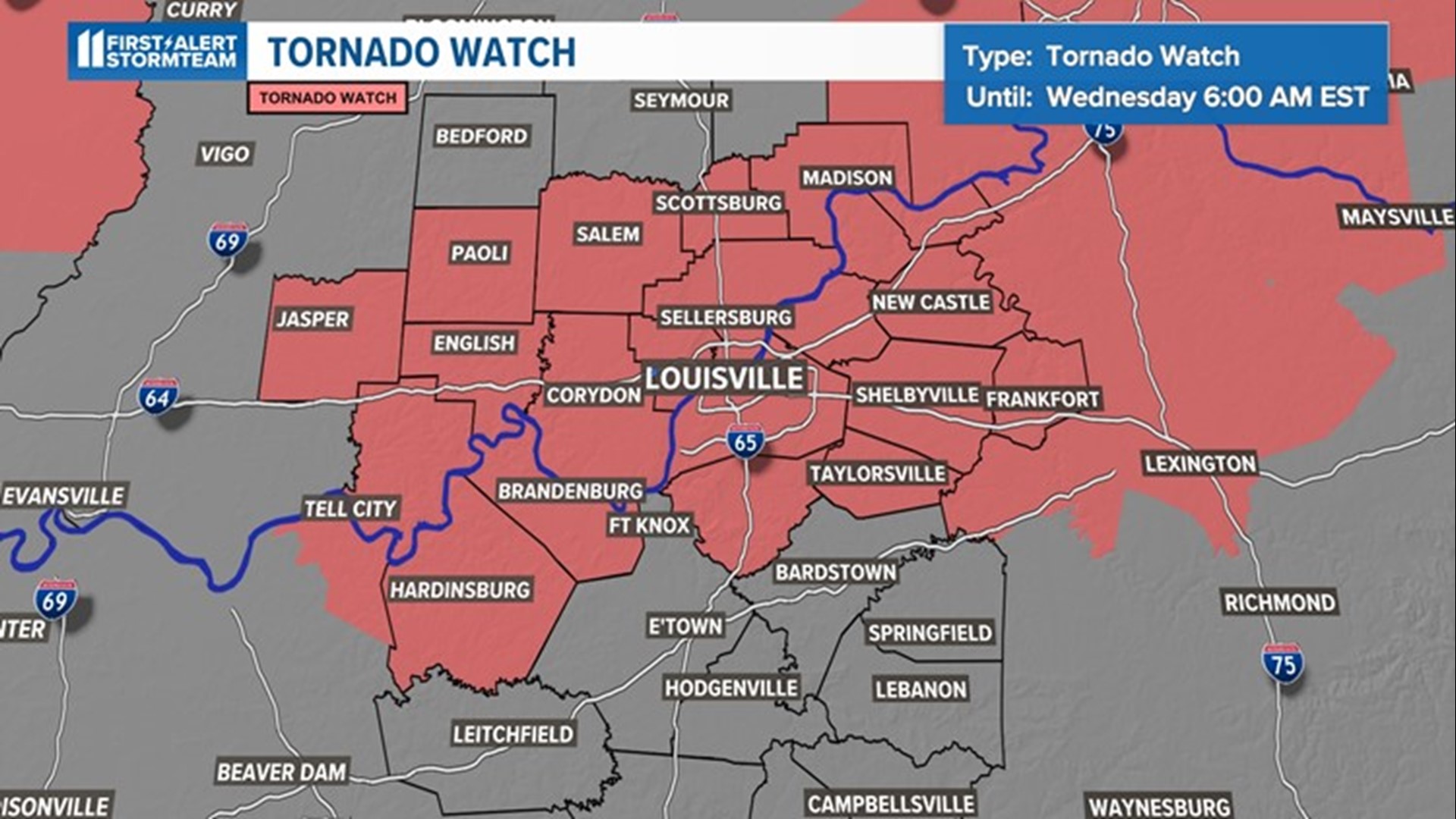
A TORNADO WATCH is in effect until Wednesday 6:00am EST or 8:00 a.m. CST for parts of Kentucky and Indiana. This means tornadoes are likely in these communities. Have multiple ways to receive warnings.

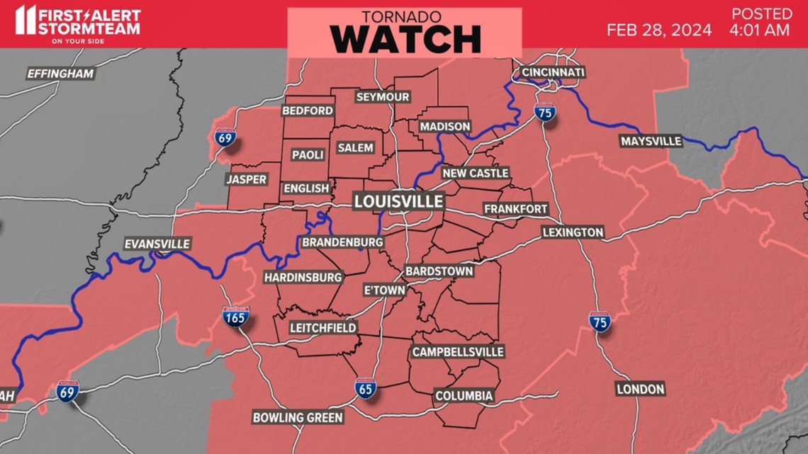
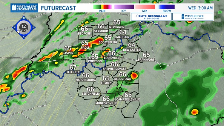
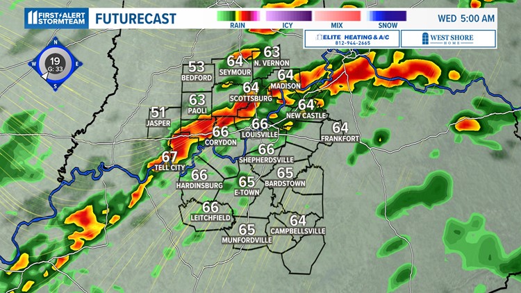
Before 2 a.m., large hail between quarter and golf ball-sized is possible, along with damaging winds, are possible in an isolated thunderstorm. After 2 a.m., a line will develop and that's when the worst of the weather is expected.
School closings
Only two Kentuckiana schools are on a two-hour delay Wednesday. Rock Creek Community Academy and Silver Creek School Corporation, both in Sellersburg, Ind., are operating on a two-hour delay.

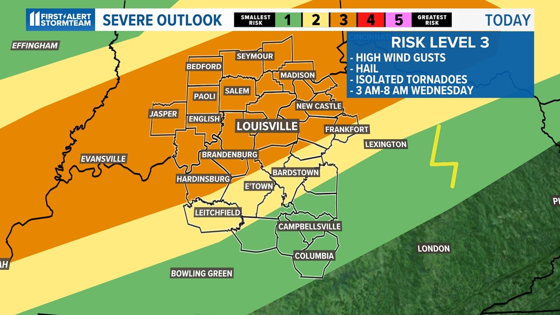
Timing
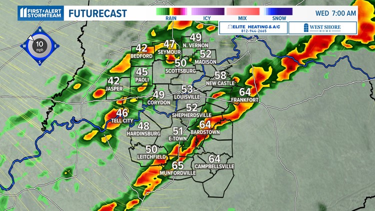
Severe weather is most likely to occur Wednesday morning from 2 a.m. to 9 a.m. A line will first approach Indiana, strengthen across Louisville, then weaken as it enters southern Kentucky. It is possible to see strong wind gusts, strong tornadoes along the line and large hail of two inches in diameter. If we see a tornado, it could become strong, but with the system we have it would likely be short lived.
Good Morning Kentuckiana will have live coverage of the storms to keep you safe and informed on Wednesday morning. Coverage will also be live streaming on WHAS11.com, WHAS11+ and the WHAS11 YouTube channel.
First Alert Stormteam Forecast
Unfortunately, the strongest storms are expected to roll in when most folks are sleeping, which can add to the danger if you do not have multiple ways to receive warnings. It is best to have at least two different ways to receive watches and warnings. The WHAS11 mobile app and a NOAA weather radio are two great options.
Here are a few tips to make sure you are staying up-to-date with the latest severe thunderstorms overnight tonight:
- Stay up-to-date on the weather forecast
- Have a way to wake up for a potential severe weather warning
- Make sure your cellphone is charged and the ringer and alerts are turned on
- Keep a weather radio close by along with extra batteries just in case
- Designate a safe space in your home and ensure that you have a first aid kit
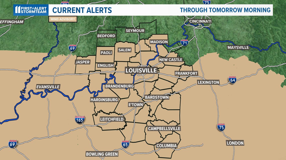
Wind advisory
A Wind Advisory goes into effect on Tuesday at 1 p.m. Wind gusts are expected to reach 40 mph at times. It won't be until early Wednesday morning that the line of showers and thunderstorms begin pushing in, but the wind gusts Tuesday will make fallen tree branches and isolated power outages more likely.

Cold & flurries to follow
This incoming cold front will be so strong that winter cold air will follow it. A chance for a few flurries is in the forecast as the rain showers will transition to a few snow flurries by Wednesday afternoon.
Keep in mind, no accumulation is expected with snow but it will certainly be a shock to the system. Temperatures will plummet well into the 30s Wednesday afternoon, with multiple places expected to hit the 20s by Thursday morning's rush hour commute.

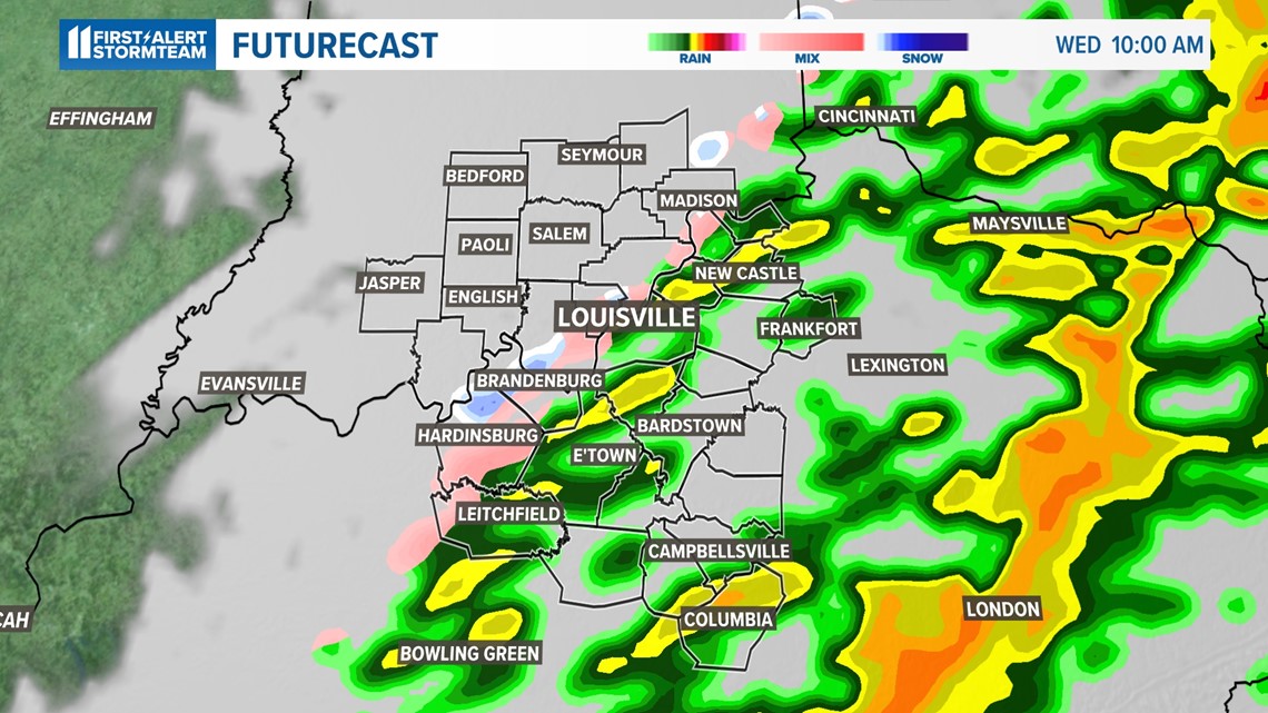

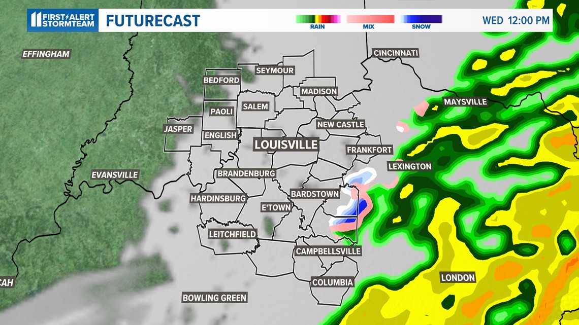
The WHAS11 First Alert StormTeam will be tracking the thunderstorms around the clock to keep your family safe. If a tornado warning is issued, we will be live on TV, our app, WHAS11+, and Facebook.
Make it easy to keep up-to-date with more stories like this. Download the WHAS11 News app now. For Apple or Android users.
Have a news tip? Email assign@whas11.com, visit our Facebook page or Twitter feed.

