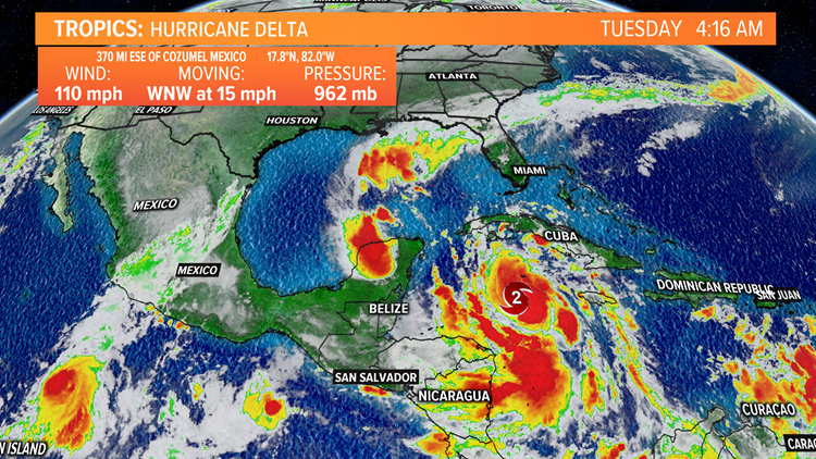
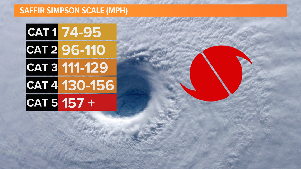
LOUISVILLE, Ky. — Hurricane Delta will likely be the 10th storm of the 2020 Hurricane Season to make landfall in the United States which would set an all-time record for land-falling storms. Just 24 hours ago Delta was a tropical storm and has now strengthened to Category 2 status with maximum sustained winds at 110 mph. To become a Category 3 storm, winds must be sustained at 111 mph. Delta is expected to continue to strengthen as it moves west-northwest towards the Yucatan Peninsula.

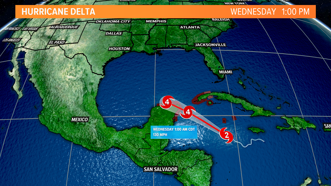
Areas like Cancun, Cozumel and the Cayman Islands will need to prepare for major hurricane force winds (>111 mph), storm surge and devastating flooding today into tomorrow as Delta passes over. The hurricane is expected to briefly weaken from a Category 4 storm to a Category 3 storm before regaining strength as it moves over warm water in the Gulf of Mexico.

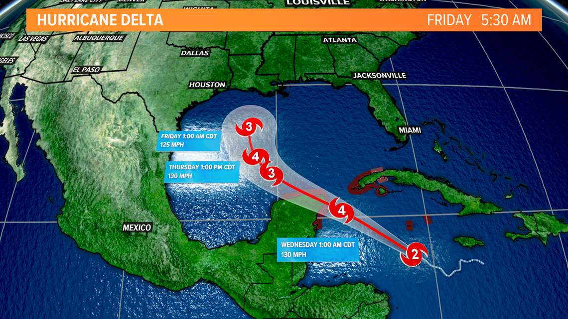
Delta may waiver between Category 3 and Category 4 strength as it steers north and eventually takes a slight northeast turn towards the Louisiana and Mississippi coastlines.

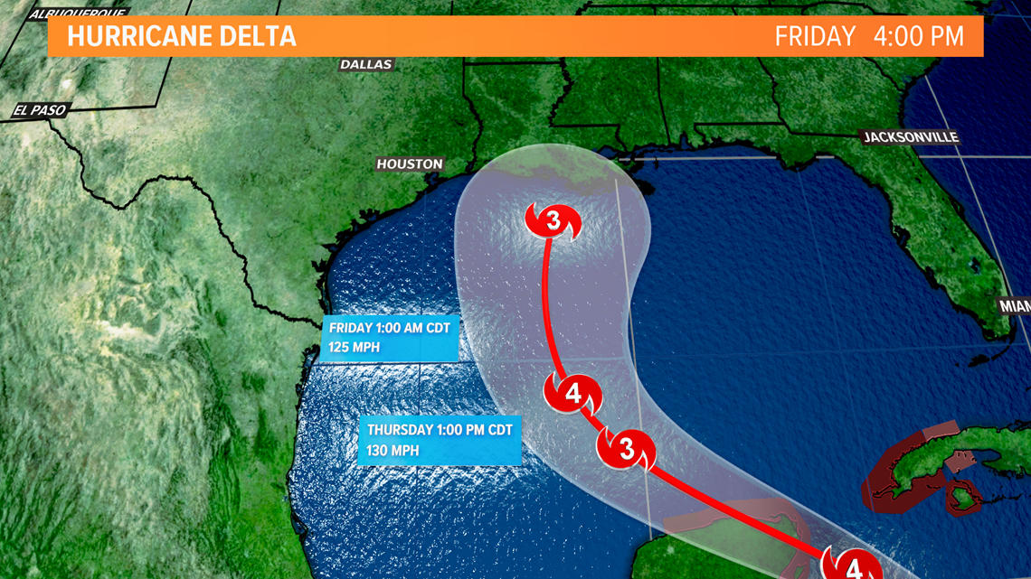
As Hurricane Delta makes landfall it is forecast to quickly weaken from a Category 3 to a Category 2 storm, but will still pack a punch. The low-lying areas of coastal Louisiana are very flood prone and the area's largest city, New Orleans, lies below sea level. When flooding rains and storm surge reach the area, we may see devastating damage. Wind will also play a big factor in the storm's destruction. Category 2 storms have sustained winds between 96-110 mph with higher gusts possible.

Hurricane Delta will eventually move inland and likely bring some rain to us in Kentuckiana come this weekend. As of now, models show some rain arriving to our area as early as Saturday afternoon and likely lasting into some of Sunday.

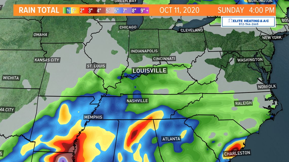
The European forecast model we call the "EURO" predicts we'll have anywhere from 1/2 - 1" of rain from Saturday through Sunday afternoon. In contrast (pictured below) the Global Forecast Systems model (GFS) is calling for slightly higher totals in the 1 - 2" range.

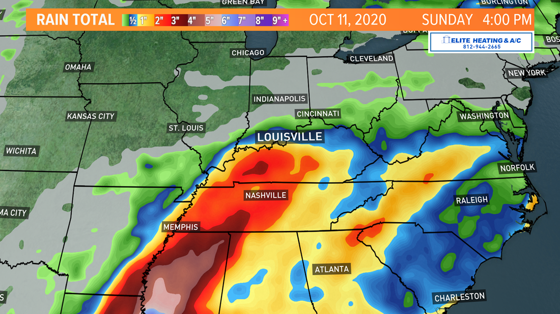
We do believe rain and some slightly higher wind gusts are possible as the remnants of Delta make their way to Kentuckiana this weekend. We'll be watching the storm closely throughout the week for any major shifts in its track or intensity that would impact our area.


Make it easy to keep up-to-date with more stories like this. Download the WHAS11 News app now. For Apple or Android users.
Or, if you love weather photography, join our Kentucky/Indiana Cloud Watchers Facebook group.
--


