LOUISVILLE, Ky. — How fitting that we have a very active weather pattern to discuss on National Weatherperson’s Day? There’s a lot happening: ample rainfall, a chance for snow, and a swing of temperatures. We’ll break it down in excruciating detail here. Scroll to the bottom for a general summary of this forecast.
Forecast at-a-glance:
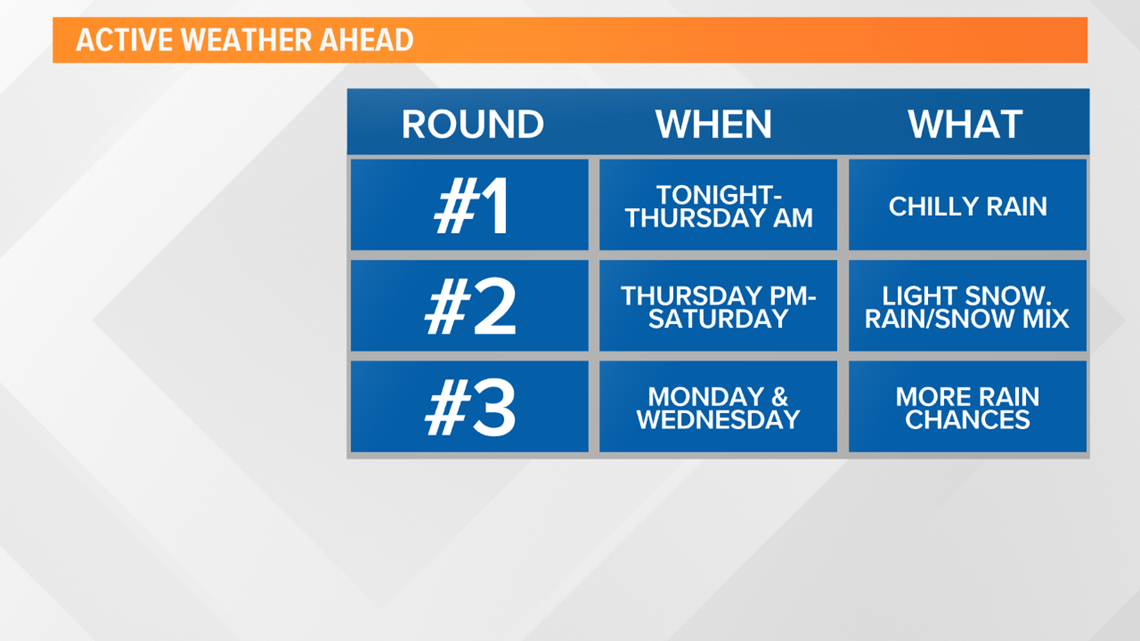
More rain expected through early Thursday, then again Saturday
Snow looks likely Thursday night into Friday and again Saturday during the day – both only yielding minor accumulations
Sunday will be a break in between systems
Even more unsettled weather forecast for next week, specifically Monday and Wednesday
Weather setup: Wednesday begun on a very cloudy and chilly note. Temperatures were marred in the middle and upper 30s, close to 40 degrees, with a nasty northeast wind keeping us chilly and a cold rain moving across the region. Certainly not fun weather. Get used to it...clouds and rain are featured nearly every single day in the 7-day forecast.
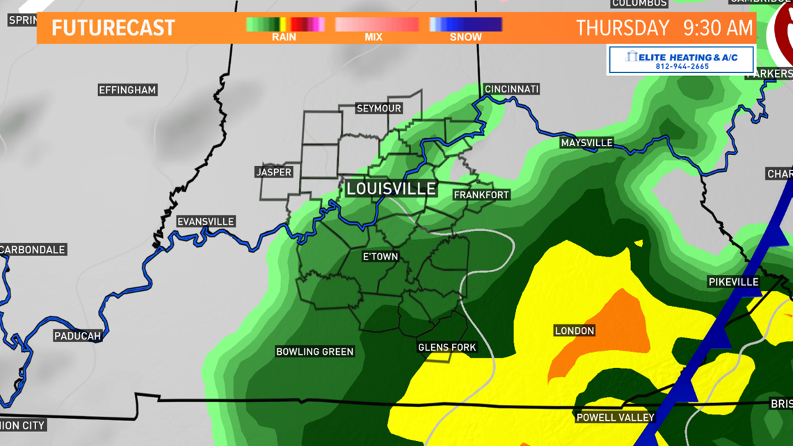
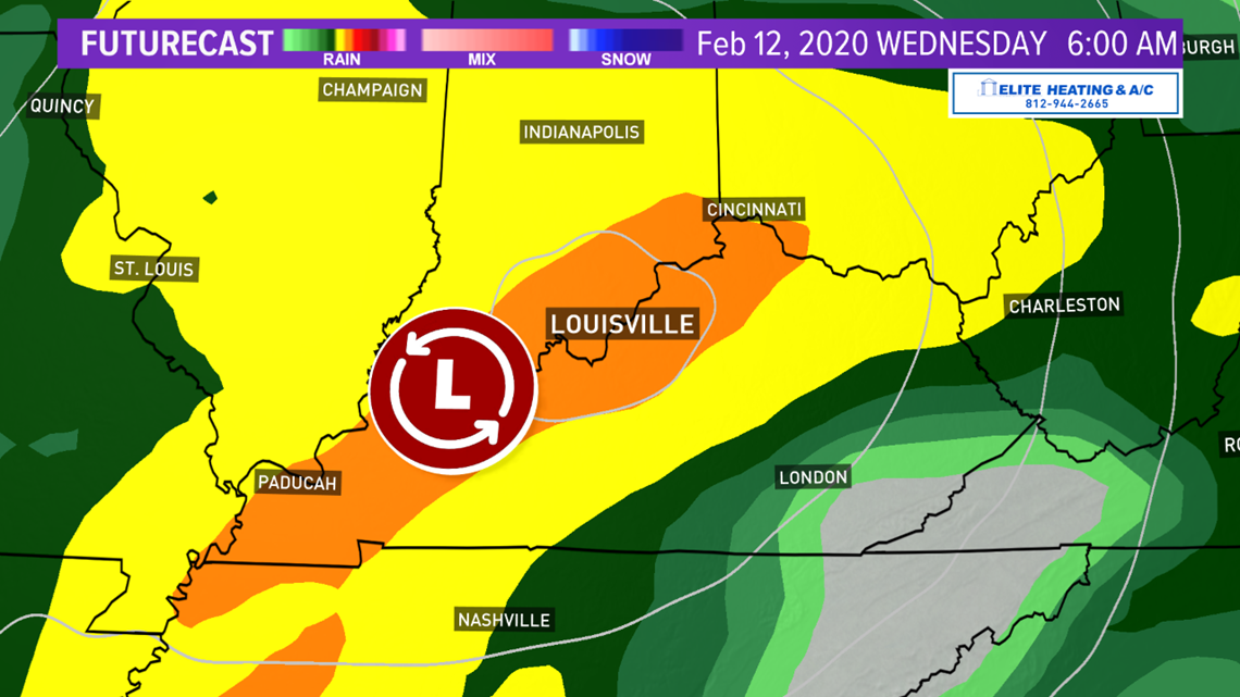
Let’s get started. First, scattered showers will continue into Thursday. The Thursday activity will be primarily in the morning, and Louisville/Ohio River will be on the northern edge of this activity. The core of the heaviest precipitation will stay to our south and east closer to the Kentucky-Tennessee border and into Appalachia.
Through this time, much of the WHAS11 viewing area will only see about an additional half-inch of rainfall; nothing the ground can’t handle. It’s still going to be chilly, however. Highs Thursday will be lucky to hit the low 40s, but for now most of Thursday afternoon should stay rain-free.

The forecast gets interesting late Thursday into Friday. As the center of our current storm moves off to the north and east, cold air and moisture will wraparound on the backside of it. This sets the stage for wintry precipitation to develop across the area.
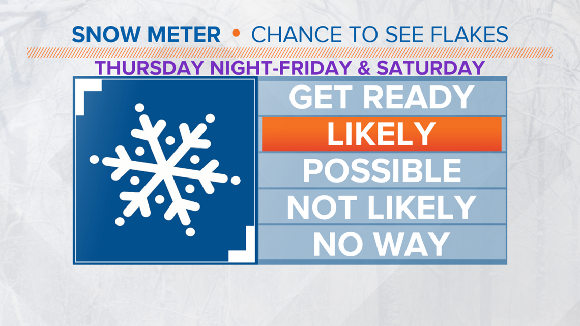
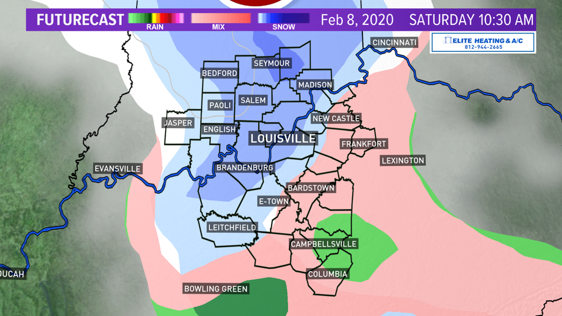
Temperatures Thursday night should dip below freezing, which would support snow. The Snow Meter is set to “Likely” for seeing snowflakes Thursday night and early Friday (as well as Saturday, but we’ll get to that in a minute). As for how much accumulation, maybe a couple of tenths of an inch, or half an inch at the most. It won’t be a major winter storm but could cause some problems during the Friday morning commute if it’s still snowing during peak rush hour.


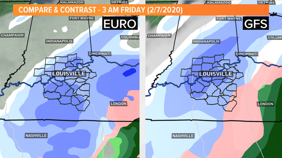
The snow shouldn’t stick around for very long as temperatures Friday are forecast to reach the middle and upper 30s. Despite being cloudy Friday, and the sky perhaps looking threatening at times, most of Friday should remain uneventful too. Our next snow-maker will be dropping down from Canada and the upper Midwest and move quickly by during the day Saturday.
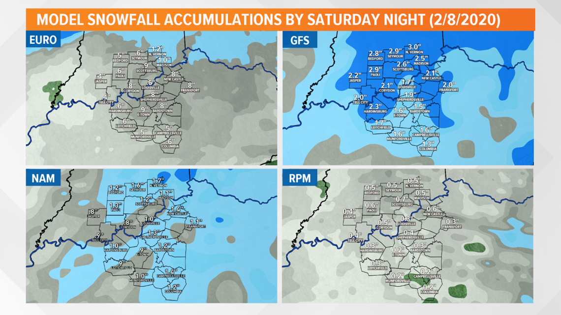
These quick-moving disturbances are known as clipper systems because they move fast and “clip” an area with precipitation. For now, only minor accumulations are again expected of maybe up to half an inch. This means that through Saturday evening, around an inch to inch and a half of snow may have fallen across the area, but given temperatures, both rounds of snow will melt very quickly. I expect the ground to be snow-free come Saturday due to temperatures Friday.


Whew...let’s take a breather for a second and enjoy Sunday because that will be the intermission before the second act of this messy theater begins next week. We might see a few peeks of sunshine as temperatures attempt to recover to the upper 40s, just under 50 degrees.
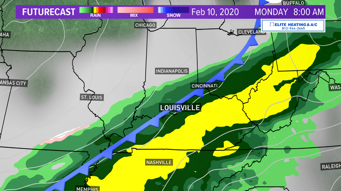
Looking ahead: While we’re getting a break from the action Sunday, another wave will be moving across the upper Midwest and drag a large Pacific cold front across the United States. I specify Pacific cold front because the air behind it will not be teeth-chattering cold as it would be with an arctic front. Ahead of this cold front, our winds should increase from the south helping to bring in more warm and moist air from the deep south. This is where models start to diverge just a little bit.
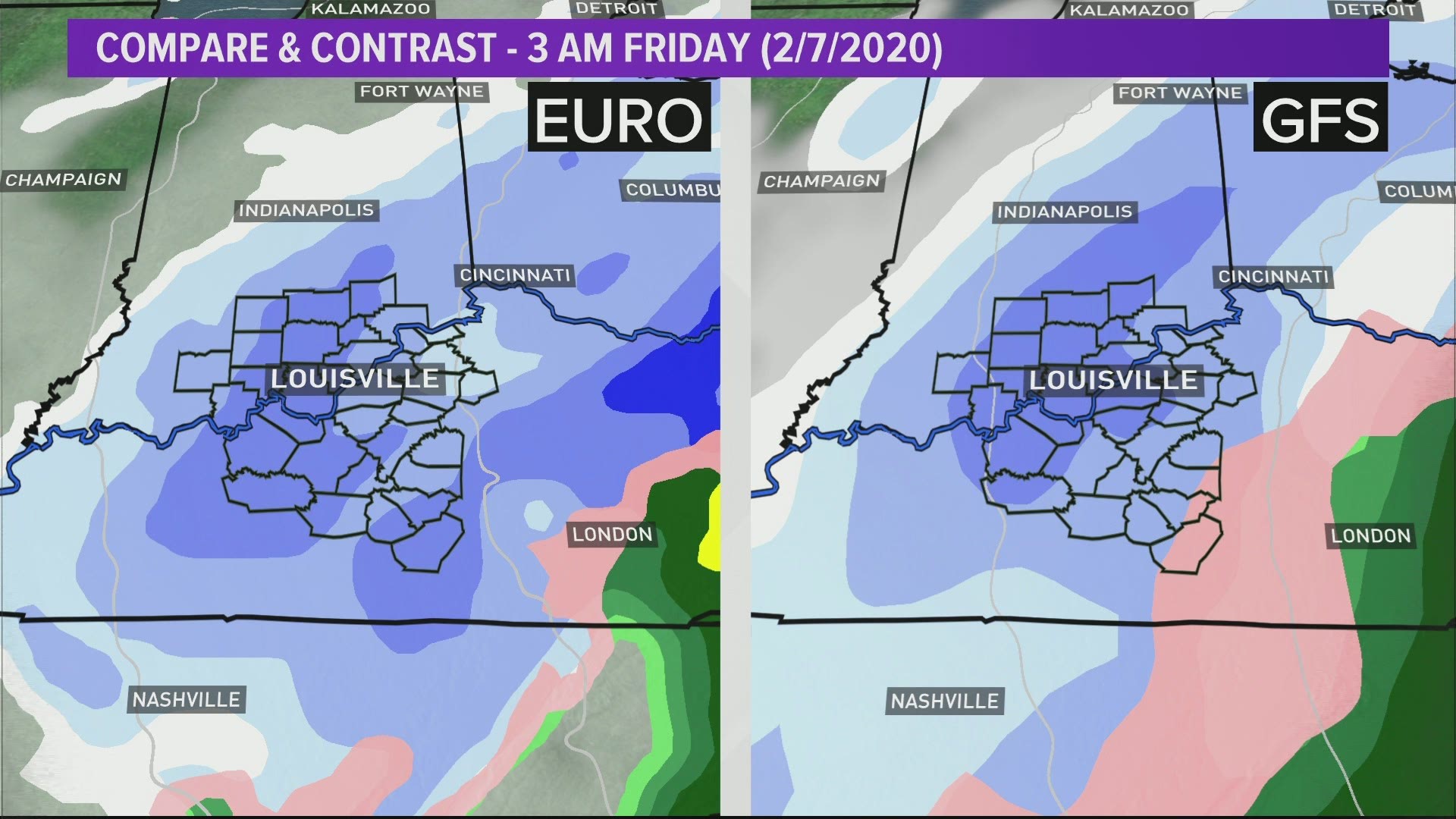
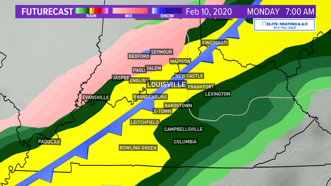
The European model is a bit quicker with the rain for Sunday and Monday, returning rain into Kentuckiana Sunday afternoon. The GFS is much slower and holds off rain until Sunday night and early Monday. I am inclined to follow the American GFS model. The cold front should be a fairly slow mover, so we can again anticipate widespread rain in the area.


We get another brief intermission Tuesday, but our attention then turns to our southwest. A much stronger storm than the ones following it will be forming and move northeast up the Mississippi River Valley into the Ohio Valley by Wednesday. Again, the American and European models have disagreements regarding the track of the storm and where the heaviest rain will fall. The GFS tracks the center of the storm right up the Ohio River, which would put Louisville and the surrounding communities in the bullseye for the heaviest rain.

Things to keep in mind: Especially regarding the forecast next week, models and our forecast will change. Remember, a week is a long time in meteorology. Timing, storm track, and precipitation amounts will change over the next several days, however, confidence is high that widespread rain Monday and a storm Wednesday will impact the Ohio Valley.
The quick and dirty: Scattered showers expected through the first half of the day Thursday. The heaviest core of rain will stay in southeastern Kentucky Thursday. Thursday night into Friday brings a chance for light accumulating snow to the region. Snow totals of around half an inch are possible, but it will quickly melt with temps above freezing Friday.
Saturday, another “clipper” system will move by and may dump another half-inch or so of snow, but with temperatures again above freezing, it won’t stick around long. Sunday will bring a break in the precipitation until late Sunday night/early Monday morning before sunrise. Widespread rain is expected Monday that should end by Monday night. Tuesday will be another dry day before the “main event” arrives Wednesday. There are still a lot of uncertainties regarding the rain next Monday and Wednesday, but confidence is high that rain will fall.

Whew, that was a lot. Follow the First Alert Storm Team for all the latest weather information!
Meteorologist Alden German
Facebook: Facebook.com/AldenGermanWX | Twitter: @WXAlden
Chief Meteorologist Ben Pine:
Facebook: Facebook.com/MeteorologistBenPine | Twitter: @WHAS11Ben | Instagram: @whas11pine
Meteorologist T.G. Shuck
Facebook: Facebook.com/tgshuck | Twitter: @TGweather
Meteorologist Kaitlynn Fish
Facebook: Facebook.com/WXkaitlynnfish | Twitter: @kaitlynnfish | Instagram: @kaitlynnfishwx
Meteorologist Reed Yadon
Facebook: Facebook.com/reedyadon | Twitter: @whas11reed
►Download the WHAS11 News App and get weather alerts on your phone.Click/Tap here to download for iPhone or Android
Join our WHAS11 StormTeam Weather Spotters Facebook group. Or, if you love weather photography, join our Kentucky/Indiana Cloud Watchers Facebook group.

