LOUISVILLE, Ky. — Hello, Spring! The new season officially begins here in Kentuckiana on March 20 at 5:24 p.m. EST.
Despite a recent cold snap, we’ve already seen spring-like weather since February and early March. We had several days in the 70s and even a couple of days in the 80s.
March is a month of changes as we exit winter and enter the warm season. Average high temperatures steadily rise to start in March.
Now until mid-June, we typically see the quickest rise in our average daily high and low temperatures. Starting today, our average high temperature is now 60°.

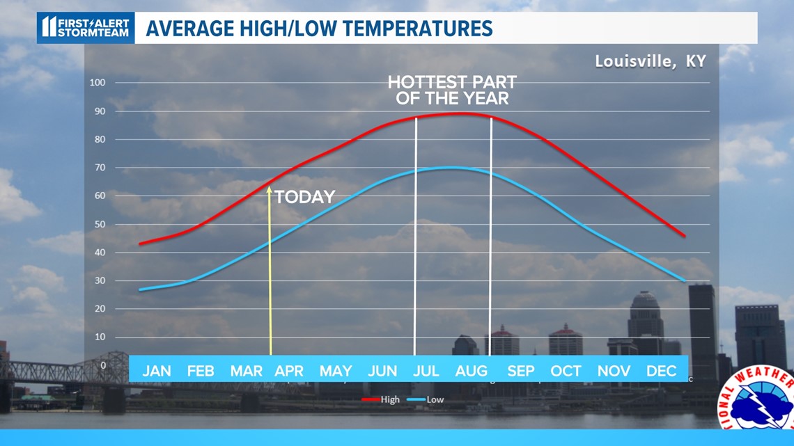
By the end of April, our average highs rise into the lower 70s, and the end of May sees average high temperatures in the lower 80s.
Late June through middle August is the hottest time of year around Louisville. Our daily average high temperature tops out just shy of 90 degrees.
What causes the seasons?

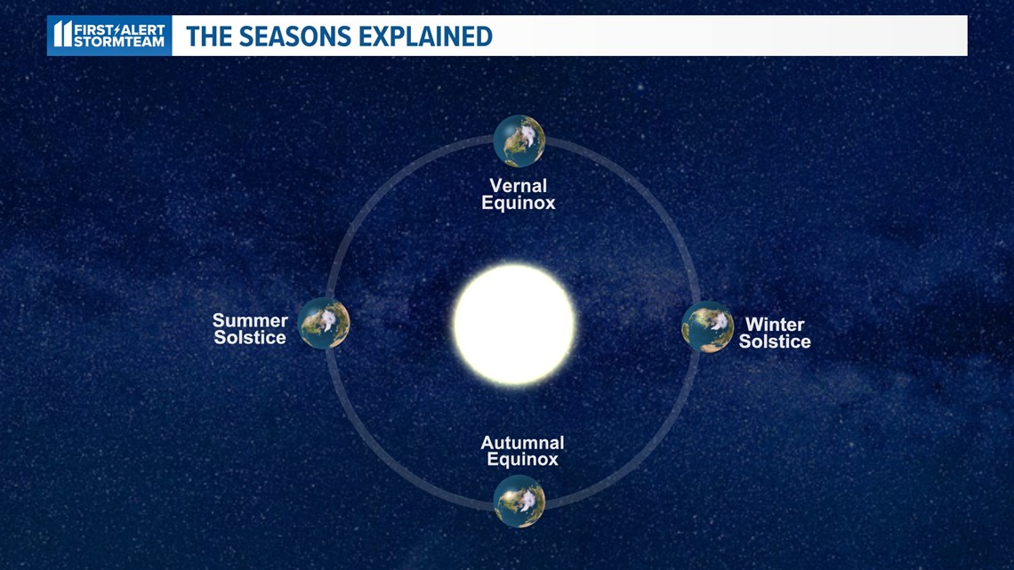
The Earth orbits the sun in an elliptical path, not a perfect circle. It’s also tilted on an axis relative to its orbit around the sun and has an angle of 23.5°. In a way, it spins on this axis like a top.
On the vernal (spring) and autumnal equinox, the earth is tilted neither toward nor away from the sun. This gives near equal hours of daytime and nighttime across the planet – hence the term equinox.

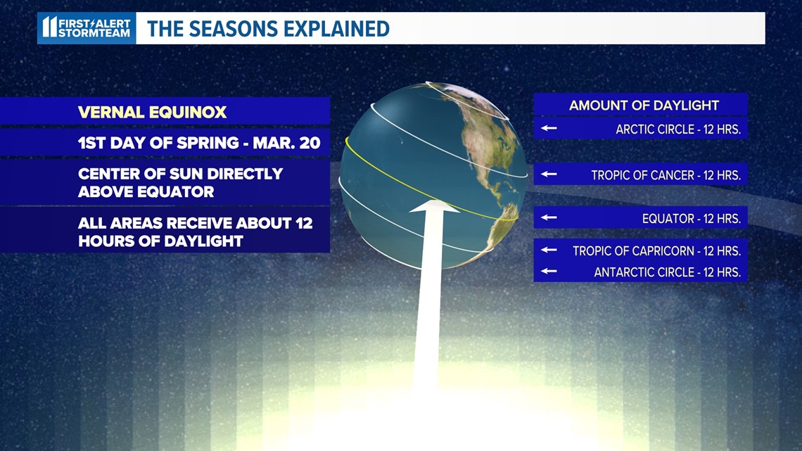
Let’s compare that to winter and summer.

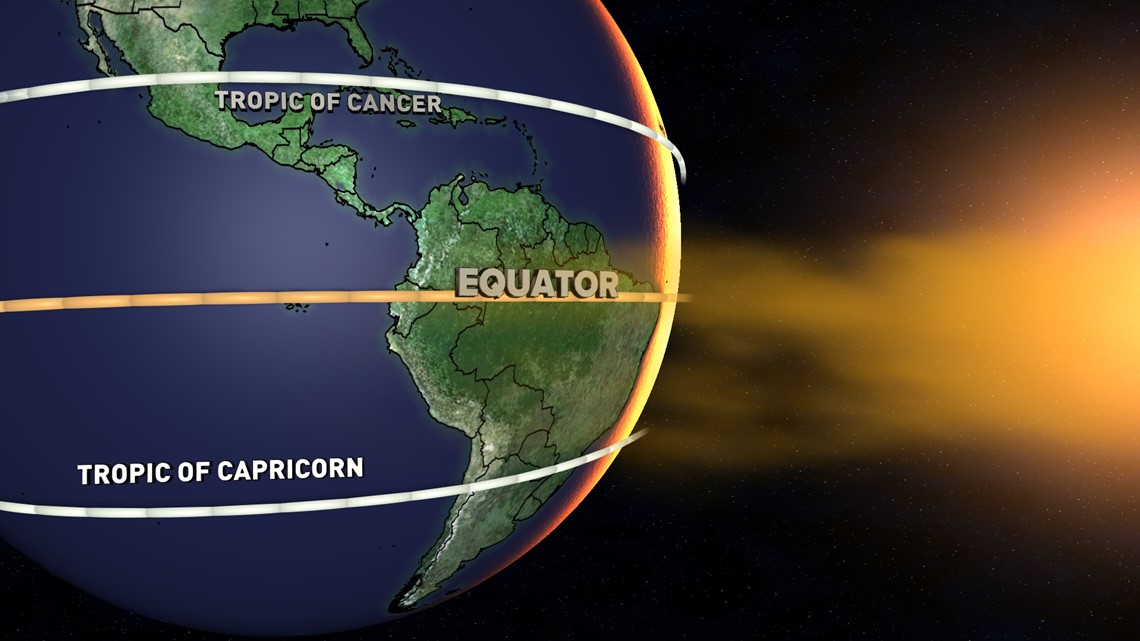
For the northern hemisphere’s winter, the earth’s tilt away from the sun is at its maximum, hence why we experience colder temperatures.
In the summer, the tilt toward the sun is at its maximum giving us much warmer weather.
Looking back on winter – or the lack thereof
Depending on who you are, this past winter was either disappointing or tolerable.
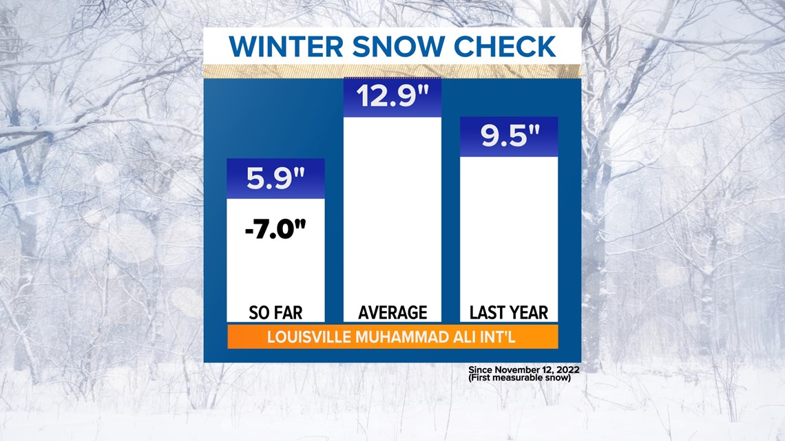
Snow was very hard to come by. Louisville averages just under 13” of snow per year, but this winter only 5.9” of snow fell. That's 7" below normal, the second straight year of below-normal snowfall, and even less snow than the winter of 2021-2022.
In fact, no measurable snow fell in Louisville for February, and it’s unlikely we’ll see any snow for what’s left of March, either.

This past February was the 2nd warmest ever in Louisville’s recorded history.
The meteorological winter (December-January-February) was the 5th warmest in Louisville’s history.
We had an astonishing period of 4 straight weeks with at least one day setting a record-high temperature. Even more bizarrely, three of those happened on consecutive Wednesdays!
What’s ahead for spring (and summer)
Seasonal outlooks are difficult and there’s a multitude of factors that contribute to the weather we experience.
A big one to watch for this year is El Niño. La Niña is ending after an unprecedented three-year run and El Niño conditions are expected to develop by this summer.
In the meantime, we’re trending to (if not already in) a “neutral” pattern, meaning neither La Niña nor El Niño conditions.
What does that mean for us? It depends.
As mentioned, a multitude of factors can influence how warm, dry, cool, or wet a season is. The intensity of an El Niño/La Niña is also important.
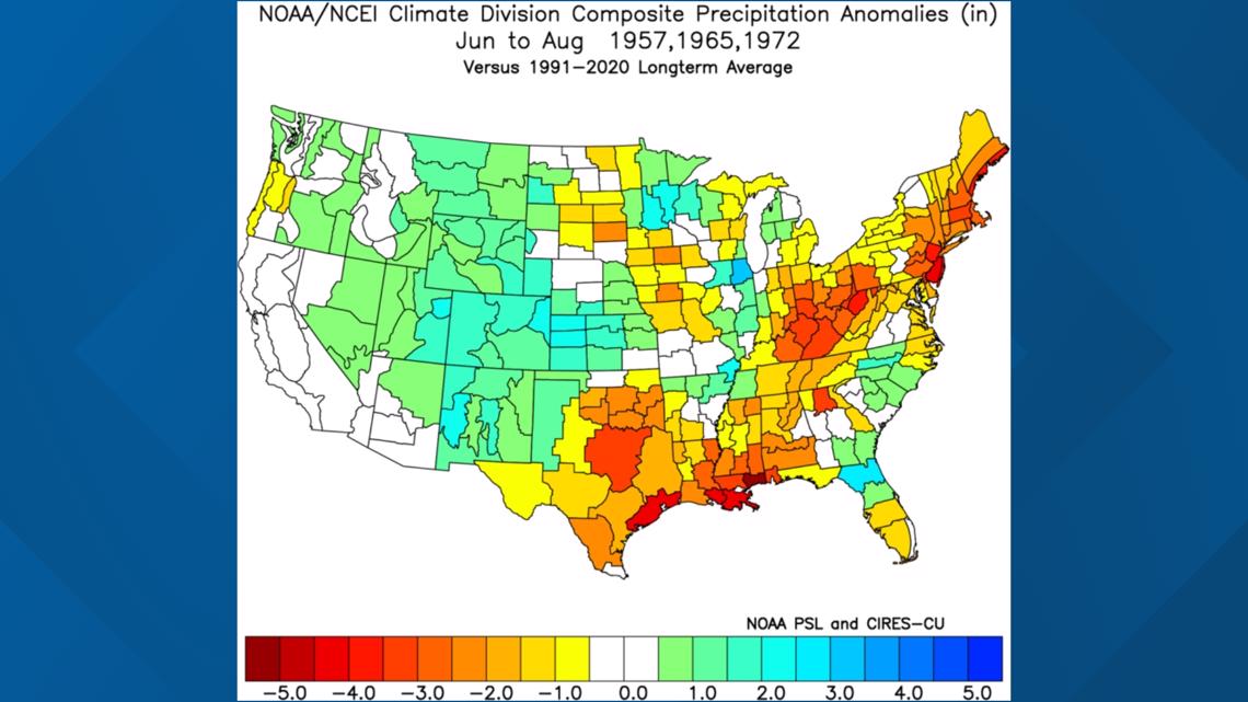
Historically, weak-to-moderate El Niños have seen drier conditions in the Ohio Valley during summer, while strong events see wetter conditions.

For temperatures, weak-to-moderate strength El Niños trend toward cooler summer temperatures, while strong events are closer to normal.

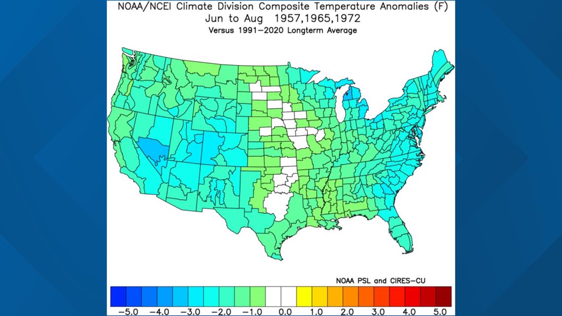
It’s important to remember that these are just guidelines and not a forecast.
An example of this is the ending of La Niña. Typically, they bring drier weather to the Ohio Valley, but we were relatively wet.
Cooler temperatures are also a feature of La Niñas, but outside of a couple of intense cold snaps, our winter was actually quite warm.
Make it easy to keep up-to-date with more stories like this. Download the WHAS11 News app now. For Apple or Android users.
Have a news tip? Email assign@whas11.com, visit our Facebook page or Twitter feed.

