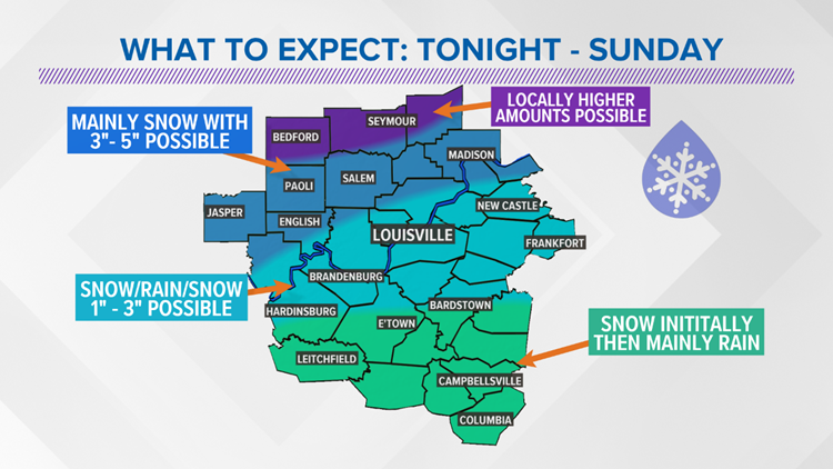
The WHAS First Alert Storm Team continues to track a wintry weather system moving into Kentuckiana this weekend giving us our first taste of wintry weather in 2019.

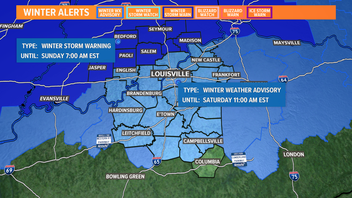
We have a Winter Weather Advisory as well as a Winter Storm Warning in effect for parts of Kentuckiana beginning this evening and lasting into the weekend.


A low-pressure system originating in Texas will make its way through the midwest states today and towards the Ohio Valley this evening.
► Download the WHAS11 News App and get weather alerts on your phone. Click/Tap here to download for iPhone or Android
This system will encounter colder temperatures in the Ohio Valley and produce snowfall for much of Kentuckiana starting around midnight Friday into Saturday.


Most folks should wake up to light snow on tomorrow morning with some light accumulations across much of the area, even down south.

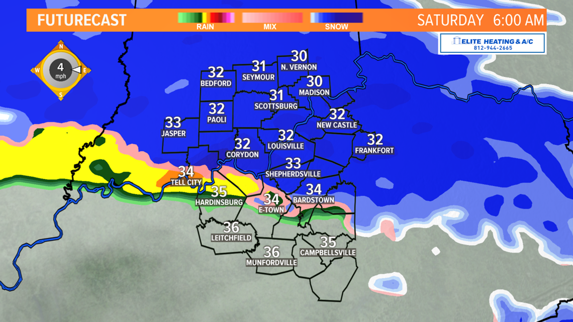
It is when we get into the daylight hours when things get a little more complicated as a nose of warmer air just above the surface should change snow over to rain across areas along and south of the Ohio River, with the warmer air eventually working farther north as the day wears on.

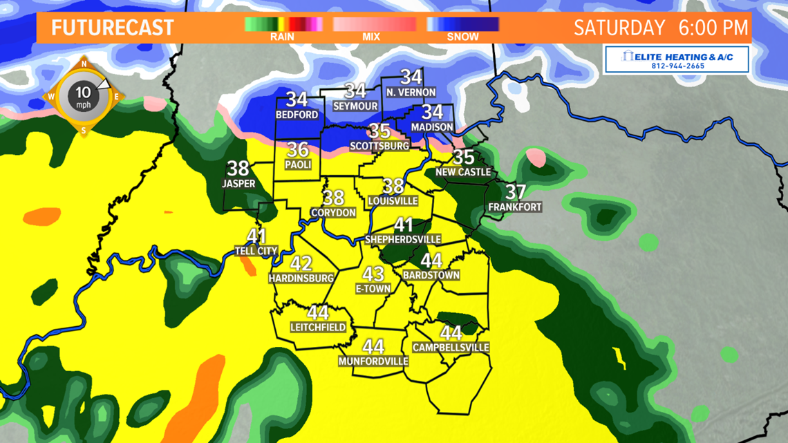
Just how far north the warm air makes it is critical to how much snow ends up on the ground. Some of the accumulating snow from Friday night could melt a bit or be washed away but whatever rain falls during the day.


Saturday night into Sunday we'll see temperatures drop to around the freezing mark and we could see any precipitation switch back over to snowfall early on Sunday. Totals from this early morning snowfall will likely be around 1".


Our in-house model is basically showing the highest totals for the Friday night through Sunday evening north of the river into Southern Indiana. Areas south of the Western Kentucky and Bluegrass parkways will see the least snow from this event.


To wrap it all up, here is our forecast for the wintry weather impact for Kentuckiana this weekend. The snow that falls should be slushy and likely won't have too much impact on metro Louisville roadways. Untreated roads in Southern Indiana will see the most areas of concern for weekend travel.
Stay with the WHAS First Alert Storm Team for the latest updates on this system this weekend.
Follow the WHAS11 First Alert Storm Team on Social Media:
Chief Meteorologist Ben Pine:
Facebook: Facebook.com/MeteorologistBenPine
Twitter: @WHAS11Ben
Instagram: @whas11pine
Meteorologist T.G. Shuck:
Facebook: Facebook.com/tgshuck
Twitter: @TGweather
Meteorologist Kaitlynn Fish:
Facebook: Facebook.com/WXkaitlynnfish
Twitter: @kaitlynnfish
Instagram: @kaitlynnfishwx
Meteorologist Reed Yadon:
Facebook: Facebook.com/reedyadon
Twitter: @whas11reed

