LOUISVILLE, Ky. — The WHAS11 First Alert Storm Team is tracking a significant winter storm that will impact Kentucky and Southern Indiana this Wednesday and Thursday. Residents will see a mix of snow, sleet, rain and freezing rain depending on their location and need to be prepared for impacts to travel, schools and daily life.
Below is a breakdown of what we expect to happen over the next two days as well as a "look ahead" to this weekend.
TONIGHT THROUGH THURSDAY: Freezing rain, ice and snow
THIS WEEKEND: Snow and very cold!
Overnight Tuesday into Wednesday
The mix of precipitation will begin overnight Tuesday into Wednesday.
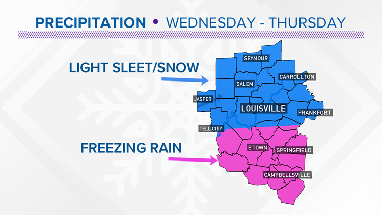
The images below show what we may expect throughout the day on Wednesday. Much of Southern Indiana will see snowfall while areas south of I-64 and areas around the Western Kentucky/Bluegrass Parkways will see a mix of freezing rain.
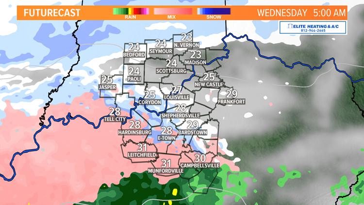
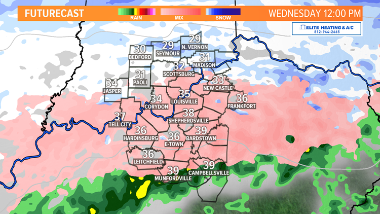
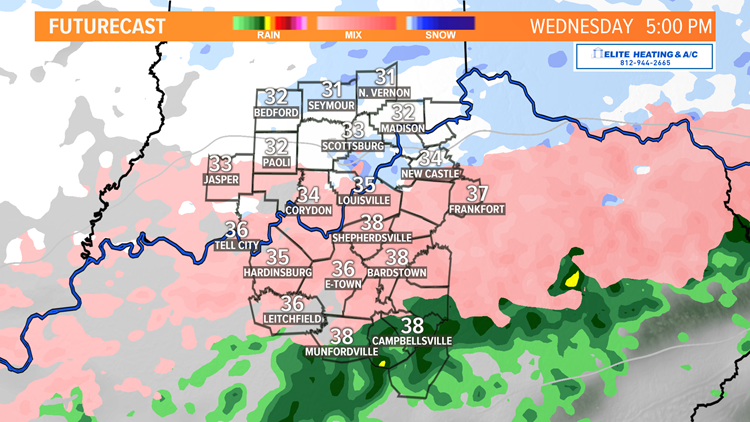
Click through the gallery below to follow the Futurecast predictions.
Timeline: Wednesday winter weather predictions


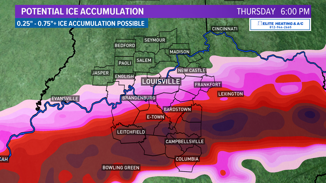
Ice Potential
The highest threat for freezing rain has now shifted to areas of Southern Kentucky. As a result an Ice Storm Warning is out for our Kentucky counties along and south of the parkways, with a Winter Weather Advisory for Louisville metro, along I-64 and into Southern Indiana where more of a light sleet/snow mix loos more likely
The amount of ice itself will vary but has the potential to cause treacherous roadways and weigh down branches, causing strain and potentially knocking out power in some spots.
Anywhere from 1/4" to 3/4" of ice accumulation is possible.

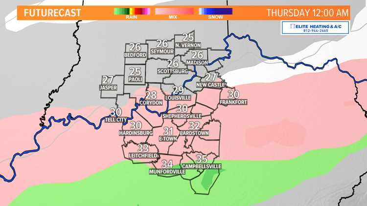
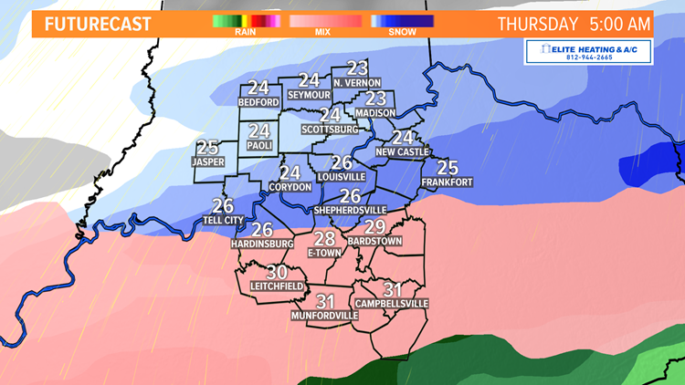
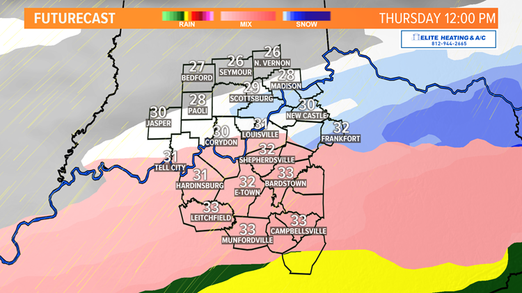
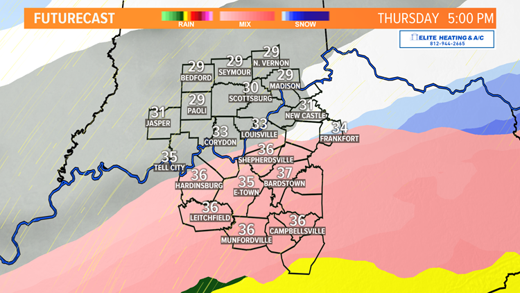
Overnight Wednesday into Thursday
The deeper moisture should arrive during this window, giving areas of Southern Kentucky the best chance for ice to accumulate. Eventually things should get cold enough from top to bottom for the activity to end as snow as the day wears on.
With temperatures staying below freezing, any snowfall will likely land on top of any ice and add weight to tree branches and power lines. Below is a timeline of what we may potentially see across Kentuckiana on Thursday.
Click through the gallery to follow the Futurecast predictions.
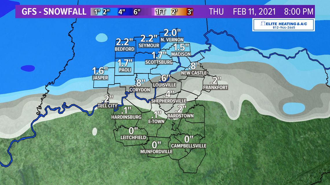
Timeline: Thursday winter weather


Projected snowfall totals are highest in Southern Indiana on Friday, but Louisville has the potential to pick up a few inches as well. These totals are subject to change, but are close to what we may see across the region. Areas south of the parkways are not expected to see much snow.


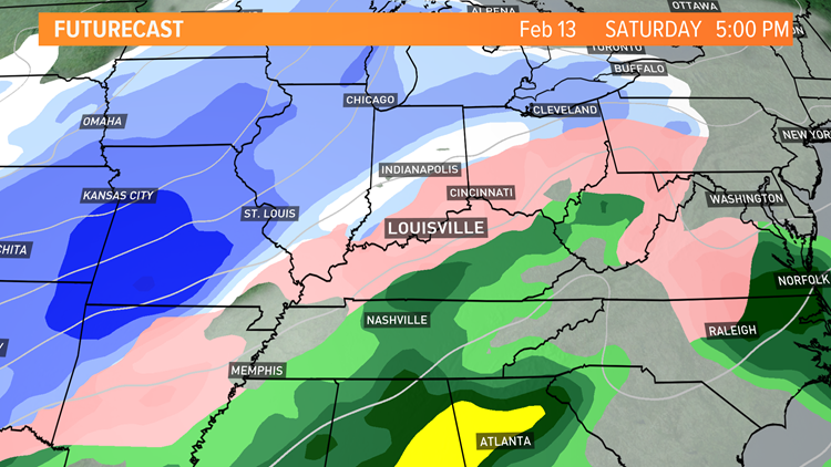
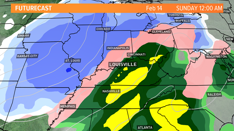
This weekend
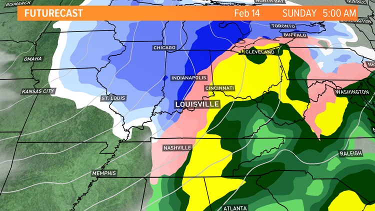
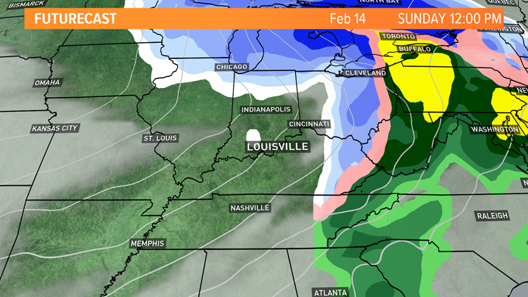
This weekend's forecast confidence is still low, but we may see a system bring another round of wintry precipitation to us Saturday into Sunday. The exact amount of rain/sleet/snow is still to be determined, but here is an early look at what we might see.
We are certain that our temperatures this weekend will be unseasonably cold for mid-February. Highs will be in the 20s and overnight lows could drop down to the single digits over multiple nights.
Click through the gallery to follow the Futurecast predictions.
Timeline: Winter weather potential for the weekend


Contact meteorologist Kaitlynn Fish at kfish@whas11.com and follow her on Twitter (@KaitlynnFish) and Facebook.
Make it easy to keep up-to-date with more stories like this. Download the WHAS11 News app now. For Apple or Android users.
Have a news tip? Email assign@whas11.com, visit our Facebook page or Twitter feed.