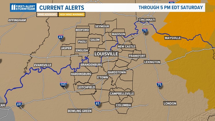
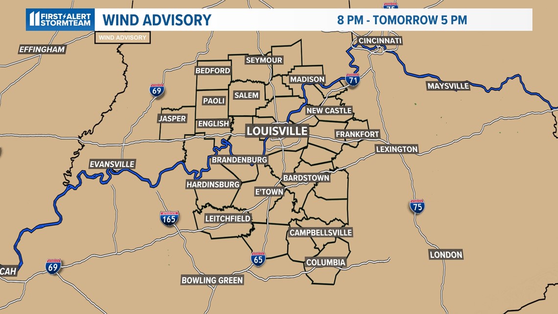
LOUISVILLE, Ky. — A WIND ADVISORY is in effect through 5 p.m. Saturday. We could see wind gusts up to 40 to 50 mph throughout the midday hours and into the afternoon hours to start off the weekend. Please make sure you take note of the strong wind if you drive a high profile vehicle or have any outdoor furniture or items on your patio!
The good news is that the wind will taper off in intensity through the latter stages of Saturday, thus quiet conditions will move in Saturday evening and overnight. Expect a cold night ahead as temperatures will dip into frost/freeze category overnight Saturday and into Sunday morning.

Have multiple ways to receive warnings in your area in case of a power outage such as the free WHAS11 app and a weather radio.
Looking Ahead
The wind will still remain persistent out of the west to at times northwest in the wake of Friday night's storms and through the course of Saturday.
Therefore, Saturday will bring a lot drier air in the passage of the cold front but wind gusts will still make for hazardous conditions to open up the weekend.
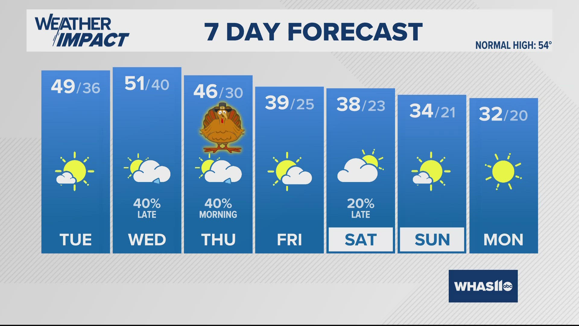
We will be a lot quieter and more comfortable on Sunday, as high temperatures will climb well into the lower to middle 60s.
Want to reach out to the WHAS11 First Alert StormTeam? Send an email to weather-all@whas11.com.