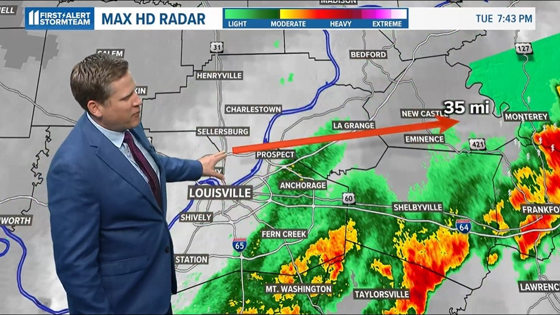
LOUISVILLE, Ky. — The Louisville area was greeted with two rounds of severe weather Tuesday, and one suspected tornado may have been on the ground for 30 miles -- or more.
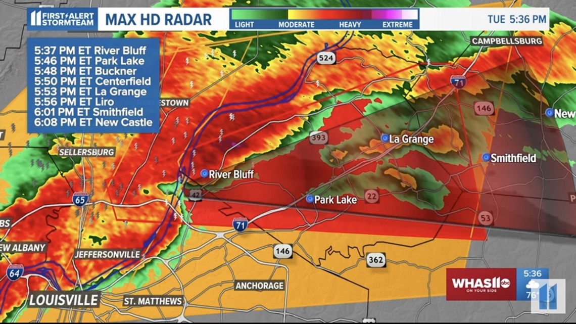
A tornado warning was issued for Clark County in Indiana just after 5:30 p.m. That warning eventually extended all the way to Henry County in Kentucky.
The National Weather Service has yet to confirm a tornado, however Louisville Mayor Craig Greenberg said during a news conference Tuesday night the damage is consistent with a tornado.
WHAS11 Chief Meteorologist Ben Pine said the NWS will likely find evidence of an EF-2 or even EF-3 tornado.
"It started off as just a little spin-up around I-65 and 265 in Jeffersonville," Pine said. "And then it really started to ramp up its energy and turned into a strong and long-lived tornado that went all the way from near Utica and 265, near the roundabout up there. These are busy and growing areas in Clark County, Indiana."


The WHAS11 weather center picked up winds speeds of 131 mph between Utica, Indiana and Prospect, Kentucky. The tornado slowed down over Prospect, which sustained the most damage.
"Sometimes when they get strong like this, they can have a mind of their own and slow down in respect to the overall atmospheric winds that are really fast," Pine said.


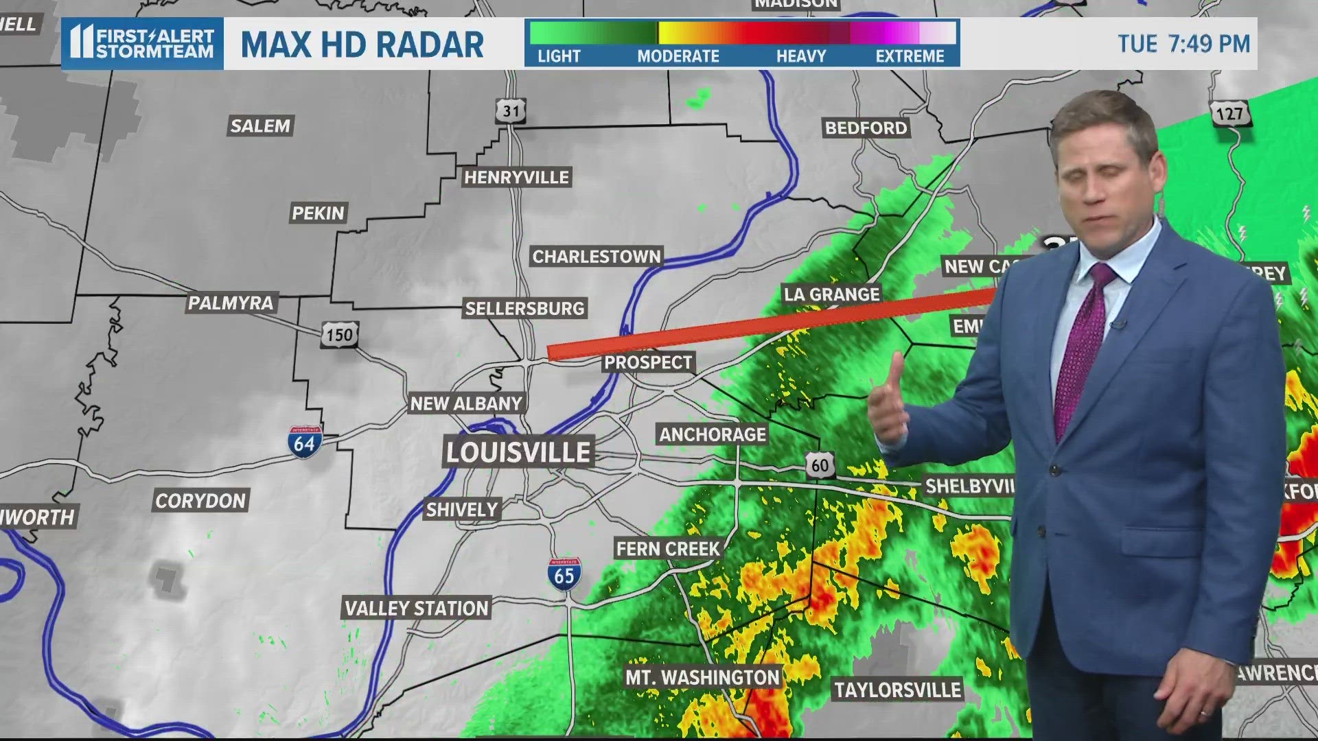
According to Pine, the radar-indicated tornado formed near Jeffersonville in Indiana, passed over Utica and the Ohio River, then entered Prospect in Kentucky and maintained momentum through Oldham County and into New Castle in Henry County.
Extensive damage was reported in Prospect, including numerous homes. Damage was also reported in New Castle.
"That storm did lose a little rotation and pulse back up, so it might end up being a couple segments of a tornado," Pine said.
No serious injuries or deaths were reported as of 9 p.m. Tuesday.
The NWS surveyed the area Tuesday night and will return Wednesday.
RELATED VIDEO

