FLORIDA, USA — Florida is once again bracing for a major hurricane after Milton gained a ton of strength Monday morning in the Gulf of Mexico.
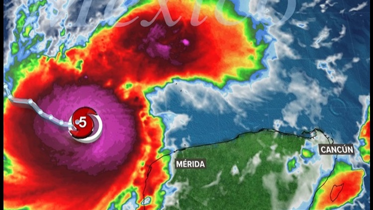
Less than two weeks after Hurricane Helene caused major damage to Florida and the southeast United States, Hurricane Milton is threatening the Sunshine State. Milton rapidly intensified in the Gulf of Mexico Monday morning and reached Category 5 status about noon EST.
According to the National Hurricane Center, "there is an increasing risk of life-threatening storm surge and wind impacts for portions of the west coast of the Florida Peninsula beginning late Tuesday or Wednesday."
The National Weather Service in Tampa said in a news conference Monday this storm will be "historic" for Florida's west coast.
Hurricane and storm surge watches are in effect for Florida's Gulf Coast.
Live interactive radar
Forecast and projected path
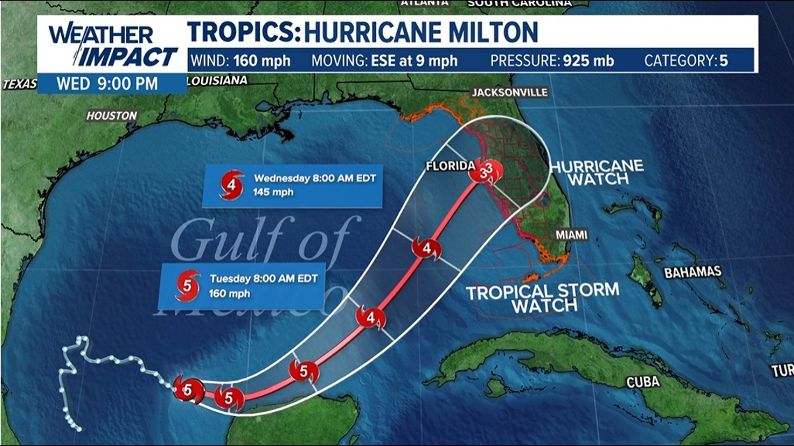
As of Monday at 11:30 a.m. EST, Milton was spinning in the Gulf of Mexico about 700 miles west of Tampa. Milton is a Category 4 hurricane with wind speeds of 150 mph, tracking east-southeast at 8 mph.
By noon, Milton reached Category 5 status with 160 mph winds.
According to The Weather Channel, Milton more than doubled the criteria for rapid intensification. Winds increased from 65 mph at 10 a.m. Sunday to 150 mph by 8 a.m. Monday.
The storm is expected to gain strength and it's possible it will reach Category 5 status for a brief time over the central Gulf of Mexico. Forecasts call for Milton to lose some strength as it approaches Florida due to dry air and increasing wind sheer.
However Milton will remain a major hurricane when it makes landfall late Wednesday into early Thursday.

According to The Weather Channel, Milton's potential weakening will not reduce impacts from the storm, including major storm surge. The National Hurricane Center is forecasting storm surge of 8-12 feet above ground level if peak surge coincides with high tide along the west-central Gulf Coast.
Storm surge could be 5-10 feet as far south as Fort Myers Beach and in places north of Tampa Bay.
Storm surge will be most severe near and south of the eye.
Rainfall totals across the Florida Panhandle could be 5-10 inches, with 15 inches possible locally through Thursday.
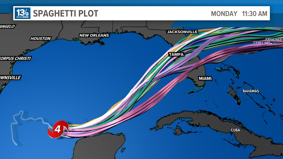
Spaghetti models
Here are the latest spaghetti models: