Tropical Storm Cindy, which made landfall early this morning along the Texas/Louisiana Gulf Coast, will bring active weather to Kentuckiana today. The storm weakened a bit prior to landfall with maximum sustained winds at only 45 miles per hour, so it has been more of a rain maker instead of a wind maker.
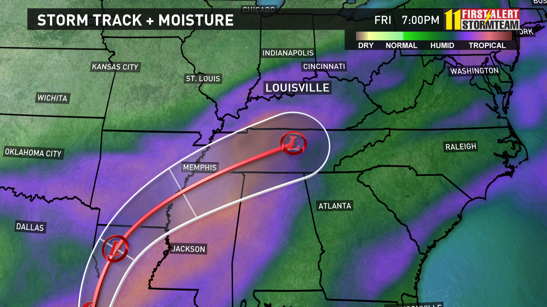
The extensive shield of tropical moisture extends well to the north and northeast of the storm's center and the Gulf Coast and Deep South have been pounded by heavy rain over the last couple of days. Even though the storm will continue to weaken as it moves into the Tennessee Valley on Friday, the remnants will bring abundant rain and moisture to Kentuckiana.
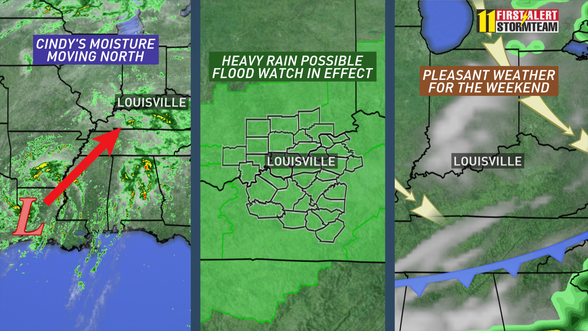
Scattered to numerous rain showers are expected through Friday ahead of this tropical system and ahead of an approaching cold front which is essentially squeezing out all the available moisture over the area.
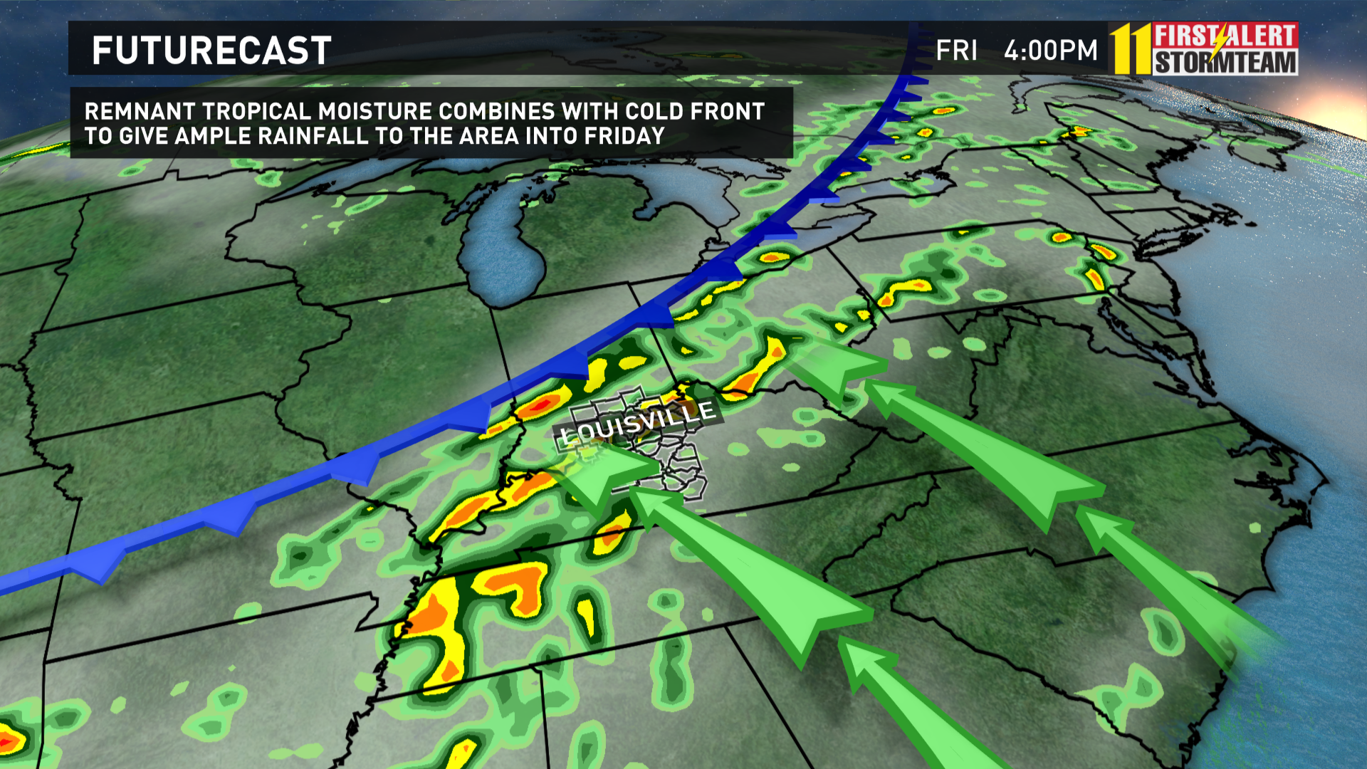
The combination of the tropical moisture and a cold front moving in from the northwest should increase the chances for heavy rain during the day on Friday.
Rainfall amounts of 1-4" are possible in Kentucky with some locally higher amounts if this system moves according to the latest data, and this could create a few flooding problems. Stay tuned for updates to this forecast as more changes are possible.
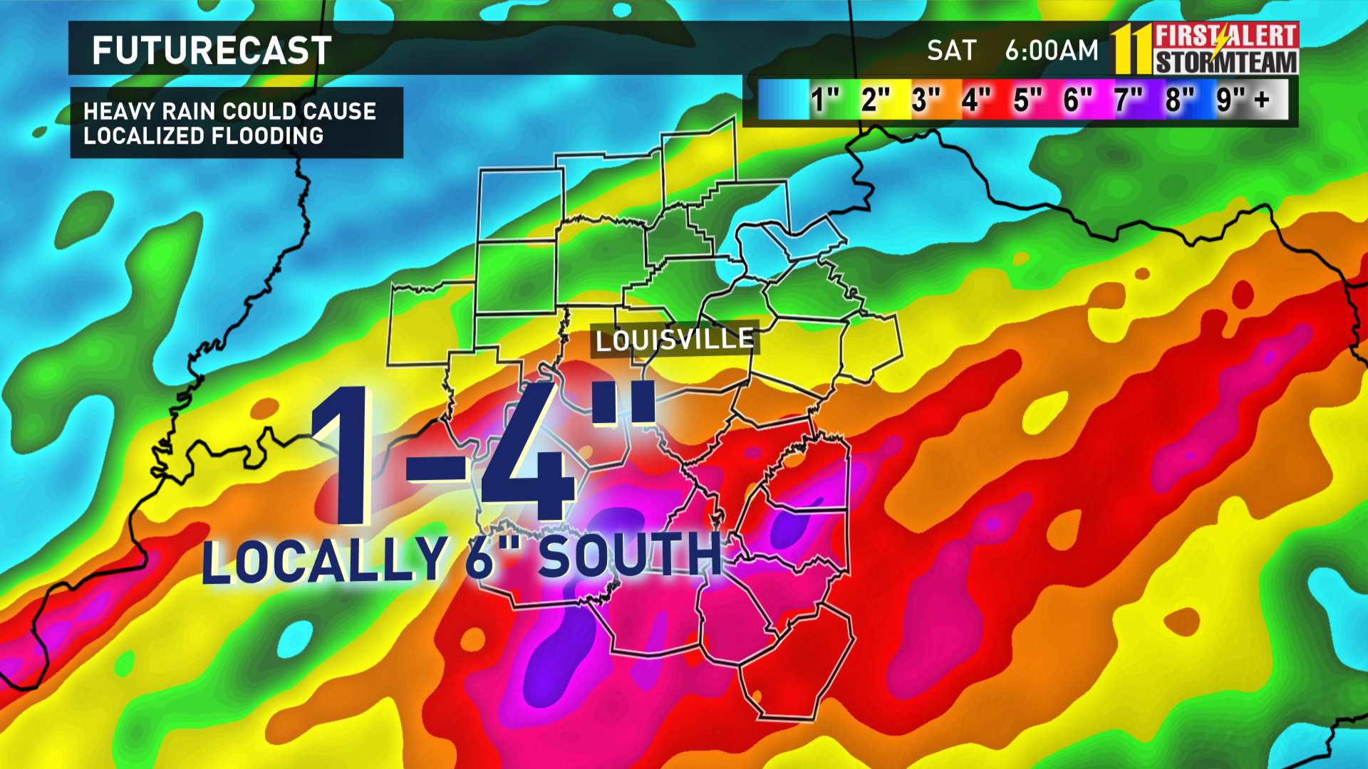
A flood watch is in effect. A few storms may become strong with gusty winds and an isolated tornado risk south of Louisville Friday afternoon as well as the remnant wind energy from Cindy moves by.
Stay with WHAS11 for further updates!

