
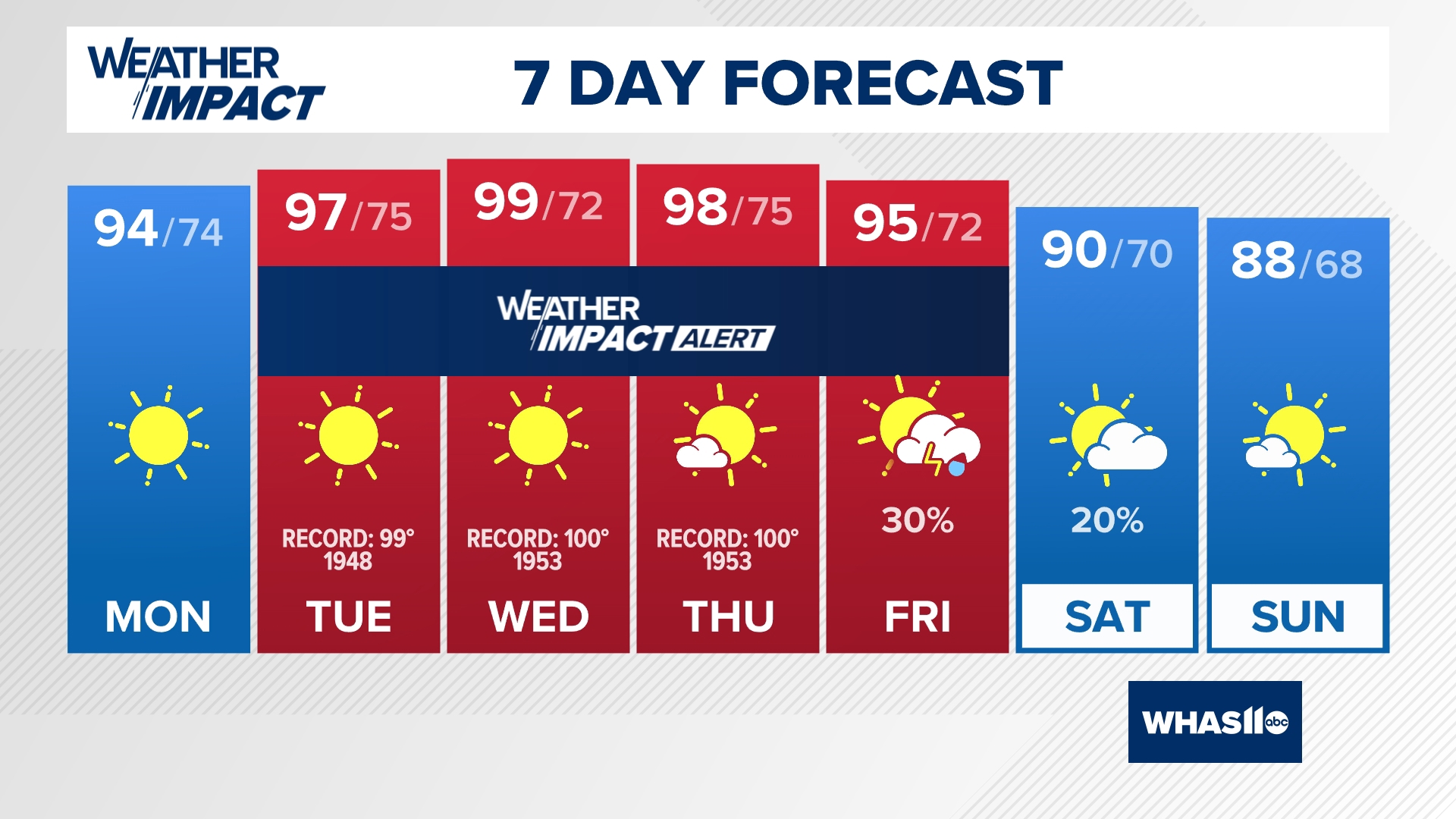
LOUISVILLE, Ky. — After a taste of Fall temperatures last week, we are focused on high levels of heat and humidity in central Kentucky and southern Indiana.
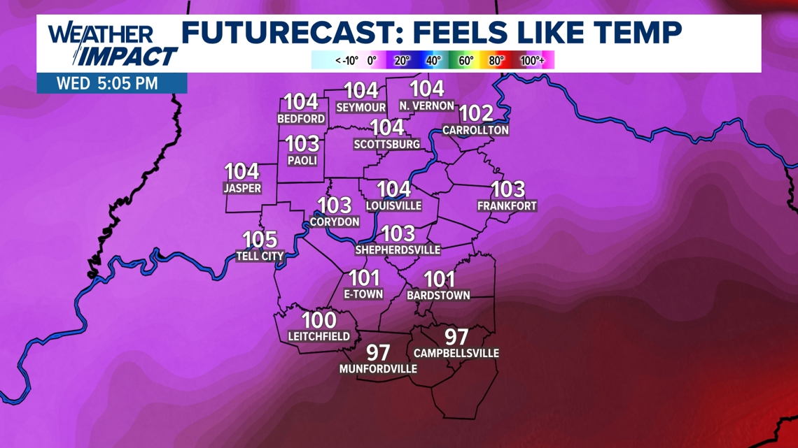
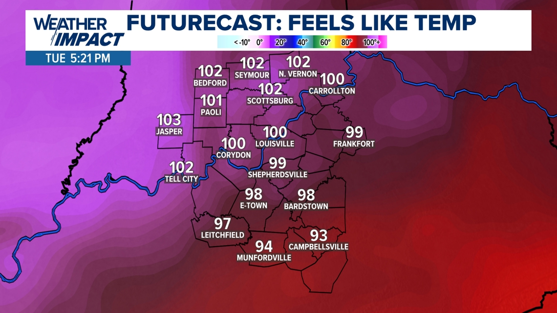
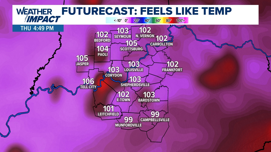
It all begins Tuesday and will affect us through Friday. High temperatures will soar between 95-100 degrees each day with feels like temperatures ranging from 100-110 degrees because of heightened humidity levels and the heat.

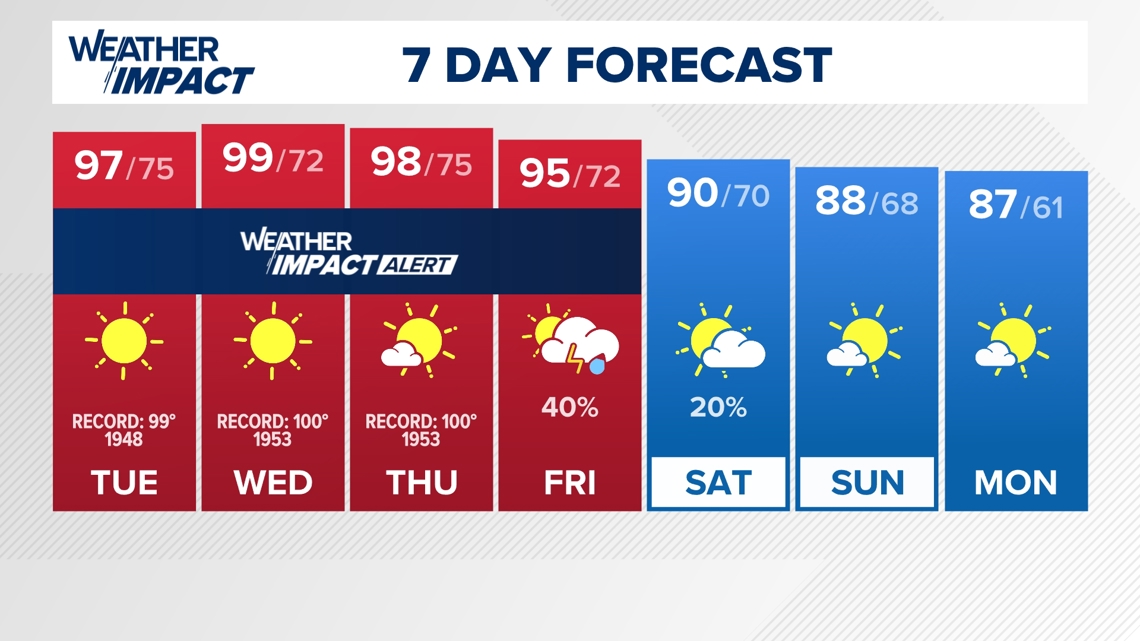
It will be so hot across our area that daily record high temperatures are in jeopardy. The following are daily records on the days through this week:
Tuesday: 99 degrees (1948) - Forecast: 97 degrees
Wednesday: 100 degrees (1953) - Forecast: 99 degrees
Thursday: 100 degrees (1953) - Forecast: 98 degrees
Dangerous Heat


How to protect yourself against heat
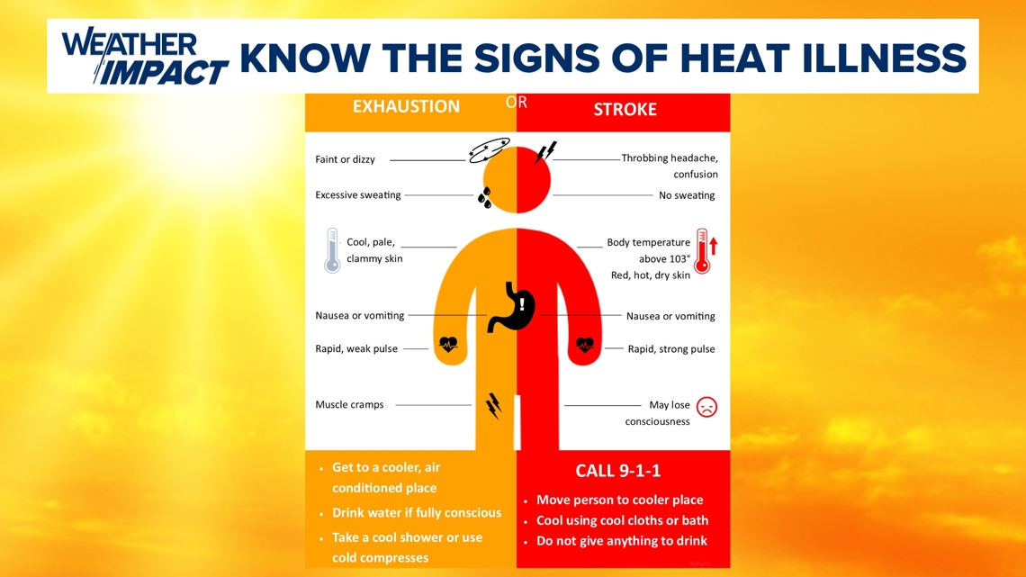
It is very important that all of us familiarize ourselves with the signs and symptoms of heat stroke and heat exhaustion.
If you feel nauseous, have the chills or have dizziness, please make sure you call 911 and seek medical attention. The week's heat and sun is nothing to mess around with.

Rain Chances
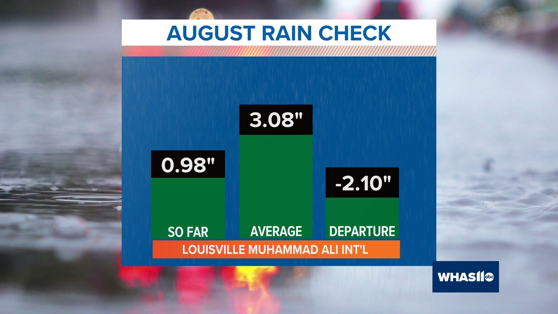
We are also concerned about the lack of rainfall lately. Louisville has not picked up measurable rainfall in 10 days (0.20 inches on August 16th) and we do not expect to receive any rain until Friday and possibly Saturday morning of this week.
Note, that August also remains very dry as we have struggled to near an inch of rain this month.

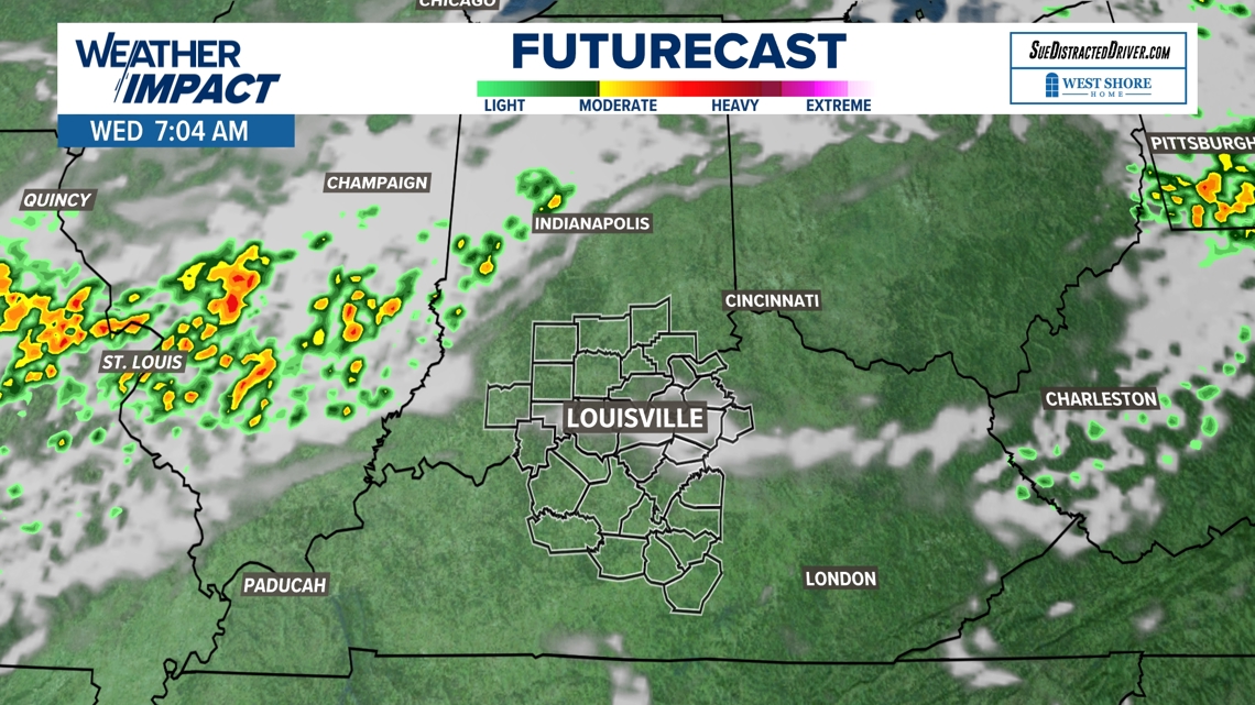
The best chance for rainfall will arrive Friday and into Saturday morning but chances for a washout appear slim at this time. Most of the storms that develop will be isolated and may provide brief heavy downpours to localized spots.
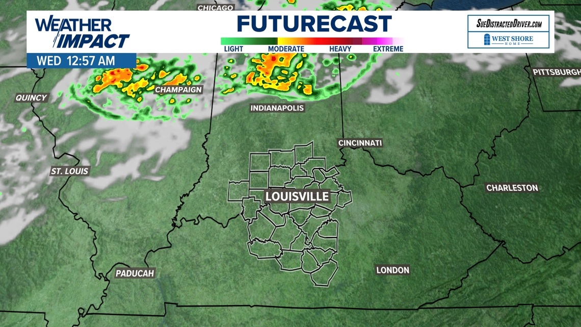
There is still time for the forecast to change, however. A stray shower or storm will veer away from us but may affect portions of Indiana, Ohio and eastern Kentucky early Wednesday morning and again Wednesday evening.


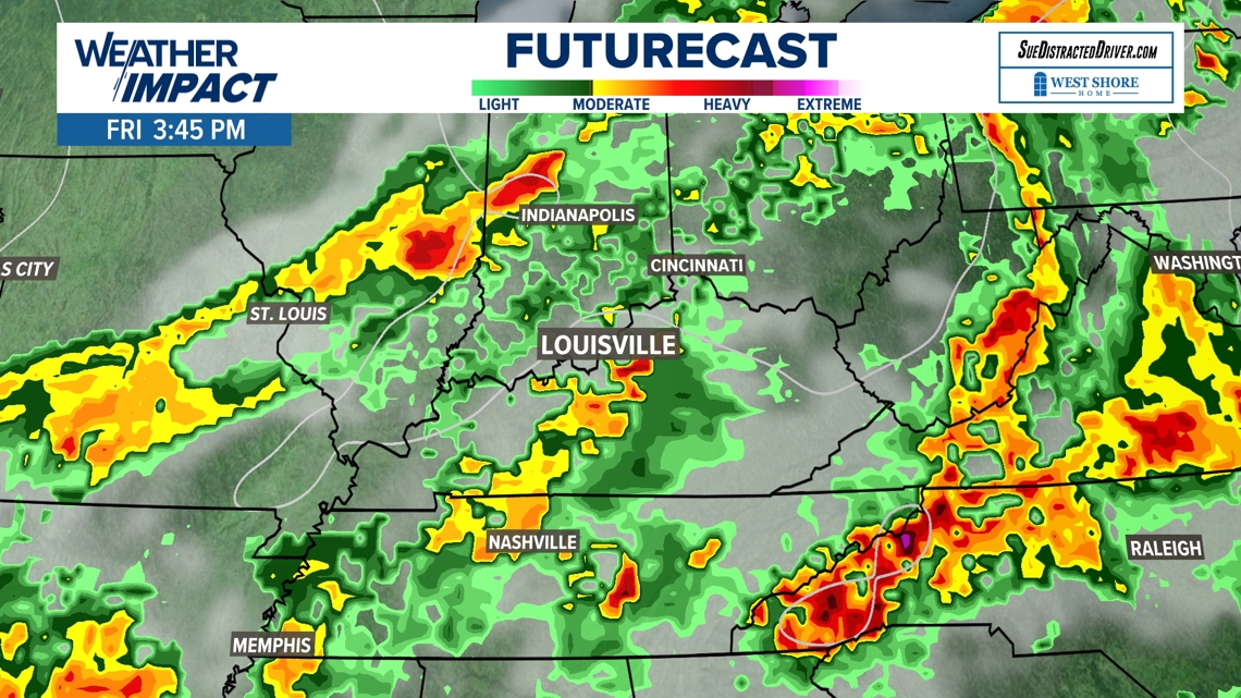
Luckily, much cooler air will finally arrive behind Friday's cold front and storm chance. This will set up central Kentucky and southern Indiana for a more seasonable and temperate start to the month of September.