
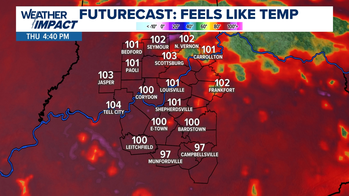
LOUISVILLE, Ky. — Extreme heat along with Orange Air Quality Alerts in place through Kentucky and Indiana for the rest of our workweek.
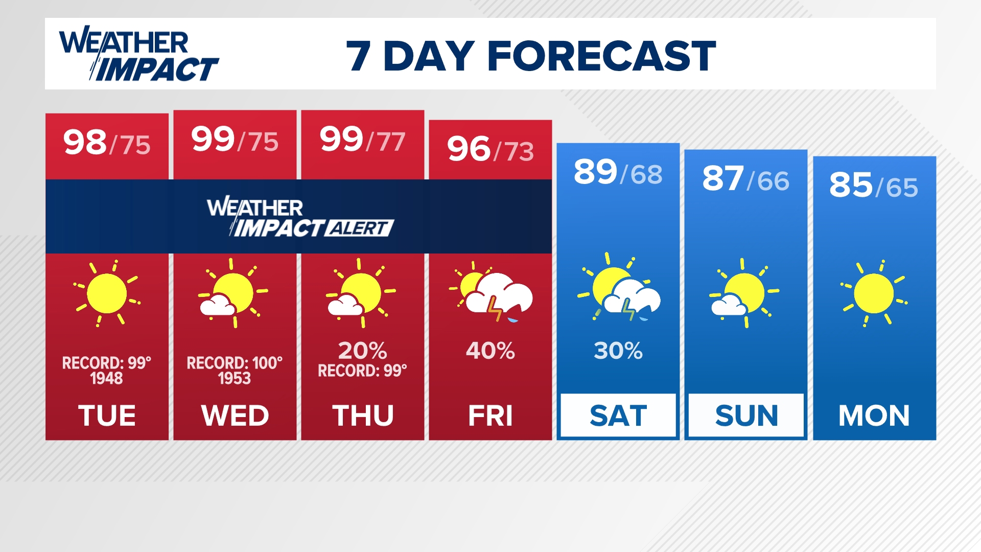
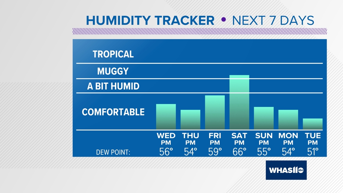
High temperatures will soar near 100° degrees each day. Thankfully, humidity levels will be fairly low, so this dry heat won't feel too much worse than the actual temperature.


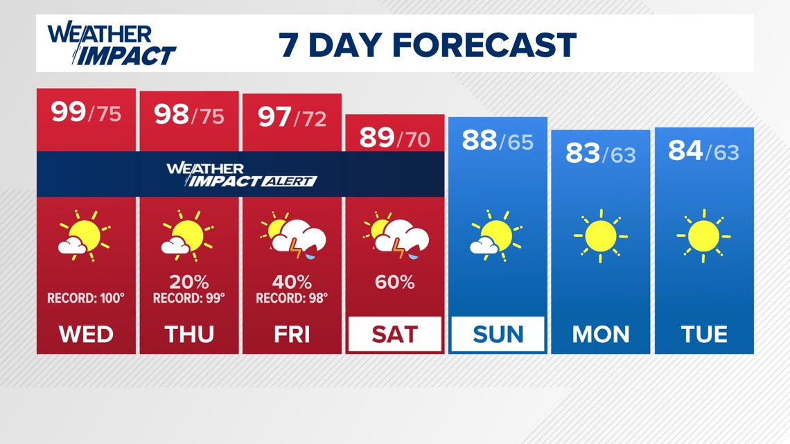
It will be so hot across our area that daily record high temperatures are in jeopardy. The following are daily records on the days through this week:
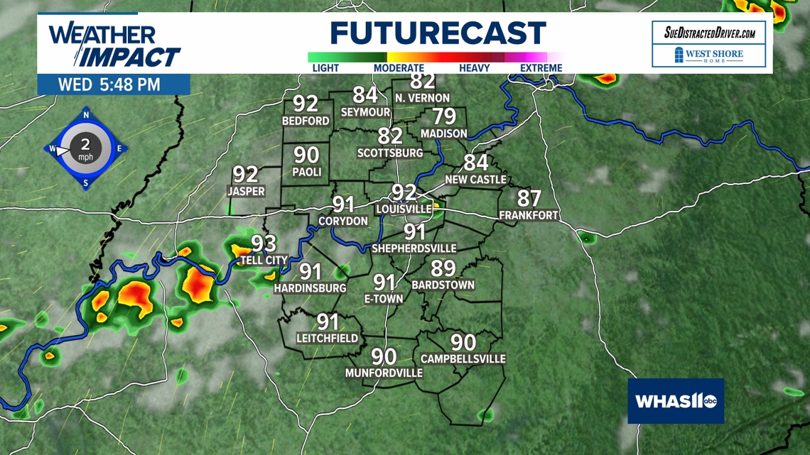
Wednesday: 100 degrees (1953) - Forecast: 99 degrees
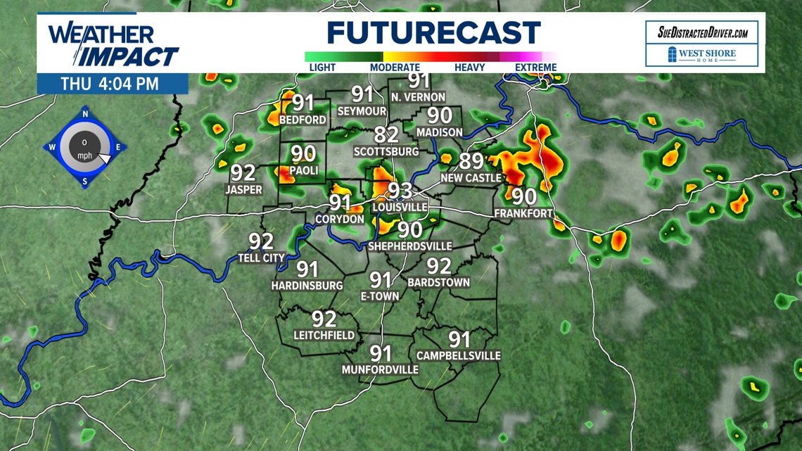
Thursday: 99 degrees (1953) - Forecast: 98 degrees
Friday: 98 degrees (1953) - Forecast: 97 degrees
Louisville tied a record high temperature on Tuesday. The high temperature was 99 degrees and this tied a previous record of that value back in 1948!
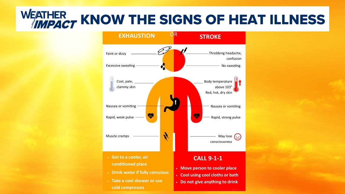
Dangerous Heat

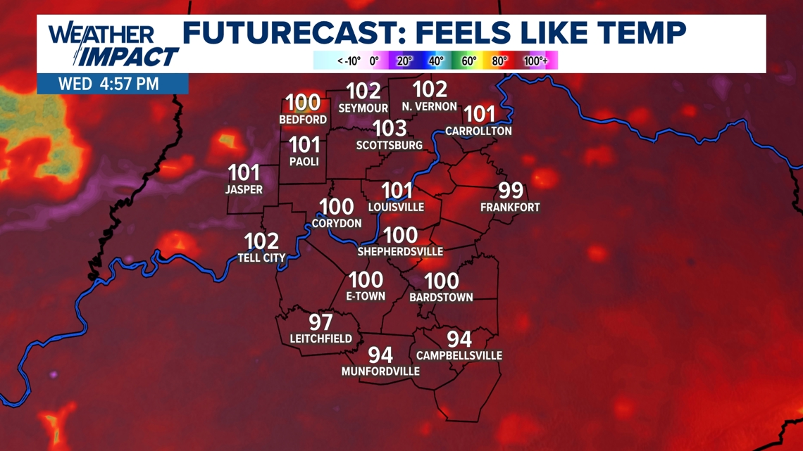

How to protect yourself against heat
It is very important that all of us familiarize ourselves with the signs and symptoms of heat stroke and heat exhaustion.
If you feel nauseous, have the chills or have dizziness, please make sure you call 911 and seek medical attention. The week's heat and sun is nothing to mess around with.

Rain Chances
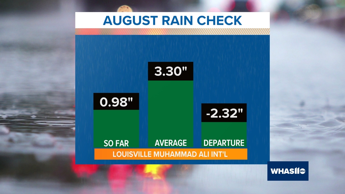
We are also concerned about the lack of rainfall lately. Louisville has not picked up measurable rainfall in 12 days (0.20 inches on August 16th) and we do not expect to receive any rain until Friday and possibly Saturday morning of this week.
Note, that August also remains very dry as we have struggled to near an inch of rain this month.

The best chance for rainfall will arrive late Friday and into Saturday, but chances for a washout appear slim at this time. Most of the storms that develop will be isolated and may provide brief heavy downpours to localized spots.

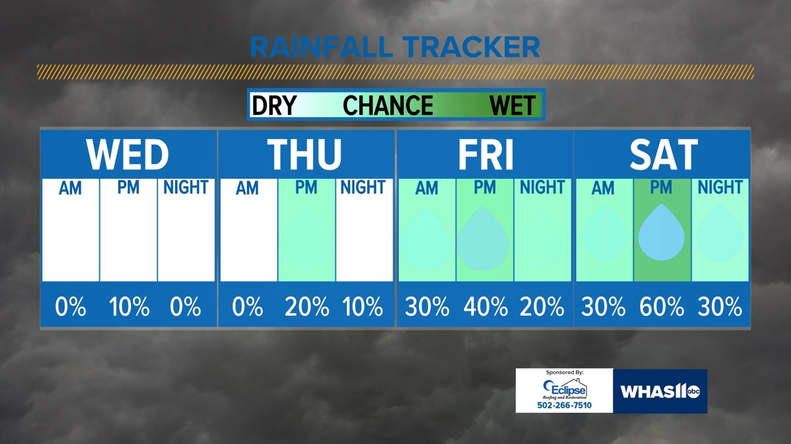


Luckily, much cooler air will finally arrive behind Friday's cold front and storm chance. This will set up central Kentucky and southern Indiana for a more seasonable and temperate start to the month of September.