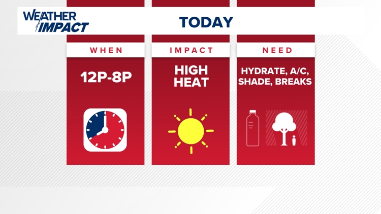
LOUISVILLE, Ky. — Extreme heat along with Orange Air Quality Alerts in place through Kentucky and Indiana for the rest of our workweek.
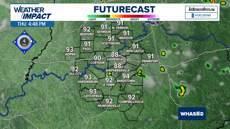
Temperatures hit a record high of 102 degrees on Thursday; that's the hottest its been since July 8, 2012. Thankfully, humidity levels will be fairly low, so this dry heat won't feel too much worse than the actual temperature.
Expect feels like temperatures to range between 100-105 degrees.

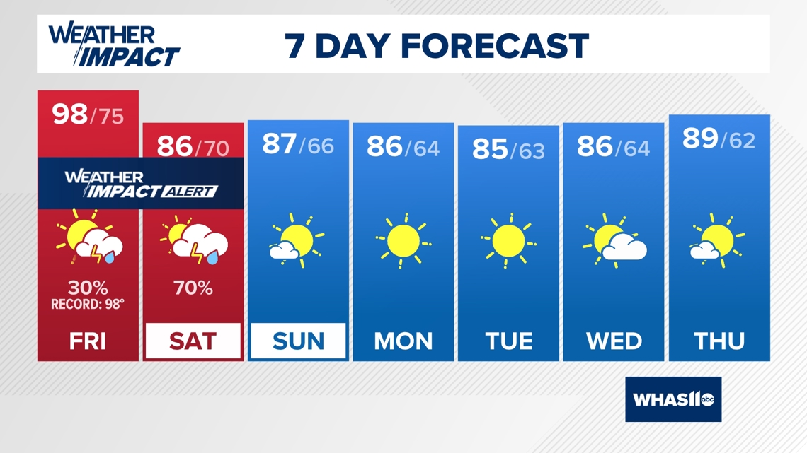
Louisville tied a record high temperature on Tuesday. The high temperature was 99 degrees and this tied a previous record of that value back in 1948!
We did not quite get to the record high of 100 degrees on Wednesday. Instead we warmed to 99° for our high temperature on hump day.

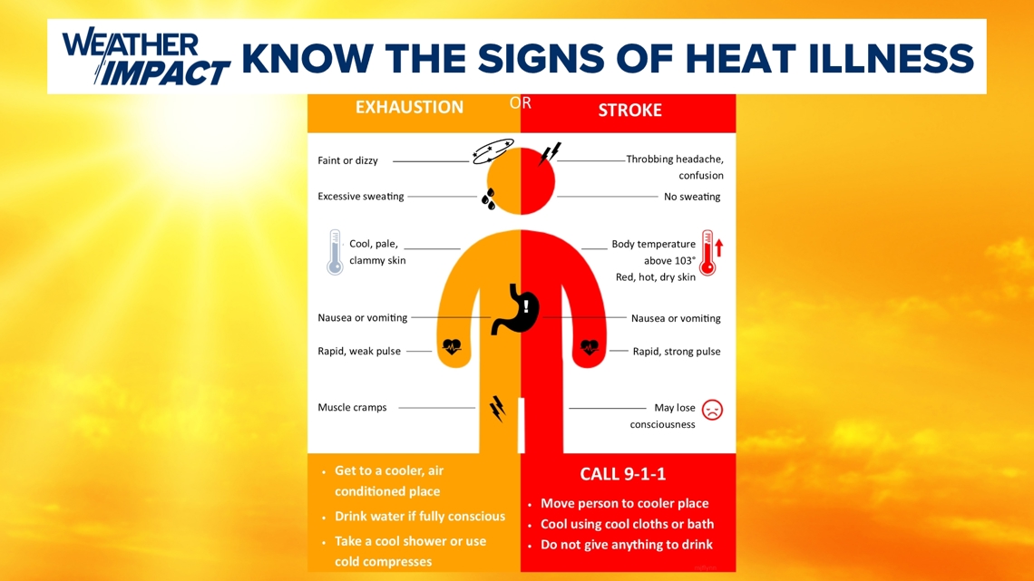
How to protect yourself against heat
It is very important that all of us familiarize ourselves with the signs and symptoms of heat stroke and heat exhaustion.
If you feel nauseous, have the chills or have dizziness, please make sure you call 911 and seek medical attention. The week's heat and sun is nothing to mess around with.

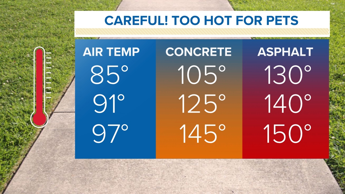
Also, please make sure you wait and walk your pets either in the morning or the evening hours. The heat of the day will make for concrete and asphalt to clock in between 150 to 200 degrees. This would be hurtful for your pets paws.

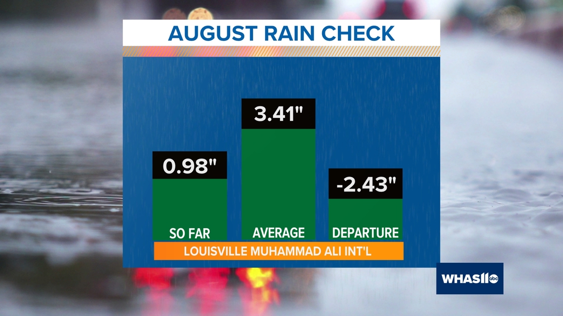
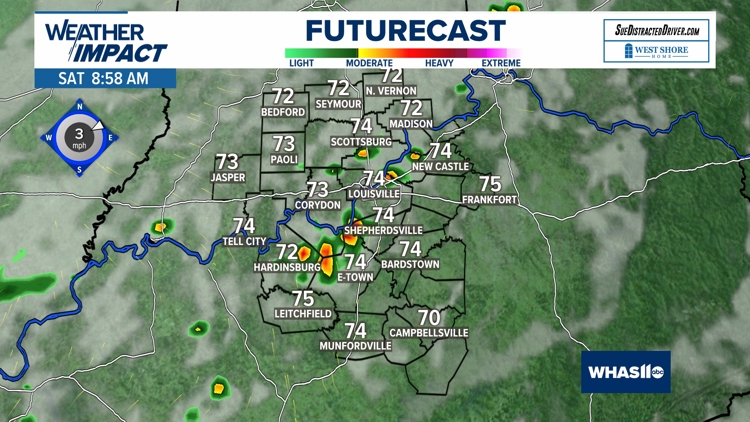
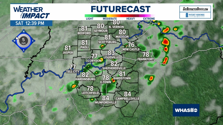
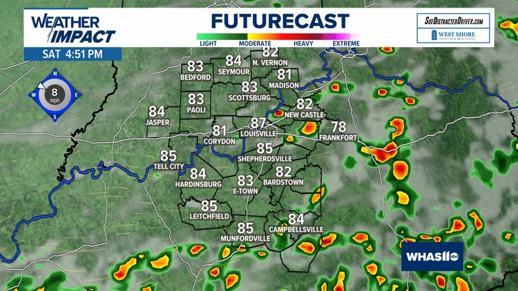
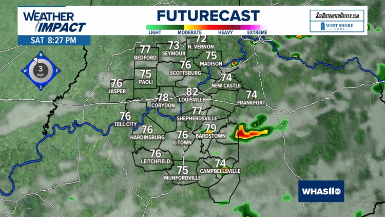
Rain Chances
We are also concerned about the lack of rainfall lately. Louisville has not picked up measurable rainfall in 13 days (0.20 inches on August 16th) and we do not expect to receive any rain until Friday and Saturday.
Note, that August will go down abnormally dry as we have struggled to top an inch of rain this month.

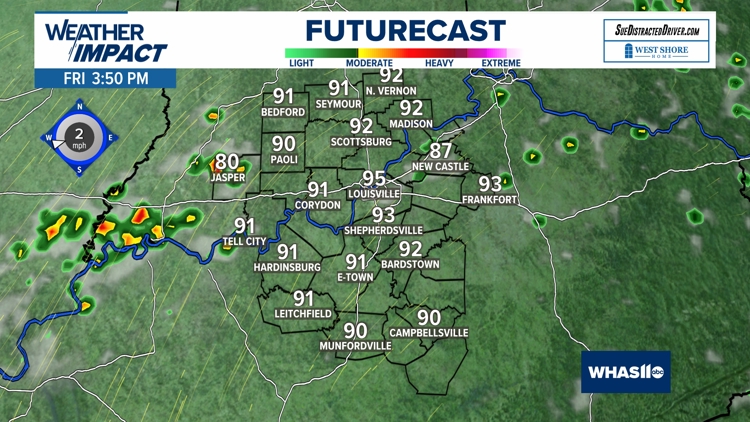
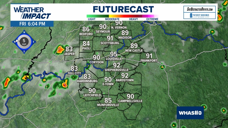
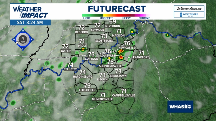
The best chance for rainfall will arrive late Friday and into Saturday, but chances for a washout appear slim at this time. Most of the storms that develop will be isolated and may provide brief heavy downpours to localized spots.
There is a very LOW risk for severe weather. Any storms that ignite will provide brief heavy pockets of rainfall and a isolated strong wind gust of two (40-50 mph).
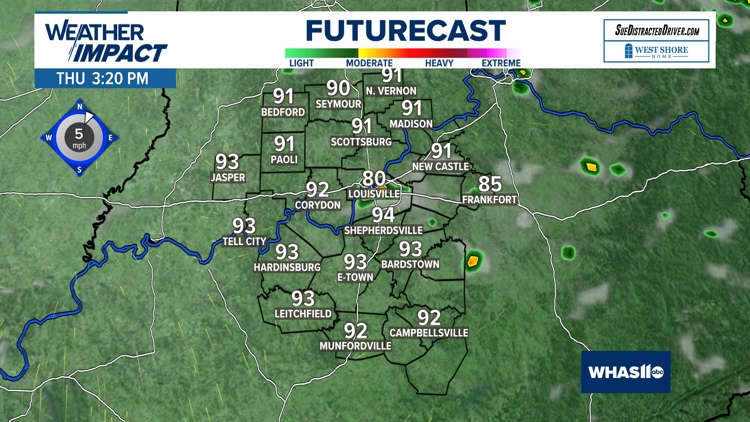
Futurecast: Thursday, Friday and Saturday


Worsening Drought
Luckily, more seasonable air will move in for the end of the weekend and through next week.
Let's hope that September brings a lot more rain because we are beginning to really see the drought monitor increase in coverage across central and northern Kentucky as well as far southern Indiana.