

LOUISVILLE, Ky. — Ida is one of the strongest hurricanes to hit Louisiana as a category 4 hurricane. According to the National Hurricane Center (NHC), the sustained wind speeds were 150 mph and stronger gusts when it hit.
It made landfall near Port Fourchon, Louisiana, at 12:55 pm on Sunday. Ida hit on the 16 anniversary of Hurricane Katrina that hit New Orleans as a category 3 hurricane. The NHC stated parts of the Louisiana and Mississippi coast faces life-threatening storm surges and catastrophic wind damage on Sunday. Ida will also produce the threat of flooding for many states as it moves inland.

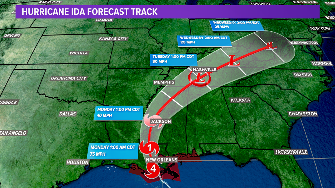
As Ida tracks through the Mississippi Valley Sunday evening and Monday morning, it will lose its intensity. Some of the remnants will reach Kentuckiana on Monday and interact with a cold front positioned to our north. Expect scattered storms to be picking up throughout the day. Heavy rainfall from storms will be possible.

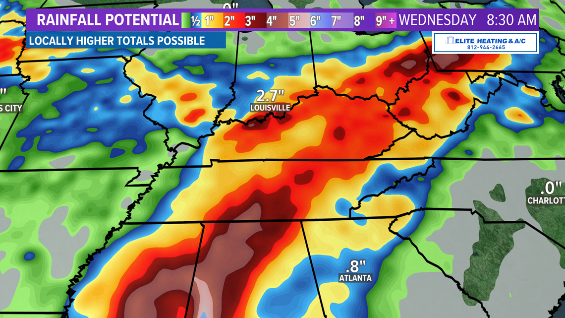
The center of Ida will track through the Tennessee Valley on Tuesday, bringing more tropical rain to our area. Forecast models are in slight disagreement on how far north it will move. Heavy rainfall is expected south of the Ohio River, especially south-central and eastern Kentucky. Heavy rain and high rainfall rates will likely lead to localized flooding.
►Make it easy to keep up-to-date with more stories like this. Download the WHAS11 News app now. For Apple or Android users.
Have a news tip? Email assign@whas11.com, visit our Facebook page or Twitter feed.