Another La Niña expected this winter - Here's what its means for the Ohio Valley
This is an unusual occurrence and doesn’t happen too often, but it's the third straight winter we'll have one.
WHAS
We’re well into autumn, but winter is already on the mind. The Climate Prediction Center’s recently released their initial winter forecast for 2022 into 2023.
La Niña conditions are again expected this winter.
But what exactly is La Niña and how does it affect our weather in the Ohio Valley?
It’s always important to remember that meteorologists and climatologists are attempting to predict what’s going to happen in the future – something your March Madness bracket has probably proven, is very difficult to do.
What is La Niña? An unusual occurrence that doesn't happen often
For the third straight meteorological winter, December through February, La Niña conditions are expected in the Pacific Ocean.
This is an unusual occurrence and doesn’t happen too often, but its impacts on the Ohio Valley may be minimal.
Historically, La Niña in the Ohio Valley doesn’t result in dramatic changes to our weather, but it’s not the only player in our weather game.

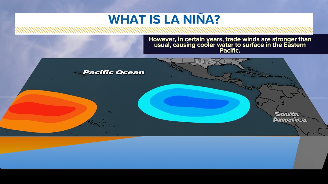
La Niña is Spanish for “the girl,” and it's a phenomena where unusually cold ocean temperatures in the Pacific Ocean dominate near the equator in South America, with warmer than normal ocean temperatures in the western Pacific.
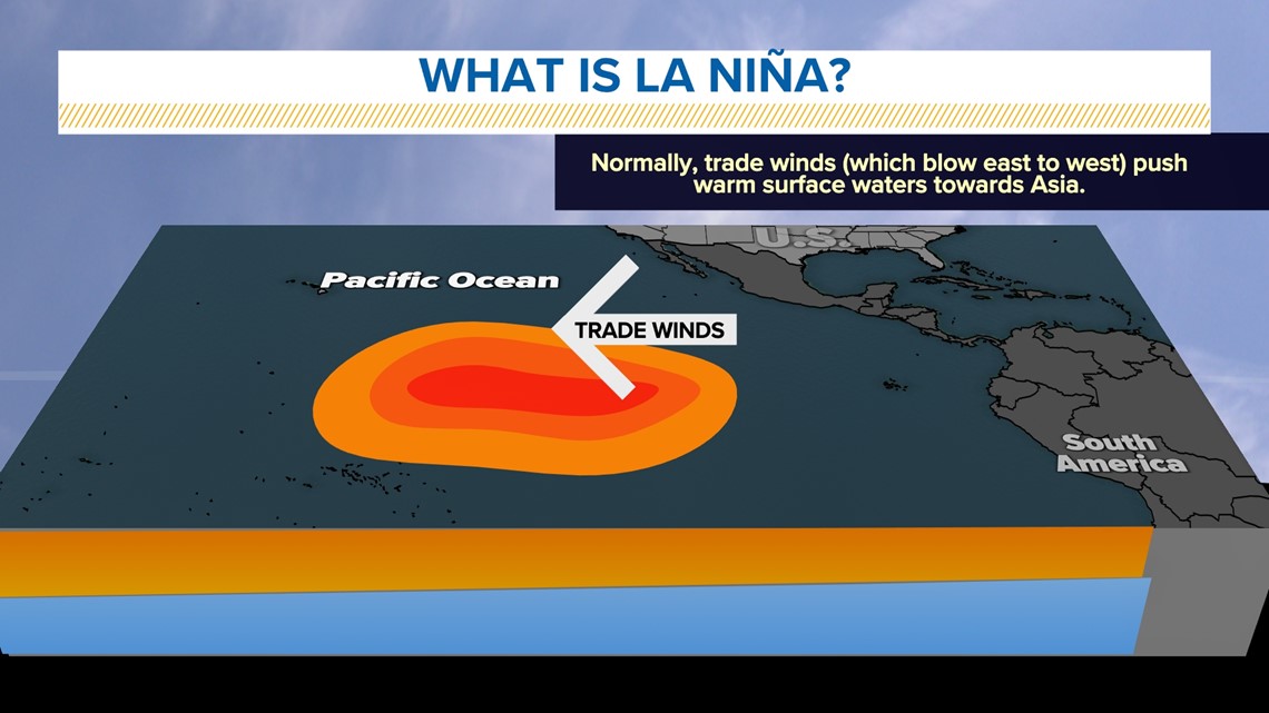
This is because of the trade winds - winds that reliably blow east-to-west along the equator. In years where they're stronger than normal, La Niña is likely to develop.
It’s the opposite of El Niño, or “the boy,” which sees warmer ocean waters off the equatorial South American coast because of weaker trade winds.
Together, these two phenomena make up the El Niño–Southern Oscillation, or ENSO. To keep it simple, ENSO is the irregular cycling of wind patterns and sea surface temperatures along the equator in the Pacific Ocean that result in La Niñas or El Niños.

How La Niña affects us What to expect later this winter
The influences of La Niña are most apparent during winter months in North America, but some areas see far greater impacts than others.
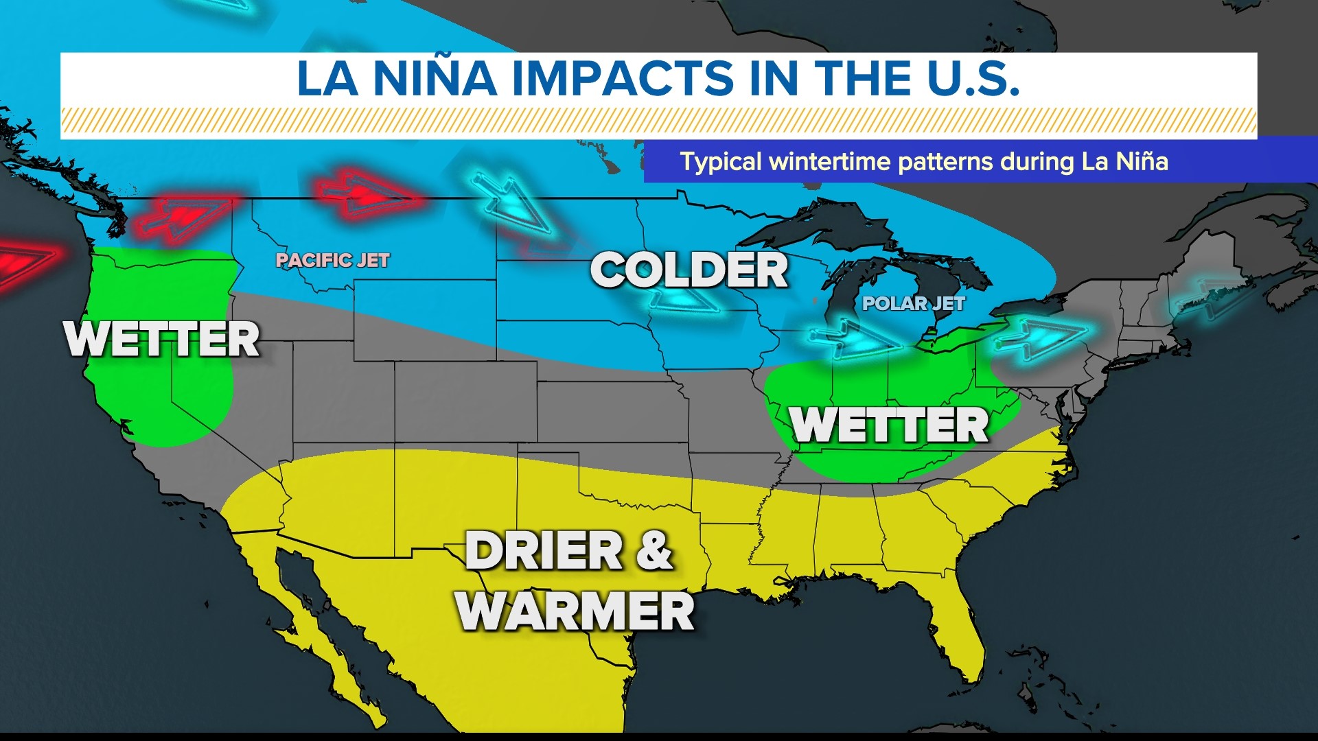
Unlike other parts of the country, the Ohio Valley is not greatly impacted by La Niña in the winter months. Historically, slightly wetter and cooler weather occurs in the winter months. Snowfall may also be slightly reduced.
We’re most likely to see the impacts of La Niña in late winter and early spring when higher rainfall than normal may occur and result in flooding events. March is often the month when flooding is most likely to happen.


Nationally, the southern United States generally experiences drier and warmer conditions – something that isn’t welcome to hear given the ongoing expansive drought.
The Pacific Northwest often sees cooler, wetter conditions.
Colder weather is often found in La Niña events from the Aleutian Bay southeastward into the northern Great Plains.
Winter outlook 2022 How meteorologists make these future predictions
The Climate Prediction Center’s initial winter outlook indicates a slight chance for above average precipitation from the Great Lakes into the Ohio Valley.
The Pacific Northwest is also currently expected to have wetter weather conditions. Drier weather is likely across the southern half of the United States.
As for temperatures, there’s an equal chance at above or below normal temperatures for winter. The northern U.S. is leaning toward colder weather, with the southern U.S. more likely to see warmer temperatures.
Other factors to consider
La Niña is not the only feature taken into consideration when doing long range forecasts like this. There are multiple other climatic patterns that play alongside ENSO to influence our weather, but how these different features interact with each other is often difficult to predict.
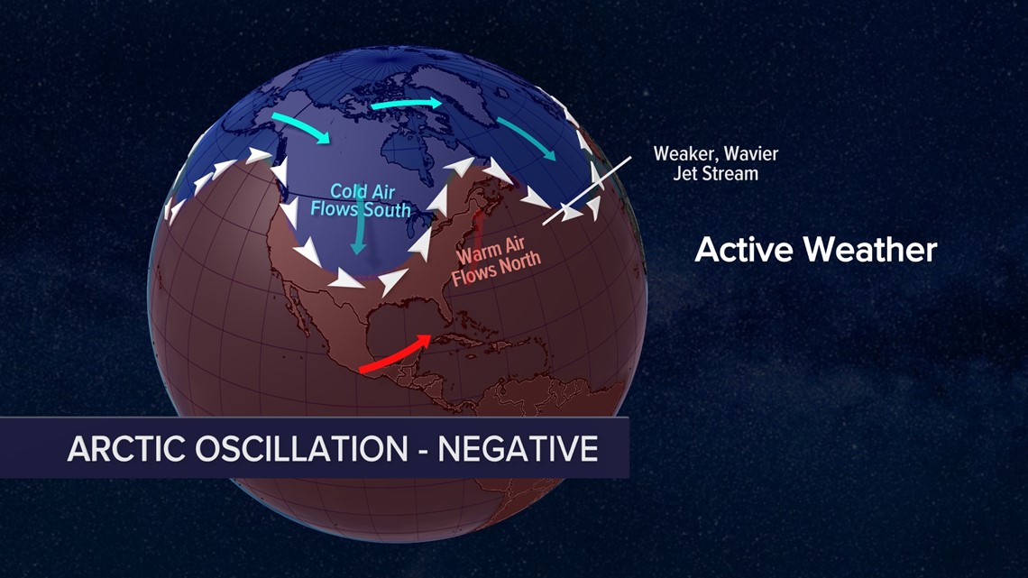
One of those other factors is the Arctic Oscillation (AO). AO is the everchanging pressure difference between the Arctic region and mid-latitudes, where we live. The AO frequently changes from positive and negative during the year.
When AO is positive, the jet stream is strong and stays northward more along the U.S.-Canada border bottling up cold air. It also prevents Arctic air outbreaks in our region and keeps storm systems to our north.

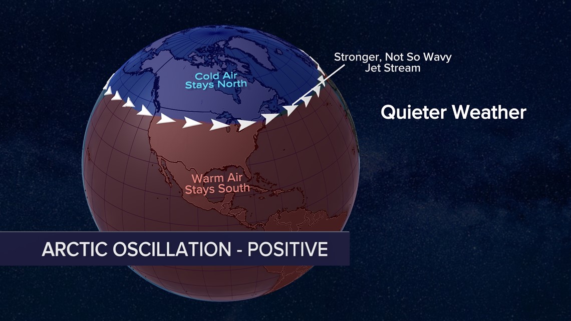
A negative AO means the jet stream is weaker and meanders around in a wavier pattern. This can cause more frequent Arctic air outbreaks and more active weather for us in the Ohio Valley.

What we still don’t know
Despite the confidence in some factors this winter, there are still some things meteorologists and climatologists have less certainty in:
How strong will La Niña be this winter?
It’s currently though to be weak-to-moderate which may mean near-to-below normal temperatures and near-to-above normal precipitation in the Ohio Valley.
How will other climate patterns (like the Arctic Oscillation) behave?
These can be less predictable and either enhance or lessen the impacts of La Niña. For example, if Arctic Oscillation has a prolonged negative period, we could experience weeks of very active winter weather.
What will potential storm tracks be?
That’s a question any time of the year but expected wetter than normal precipitation in addition to possibly negative Arctic Oscillation may mean frequently changing weather patterns.
How much snow will fall?
This is the biggest question everyone wants to know for winter. Given that La Niña has shown to have little influence on snowfall in our region, near average snowfall (approximately 12.5” in Louisville) can be expected.
Remember, weather is ever-changing and this forecast is only the initial outlook for our upcoming winter. Another outlook will be released mid-November which may be similar to this outlook, or show something much different.
Meteorologist Alden German
Facebook: Facebook.com/AldenGermanWX | Twitter: @WXAlden
Make it easy to keep up-to-date with more stories like this. Download the WHAS11 News app now. For Apple or Android users.
Have a news tip? Email assign@whas11.com, visit our Facebook page or Twitter feed.
