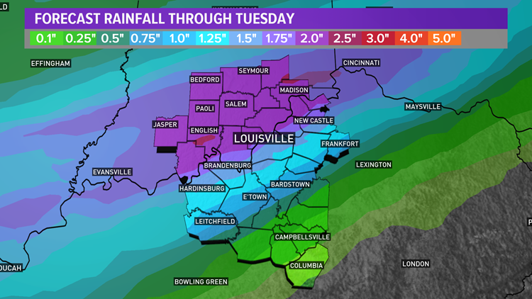
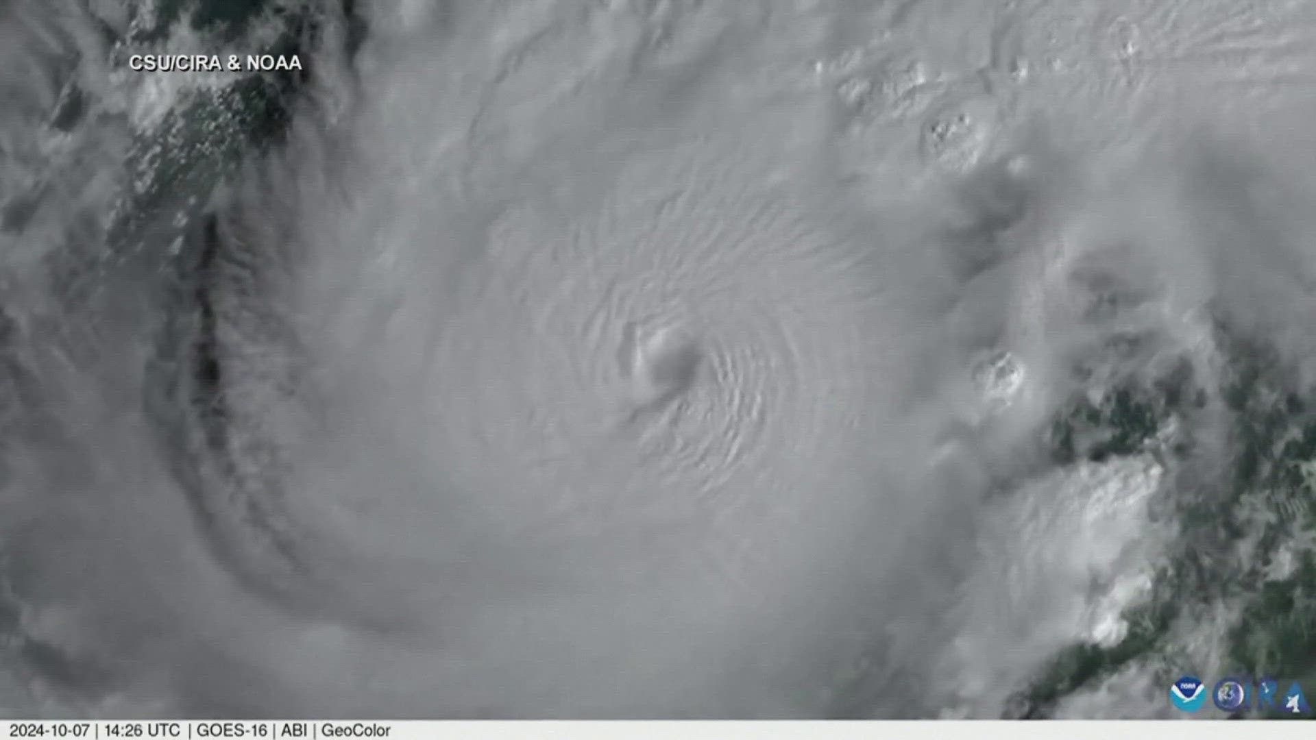
We’ve had quiet and dry weather for the past several weeks, but that’s finally about to change as some much needed rain is on the way. It should be a good soaking rain at that will combat drought conditions for some, and it’s not the only chance for rain we have this week.
Forecast at-a-glance:
- Soaking rains are expected Sunday night and Monday, especially in southern Indiana
- Temperatures briefly touch 80 degrees midweek
- More rain is possible Friday into next weekend
Weather setup: Sunday saw a great increase in clouds compared to Saturday’s sunny – but hazy – sky. It wasn’t nearly as cold Sunday morning compared to the past couple mornings with temperatures in the middle 50s. Of note, though, is a cold front approaching from the northwest. This storm system has even brought accumulating snow to parts of the Midwest! We won’t see any snow, but a healthy rain is expected which will alleviate drought conditions in Indiana.
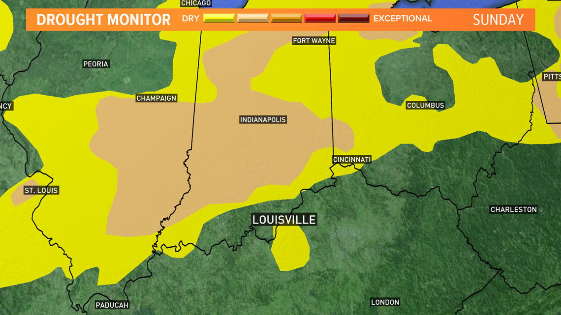
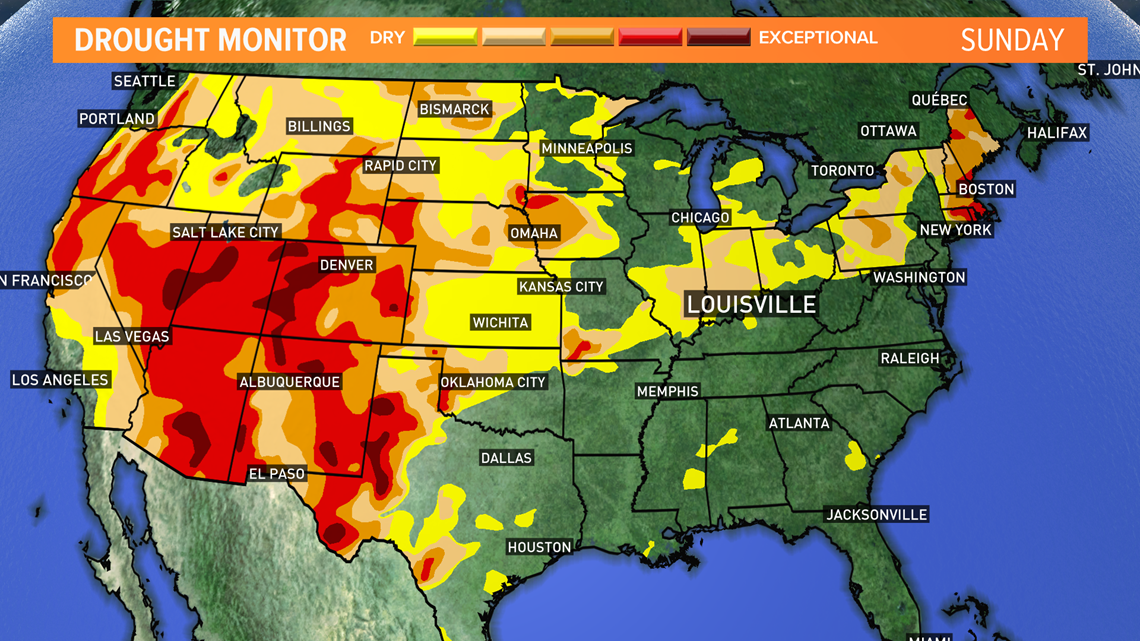
Here’s a look at the latest drought monitor released on Thursday, October 15th. Much of central Indiana is in a moderate drought, which isn’t the worst but indicates that rain has been scarce, and the environment is starting to get dry. Kentucky has been more fortunate and is not experiencing drought conditions. A broader view of the country reveals that much of the United States, particularly the west, is experiencing drought conditions on the upper end of the scale with little sign of relief coming. The upcoming La Nina for this winter will not help either. Fortunately, Indiana does have relief on the way.


That cold front mentioned earlier will slowly sag south late Sunday before stalling and becoming a stationary front in the vicinity of the Ohio River. This stationary front will serve as a focal point for rain and perhaps a few thunderstorms Sunday night through Tuesday. The heaviest waves of rain are likely Sunday and Monday with lingering showers Tuesday as the stationary front begins to move north as a warm front.

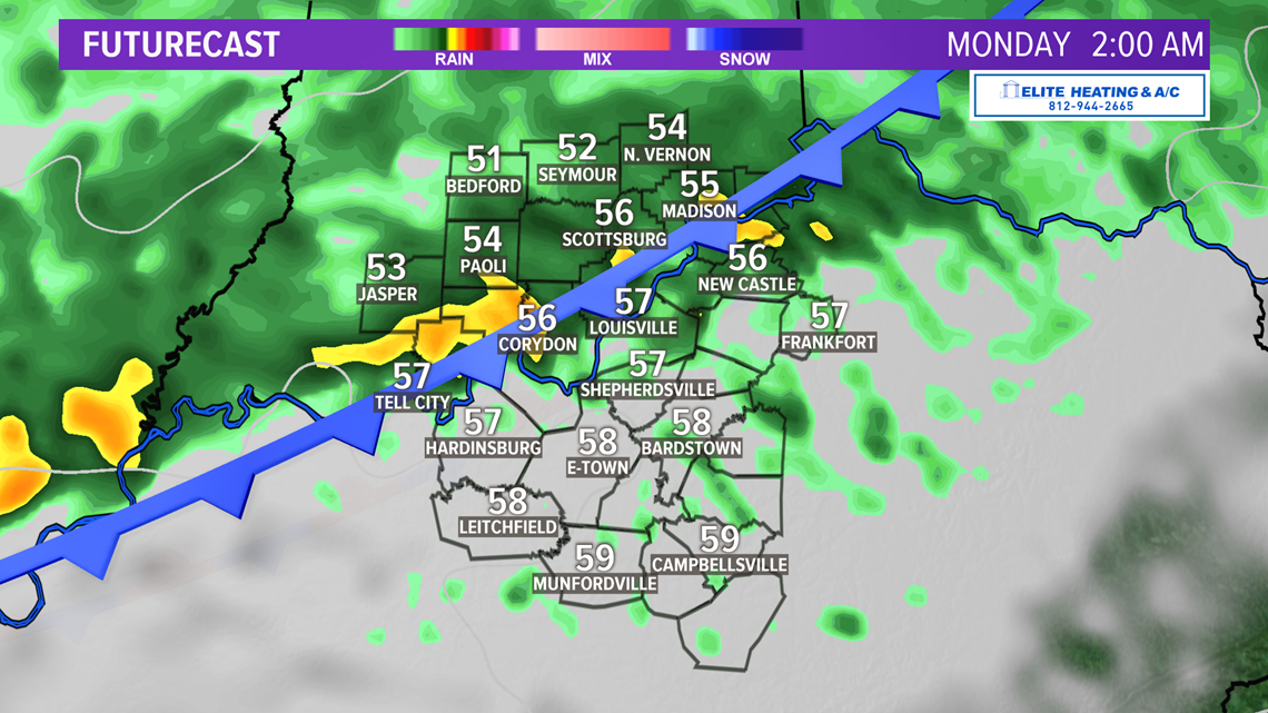

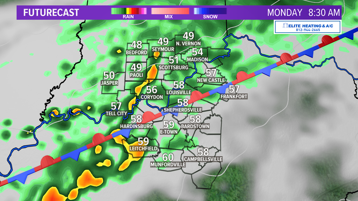

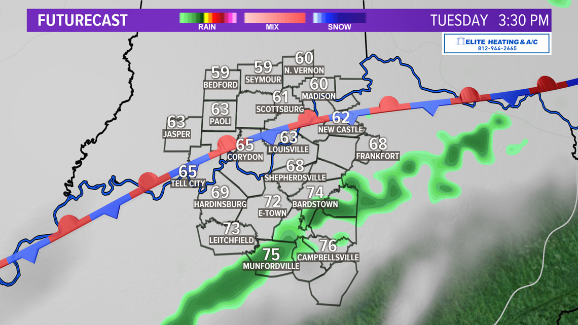
Lawrence, Jackson, and Jennings Counties in southern Indiana may still experience a few lingering showers Wednesday, but the majority of us will stay dry.
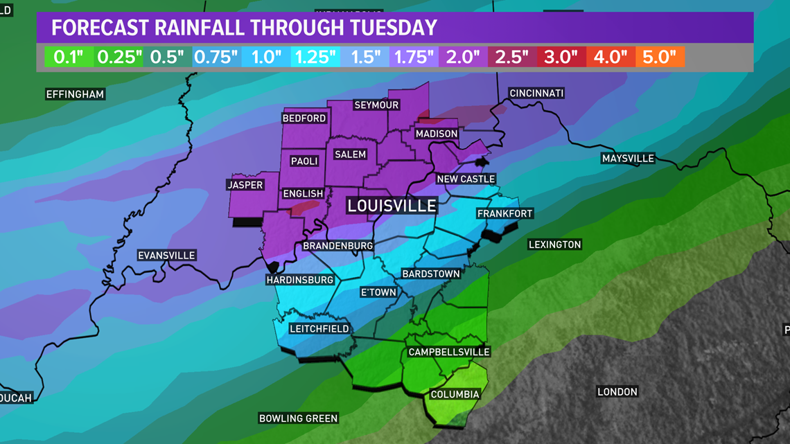
How much rain? A good bit it looks like. A bullseye in southern Indiana of 2 inches or more appears likely through Tuesday. The flooding risk is low since this is expected rainfall over a couple day period rather than a few hours, so the ground will be able to handle the water. Less rain is expected in central Kentucky through Tuesday, but they should still get a little drink. Louisville is in a bit of a transition zone between the higher and lower totals.
The exact location of the stationary front will be important for how much rain Louisville and other towns see. If it ultimately stalls further south of Louisville, we could find ourselves in that 2” bullseye. A bit further north, though, and we could see a little less. Any thunderstorms that develop could produce locally higher amounts.

Long term: That warm front Wednesday will usher in much warmer air for the midweek. Mostly sunny conditions Wednesday and Thursday along with temperatures in the upper 70s and low 80s will help dry us out a bit thanks to warm, moist air from the Gulf of Mexico. The dry weather doesn’t last long. Another cold front is slated to arrive late Friday into Saturday bringing more rain with it. The timing of this late week front has changed model run-to-model run. Late Saturday (October 17th) night models were indicating the front arriving during the afternoon Friday, but as of Sunday they appear to have slowed it down with it showing up early Saturday morning. We’ll see how models change in the coming days.

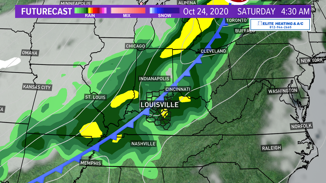
Cooler air again looks to overtake the area behind the front with temperatures in the 60s for the final full week of October. How cool remains uncertain. One model is insistent on high temperatures to close October and start November in the 40s and 50s, while another believes we’ll stay in the 60s. I’m inclined to lean on the side of temps in the 60s, but that’s still a good two weeks out and plenty will change before then.
Meteorologist Alden German
Facebook: Facebook.com/AldenGermanWX | Twitter: @WXAlden

