LOUISVILLE, Ky. — January's very active weather pattern continues as we head into the middle of the month. More storm systems in this long parade of storms will bring rain, snow, and bitter cold to the region.
Tracking more snow
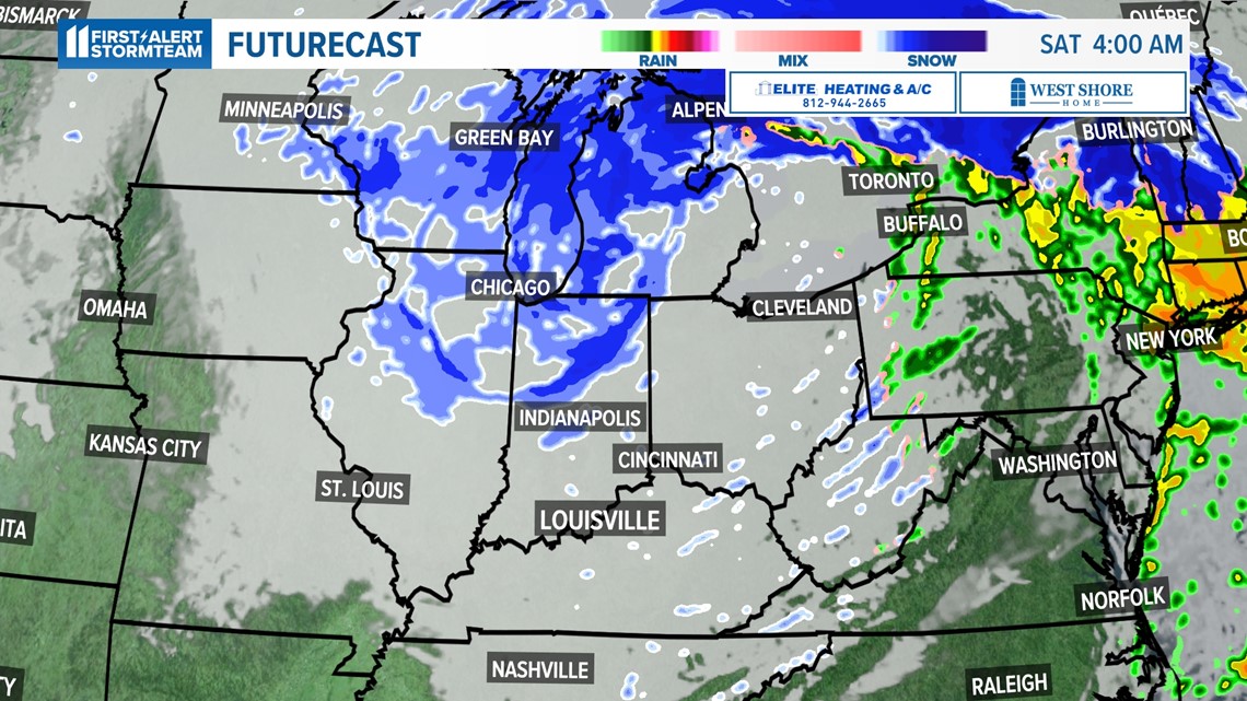
In addition to rain, we're also tracking what could be a significant snow storm for the Ohio and Tennessee Valleys Monday. Before that, however, is the potential changeover to snow late Friday night into Saturday morning on the backside of the Friday rain event.
Although we might see minor accumulations, major impacts locally appear unlikely (see the Ohio Valley section below for elsewhere.)
The more significant storm we're looking at starts Sunday night through Monday. There is still a lot of unknowns with this storm, especially the storm track. Generally, Kentuckiana needs a storm to track south of us to put us on the cold side of a storm and receive snow.

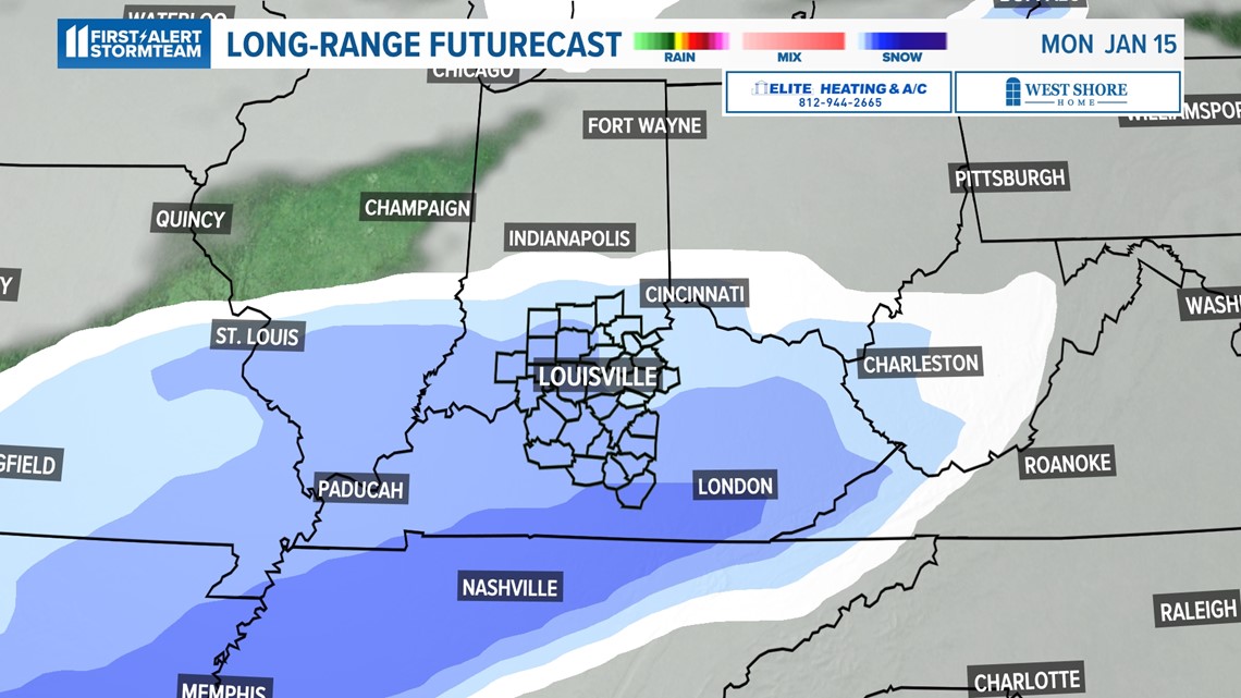
However, too far south and we can miss out entirely. This appears to be the trend as of today. The number one thing we'll be watching for late Sunday and Monday is where specifically the storm is expected to track.
If the center line of the storm passes near the KY/TN state line, that will put Louisville and surrounding regions in a good position to see snow.

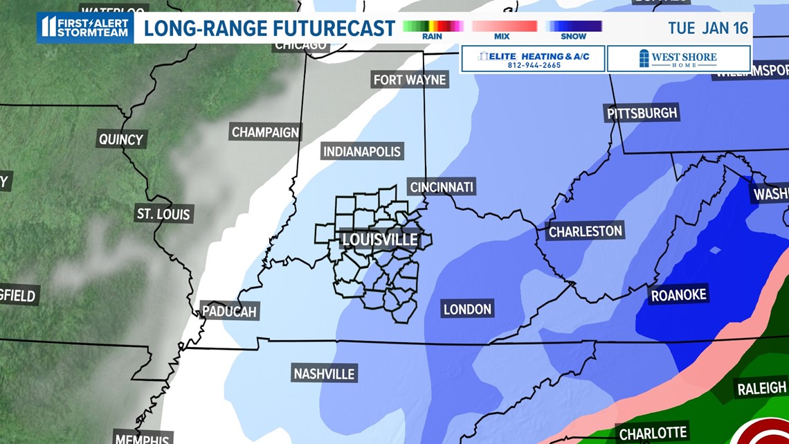
Current model trends are moving further south with this storm which would place higher snow totals along and south of the KY/TN state line and into the Appalachian Mountains.
We could still see light snow accumulations across Kentuckiana. Lesser amounts would be likely in southern Indiana, with higher amounts more probably toward the Lake Cumberland region.
Arctic plunge
Get ready for a blast of Arctic air starting Saturday, and "peaking" Tuesday of next week. The jet stream will dip very far south during this time and bring with it the coldest air we've experienced since December 2022.
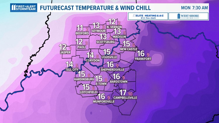
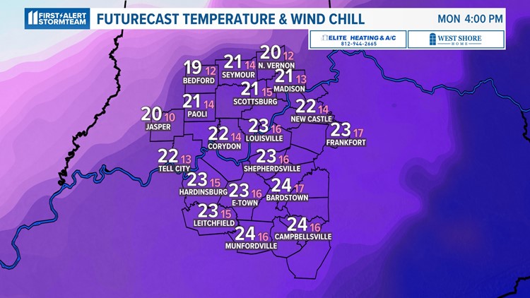
Our current forecast calls for widespread highs to dip into the teens with lows in the single digits. In fact, Louisville may come close to 0° Monday night/Tuesday morning, meaning surrounding counties and communities would likely dip well below zero for actual air temperatures.

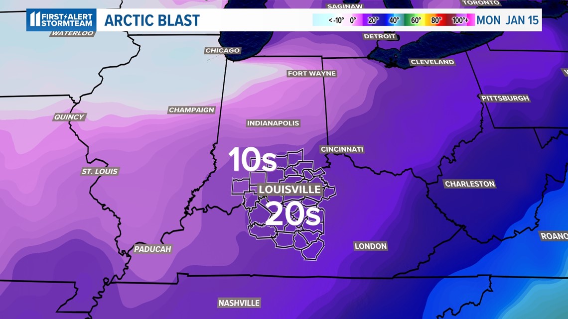
We'll have to watch winds as well as they could bring dangerously cold wind chills to the area. Current forecast calls for these "feels like" temperatures to drop deep into the single digits during the daytime, and overnight, Sunday through Wednesday morning.
Arctic air temperature forecast next week


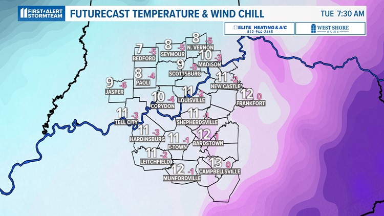
Snow will be play a huge roll in our temperatures too. Any snow on the ground will automatically mean colder temperatures than what is currently in the WHAS11 First Alert StormTeam forecast.
Should we see a few inches or more of snowfall, that will likely place some locations deeper into below zero territory for both air temperature and wind chills.
Ohio Valley and elsewhere
Friday's soaking rain will be more impactful for the Ohio Valley than Monday's snow, given storm track.
While we're seeing heavy rain, locations north of I-70 will probably experience a significant snow storm. This will probably result in several inches of accumulation with major travel delays.

From there, we'll see what happens south of us in the Tennessee Valley for snow impacts Monday and early next week. A lot of active weather -- a very busy time in the weather center!
Make it easy to keep up-to-date with more stories like this. Download the WHAS11 News app now. For Apple or Android users.
Have a news tip? Email assign@whas11.com, visit our Facebook page or Twitter feed.