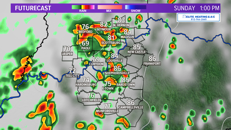
LOUISVILLE, Ky. — Summer 2020 is set to start off with a bang! Thunderstorms are in the forecast for the next several days, unfortunately making outdoor plans for Father’s Day unlikely.
Forecast at-a-glance:
- Hello summer
- Mother Nature is gifting storms for Father’s Day
- Storms in the forecast for the next several days
- Temperatures try to hold steady
Weather setup: The first day of summer certainly felt like it as temperatures climbed into the upper 80s and low 90s with a mostly sunny to partly cloudy sky. While today was quiet, tomorrow won’t be. Our attention is focused west in the Mississippi River Valley at a little disturbance producing rain and thunderstorms in Arkansas. This will continue to strengthen through Saturday night into a larger complex of storms (known as a mesoscale convective complex) that has its eyes set on us tomorrow afternoon.

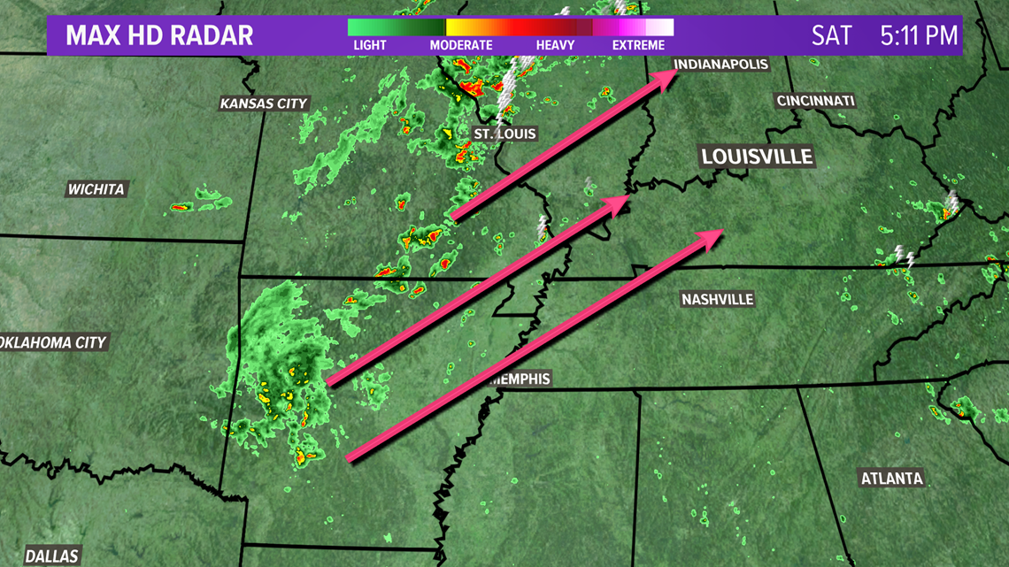
There will be plenty of moisture for this storm to work with, so a few vigorous thunderstorms that produce heavy rain, gusty winds, and maybe even hail will be possible. The potential for severe weather isn’t the most impressive, so an outbreak of severe storms is not anticipated, but a few storms could cross the severe threshold primarily for wind and hail.



RELATED: Record low May tornadoes
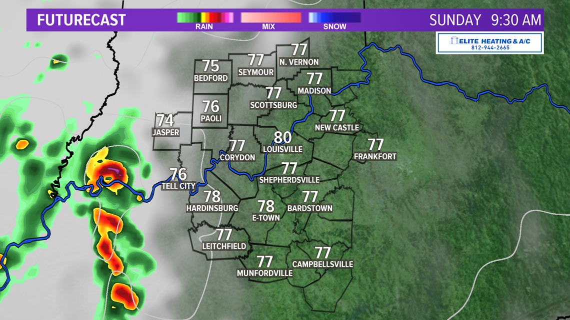
Temperatures are also a bit tricky…if we see increased high clouds from storms as they approach from the west tomorrow morning then it may act as a type of shield and prevent us from warming up too much. Our forecast as bumped temps down from the upper 80s and low 90s Sunday to the middle 80s because of clouds and any rain-cooled air. Downpours could easily drop temps for some communities into the 70s.

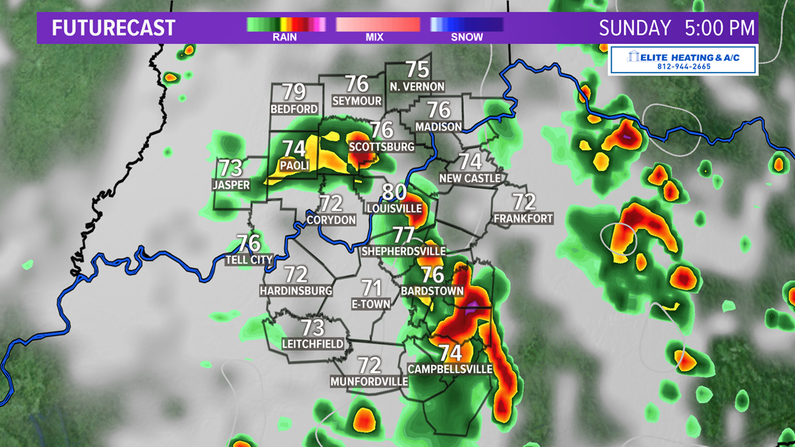

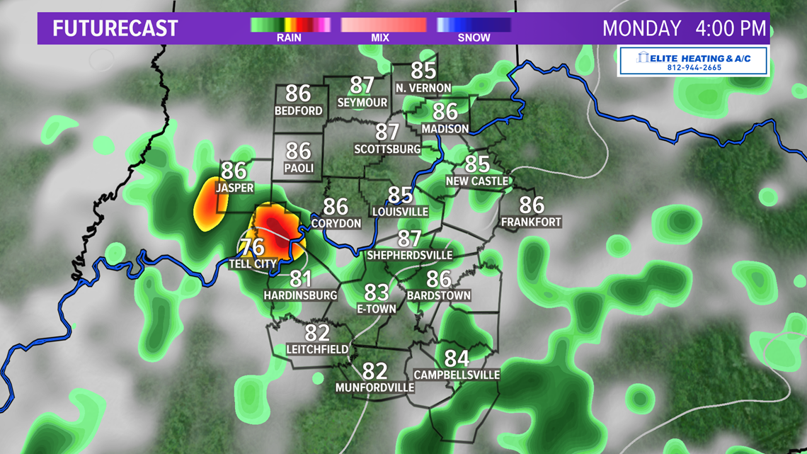
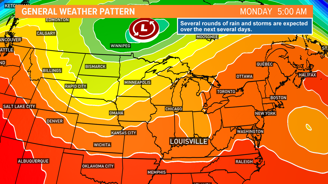
This complex of showers and storms should linger into Sunday night as well as Monday, which brings another good opportunity for thunderstorms. Why is it so active? Well, let’s look north to Canada. There’s a large area of low pressure kind of spinning in place just north of the border. As it spins, several shortwave disturbances will swing through the Ohio Valley and bring us several opportunities for rain. June has been a bit dry, so the moisture will definitely be welcomed.
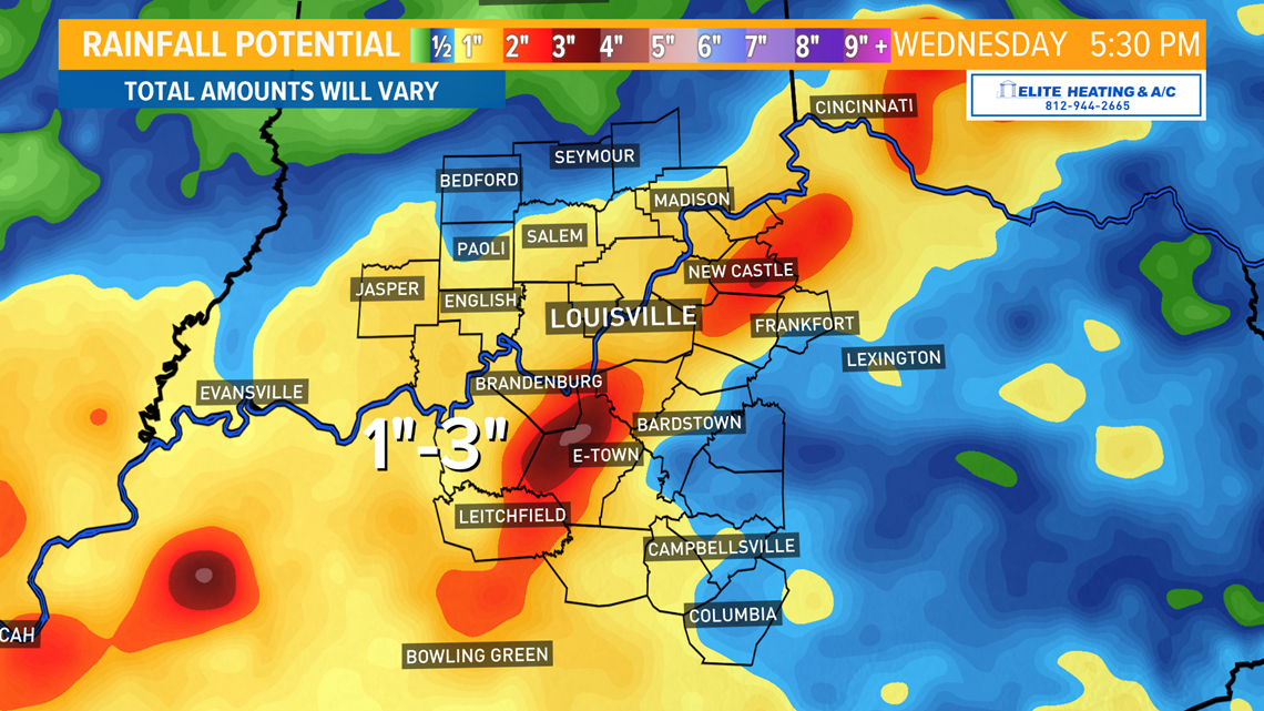
How much rain? Totals are going to vary due to individual thunderstorms dumping higher rain totals in some backyards than others. Overall, widespread amounts of about 1" are possible through Wednesday. Strong downpours may result in localized areas over that, so wide ranging totals between 1" and 3" is likely for some.


Long term: A cold front, partially associated with that Canadian storm, will swing by Tuesday. Tuesday looks like the best day to see widespread rains in the area. Again, the severe weather setup just is not that impressive, but a few stronger thunderstorms forming is not unreasonable. The cold front will bring slightly cooler air with it, but it’s not going to be like last week when we saw highs only in the 70s. We should hold steady in the middle 80s Tuesday and Wednesday.

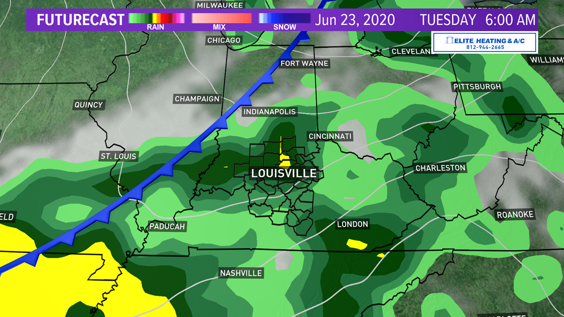
Showers and storms are set to linger into the first half of the day Wednesday before moving out as the cold front continues east. After the front clouds should begin to clear and leave us with a dry (and hopefully sunnier) afternoon. Wednesday is still 4 days out as of this blog, so the timing of the frontal passage can still change a bit which would affect timing of rain.
The forecast becomes difficult after Wednesday. Thursday appears to bring a brief reprieve from rain with partly cloudy conditions and highs in the middle 80s. Showers return to the forecast Friday with highs in the upper 80s, but for now that precip chance is small. The weekend brings even more questions. Will Saturday or Sunday be stormy? How hot will it get? Questions to keep in the back of our mind, but our primary focus is rain Sunday through Tuesday.
Meteorologist Alden German
Facebook: Facebook.com/AldenGermanWX | Twitter: @WXAlden

