LOUISVILLE, Ky. — Signs of the first potential snowflakes in Kentucky and southern Indiana are showing up in the long-range weather model data.
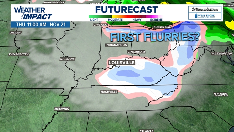
For several days now, the GFS, European, and Canadian weather models have been showing a much colder pattern taking shape late next week, with perhaps a little light wintry precipitation as well.
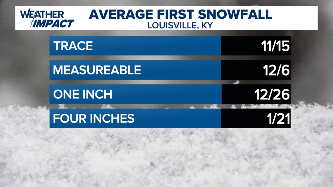
It's about that time of year anyway, as the region typically sees its first flurries or trace of snowfall around Nov. 15.
Don't expect to see a lot though, the first "measurable" snow in Kentuckiana typically doesn't come until December.
More significant snowfall tends to hold off until January.

What's in the forecast?
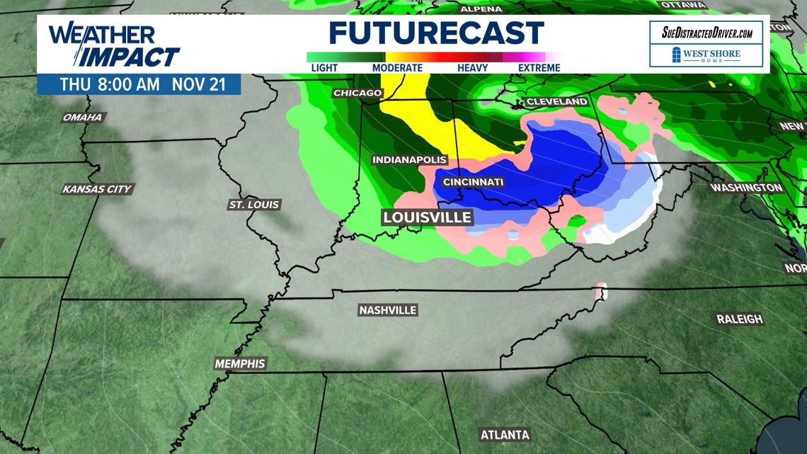
The WHAS11 Weather Impact team's Futurecast maps indicate the potential for light wintry precipitation in our region around midday next Thursday, Nov. 21.
This is certainly only a "chance" of wintry weather, definitely not a guarantee, as the forecast is subject to change between now and then.


Bundle up next week!
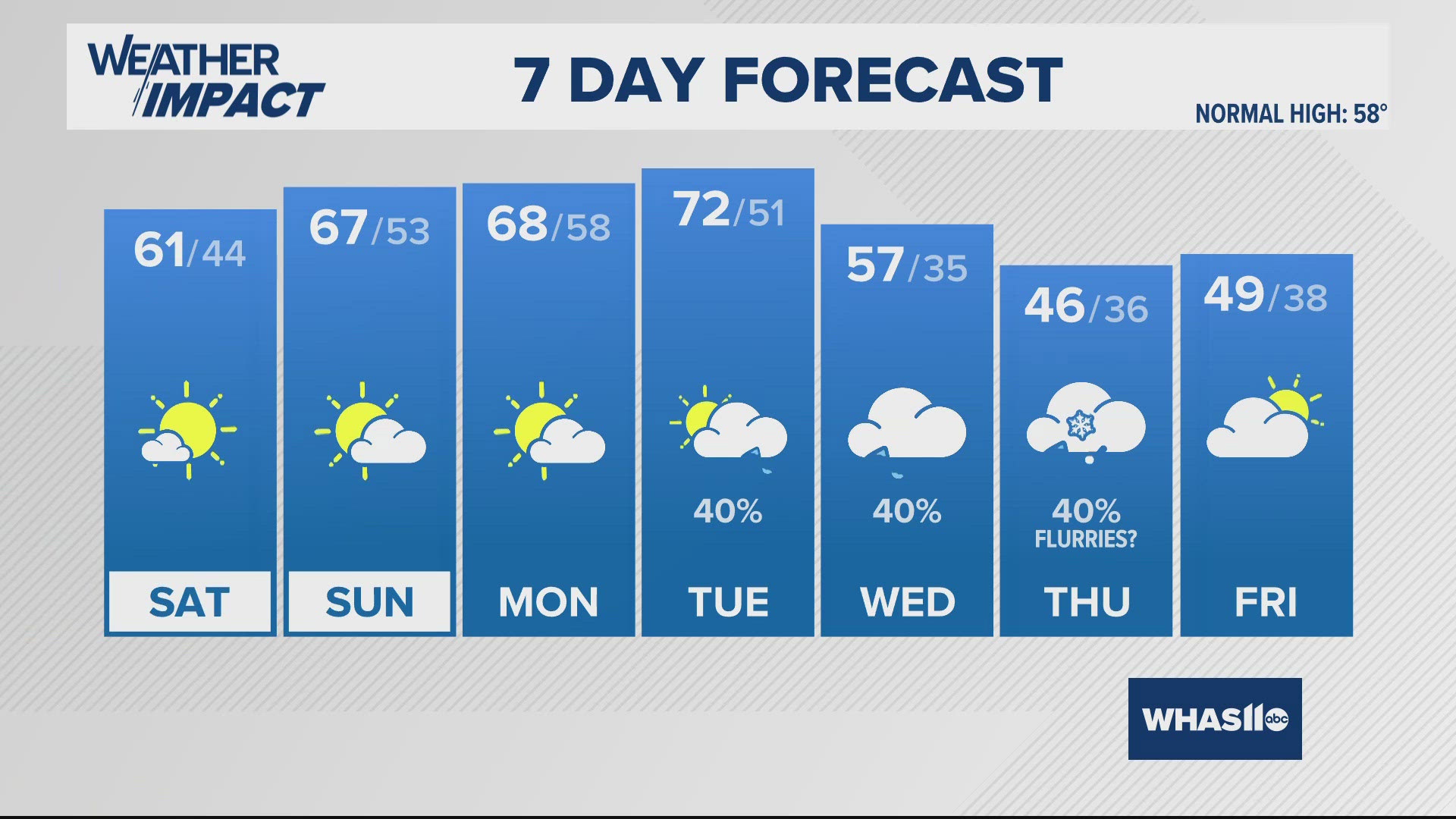
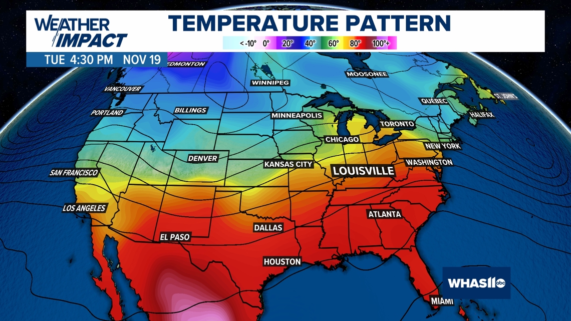
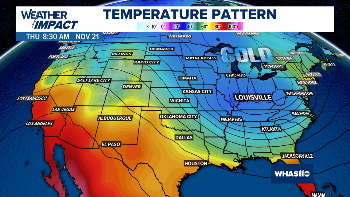
Expect above normal temperatures in the forecast through next Tuesday, with possibly lower 70s Tuesday afternoon. but temperatures begin to fall Wednesday, with winter-like temperatures likely on Thursday.
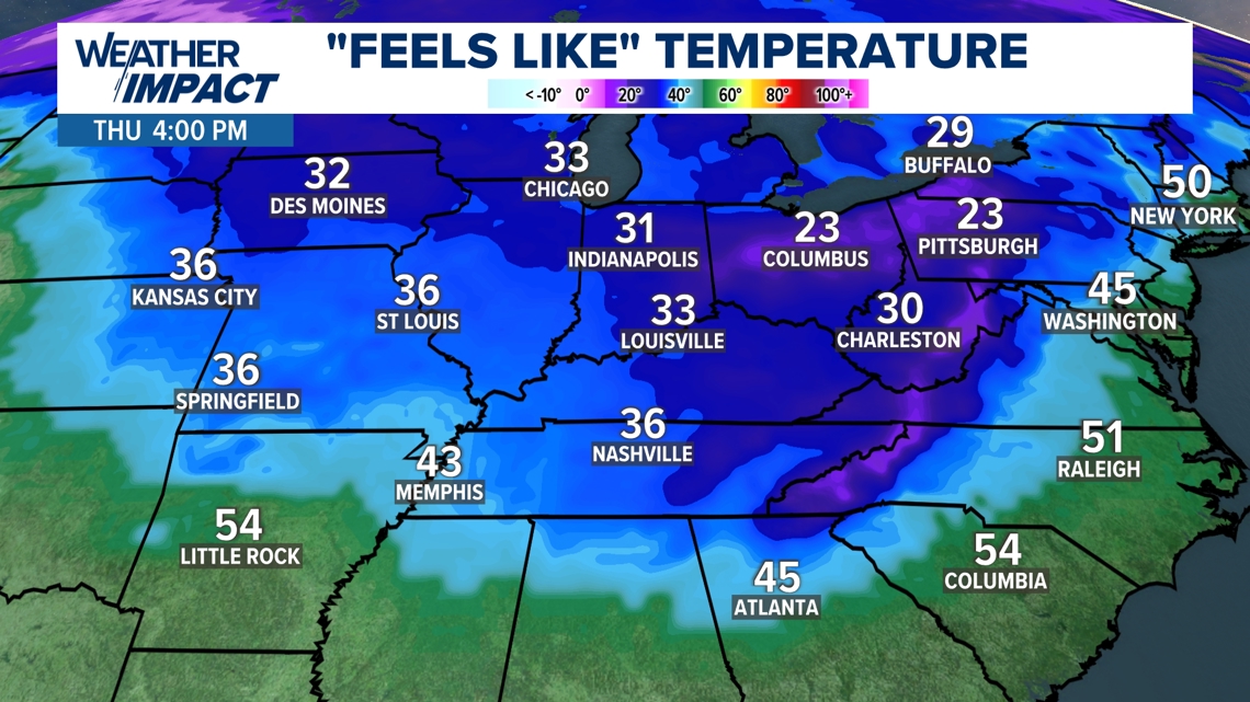
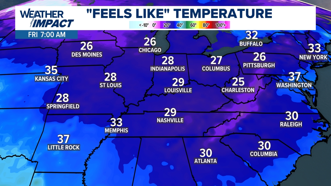
Not only will it be cold, it could be windy as well, putting our wind chills down to the 30s Thursday afternoon and 20s Thursday night into Friday morning.


"Feels like" temperatures will also drop on Thursday! So stay warm and bundled up.


Cold air building up north
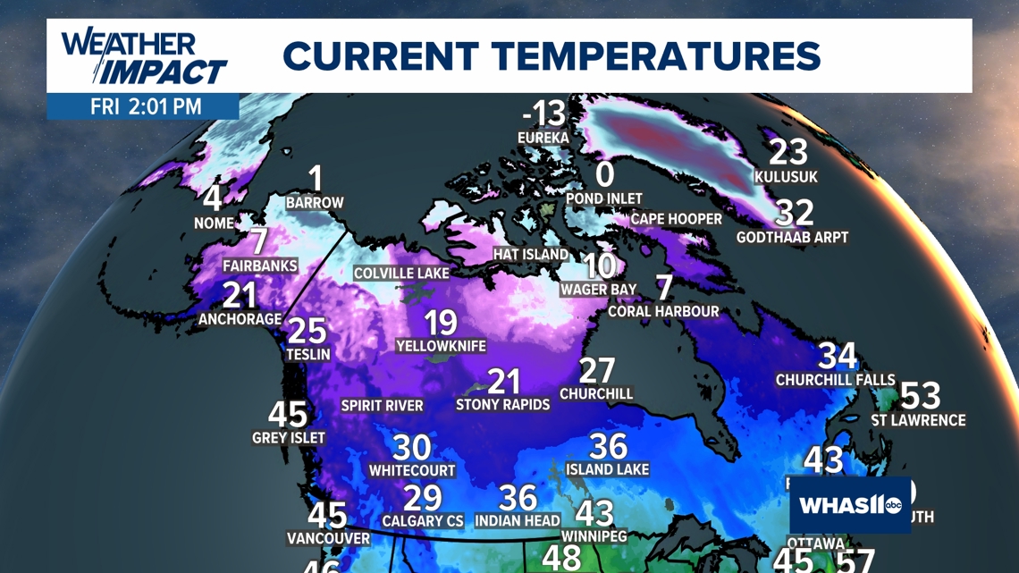
While our weather pattern has been mild all autumn, colder air has been developing north of the border.
Here's a look at the Friday, Nov. 15 temperatures currently up in Canada. We just need the jet stream to take that dive, and open the door to that colder air!

