
LOUISVILLE, Ky. — Recent rounds of storms have brought damaging wind, torrential rain, and frequent cloud-to-ground lightning to Kentucky and Indiana, and unfortunately, more of the stormy rounds are expected over the next several days.
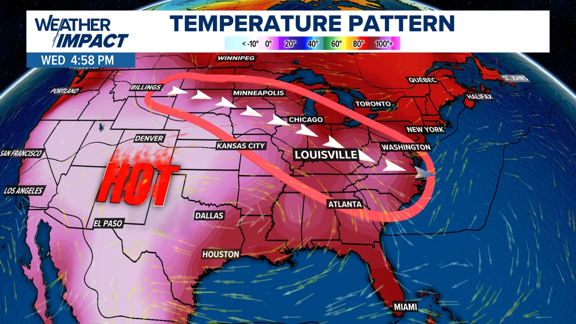
The storms are firing up along the edge of a heat wave, and the disturbances are traveling through the Ohio Valley along the storm highway -- which is an overall air flow from northwest to southeast. Which simply means -- a very active weather pattern, and a hot one.

FUTURECAST & THREATS
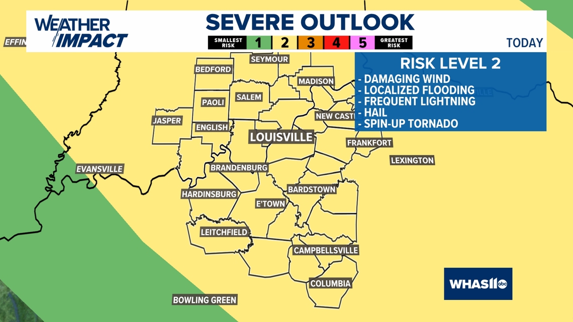
The weather models often have a tough time timing out exactly when the storms will hit in a pattern like this, but Futurecast is showing more potential rounds of storms almost every 12 hours or so. In fact, Tuesday had three rounds of storm pass over the WHAS11 viewing area.
The afternoons could always have a few pop-up storms, but any impulse or disturbance could cause additional areas of storms to fire up at any time of day or night.
So, in this active weather pattern, as always, just be prepared for alerts and warnings and taking shelter if need be, and have a back-up plan if you have any outdoor plans.

EXCESSIVE HEAT
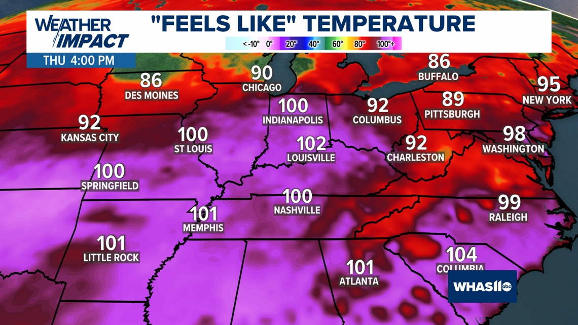
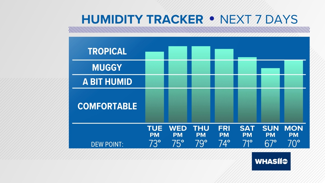
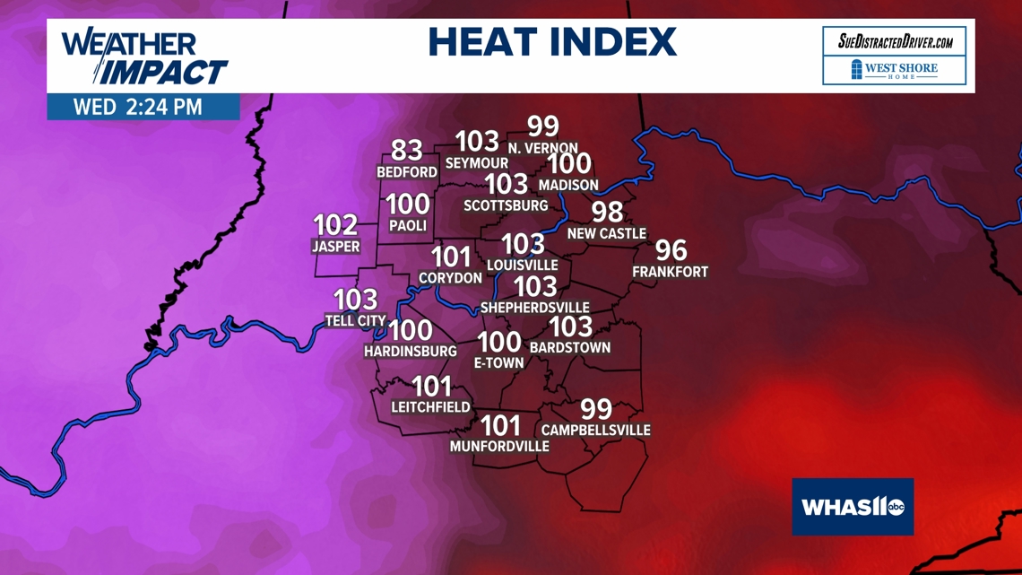
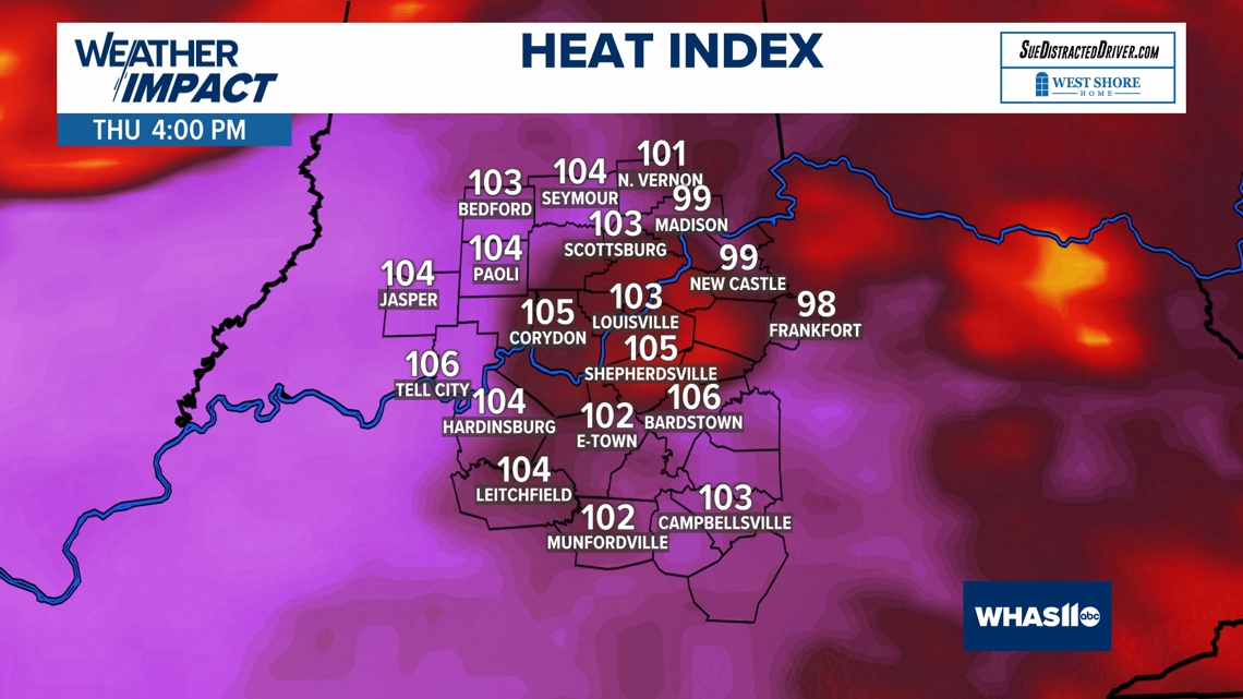
Now, let's talk about the heat which will be a weather impact we'll all have to deal with over the next week at least.
The combination of high temperatures and humidity will produce heat index values in the triple digits, especially during the mid-afternoon.
Take precautions to keep cool if you work or play outdoors, and keep an eye on kids overheating, especially if they have sports practices this time of year. Stay hydrated, and keep enjoying that air conditioning.


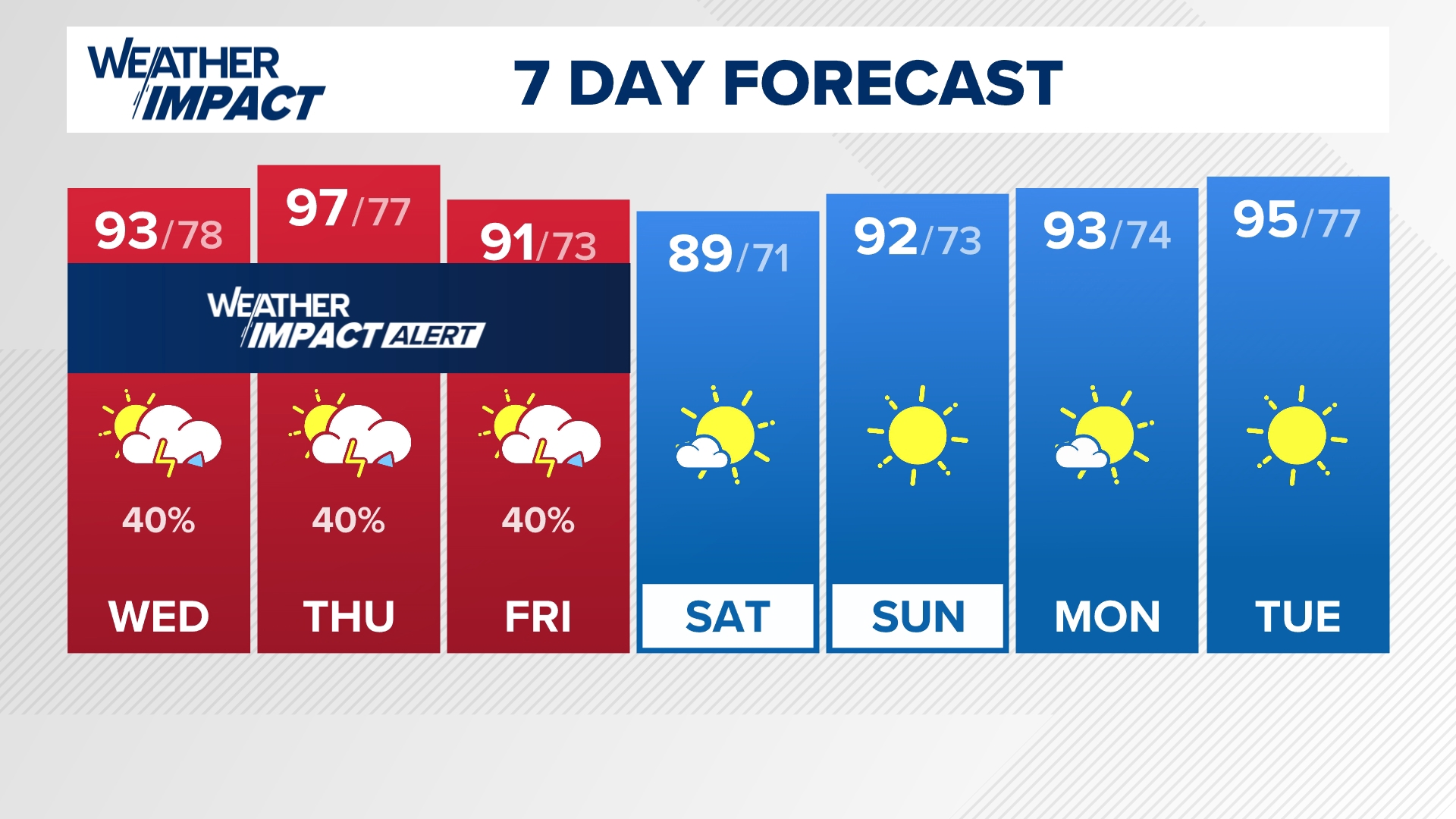
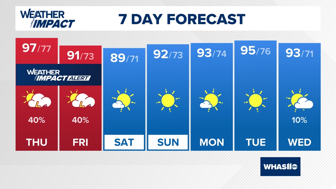
WEATHER IMPACT ALERT DAYS
With the heat and storm combo over the next several days, the WHAS11 Weather Impact Team has issued Weather Impact Alert Days through Friday.
While the severe weather threat may stay fairly low, any storm in this tropical atmosphere could produce localized flooding, isolated damaging wind, and frequent lightning.
The torrential rain can also cause blinding driving conditions. So, take care in the heat and dodging the storms over the next several days.
Download the WHAS11 app at your app store for more alerts, information, and interactive radar.

Continue to stay weather aware and follow the Weather Impact Team's latest forecast.