
LOUISVILLE, Ky. — Hurricane Helene will leave its mark on the Louisville area after it makes landfall along the Florida Gulf Coast as a strong hurricane, just in time to help put a major dent in the ongoing drought.
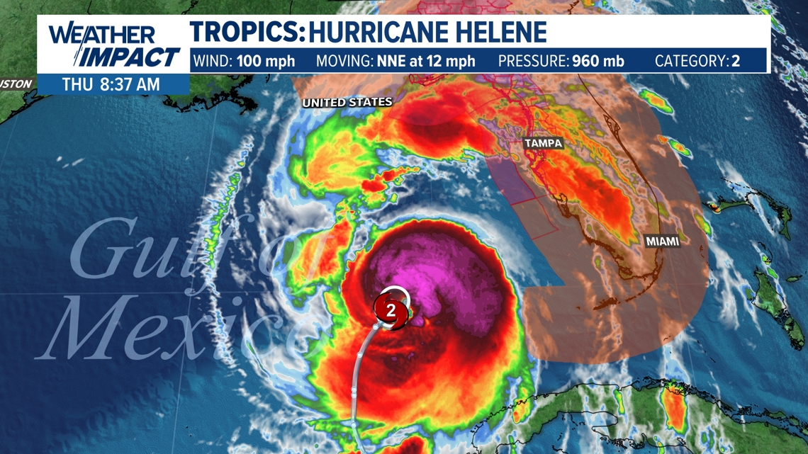
Helene will continue to strengthen as the storms moves quickly north over the Gulf of Mexico, possibly becoming a Major Category 4 Hurricane.
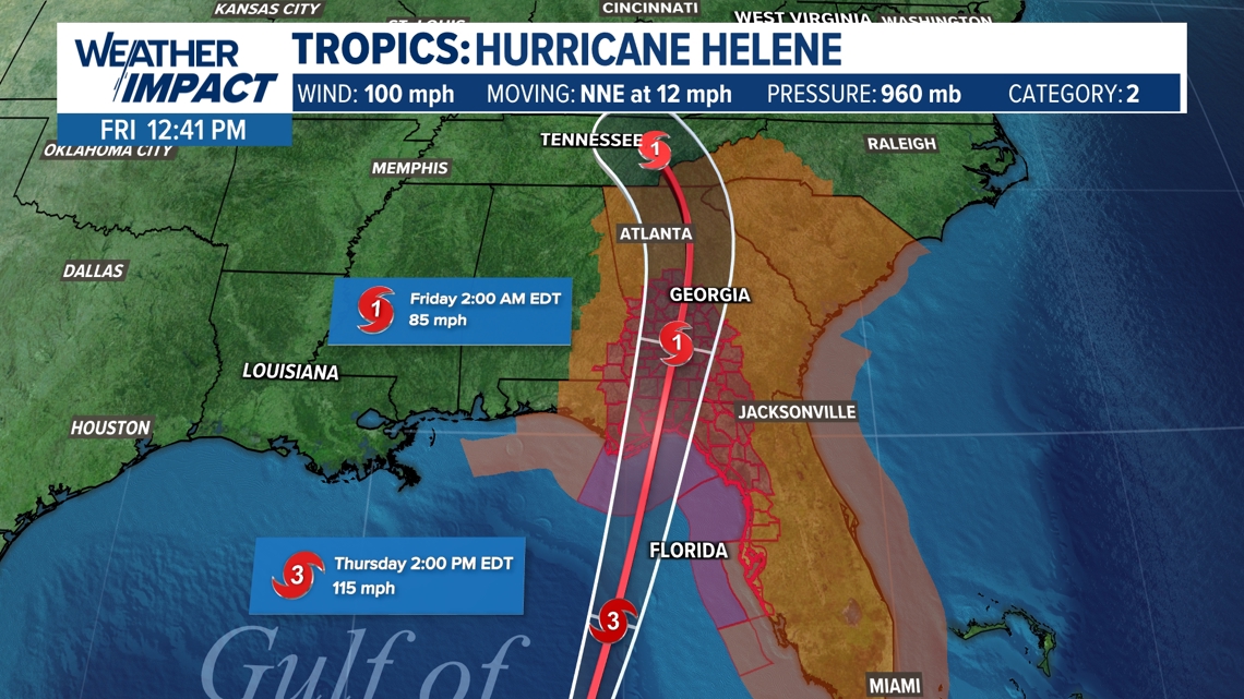
Helene will quickly weaken as the storm moves inland over Georgia, but will still pack heavy rain and gusty winds for Kentucky and Indiana Friday.
Timing and rainfall amounts
Steady-to-heavy bands of rain will approach from southeast to northwest throughout the late night hours Thursday night and through the day Friday.
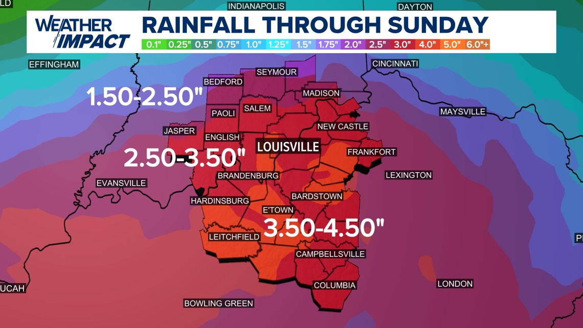
Between 2-4 inches of rain is in the forecast along the Ohio River, including the Louisville area, with several locations south of the Bluegrass and Western Kentucky Parkways collecting 2.5-4.5 inches of rain.
Flooding will be a possibility with the heaviest bands of rainfall. Keep in mind that the wind will also be strong, so rain will be falling sideways. Wind gusts could reach 40-50 mph locally.
Visibility will be reduced and there will be ponding of water on roadways. Always remember: slow down, turn around and don't drown.

Wind Gusts
Wind gusts remain a big story with the remnants of powerful Helene eyeballing central Kentucky and southern Indiana. Wind gusts will easily range from 30-40 mph, and possibly briefly topping 45 mph. Sustained wind and wind gusts of this caliber will make for power outages in some locations.
Make sure your phones, laptops, and other appliances are charged up in the event you lose power.
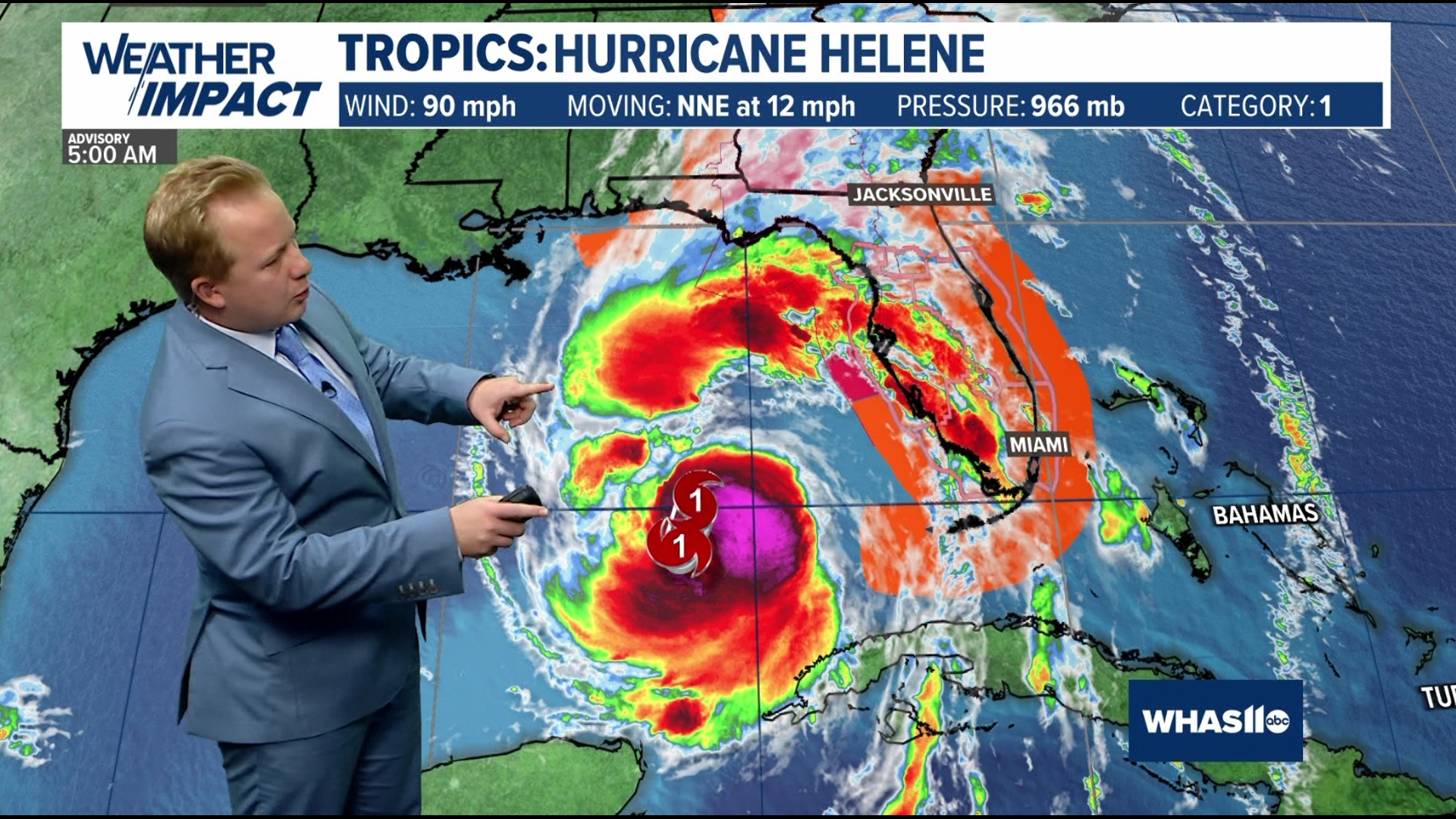
Where is Helene Now?
Helene is currently a Category 2 hurricane, likely progressing into a Category 4 hurricane when it makes landfall on the Florida coastline Thursday night; 12-20 foot storm surge, flooding rains and catastrophic wind gusts will make for dangerous to life-threatening conditions in Florida.


Stay tuned to WHAS11 on air and through out WHAS11 News App for more information.
Continue to stay weather aware and follow the Weather Impact Team's latest forecast.
Download the free WHAS11 app to watch live coverage during severe weather and get real-time weather alerts, even if your power goes out. For Apple or Android users.