
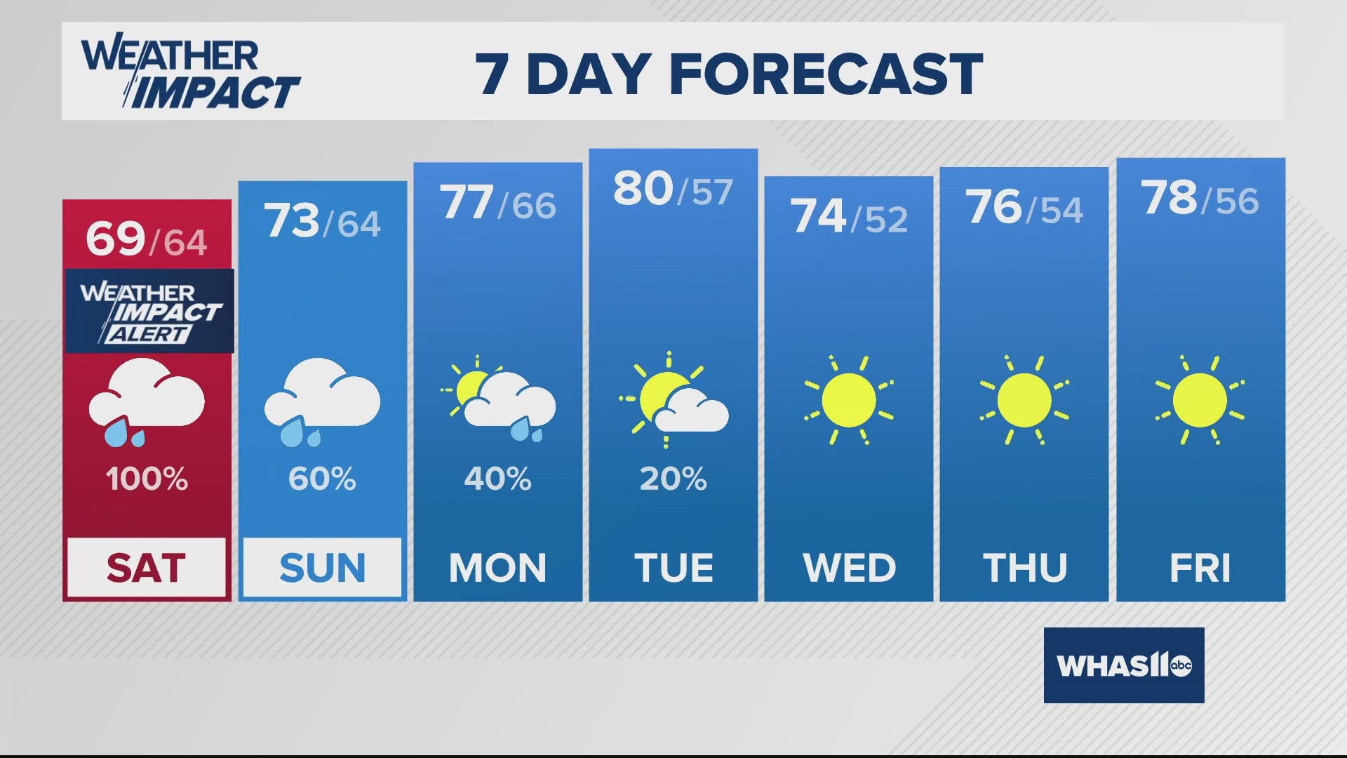
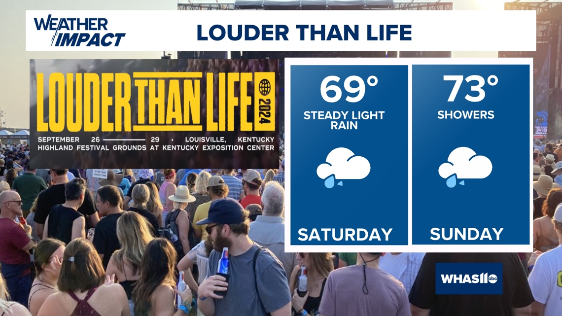
LOUISVILLE, Ky. — Our Weather Impact Alert Day for Saturday is for more rain. That basically sums it up for this weekend.
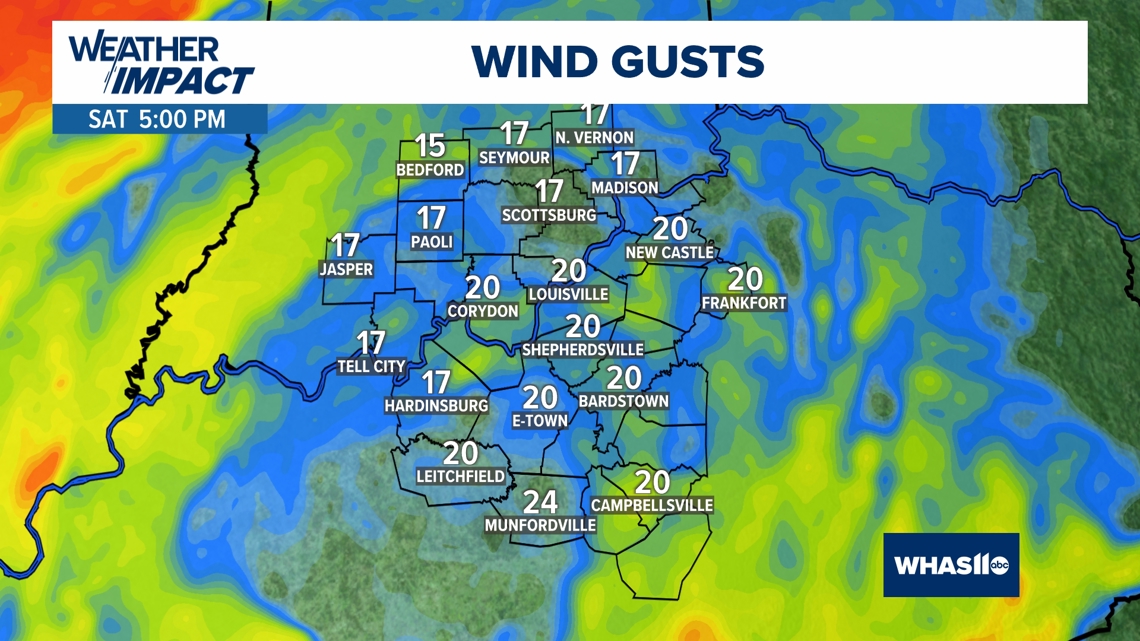
Thankfully, the winds will die down and be much lighter through this weekend.
No severe weather, and there's only a minor flooding potential expected Saturday -- watch for some swollen rivers, creeks and streams, especially for areas south of Bullitt County.
FUTUREAST
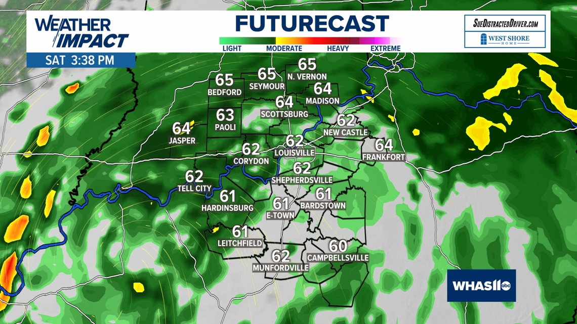
The rain will mostly be on the light side, but steady Saturday.
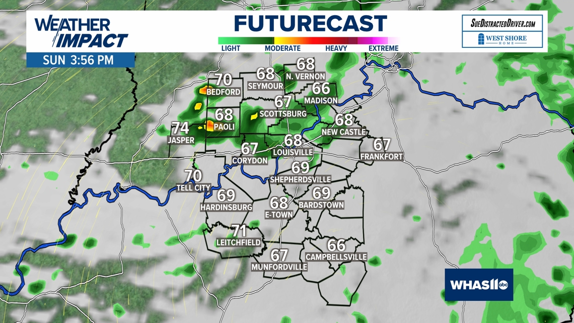
As long as we have clouds and rain, temperatures will be cool in the 60s. Below are our Futurecast maps showing Saturday and Sunday afternoons.
Sunday won't be as wet, but we'll still have some spotty showers.


WIND
After very strong wind gusts Friday, the winds will be much lighter Saturday and Sunday. Expect sustained winds around 5-15 mph, wind perhaps some gusts around 20 mph. So, wind is not a concern.

The moral of the story for the weekend is to bring the rain gear if you have any outdoor plans. As a silver lining, no more drought, with a big surplus of September rain.
We will have very enjoyable weather as October begins next week.

Continue to stay weather aware and follow the Weather Impact Team's latest forecast.