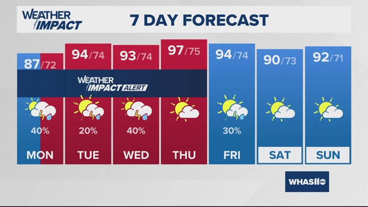
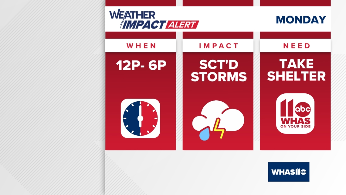
LOUISVILLE, Ky. — Monday is a WHAS11 Weather Impact Alert Day due to the threat of scattered showers and thunderstorms. It will be a near repeat of what we experienced Sunday afternoon.

Timing
Plan to wake up dry then see showers and thunderstorms arrive in the afternoon. Storms will be very disorganized and therefore difficult to pinpoint where it will be at a given time. That being said, primary timing will be between noon to 6pm before a lull in activity.
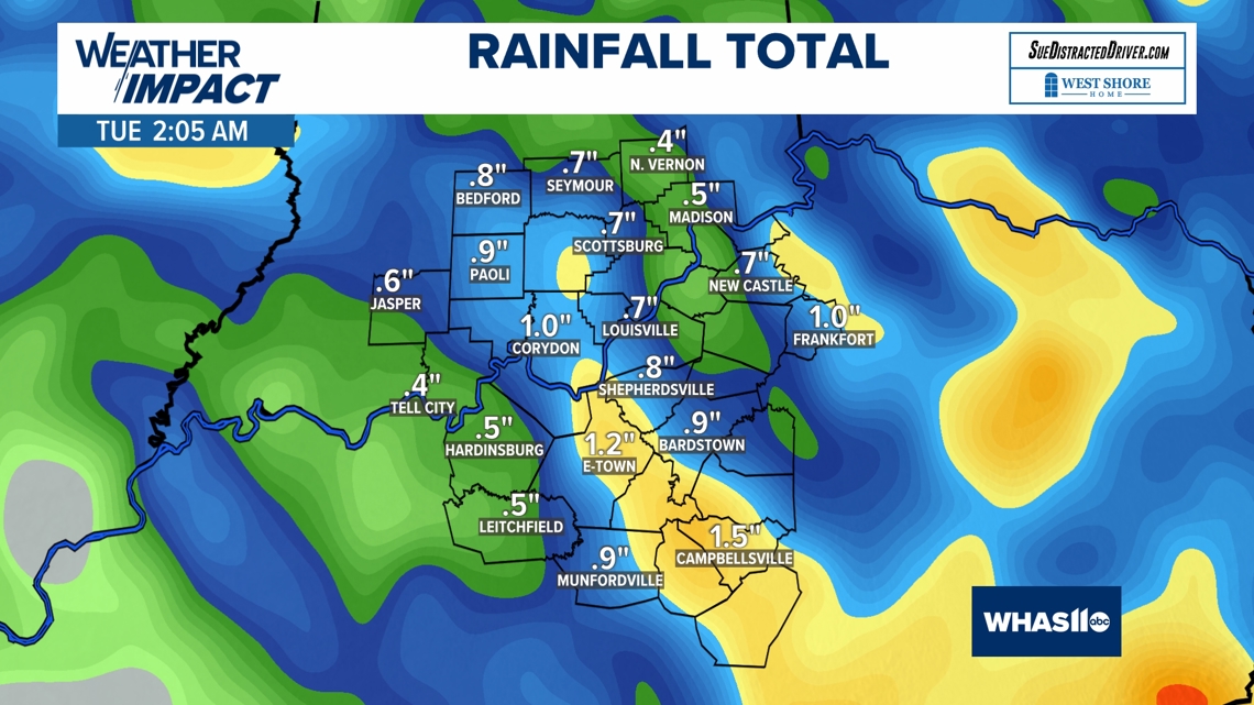
Monday overnight into early Tuesday morning could bring another round of thunderstorms, a few strong.
Threats
Once again, not expecting severe weather during the day but storms will feature very heavy rainfall. Especially given that this will be day two of downpours over relatively the same areas, localized flash flooding will be a concern.
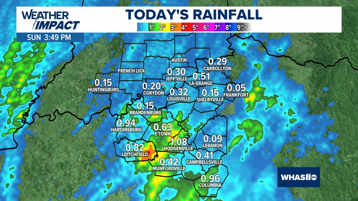
Many spots in Kentucky picked up between half an inch to over an inch on Sunday, with up to an additional inch possible through late Monday.


Remember to turn around, don't drown! Never drive or walk through flooded roads.
Download the free WHAS11 app to watch live coverage during severe weather and get real-time weather alerts, even if your power goes out. For Apple or Android.
Follow the WHAS11 Weather Impact Team on social media.
DOWNLOAD THE WHAS11 APP:
Download the free WHAS11 app for the latest weather alerts from the WHAS11 Weather Impact Team. For Apple or Android users.
JOIN THE CLOUD WATCHERS FACEBOOK GROUP:
Interested in photography? Join nearly 8,000 residents from Kentucky and southern Indiana and share your weather photos. Click here to join the group!