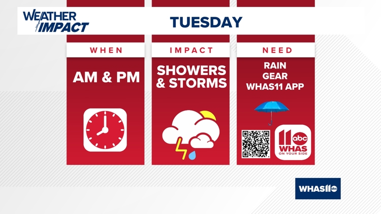
LOUISVILLE, Ky. — Just like on Monday, our area will pick up routine showers and storms during much of the daytime hours on Tuesday.
Again, the risk for severe weather is very low, but a few storms may produce some brief but strong wind gusts and some localized heavy rain reports.
Make sure you have the umbrella packed with you as you step out the door on Tuesday.

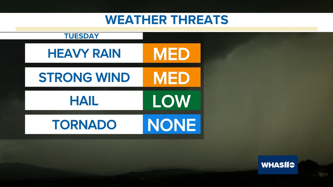
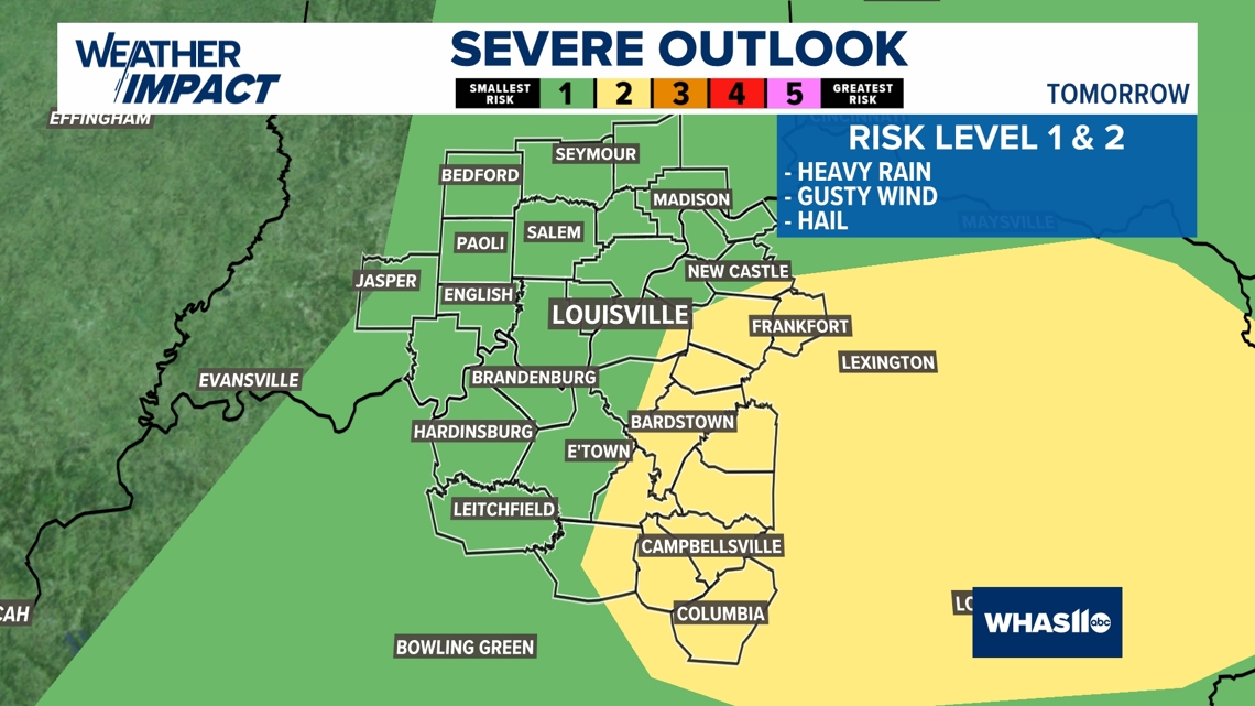
The Storm Prediction Center has placed areas along and east of I-65 in a Slight Risk of Severe Storms, capable of isolated damaging wind gusts, frequent lightning, heavy rain, and possibly some hail.

Timing
Mother Nature will dump some steady showers and storms for the area throughout the course of the daytime hours Tuesday.
Most of the rain will occur by late morning, midday and throughout much of the afternoon.
Make sure you are careful with travel during the morning commute because rainfall rates may exceed a half inch to an inch per hour.
Beneficial Rain
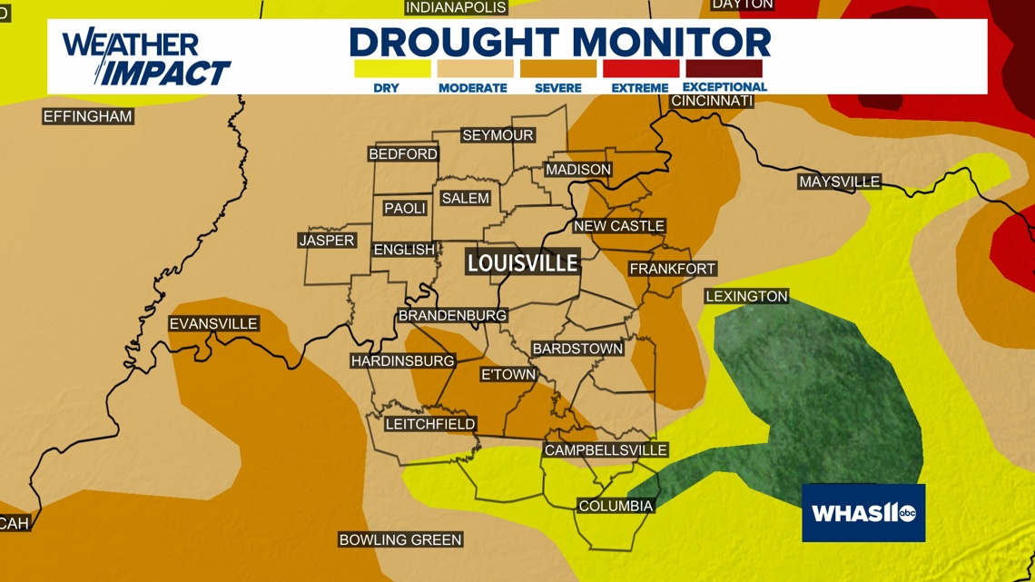
Central Kentucky and southern Indiana remains in a huge deficit with rainfall as of late. A moderate and severe drought remains in effect.
This week's rain will help put a band aid on the hole in our rainfall.

Afterwards
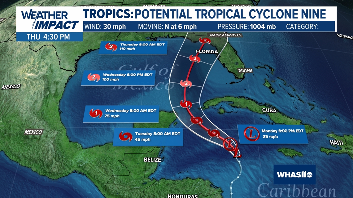
The remnants of what will be likely Tropical Storm or Hurricane Helene will move towards central Kentucky and southern Indiana just in time for Friday and the weekend. Rainfall may be heavy, so this is something we will be watching closely.

For the latest weather updates follow Chief Meteorologist Ben Pine on X @WHAS11Ben, Facebook and Instagram.
Continue to stay weather aware and follow the Weather Impact Team's latest forecast.