
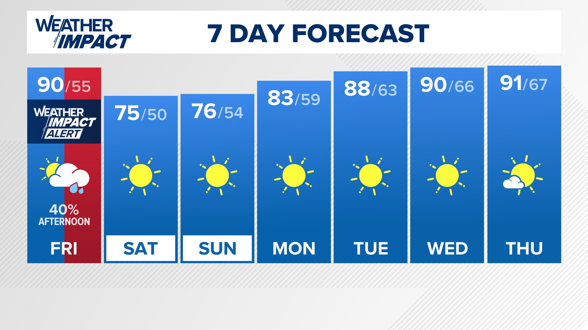
LOUISVILLE, Ky. — We will have some much-needed rain chances Friday afternoon and evening. This may be a brief inconvenience for some of our high school football games.
The rain will be spotty, so we won't all get the raindrops. Please stay tuned to us for the latest forecast as we are declaring a Weather Impact Alert for the second half of the day Friday.
Timing
The showers and thundershowers will provide some brief heavy rainfall as they pass by from west to east Friday. The first few showers will organize around 3 p.m. to 5 p.m. and then there will be some additional rain showers lingering into the early evening.
The rain will be spotty, so not everyone will get it, although our entire area needs the rain.
Most of the rain will come to a halt by the sunset hour, leaving all of us dry by 10 p.m. Friday.
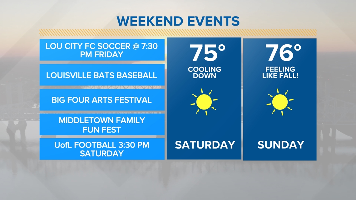
In conclusion, the cold front will pass and will leave us very comfortable and fall-like into the weekend. There are no more rain chances in our 7-Day Forecast after we deal with Friday's showers and rumbles of thunder.
Enjoy the beautiful weekend on the way.

How much rain?


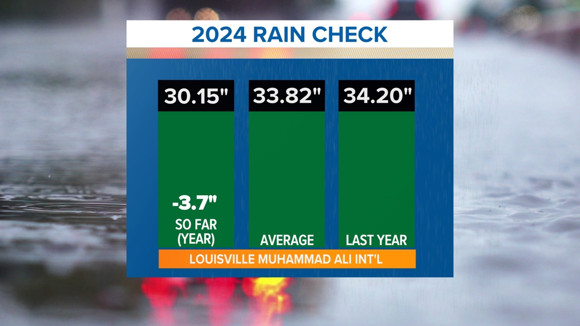
Kentucky and southern Indiana has been in a huge rainfall deficit lately. In fact, the Louisville International Airport has only picked up 0.24 inches of rain since the first few days of August.
Unfortunately, we are not picking up much rainfall from this cold front. The majority of the scattered to widespread rain will affect areas just to the northeast of us. We have been very dry and the drought continues to worsen for central Kentucky.
A long dry pattern will continue after Thursday, with no rain expected through next week.


Continue to stay weather aware and follow the Weather Impact Team's latest forecast.