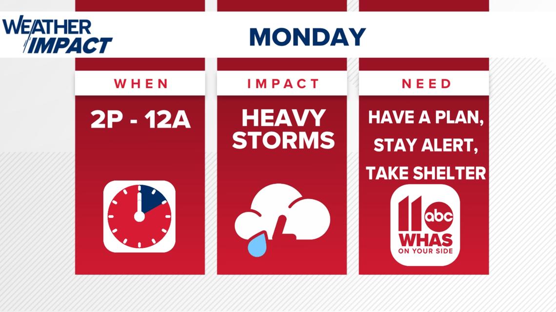
LOUISVILLE, Ky. — Monday is a WHAS11 Weather Impact Alert Day because of the threat of showers and storms this afternoon and evening. Storms that develop will most likely produce pockets of very heavy rainfall and some strong wind (wind gusts up to 55 to 65 mph).
Some hail or an isolated tornado cannot be ruled out but we are mainly concerned about the risk for locally heavy rain and strong wind.
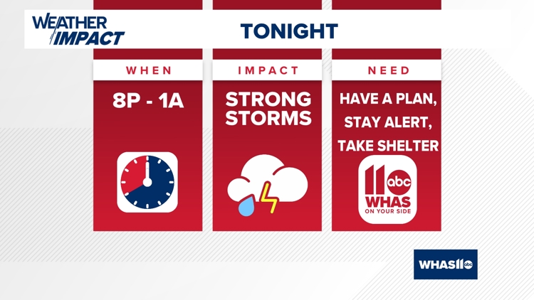
Timing
Storms will push through Monday evening, likely beginning around the sunset hour. With time, these storms will be heavy rain producers and may bring flash flooding and wind gusts between 55-65 mph. Stay extra weather aware from 8pm until 1am.
Make sure you have a reliable and efficient way of receiving severe weather alerts. The WHAS11 News App is a great tool to have to track the latest severe weather.
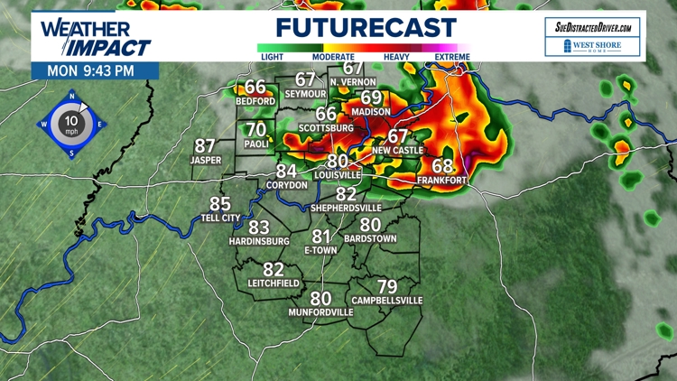
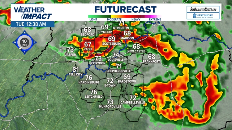
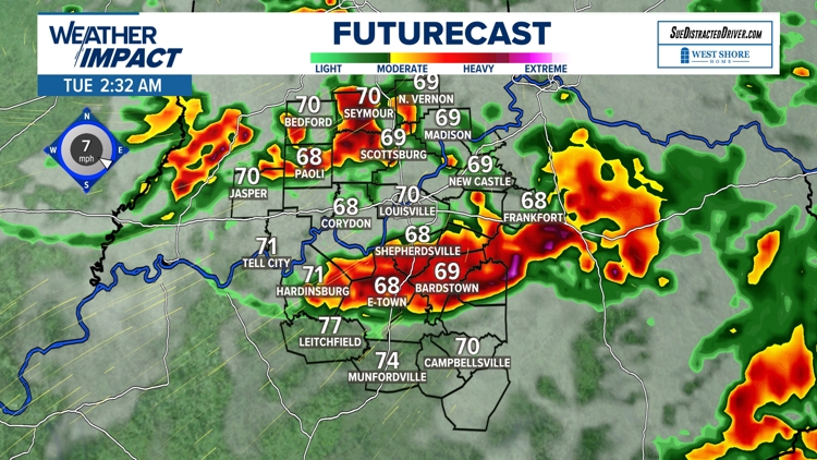
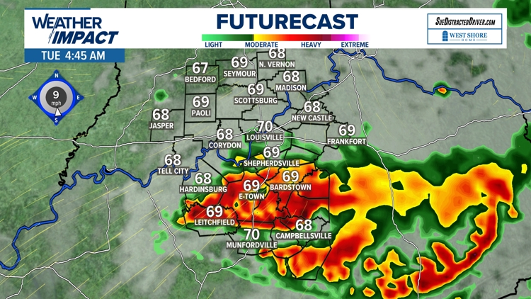
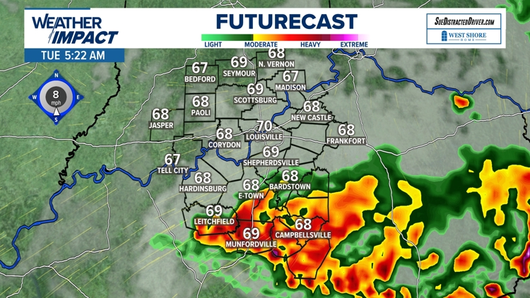
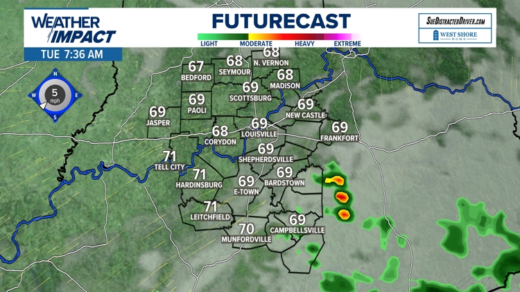
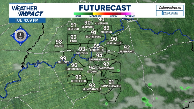
Futurecast Monday evening through Tuesday


Threats
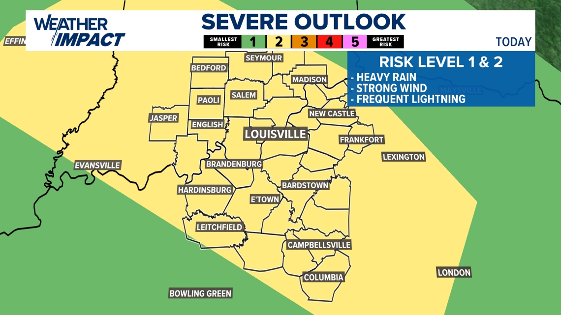
The Louisville-area will be at a severe weather risk level 1 or 2 Monday evening. This means there are chances of our area being hit by heavy rain, strong winds and frequent lightning.


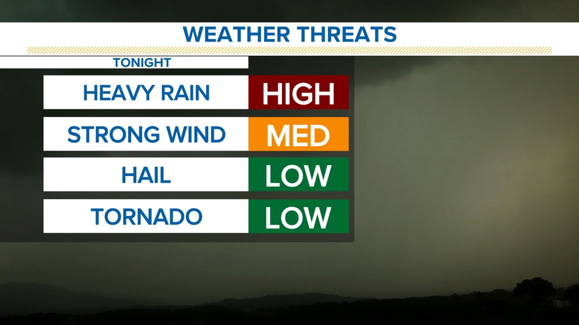
Monday night's storms will greatly produce copious amounts of rainfall that may lead to localized flooding, especially in river valleys or creeks and streams across our area. Remember to turn around, don't drown! Never drive or walk through flooded roads.
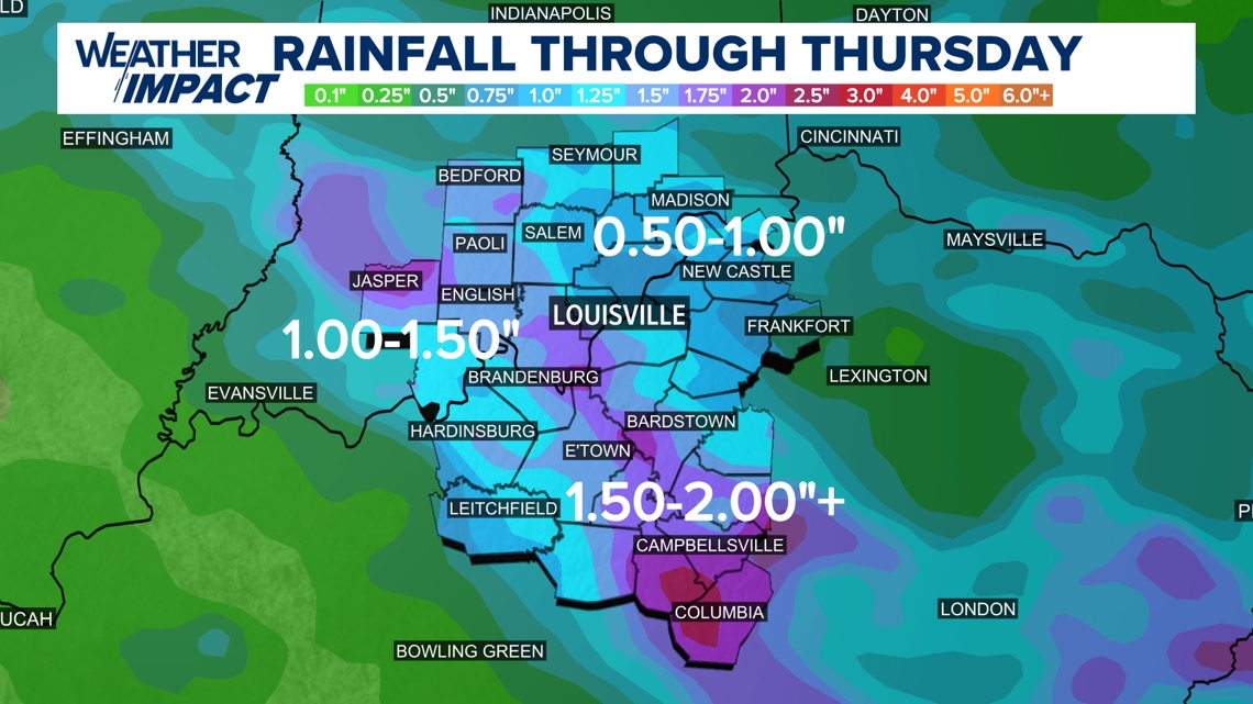
There are additional storm chances in our forecast that will make for more rain through the course of the week. Rainfall rates from some of these heavy pockets of storms may amount to an inch to two inches per hour!

Download the free WHAS11 app to watch live coverage during severe weather and get real-time weather alerts, even if your power goes out. For Apple or Android.
Follow the WHAS11 Weather Impact Team on social media.