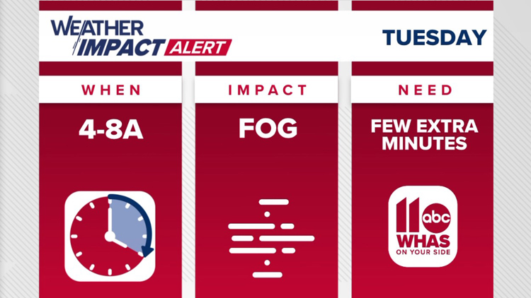
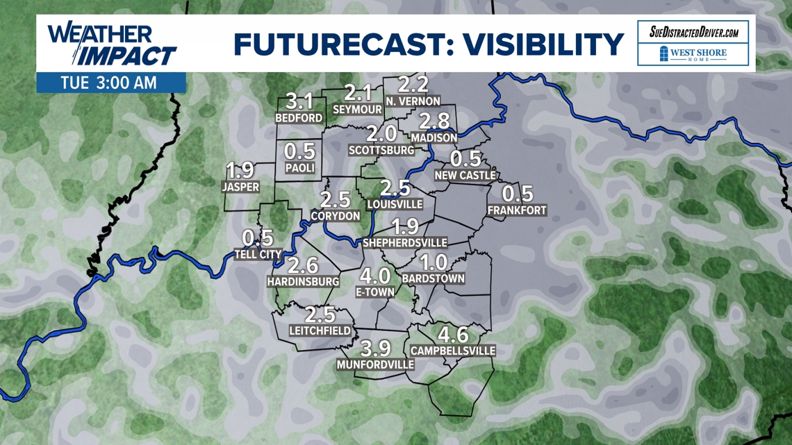
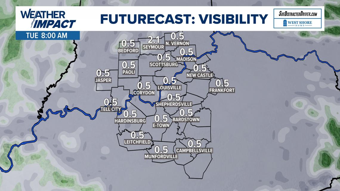
LOUISVILLE, Ky. — A Dense Fog Advisory is in effect for southern Indiana through 9 AM this morning. This means that visibility will range at or below a half mile through most of the early and mid-morning for cities such as Seymour, Bedford, Hanover, Madison and Scottsburg.
Some tips for battling the dense fog are use only your low-beam headlights, slow down and give plenty of room between you and the vehicle in front of you.

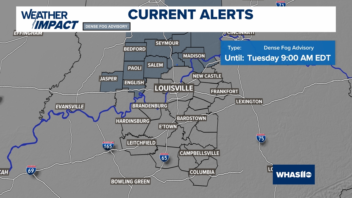
Expect fog to be a nuisance lasting through 9 AM Tuesday morning. Fog will be most dense outside of the city, with rural spots picking up the worst of the thick areas of fog.


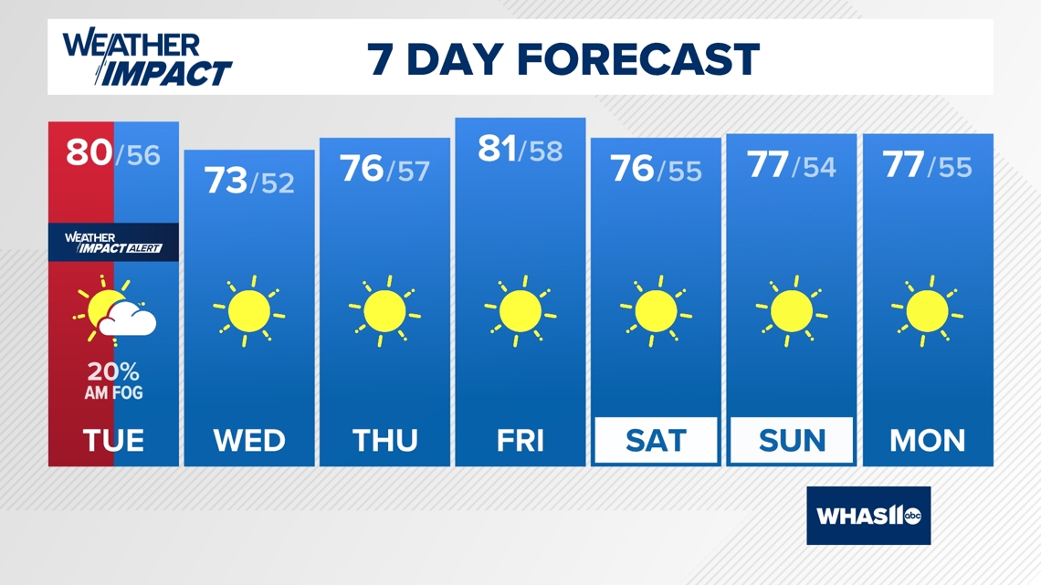
Other than a few rain showers and some isolated fog Wednesday morning, the focus then turns to the extended forecast. Get ready for quite a bit of sunshine for the first few days of October! Perfect fall weather.

Download the free WHAS11 app to watch live coverage during severe weather and get real-time weather alerts, even if your power goes out. For Apple or Android.
LIVE RADAR
Follow the WHAS11 Weather Impact Team on social media.
DOWNLOAD THE WHAS11 APP:
Download the free WHAS11 app for the latest weather alerts from the WHAS11 Weather Impact Team. For Apple or Android users.
JOIN THE CLOUD WATCHERS FACEBOOK GROUP:
Interested in photography? Join more than 15,000 residents from Kentucky and southern Indiana and share your weather photos. Click here to join the group!