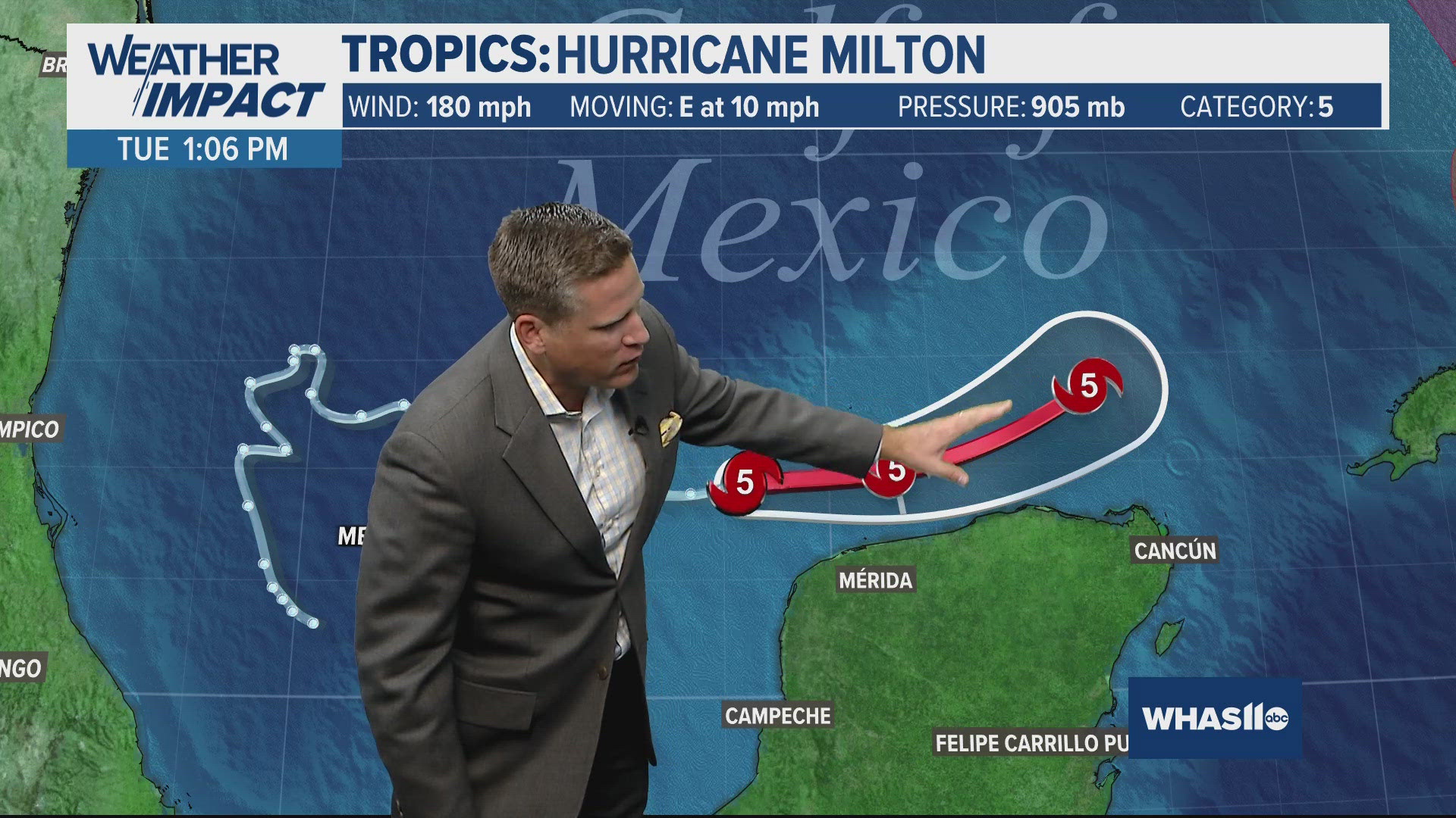
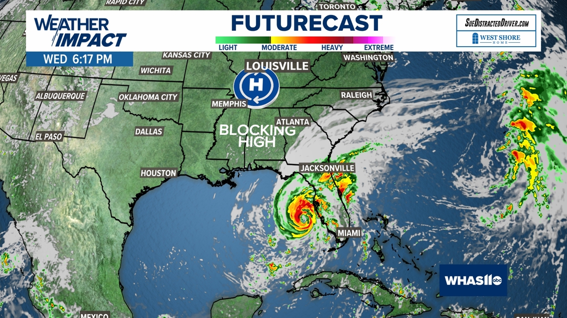
LOUISVILLE, Ky. — Unlike Hurricane Helene, Kentucky and Indiana will have no impacts from the remnants of Hurricane Milton, and we can thank high pressure for that.

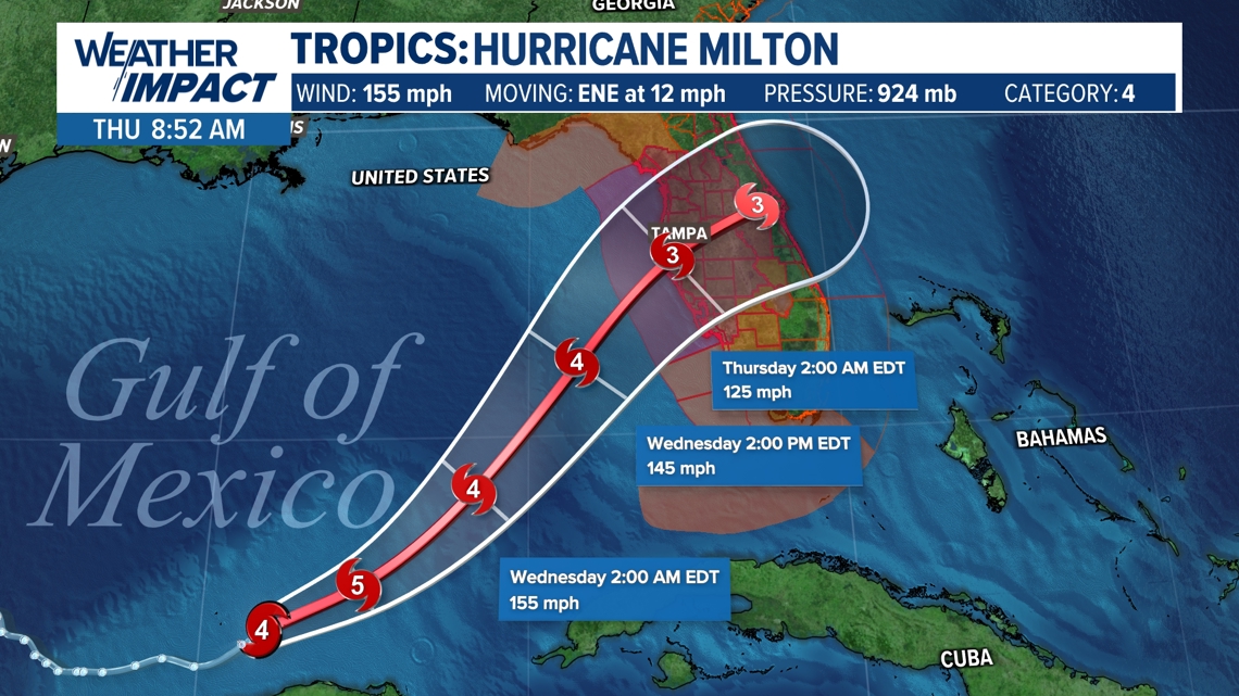
You can see Milton's latest forecast staying well south over Florida, then out into the open waters of the Atlantic Ocean.
So, first off, what is high pressure?
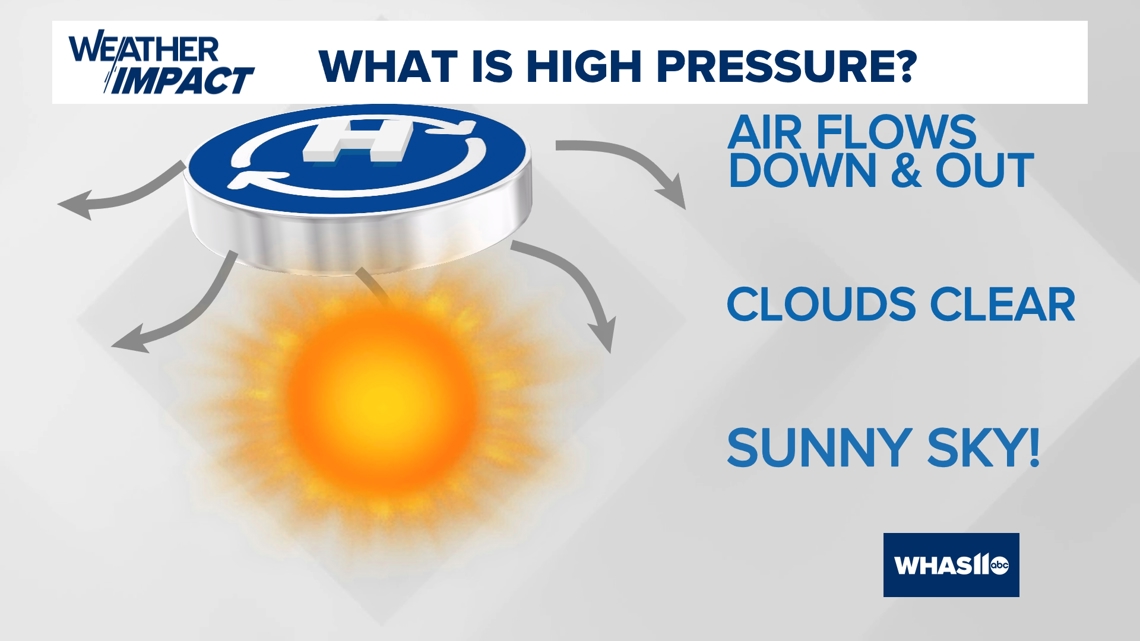
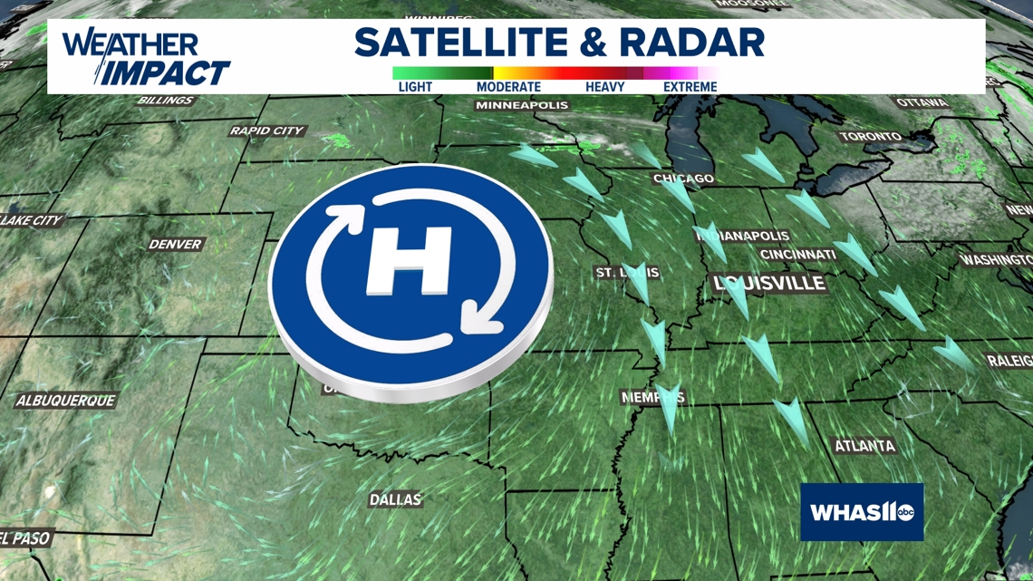
An area of high pressure is a region of air characterized by slowly sinking air, with the air flowing outward.
Low pressure is the opposite, and is a storm system where the air is flowing inward and up, creating clouds and rain.
This clears out the sky and provides a period of dry weather. For Kentucky and Indiana, we could be looking at another week or two of dry conditions thanks to this region of high pressure locking in place for a long time.


Notice on the maps below, the air flows out in a clockwise pattern (again, the opposite is true for low pressure), out of the high pressure center, that puts our area under a north wind flow.
The north wind will keep blocking any "bad" weather to the far south.


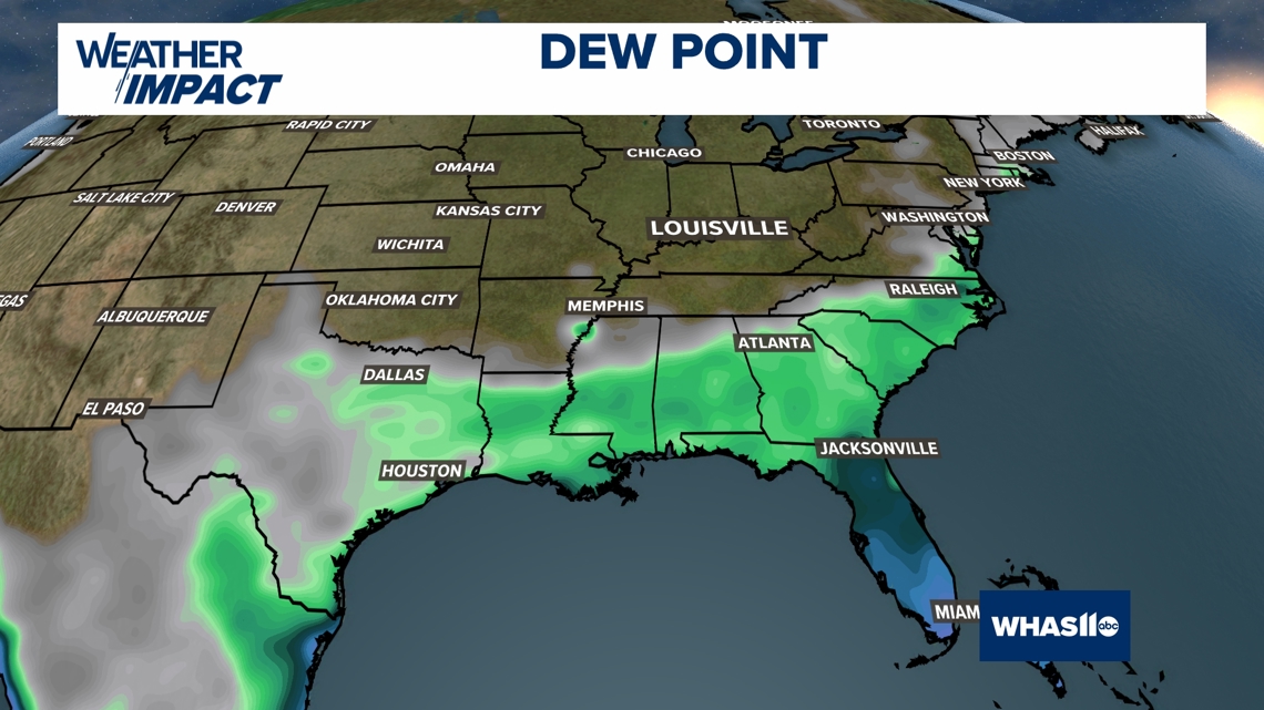
This will supply Kentucky and Indiana with dry autumn air. The more humid air is down along the Gulf Coast, but the really tropical air over the southern half of Florida.

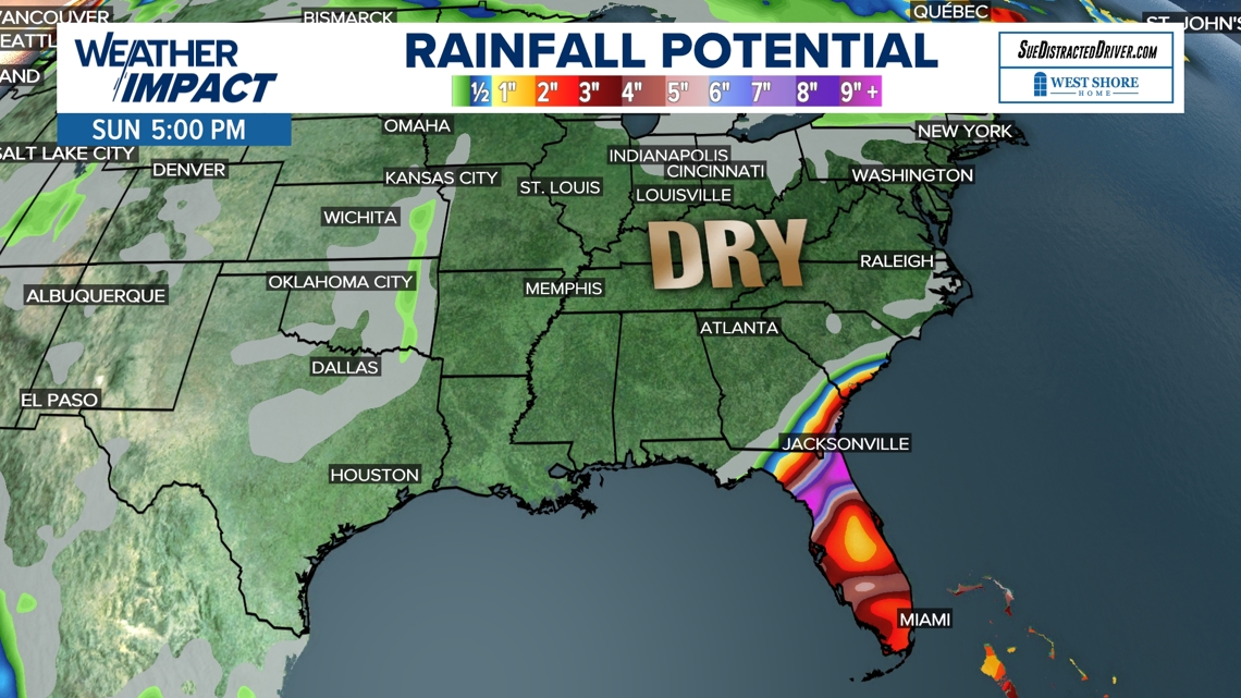
The rainfall total over the next seven days is nothing for us, with all of flooding rain from Milton over Florida.

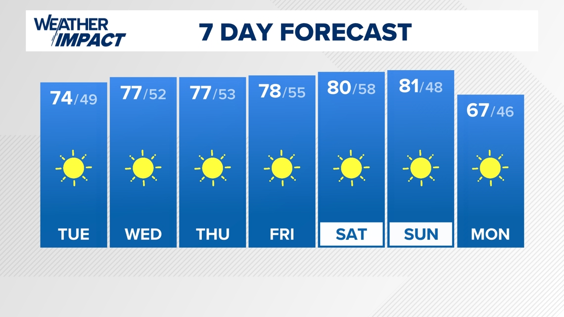
This weather pattern will keep sunshine around for the rest of this week, and possibly through next week as well.

Continue to stay weather aware and follow the Weather Impact Team's latest forecast.

