
LOUISVILLE, Ky. — The remnants of Tropical Storm Helene are on the way Friday, bringing heavy rain and strong winds.
Helene made landfall late Thursday night as a major Category 4 hurricane in Florida. By Friday on 7 a.m., Helene was downgraded to a tropical storm with maximum sustained winds of 70 mph over Georgia.
Let's discuss all of the alerts and timing of the of impacts in our area.

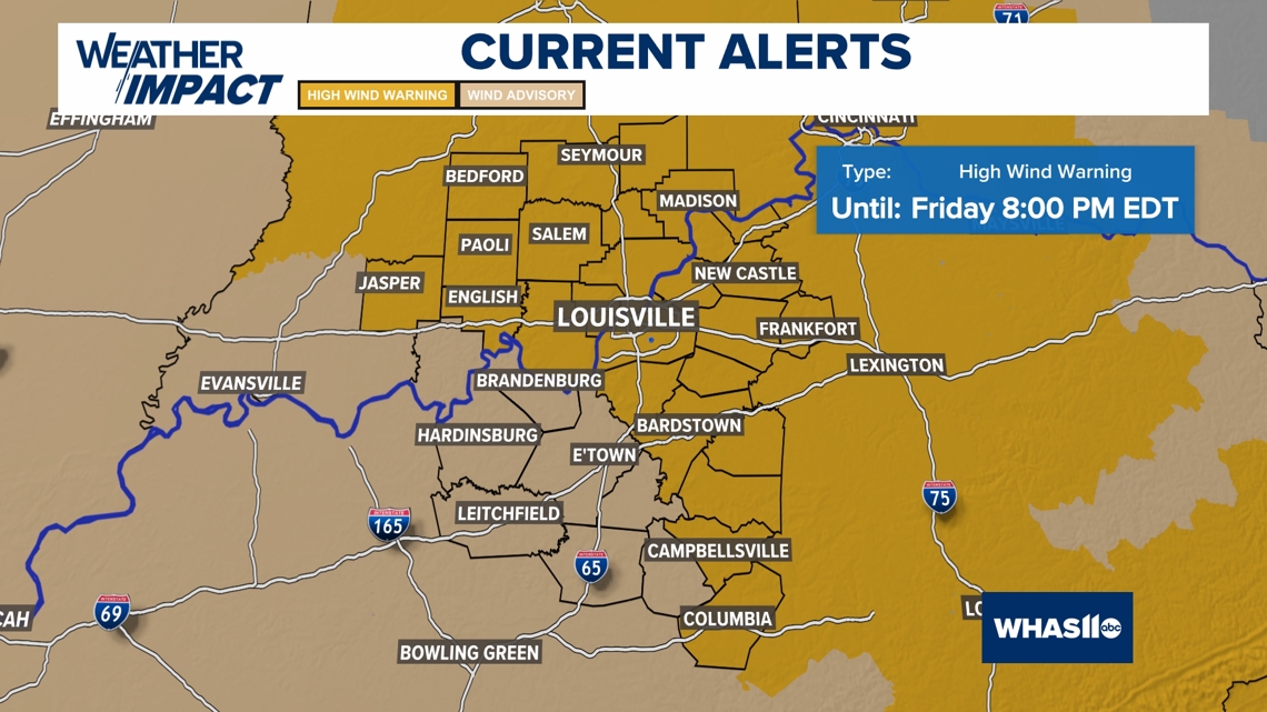
WIND AVISORY
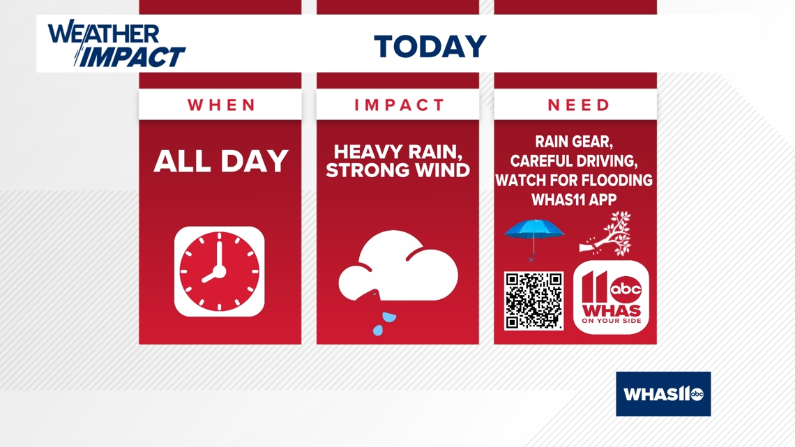
A High Wind Warning and Wind Advisory (expires 8 PM Friday evening) has been posted. Wind gusts between 35-45 mph or even higher will make for falling tree branches and power outages. Make sure your devices are charged up and you have plenty of flashlights and candles.
With the wet ground, sometimes trees can topple over a bit easier, so spotty power outages will be possible.
We'll also need to be extra attentive while driving, not only because of the ponding of water on the roads, but also the strong sustained winds.

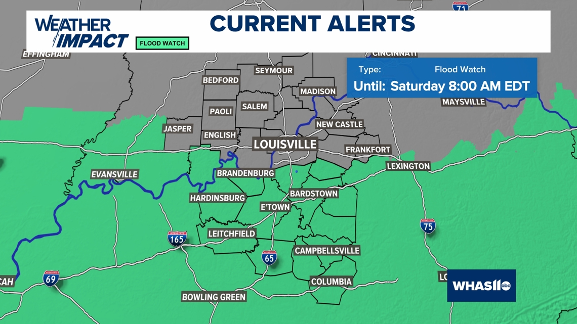
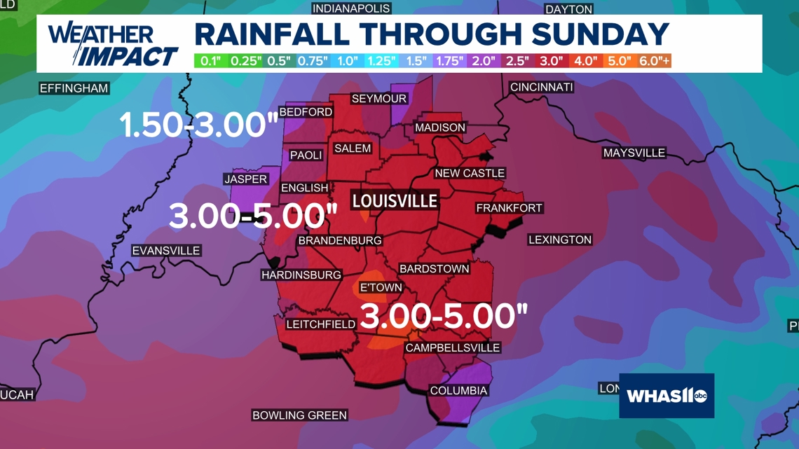
FLOOD WATCH
A Flood Watch is in effect through Saturday morning with 2-4" rainfall totals possible, along and south of the Bluegrass and Western Kentucky parkways.
Flooding will be possible in other areas as well, and watch for rising rivers, creeks and streams all weekend.
Keep an eye out for ponding of water on the roadways.

FUTURECAST TIMING
The steady to heavy rain will have a big impact on travel. Turn around, do not drown if you encounter a flooded roadway. Please be careful and alert for hydroplaning.
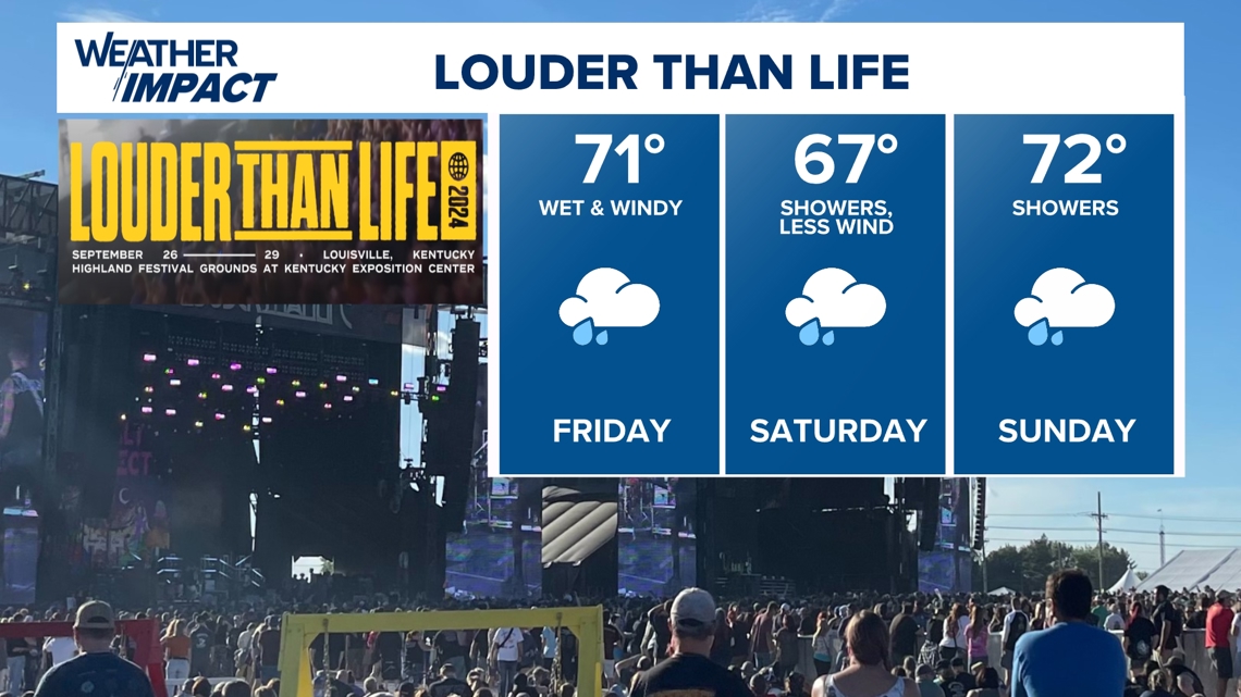
Rainfall totals could be up to around an inch early Friday.
As the rain continues Friday afternoon, the winds will be picking up, with gusts to 40-50 mph.
Thankfully, severe weather is not expected. Rainfall totals of 2" are possible by late afternoon Friday.
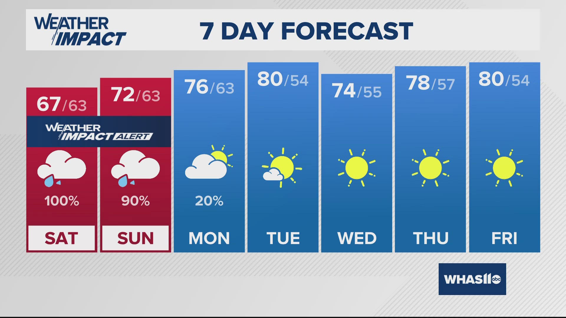
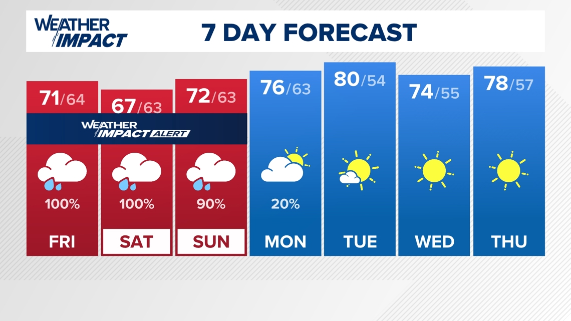
The rain continues through Saturday with storm totals of 2-4" possibly. Goodbye, drought!

While severe thunderstorms are not likely, certainly be prepared for a very wet and windy Friday, and more rain through this weekend.

Our weather will improve with sunshine and 70s by the middle of next week and the beginning of October!

Continue to stay weather aware and follow the Weather Impact Team's latest forecast.